
 by Tom Gurney
Tom Gurney BSc (Hons) is an art history expert with over 20 years experience
Email: tomgurney1@gmail.com / Phone: +44 7429 011000
Durand in the Catskills and American Landscape: Introduction
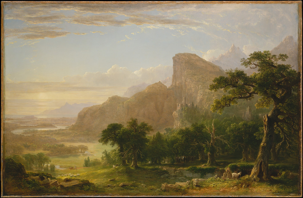
Asher Brown Durand’s journeys supplied a growing knowledge of trees, rocks, water and mountain forms. His paintings developed that knowledge into different kinds of landscape: a cultivated valley in Dover Plains, a broad mountain prospect in High Point and a sheltered stream opening toward distant country in The Catskills.
A place name can identify an important regional connection without making every painting a literal record of one fixed viewpoint. Durand selected and combined forms, adjusting their relationships within a canvas. Looking at the works together reveals both a sustained interest in real country and the artistic choices that give each scene its character.
At a Glance
- ArtistAsher Brown Durand (1796–1886)
- Important journeyAdirondack sketching with Thomas Cole, 1837
- Recurring regionsCatskills and Hudson Valley, among other northeastern destinations
- Paintings consideredDover Plains, High Point, The Catskills and Kindred Spirits
- Photographic contextAndy Arthur’s Kaaterskill Falls photograph, 2011, CC BY 2.0
- Map contextUSGS Kaaterskill sheet, surveyed 1892, September 1903 edition, reprinted 1948
- FocusHistorical landscape and artistic selection
Contents
- The Adirondack journey with Cole
- A region encountered through travel and study
- Dover Plains and a cultivated valley
- High Point and repeated visits near Olive
- The Catskills and the Plattekill setting
- Kindred Spirits as a composed memorial landscape
- A modern photograph of Kaaterskill Falls
- Reading a later map of the region
- Selection within an inhabited landscape
- Annotated details
The Adirondack journey with Cole
Olson identifies the 1837 sketching journey to the Adirondacks with Thomas Cole as an important episode in Durand’s movement toward landscape. Her discussion connects the trip with the surviving Schroon Lake sketchbook and an increased attention to trees.[1]
The Adirondacks and Catskills are distinct regions. Keeping their names separate prevents an important shared journey from becoming a generic Catskill excursion. It also shows that Durand’s landscape interests developed through more than one mountain environment.
The journey’s significance concerns a practice as well as a destination. Sketching required time with individual forms, while a finished painting could later bring selected observations into a more extensive arrangement. The travelling artist gathered knowledge that could remain useful beyond a single view.
Cole’s presence also gives the episode a personal dimension. Durand’s later Kindred Spirits placed his deceased friend within a composed Catskill landscape, alongside Bryant. The memorial picture belongs to a later purpose and should remain distinct from the actual circumstances of the 1837 trip.
Annotated Details from Durand in the Catskills and American Landscape
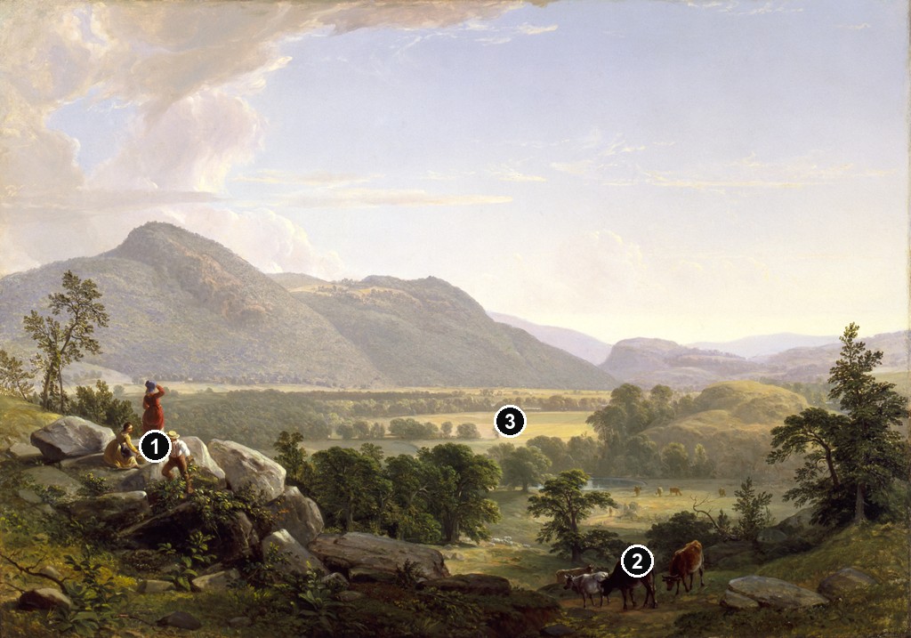
The numbered points identify visible features discussed in this article. Return from each detail to the whole composition. Asher Brown Durand, Dover Plains, Dutchess County, New York, 1848. Oil on canvas. Smithsonian American Art Museum, 1978.126. Image source. CC0 / Public domain. Resized only; native appearance, complete carrier and margins preserved.
Details from DURAND IN THE CATSKILLS AND AMERICAN LANDSCAPE
Compare the cropped details with the complete images above. Notice how their colours, shapes and positions contribute to the larger compositions.
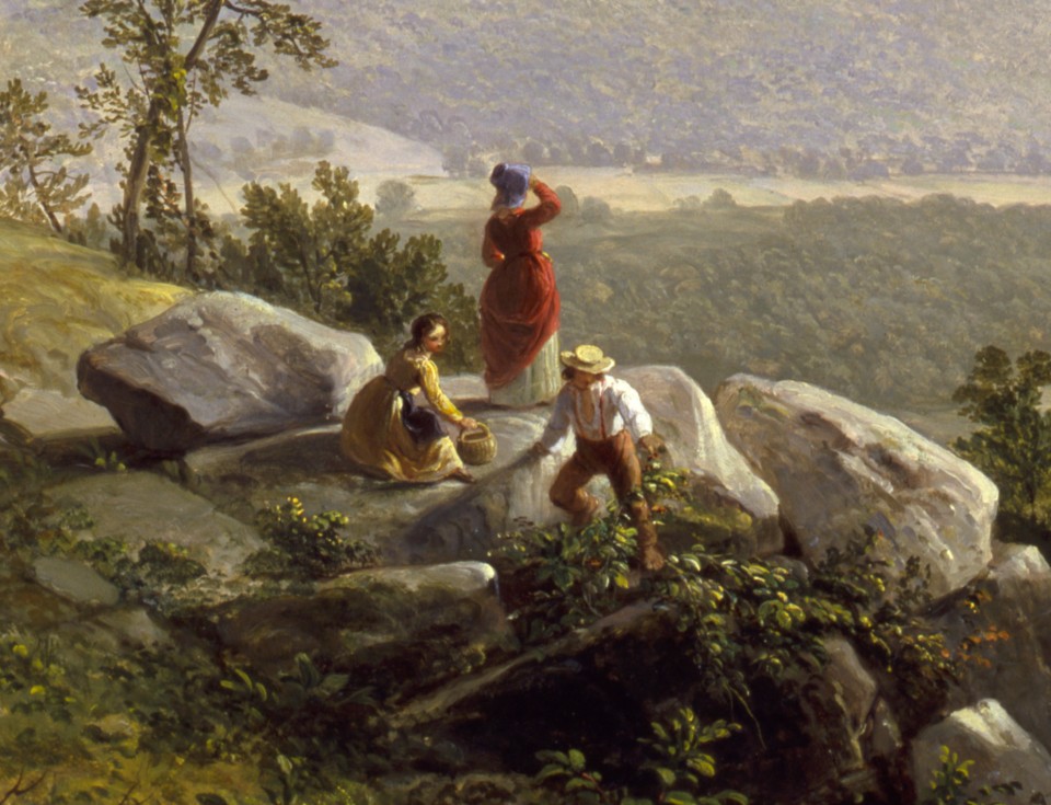
Three figures on the ledge
Three figures occupy the near left ledge, looking across the valley. Their clothing and poses remain distinct within the group.
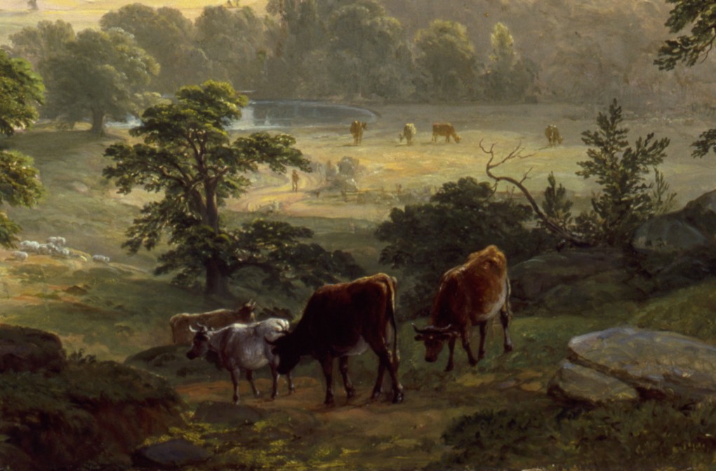
Cattle beside the descending ground
Near cattle stand on the right-hand descending ground. Smaller animals farther away help establish distance.
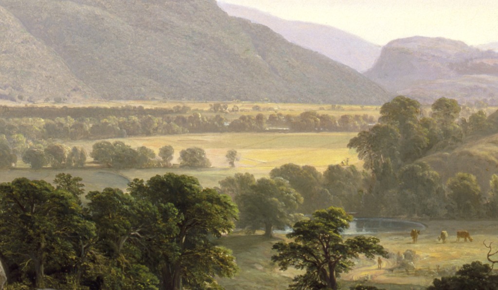
Fields within the enclosing hills
Light fields and darker trees extend beneath the enclosing hills. The crop connects cultivated ground with the broad regional view.
A region encountered through travel and study
Margaret Stenz’s historical guide for the Brooklyn Museum describes the Catskills as a region familiar to artists and tourists. It notes the use of boardinghouses and the search for creeks, cloves and cascades beyond the celebrated prospects.[2]
These different encounters with country offer a useful background to Durand’s subjects. A broad vista presents mountains and atmosphere together. A nearer stream or tree supplies another kind of attention, with more opportunity to examine surface and structure.
The finished paintings preserve both scales. High Point makes a mountain a dominant feature of the distance; The Catskills brings large trees close to the viewer. Each can carry a regional identity while organising the viewer’s encounter in a different way.
Travel therefore mattered beyond the discovery of picturesque destinations. Returning to a region could provide further studies, different conditions of light and a richer knowledge of its forms. That material could support several paintings rather than one literal transcription.
Dover Plains and a cultivated valley
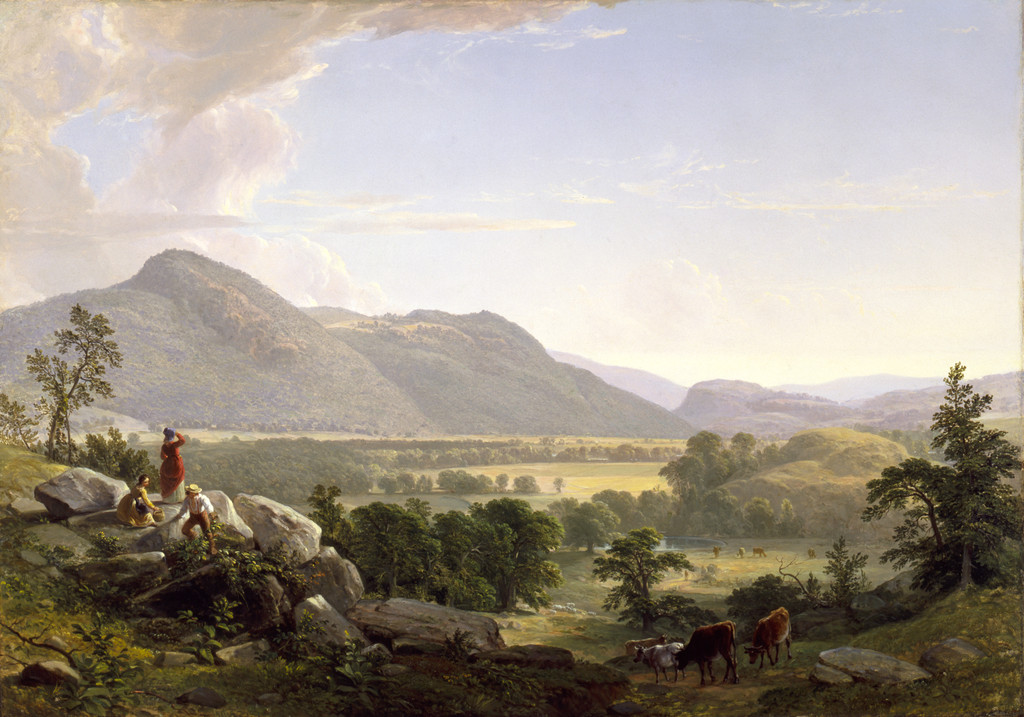
Dover Plains, Dutchess County, New York, 1848, presents settled country beneath a broad sky. Fields, buildings, cattle and small foreground figures give the valley a visible pattern of habitation. Mountains enclose the distance without displacing the rural activity below.
The Smithsonian American Art Museum identifies the canvas as accession 1978.126. Its account discusses the painting’s connection with contemporary ideas of national scenery and the recognition of familiar American landscape.[3]
Stenz records Durand’s 1847 visit, connected with the railway’s reach to Dover Plains, and proposes a possible interest in the Stone Church. She also notes enlarged background mountains and the later removal of a foreground drumlin for road gravel.[2]
These observations distinguish regional recognition from exact pictorial equivalence. A landscape can retain enough of a place to be recognisable while adjusting scale within its composition. Subsequent physical changes can also make a present comparison difficult.
The painting’s foreground helps establish that adjusted scale. People on a rocky ledge look across the valley, while cattle occupy ground at the right. Their small bodies give the land an extent that can be experienced from the viewer’s imagined position.
This is a landscape of fields and movement as well as mountains. Its inhabited character provides an important comparison with the more enclosed woodland subjects. Durand did not need to remove every sign of ordinary life to make country meaningful.
High Point and repeated visits near Olive
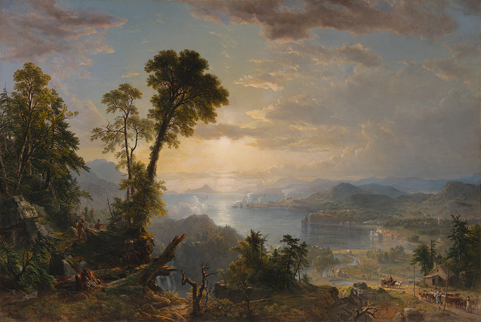
High Point: Shandaken Mountains, 1853, gives a substantial mountain a broad position above nearer water, cattle and trees. The blue-grey distance contrasts with warmer foreground forms, while a small pair of figures occupies the bank at the right.
The Met identifies the setting near Olive, New York, and the mountain as High Point, also known as Ashokan High Point. Its account connects earlier sketches from an 1847 visit with studies made during later stays in 1853 and 1855.[4]
The canvas was already shown at the Academy’s 1853 annual exhibition. The later summer studies therefore belong to Durand’s continuing regional practice; they should not all be treated as preparations for a painting already exhibited.
The chronology makes return visits especially interesting. Durand continued to examine a landscape whose forms he had already used. A familiar mountain could remain a source of further observation rather than a subject exhausted by one finished canvas.
The stream and rural foreground also change how the mountain is encountered. The viewer begins among substantial near forms and then looks beyond them. The distant height remains connected with a place of water, shade and human activity.
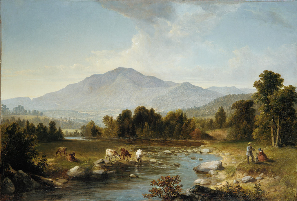
Asher Brown Durand, High Point: Shandaken Mountains, 1853. Metropolitan Museum of Art, 77.3.1. Bequest of Sarah Ann Ludlum, 1877. The painting was exhibited before the later summer return studies discussed by the museum. The Metropolitan Museum of Art. Image source. CC0 / Public domain. Resized only; native appearance, complete carrier and margins preserved.
The Catskills and the Plattekill setting
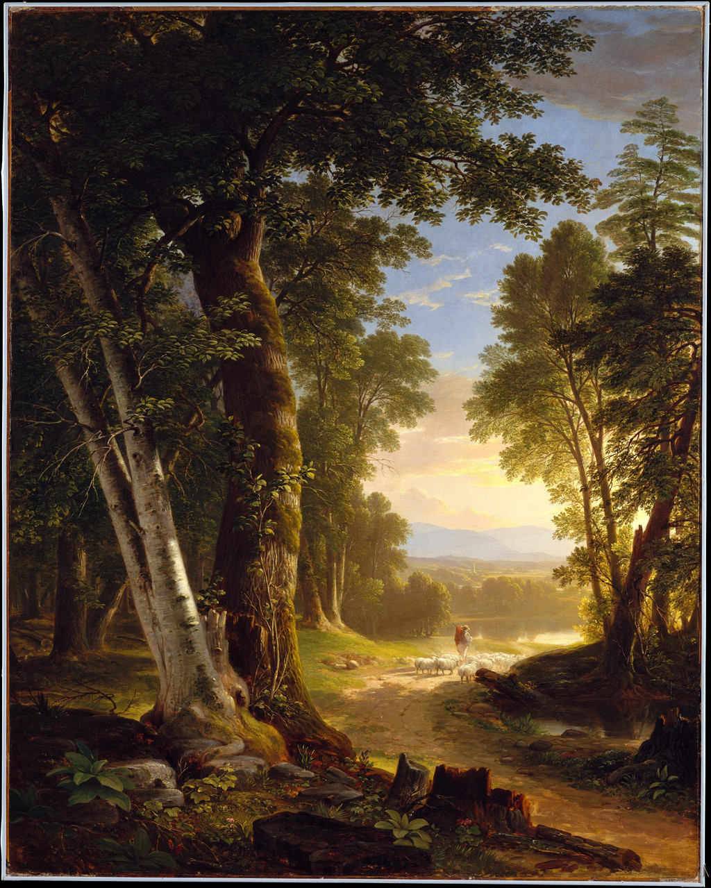
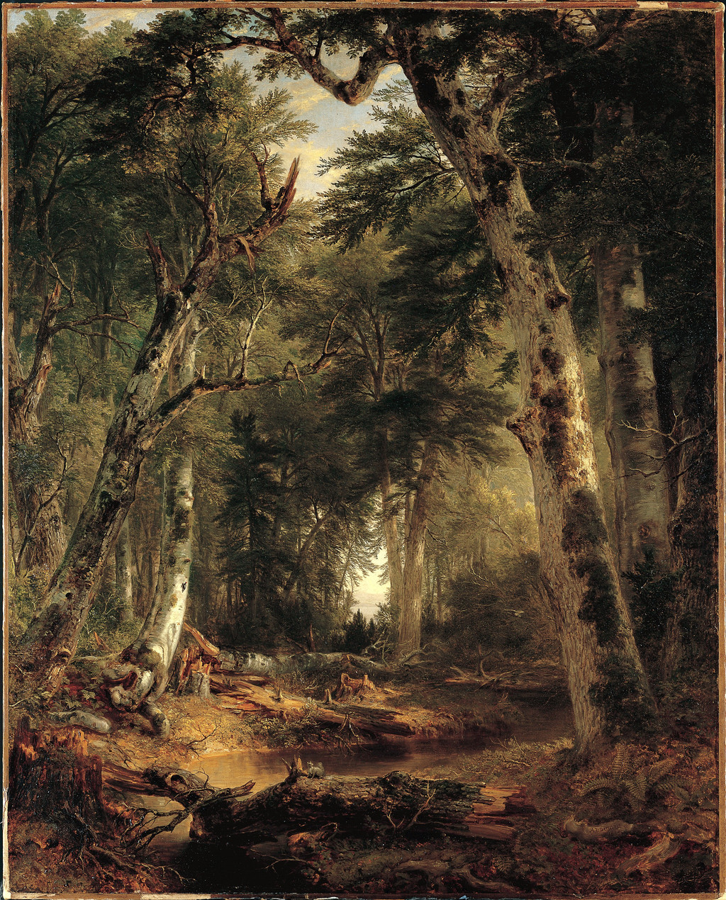
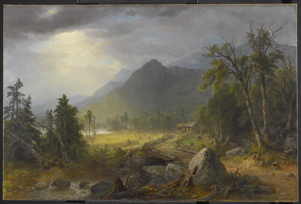
The Catskills, 1859, offers a taller and more enclosed arrangement. Pale trunks rise near the front, rocks border a narrow stream and a small waterfall occupies the middle distance. A brighter opening leads farther away.
The Walters Art Museum identifies the depicted region as Plattekill Clove. Its record states that William T. Walters commissioned the painting on June 8, 1858, with payment on May 3, 1859. The canvas is accession 37.122.[5]
Stenz relates the picture to sketches made around Palenville and nearby Platte Clove in 1858. Her guide identifies a sycamore study among the associated works shown in the historical exhibition.[2]
The large canvas transforms the scale of that encounter. The nearest trunks become major boundaries to the scene, while the stream offers a narrow route through the foreground. Distant country appears as an opening within a much closer environment.
The arrangement differs from the breadth of High Point. Instead of placing the mountain across a wide upper distance, the picture gives the viewer a sense of looking outward from among trees and rocks. Both works use regional knowledge to construct a particular kind of space.
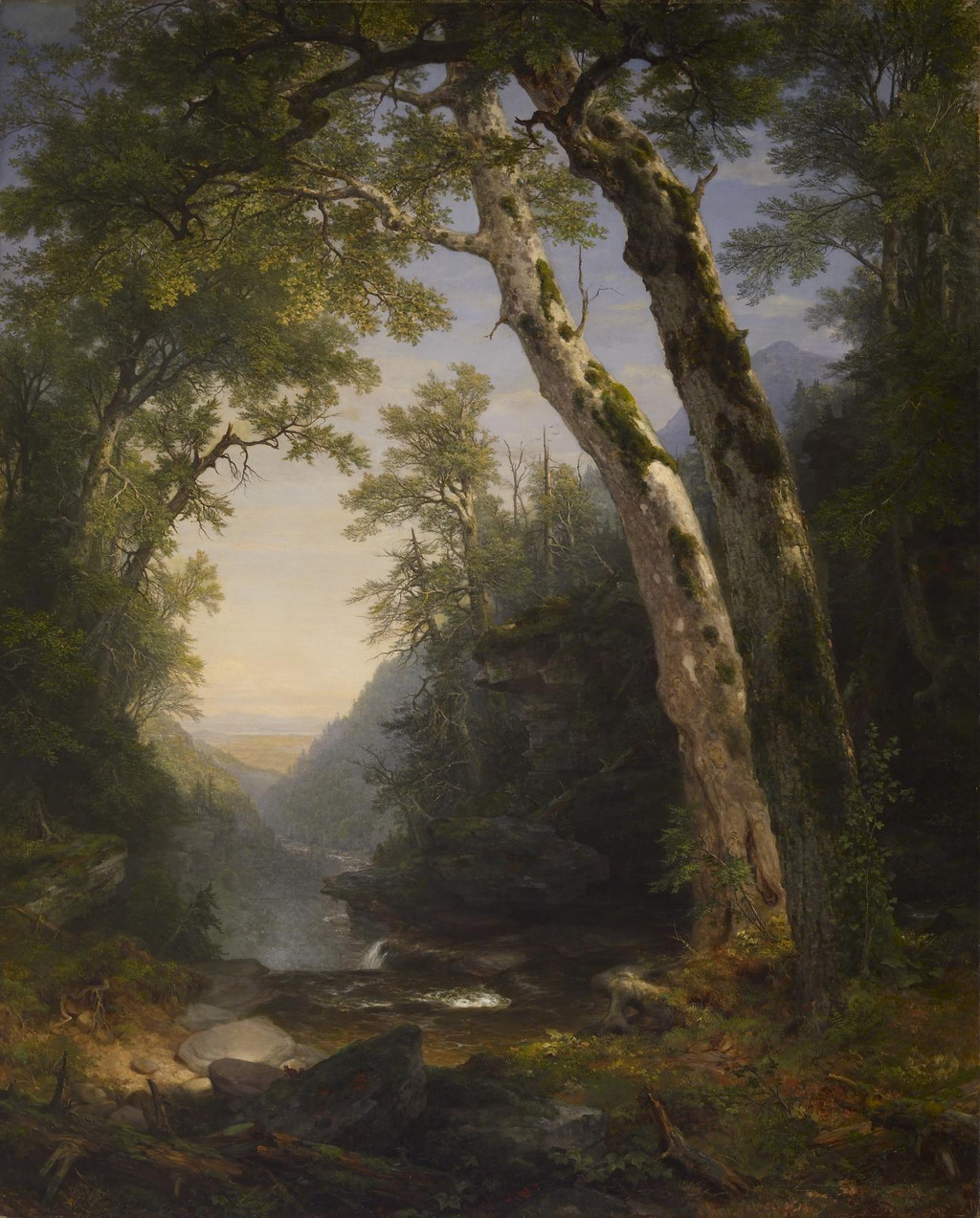
Asher Brown Durand, The Catskills, 1859. Walters Art Museum, 37.122. Commissioned by William T. Walters in 1858. The museum identifies the represented region as Plattekill Clove. Image source. Public domain. Resized only; native appearance, complete carrier and margins preserved.
Watch: Asher Brown Durand
Choose a film to explore the artist’s work, its interpretation and its wider setting.
Friendship and landscape, Asher B Durand's Kindred Spirits
Smarthistory and Crystal Bridges discuss friendship, memory and landscape in Kindred Spirits.
Watch on YouTubeKindred Spirits as a composed memorial landscape
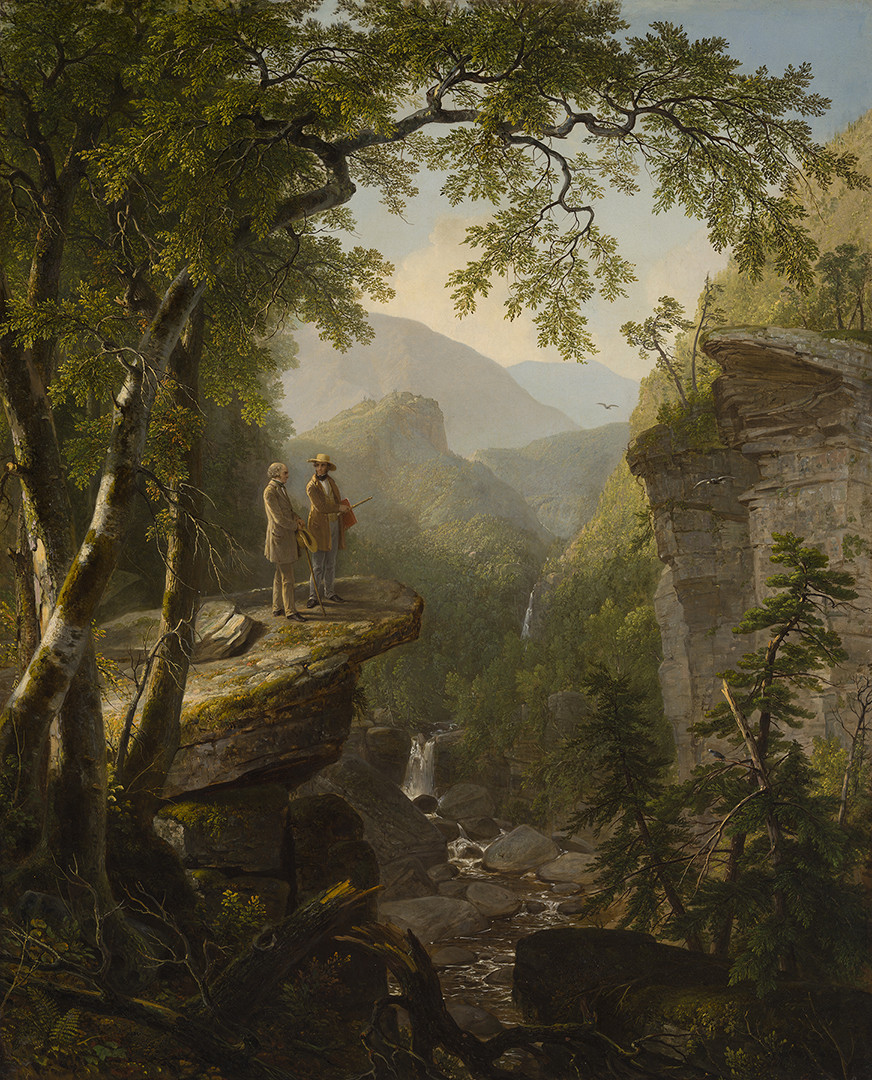
Kindred Spirits, 1849, places Cole and Bryant on a rocky ledge within an extensive wooded gorge. Crystal Bridges identifies the painting as the memorial gift commissioned by Jonathan Sturges for Bryant after Cole’s death.[6]
The figures give the landscape a personal and commemorative purpose. Their conversation is imagined within a setting associated with their shared admiration for nature. The painted country supports that relationship without becoming a straightforward record of one meeting.
Stenz describes a composition of characteristic Catskill features, proposing Church’s Ledge and Fawn’s Leap as possible sources for particular elements. These suggestions remain qualified site relationships rather than exact coordinates for the entire picture.[2]
The assembled setting makes the memorial more extensive than its small figures. Trees, water and distant heights surround the men, allowing their presence to become part of a larger landscape. Regional forms and personal remembrance work together within one designed scene.
A modern photograph of Kaaterskill Falls
Andy Arthur’s Kaaterskill Falls II was photographed on October 21, 2011. The image is available under CC BY 2.0, with the photographer credited and the licence linked in its caption.[7]
Two tiers of falling water descend through the photographed rock formation. Horizontal strata remain prominent on both sides, while autumn trees and branches occupy the surrounding slopes. The photograph supplies a contemporary view of physical forms within the wider region.
Those features can help a reader attend to the kinds of rock, water and woodland that appear in Durand’s landscapes. Their usefulness lies in geographical context and visual comparison. The photograph does not establish that Kindred Spirits reproduces this exact waterfall or the camera’s viewpoint.
The different date also changes the comparison. Durand’s paintings belong to nineteenth-century artistic circumstances; the photograph records an encounter more than a century later. Keeping both dates visible lets each image contribute its own evidence.
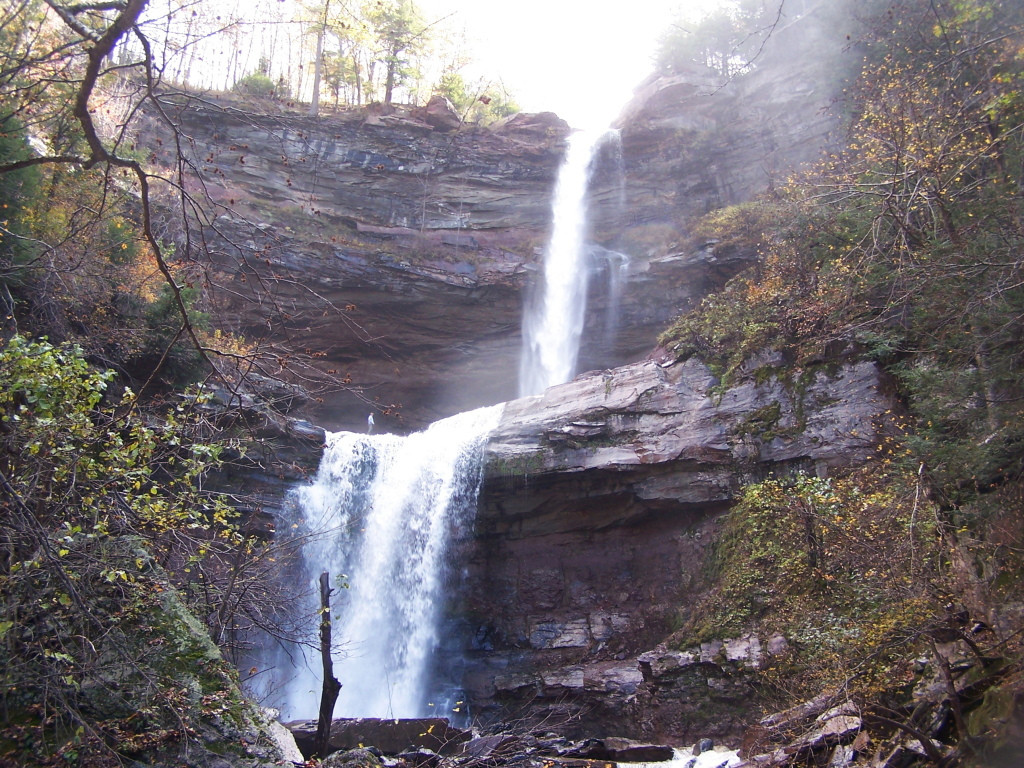
Andy Arthur, Kaaterskill Falls II, October 21, 2011. CC BY 2.0. A modern view of the region’s two-tier waterfall and rock strata; this photograph is not an exact source view for Kindred Spirits. Supplied appearance preserved; resized only. Andy Arthur, Kaaterskill Falls II, October 21, 2011; CC BY 2.0. Image source. CC BY 2.0. Resized only; native appearance, complete carrier and margins preserved.
Reading a later map of the region
The USGS Kaaterskill quadrangle provides a different kind of context. Its imprint records a survey in 1892, an edition in September 1903 and a reprint in 1948. The complete sheet is preserved here through the Perry-Castañeda Library map collection’s public-domain reproduction.[8]
The map shows the relations among mountain slopes, cloves, settlements and waterways. Kaaterskill Clove and Palenville can be located near North and South Mountains, while Platte Clove appears farther south. Contour lines make the steepness and enclosure of the country particularly apparent.
A map and painting organise attention differently. The sheet places neighbouring features within measured geographical relations. A canvas offers a view from an imagined position, adjusting its visible field through framing, emphasis and scale.
The later map cannot reconstruct Durand’s exact journeys or prove the presence of every printed road and railway during a painting’s date. It helps orient the named regions while leaving those historical questions attached to appropriate evidence.
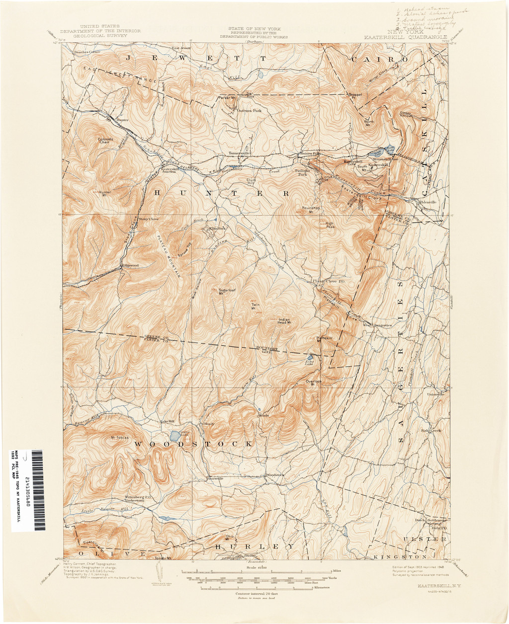
United States Geological Survey, Kaaterskill quadrangle: surveyed 1892, September 1903 edition, reprinted 1948. Perry-Castañeda Library Map Collection, University of Texas at Austin. Public domain. A later geographical reference, preserving the complete sheet; no reconstruction of Durand’s exact itinerary. United States Geological Survey; Perry-Castañeda Library Map Collection, University of Texas at Austin. Image source. Public domain. Resized only; native appearance, complete carrier and margins preserved.
Selection within an inhabited landscape
Stenz’s account of the 1866 Kaaterskill Clove notes omissions of industry and cleared ground. Farms, sawmills and other regional activities could be absent from a painting whose subject appeared extensively wooded.[2]
That example gives selection a historical consequence. A picture’s calm or apparent wilderness may depend partly on what the artist has left outside its field. Looking at a landscape should therefore include questions about its chosen forms and its exclusions.
Durand’s own advice recognises selection as part of artistic practice. The excerpts preserved by John distinguish detailed knowledge of nature from the representation of a scene’s larger meaning.[9]
The regional works offer several answers to that task. Cultivated fields, mountain distance, shaded streams and a memorial gorge give different forms to the country Durand studied. Travel supplied the encounters; the paintings communicate particular choices about how that country could be seen.
Artworks directory
A collected selection of 19 individually identified paintings, prints and a graphite study, including fifteen dedicated artwork articles. This directory is not a complete catalogue raisonné. Links lead to a companion article where available, otherwise the consulted institutional record. Progress is identified by title, date and museum; an unverified accession is omitted. Unillustrated objects remain searchable.
Frequently Asked Questions
The consulted regional guide describes a composed setting and proposes possible sources for individual elements. It does not identify a single exact viewpoint for the whole painting.[2]
No. Its survey, edition and reprint dates are 1892, 1903 and 1948 respectively. It provides later geographical orientation.[8]
Dover Plains shows that Durand’s regional landscapes could include cultivation and rural activity as well as extensive wooded country.[3]
Discussion
Look again at the images and ideas explored in Durand in the Catskills and American Landscape. These editorial prompts invite your observations.
Reader Insights
How does a broad valley differ from looking outward through a wooded enclosure?
Which regional forms does the map help you locate in relation to one another?
What signs of habitation or land use remain visible in each painting?
Join the Conversation
Share a detail, comparison or question about Durand in the Catskills and American Landscape below.
References
- Roberta J. M. Olson, “A Magnificent Obsession”: Durand’s Trees as Spiritual Sentinels of Nature (2010). Consulted printed pp.151–158 and notes; the 1837 Adirondack journey and tree study. View source
- Margaret Stenz, Following in the Footsteps of Asher B. Durand: A Walker’s Guide, Brooklyn Museum (2007). Historical regional discussion, site proposals and landscape selection; current travel directions are not adopted here. View source
- Smithsonian American Art Museum, Dover Plains, Dutchess County, New York, 1978.126. Exact 1848 painting and institutional landscape account. View source
- Metropolitan Museum of Art, High Point: Shandaken Mountains, 77.3.1. Setting, visits, study chronology and 1853 exhibition. View source
- Walters Art Museum, The Catskills, 37.122. Plattekill setting and documented commission and payment dates. View source
- Crystal Bridges Museum of American Art, Kindred Spirits, 2010.106. Exact painting, memorial purpose and gift to Bryant. View source
- Andy Arthur, Kaaterskill Falls II, 2011. Exact photograph and CC BY 2.0 evidence. View source
- USGS Kaaterskill sheet, Perry-Castañeda Library Map Collection. Public-domain source reproduction; surveyed 1892, September 1903 edition, reprinted 1948. View source
- John Durand, The Life and Times of A. B. Durand (1894). Appendix I, printed pp.211–217, selected primary extracts on observation, selection and representation. View source
- Splash image source.
Asher Brown Durand, Dover Plains, Dutchess County, New York, 1848. Smithsonian American Art Museum, 1978.126. Gift of Thomas M. Evans and museum purchase through the Smithsonian Institution Collections Acquisition Program. CC0 / Public domain. Resized only; native appearance, complete carrier and margins preserved.
View source