


 by Tom Gurney
Tom Gurney BSc (Hons) is an art history expert with over 20 years experience
Email: tomgurney1@gmail.com / Phone: +44 7429 011000
Earth, Timber and Authority: Reading the Motte-and-Bailey Castle
A motte-and-bailey castle joins two defended spaces. The motte is a steep-sided mound carrying a tower, palisade or small summit enclosure. The bailey is a larger enclosed court where the household, animals, workshops, stores and principal buildings could operate. Ditches, banks, timber barriers and a controlled route connected them. The surviving mound is therefore only one part of a working castle. [1] [2]
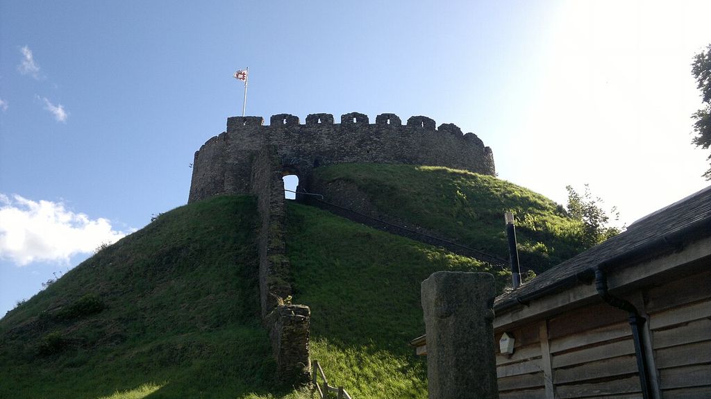
Totnes Castle’s shell keep above its steep mound, photographed in 2012. The steps are part of the present visitor approach. Steven Haslington, Totnes Castle; CC BY-SA 2.0. JPEG prepared; no crop or retouch.
This form is closely associated with the expansion of Norman power, especially in England after 1066 and in parts of Wales and Ireland. It was also used in Scotland, while related castle mounds appeared in eleventh-century France. Yet “motte-and-bailey” is an archaeological classification, not a single blueprint or an ethnic label that explains every site. Dates, builders, earlier landscapes and later alterations must be tested locally.
The broader history of defended residences belongs to Castle Architecture. This guide concentrates on the earth-and-timber form, how its spaces worked, and why archaeology frequently complicates the familiar textbook picture.
At a Glance
- MotteA steepened natural or constructed mound carrying a defended summit enclosure, hall or tower.
- BaileyA banked and ditched working court for household, service, storage, craft and animal activity.
- Controlled routeGates, bridges, ramps and changes of level connected the court to the more restricted summit.
- MaterialsEarth and timber required organised labour and skilled construction; neither implies a flimsy or temporary castle.
- Evidence cautionTimber disappears, ditches fill and later masonry or landscaping can obscure the original form and sequence.
- Reading ruleMap mound, court, ditch, banks and routes before reconstructing lost buildings from archaeological evidence.
Contents
- What Is a Motte?
- What Is the Bailey?
- Motte, Bailey and Ringwork
- Evidence Table
- How They Were Built
- The Defended Route
- Life in the Bailey
- Settlement and Landscape
- Watch Architecture in Context
- England after 1066
- Normandy and France
- Wales
- Scotland
- Ireland
- Timber and Stone
- Archaeological Evidence
- Reading the Diagram
- Recommended Books
- Conservation
- Frequently Asked Questions
- References
What is a motte?
A motte is normally a rounded, flat-topped or truncated mound made or reshaped to support a defended strongpoint. Some were built largely from earth excavated from an encircling ditch. Others incorporated natural knolls or rock outcrops whose sides were cut back and steepened. A real mound can combine natural geology, imported material and several building phases. [1]
At Totnes, the builders used a natural outcrop and heightened it. A timber tower and palisade probably occupied the top before a stone shell keep was built there in the thirteenth century. [3] At the Bass of Inverurie, a natural hillock was scarped into a motte about 12 metres high in its surviving form. [11] Neither example supports the idea that every mound was tipped up from loose soil in one operation.
The summit was valuable because height improved observation, controlled access and made authority conspicuous. It did not necessarily hold a huge freestanding keep. The platform might contain a timber tower, hall, enclosure or a sequence of structures that left only postholes, occupation layers or burned material.
What is the bailey?
The bailey was a banked and ditched court, usually attached to the motte and often protected by a palisade. Some castles had more than one. Its gate organised movement from the surrounding settlement or road, while a bridge, ramp, stair or timber gangway carried a narrower route toward the summit. [1]
Calling the bailey an “outer yard” can make it sound secondary. In practice it supported the castle as a residence and estate centre. At Totnes, the lower enclosure accommodated a hall, chambers, chapel and kitchens. [3] Stables, barns, stores, workshops and housing could stand nearby. Soldiers and animals probably used Granard's bailey in Ireland. [13] Administration, food preparation, repair and hospitality happened here even when the motte dominated the skyline.
The arrangement also created social control. Carts, livestock and supplies could enter the working court, but ascent to the summit was more restricted. Gates and changes of level separated public business, household service and elite security without making those categories identical at every site.
Motte, bailey and ringwork
A ringwork is a defended enclosure formed by an inner bank and outer ditch. It lacks the high central mound that defines a motte, although it can have a bailey. Ringworks and mottes are related families of earthwork castle, and their surviving forms can be altered enough to confuse them. [1] [2]
The distinction is not an evolutionary ladder in which an inferior ringwork automatically became a motte. Some ringworks may slightly predate the main English motte-building phase; some sites were transformed; others retained their enclosure form. Castle Acre contains unusually complex earthworks whose ringwork, mound and later masonry phases cannot be reduced to one clean type. [4]
“Motte” should also not be assigned merely because a castle has a hill-shaped feature. Analytical survey at Conisbrough found no archaeological evidence for the motte long assumed in traditional accounts. [9] Negative evidence matters: typology should follow the site, not force the site to resemble a diagram.
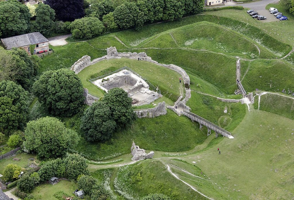
Castle Acre Castle’s earthworks and later masonry remains, photographed from the air in 2013. John Fielding, www.flickr.com/people/29372296@N00, Castle Acre Castle aerial image; CC BY 2.0. JPEG prepared; no crop or retouch.
Motte-and-Bailey Evidence: What Survives
The familiar plan is a starting hypothesis. Separate visible earthwork, excavated evidence, documentary evidence and conjectural timber.
| Feature or question | Possible role | Evidence to inspect |
|---|---|---|
| Motte profile | Raises and isolates a defended summit | Natural geology, tipped layers, scarping, erosion and later reshaping. |
| Summit platform | Supports a tower, hall or palisaded enclosure | Postholes, beam slots, occupation layers, burning and later masonry. |
| Bailey perimeter | Encloses the working court | Bank, ditch, palisade trenches, entrances and whether several courts existed. |
| Defended crossing | Controls movement between court and summit | Ramp, bridge abutments, gangway posts, worn routes and rebuilt approaches. |
| Household buildings | Provide hall, chamber, chapel and service space | Plans, hearths, floors, finds, food waste, drainage and documentary records. |
| Settlement relationship | Connects lordship to roads, churches, markets and estates | Topography, route networks, parish boundaries and neighbouring earthworks. |
| Stone additions | Alter or replace selected timber structures | Foundations, construction joints, reused earthworks and dated building campaigns. |
| Later disturbance | Changes the visible mound, court and deposits | Ploughing, quarrying, paths, cemeteries, burrowing, trees and modern monuments. |
How were these castles built?
Construction began with selection and control of a site. Builders might choose a river crossing, road, ridge, town edge or estate centre, then exploit an existing rise or excavate a ditch and accumulate its spoil. Earth was laid, compacted and retained; timber structures required carpentry, transport and continual maintenance. Labour, food, tools and permission were as essential as military design.
Excavation at Chasné-sur-Illet in Brittany exposes the relationship vividly. Around the year 1000, a circular ditch more than 10 metres wide and about 5 metres deep was cut. Excavated material contributed to a mound that may have approached 10 metres in height. A crescent-shaped defended work guarded its southern access, while another ditch, 6 to 7 metres wide, enclosed a bailey containing service buildings and perhaps a lordly residence. [12]
Those measurements describe Chasné-sur-Illet, not the type as a whole. Soil, water table, geology and available labour changed what could be built. A ditch could remain dry or hold water intermittently without becoming the picturesque moat of later imagination.
Timber was not a synonym for flimsy. Thick posts, earth-fast palisades, towers, bridges and halls demanded skilled work and could be repaired or rebuilt. Fire, rot, dismantling and later construction explain why their elevations vanish. The empty grass mound seen now understates the original volume and activity. [1] [2]
The defended route
A motte's steep slope was only one obstacle. The ditch widened the separation between mound and court. A bridge or ramp concentrated approach at a point where a gate and elevated defenders could control it. The summit palisade created another threshold.
At the Bass of Inverurie, nineteenth-century excavation found an oak gangway on the south face. The present gap between motte and bailey is partly the product of later landscaping, not necessarily the medieval route. [11] This combination of physical survival and later alteration warns against reading every modern path as original.
Some castles may have linked the bailey directly to the summit; others used a separate approach. Bridges could be rebuilt and ditches recut. A plan records a phase, not a universal circulation rule.
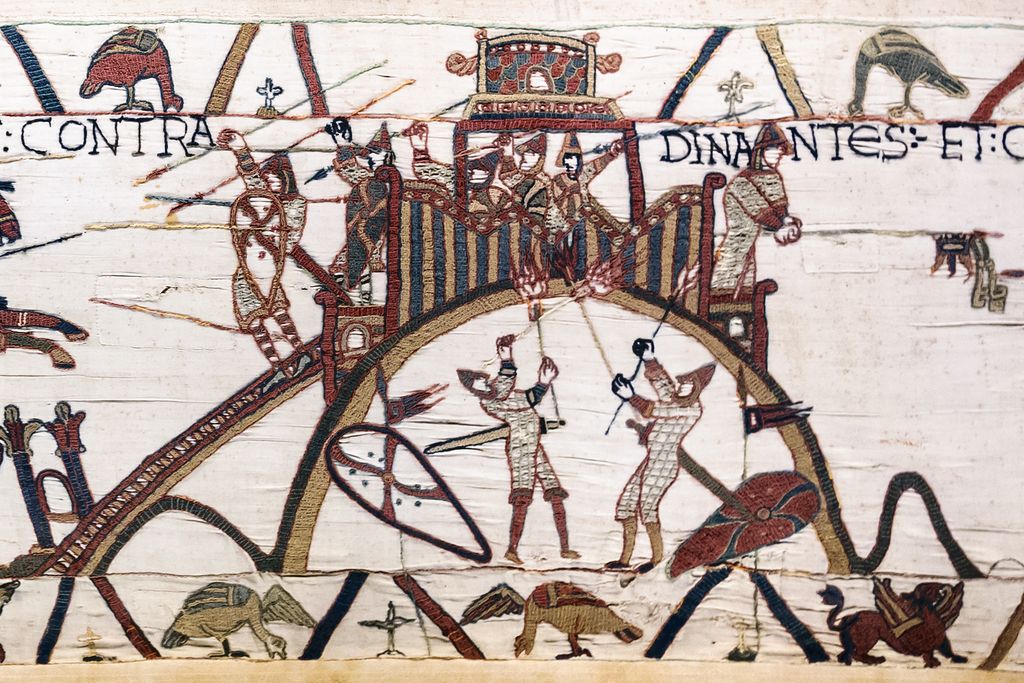
Dinan’s raised castle and approach in a detail of the Bayeux Tapestry, made in the late eleventh century; photographed in 2013. Myrabella (photograph); unidentified medieval makers (Bayeux Tapestry), Bayeux Tapestry: Dinan castle detail; Public domain. JPEG prepared; no crop or retouch. CC0 photographic reproduction release.
Life and work inside the bailey
The bailey supported the people who made lordship function. A hall accommodated meals, hearings and public business. Chambers offered more restricted lodging. A chapel organised worship, while kitchens, ovens, stores and wells supplied the household. Smithing, carpentry and animal care required work areas whose smoke, refuse and worn surfaces could leave archaeological traces.
The Bass preserves two raised rectangular platforms that may represent a hall and chamber, together with pottery recovered through excavation and grave digging. [11] At Chasné-sur-Illet, a substantial thirteenth-century manor was later built in the lower court, showing how the bailey remained a residential focus after the earliest mound phase. [12]
Archaeology may find postholes, beam slots, hearths, grain, animal bone, ceramics, metalworking waste or drainage rather than labelled rooms. Their distribution can distinguish cooking, craft, storage and movement. The absence of standing walls is not the absence of domestic life.
Castle, settlement and landscape
Earthwork castles often stood beside parish churches, villages, towns, ports, roads or river crossings. [1] Their position connected defence with rents, courts, markets and movement. The mound made a political centre visible; the bailey concentrated people and resources needed to exercise control.
Richard's Castle in Herefordshire is best understood as a landscape containing motte, bailey, outer enclosure, church, routes and the earthworks of a planned but unsuccessful borough. [10] The castle was not an isolated military object. Its relationship to settlement is part of its architectural evidence.
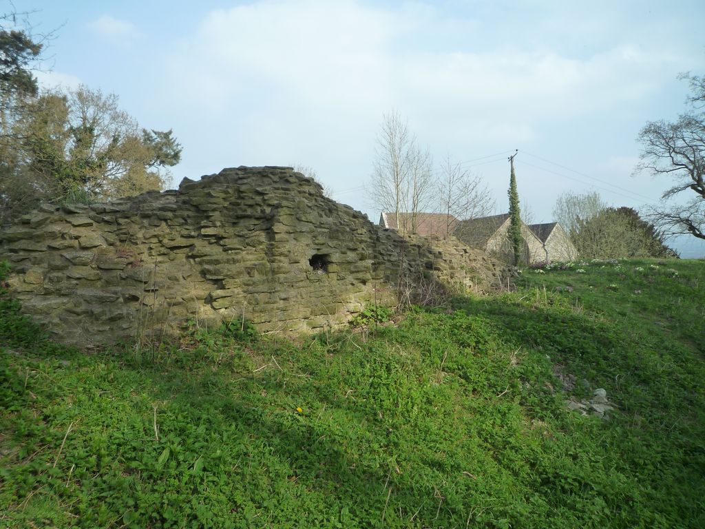
Masonry remains at Richard’s Castle with St Bartholomew’s Church partly visible beyond, photographed in 2019. Fabian Musto, Richards Castle & St. Bartholomew's Church; CC BY-SA 2.0. JPEG prepared; no crop or retouch.
At Inverurie, the Bass occupies a defensible tongue of land near the meeting of the rivers Urie and Don. Documentary and archaeological evidence associate it with administration of the Garioch in the twelfth and thirteenth centuries. [11] Visibility, communication and government converged at the site.
Watch: Reconstruct Architecture from Surviving Evidence
Choose a concise introduction to architectural reading or a longer exploration of how boundaries, thresholds and rooms create a complete building system.
Architecture 101: The Basics in 10 Minutes
A concise introduction to form, function, structure and context—the evidence needed to reconstruct how an earthwork castle organised people and activity.
Watch on YouTubeEngland after 1066—and before a simple story
Many early castles in England were built soon after the Norman Conquest as bases of occupation and statements of aristocratic authority. Earth and timber allowed substantial defences to be established without waiting for a major masonry campaign. [1]
That broad pattern does not mean every motte was erected during the first months after 1066. Construction and use continued into later centuries, and about 700 earthwork castles survive in England alone. Some occupied earlier fortified places; others accumulated settlements and stone buildings. Precise dates often depend on excavation or documents unavailable at an uninvestigated mound.
Castle Combe illustrates the limit. Its earthworks may incorporate an earlier, possibly Iron Age, enclosure, and a ringwork appears to have been added within a dense landscape of platforms. Because the site has not been excavated, its sequence remains tentative. [7] A confident diagram is not a substitute for dating evidence.
Normandy and France
The exact origins and spread of mottes in eleventh-century England and France remain debated. [1] It is safer to describe connected aristocratic and military landscapes than to claim one birthplace from later national borders.
The Chasné-sur-Illet excavation provides direct French evidence for a mound castle around 1000, before the conquest of England. It also places the castle within a village whose earlier cemetery, plots and timber houses were transformed rather than erased. [12] Castle building reorganised an inhabited landscape.
French terminology helps expose translation. Motte castrale identifies the castle mound; basse-cour names its lower court. English “bailey” carries similar spatial meaning but should not flatten local chronology or documents.
Wales: conquest and princely landscapes
Earth-and-timber castles were prominent instruments of Norman expansion in Wales. They secured routes and lordships using local earth, stone and timber, and only some received later masonry. [5] This was an architecture of conquest, settlement and supply, not a neutral transfer of building technology.
Twtil at Rhuddlan was established in 1073. Its summit probably supported timber structures and may later have carried stone. The site was superseded when Edward I founded the great masonry castle and planned town nearby in the late thirteenth century. [6] The change records a new political and logistical programme, not the inevitable maturation of one little castle.
Welsh evidence also resists a simple Norman-versus-native division. At Abergwyngregyn, the remains of a princely hall lie near an eleventh-century motte-and-bailey landscape associated with a Welsh llys, or court. [15] Native princes adopted, adapted and governed through fortified and ceremonial places whose meanings cannot be inferred from form alone.
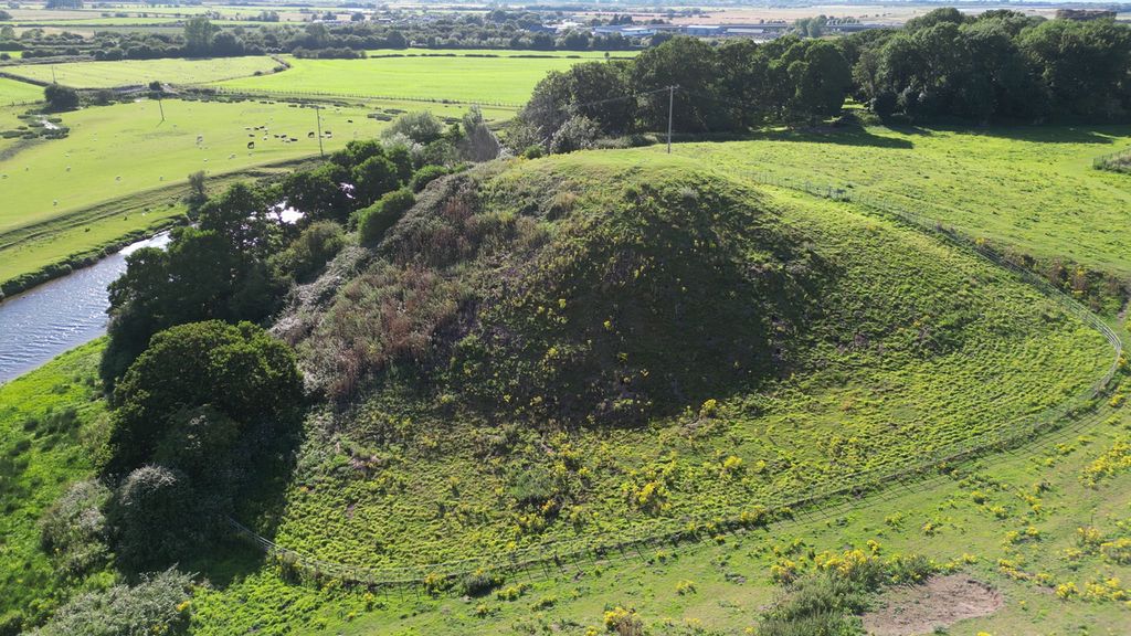
The motte at Twthill, Rhuddlan, beside the River Clwyd, photographed from the air in 2023. Llywelyn2000, Twthill, Rhuddlan: motte and bailey; CC BY-SA 4.0. JPEG prepared; no crop or retouch.
Scotland and immigrant lordship
In Scotland, motte castles are strongly associated with twelfth-century rulers and the settlement of an immigrant aristocracy, but individual sites differ in scale and status. The Bass of Inverurie is the only timber castle in Strathdon with the typical paired form, suggesting an unusually important centre or an imported planning pattern. [11]
Its substantial bailey, possible hall platforms, pottery and gangway make administration and occupation tangible. Later use of the earthworks as an ornamental feature within a cemetery helped preserve them while also levelling and cutting parts. Survival is always a later history as well as a medieval one.
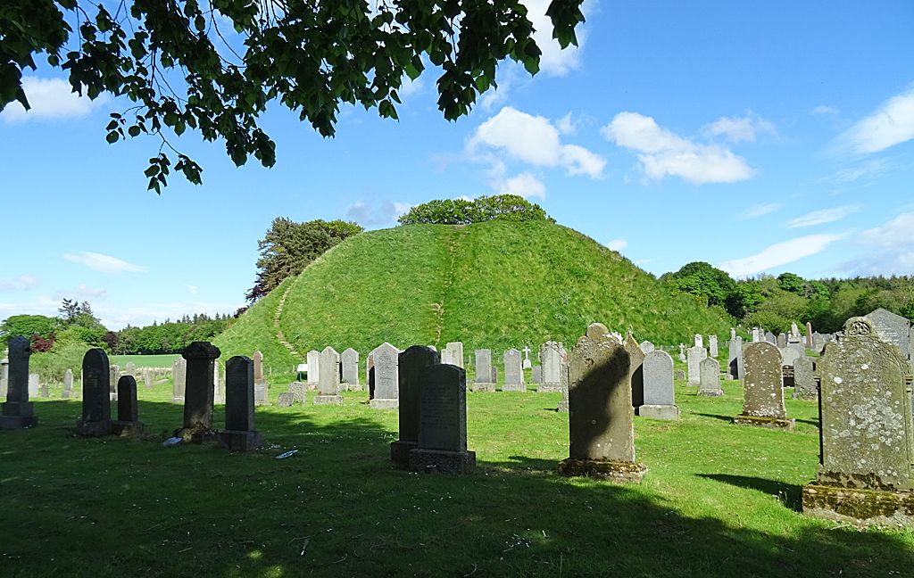
The Bass of Inverurie rises behind a later cemetery, photographed in 2022. Anne Burgess, The Bass of Inverurie; CC BY-SA 2.0. JPEG prepared; no crop or retouch.
Ireland: control, reuse and multiple courts
Anglo-Norman lords used mottes to extend control in Ireland from the late twelfth century. Granard, probably built around 1199 by Richard de Tuite, occupies a high hill and was inserted within a pre-existing ringfort. [13] That reuse joined a new fortification to a place already shaped by authority and memory.
Mannan Castle at Donaghmoyne shows a more complex plan: a motte, inner bailey and outer bailey were connected by a causeway, while later masonry occupied the motte, court and link between them. Documentary evidence records castle building in 1197. [14] Multiple courts and overbuilding are not anomalies to discard; they reveal how the institution expanded.
Irish examples should not be described only as transplanted English diagrams. Existing ringforts, church landscapes, lordship boundaries and local topography shaped their sites. Archaeological survey can reveal a bailey where its bank has disappeared or challenge one assumed from tradition.
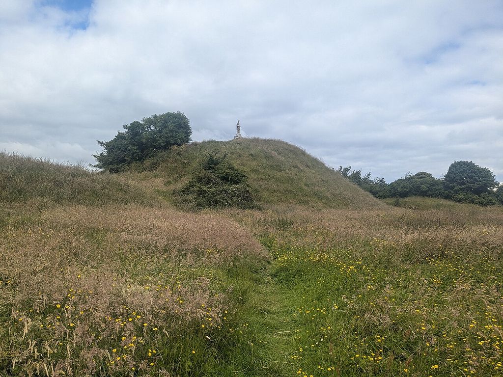
Granard Motte, photographed in 2024, with a later monument on its summit. 2ManyCats4Me, Granard Motte; CC0. JPEG prepared; no crop or retouch.
Did timber castles always become stone castles?
No. Some received stone towers, curtain walls or gatehouses; some retained timber; some were abandoned; and some masonry stood beside rather than directly replacing earlier buildings. Resources, political need, ownership and ground conditions governed each decision. [1] [2]
Ascott d'Oyley reverses the expected sequence. Excavation and documents indicate that its motte was built against an already existing stone tower between 1129 and 1150, before demolition around 1175. [8] A mound could incorporate masonry rather than await it.
At Totnes, a later shell keep followed timber occupation of the summit. [3] At Mannan, stone ruins overlie several earthwork zones. [14] These are different biographies, not stages on one mandatory ladder. Timber could be durable and sophisticated; stone could be altered, robbed or abandoned.
How archaeologists recognise a lost castle
Earthwork survey maps breaks of slope, mound profiles, banks, ditches, platforms and the way one feature cuts or respects another. Aerial photography and lidar may reveal low relief; geophysics can locate filled ditches and concentrations of activity. Excavation tests sequences, construction layers and deposits but destroys the primary context it removes.
Finds date and animate space. Pottery and coins can narrow occupation; animal bone and charred grain show diet and supply; nails, slag and postholes locate timber buildings and work. Waterlogged wood may preserve a bridge or revetment. Documents identify owners and events, but a chronicler's “castle” does not automatically establish its plan.
The strongest interpretation combines methods. Ascott's documents and excavation produce unusually close dates. [8] Castle Combe remains provisional without excavation. [7] Conisbrough demonstrates the value of refusing a familiar label when the surveyed evidence does not support it. [9]
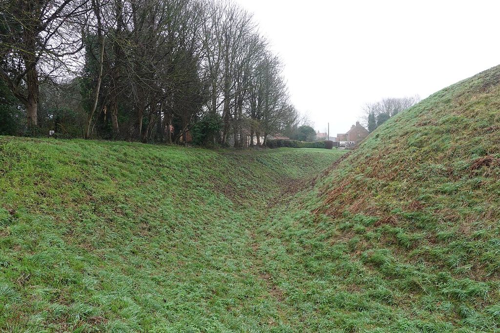
A ditch between castle earthworks at Castle Acre, photographed in December 2024. Hugh Venables, Castle earthworks, Castle Acre; CC BY-SA 2.0. JPEG prepared; no crop or retouch.
Reading the motte-and-bailey diagram
D26 pairs a plan with a section. In plan, follow the approach through the bailey gate, past working buildings and toward the defended crossing of the motte ditch. The court's bank and palisade form their own perimeter; the motte is not the castle's only defence.
In section, compare excavated earth with the timber superstructure that usually survives only as traces. The mound, bank and ditch are shown as observable forms. Dashed and labelled timber is conjectural. This distinction appears in line style and words so that it does not depend on colour.
The drawing is an explanatory synthesis, not a measured reconstruction. Real baileys may be larger, irregular or multiple; mottes may be natural, artificial or composite; a summit might hold a tower, hall or enclosure. Use the diagram to ask questions of a site, not to supply missing evidence.
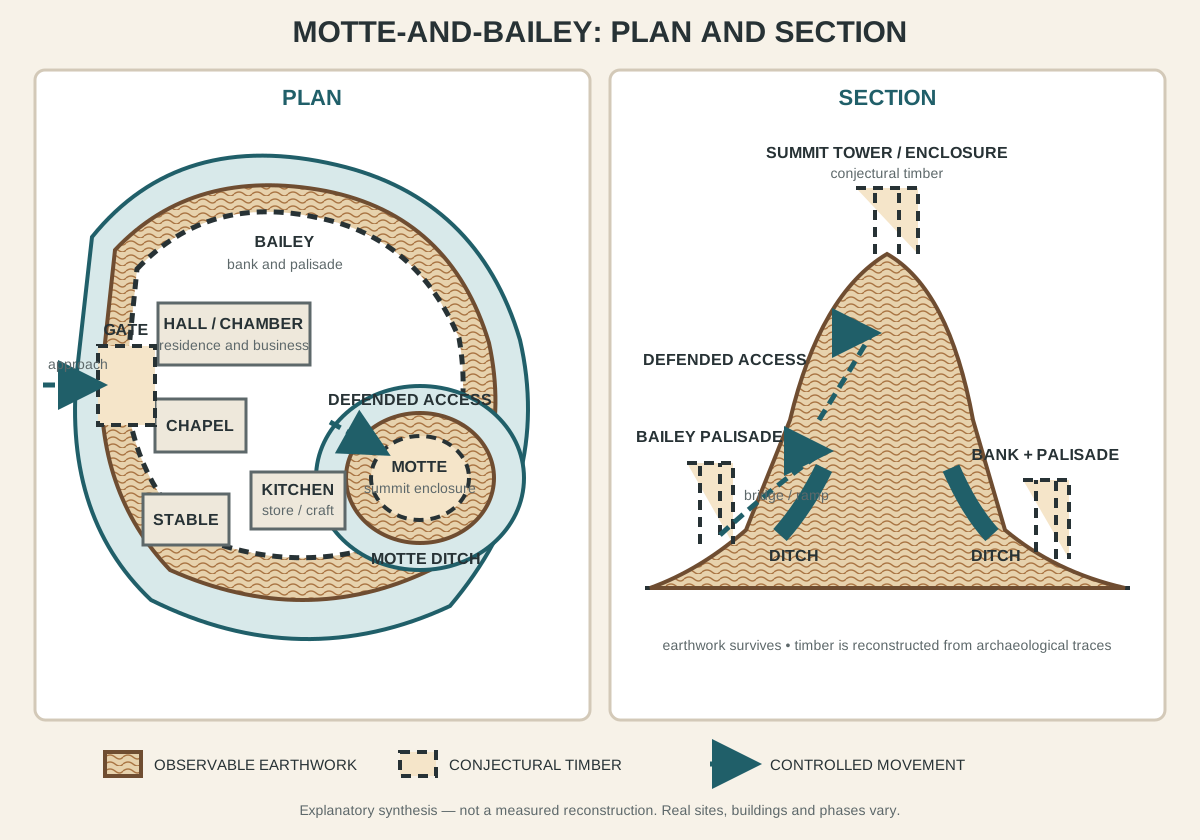
A motte-and-bailey castle was a connected strongpoint and working court. Solid earthwork and dashed conjectural timber keep evidence distinct; the drawing is not a measured reconstruction.
Conservation: why an empty mound matters
An earthwork stores stratified construction material, occupation debris and environmental evidence. Erosion can mix or remove those layers. Visitor desire lines, livestock, vehicles, rabbit burrows, scrub roots, bracken and falling trees all damage a mound or bank even when no masonry is visible. [16]
Good management favours minimal ground disturbance, stable grass cover, monitoring and carefully planned vegetation control. Repair normally requires consent and archaeological advice. Conjectural rebuilding can destroy evidence or make one imagined phase look certain. [16]
Later changes also deserve recording. Cemetery paths at Inverurie, ploughing, quarrying and garden landscaping may remove medieval features while becoming part of the site's modern history. Conservation protects both the visible form and the questions still held below ground.
Frequently asked questions
No. Earth and timber could be organised faster than a major masonry castle, but ditches, mounds, bridges, palisades and buildings required survey, labour, transport and skilled carpentry. Construction time varied by site.
No. The bailey contained much of the household, service, storage, craft and animal activity that allowed the strongpoint to function.
Not demonstrably. A summit might support a tower, hall, palisaded enclosure or several phases. Lost timber should be reconstructed only from site evidence and comparison.
A motte is a raised summit mound. A ringwork is a defended enclosure defined by bank and ditch without that high mound. Either can have a bailey, and altered sites can be difficult to classify.
Timber decays, masonry is robbed, ditches fill and slopes erode or are landscaped. Survey and excavation can recover the buildings, routes and phases that surface appearance conceals.
Discussion
Which surviving earthwork most clearly demonstrates that a motte-and-bailey castle was a working institution rather than just a mound?
Reader Insights
Where are mound, court, ditch, gate and the controlled crossing between levels still legible?
Which postholes, floors, hearths, finds or documents support a reconstruction of household and service space?
How have masonry, settlement, cemeteries, farming, trees or monuments changed what can now be seen?
Join the Conversation
Share a documented example or useful source below, noting the site, date, survey method and the difference between observed evidence and conjecture.
References
- Historic England. “Earthwork and Timber Castles.” View source
- Historic England. “Pre-1500 Military Sites: Scheduling Selection Guide.” View source
- English Heritage. “History of Totnes Castle.” View source
- English Heritage. “Significance of Castle Acre Castle and Bailey Gate.” View source
- Cadw. “Castles of Wales.” View source
- Cadw. “Twtil, Castle Motte.” View source
- Historic England. “Castle Combe Ringwork and Bailey, Wiltshire: Earthwork Survey.” View source
- Historic England. “Ascott d'Oyley Motte and Bailey Castle.” View source
- Historic England. “Conisbrough Castle, South Yorkshire: Analytical Earthwork Survey.” View source
- Historic England. “Richard's Castle, Herefordshire: An Earthwork Survey.” View source
- Historic Environment Scotland. “The Bass and Little Bass, Motte-and-Bailey Castle.” View source
- Inrap. “Aux origines de Chasné-sur-Illet: la naissance d'un bourg au Moyen Âge.” View source
- Heritage Ireland. “Granard Motte and Bailey.” View source
- Excavations.ie. “Mannan Castle, Donaghmoyne, Monaghan, 1999.” View source
- Cadw. “Castles of the Princes of Wales.” View source
- Cadw. “Looking after your scheduled monument.” View source