


 by Tom Gurney
Tom Gurney BSc (Hons) is an art history expert with over 20 years experience
Email: tomgurney1@gmail.com / Phone: +44 7429 011000
Reference, Measurement and Lived Level
A datum gives architecture something stable enough to relate other things to. It might be an actual line stretched across an uneven historic wall, a level marked on a drawing, the plane of a podium that carries several unlike forms, or a national height system to which a survey is connected. In compositional theory, Francis D. K. Ching's familiar formulation allows a datum to be a line, plane or volume whose continuity or regularity gathers and orders otherwise varied elements. The elemental sequence matters: a point extended becomes a line; a line generates a plane; a plane can bound or imply volume. A datum is therefore more than “the ground” and need not be horizontal. [1], [2], [3]
The word also travels between disciplines, and that creates traps. A model's Level 00, a surveyor's site benchmark, Ordnance Datum Newlyn and the visible edge of a roof are not four names for one thing. The first is a project convention, the second a controlled point, the third a national vertical reference system, and the fourth may be read as a compositional line. Each can coordinate work only when its scope is understood. This page follows that chain from design principle to drawing, survey, national height, threshold and flood risk, then returns to buildings where planes, lines and repeated volumes make the idea visible. [4], [5], [6], [7], [8], [9], [10], [11], [12], [13], [14], [15], [16], [17], [18]
At a Glance
- Basic meaningA datum is a declared reference from which position, level or formal relationship can be understood. In composition it can be a line, plane or volume; in surveying it belongs to a coordinate reference system. [1], [2], [3], [9], [10], [11], [12]
- Not a synonymAn axis establishes direction and balance; a grid repeats coordinates; a datum supplies continuity or reference. An axis or grid can perform as a datum, but the terms are not interchangeable. [2], [3]
- Project zeroA drawing's `0.000` is local unless its relationship to a benchmark and national datum is stated. It does not automatically mean sea level, pavement or undisturbed ground. [4], [5], [6], [7], [8], [9], [10], [11], [12]
- One building, one chainReliable levels run from national or declared site datum to control marks, project origin, storeys, slabs and thresholds. Transformations and units belong to the record. [9], [10], [11], [12], [13], [14], [15], [16], [17]
- Sea level is pluralBritain, the Netherlands, France, Germany, Japan and the United States maintain historically and technically distinct vertical systems. A datum is an agreement realised by networks, not one visible worldwide water line. [15], [16], [17], [18], [19], [20], [21], [22], [23], [24], [25]
- Historic fabricA survey datum should expose sag, lean and settlement rather than straighten them out. Historic England requires multiple floors to share one datum and assumed detail to be identified. [12], [13], [14]
- AccessA “level” approach may still have a slight gradient. Tiny steps at thresholds can decide whether a route is independent, hazardous or impossible for particular users. [26], [27]
- FloodEvery design elevation needs its vertical datum. The Farnsworth House shows why a floor raised above a recorded flood is not a guarantee against later water levels. [28], [29], [30]
- Architectural readingThe Barcelona Pavilion's plinth, MASP's suspended gallery, the Salk plaza, Kimbell vaults and Pompidou frame can be analysed as datum-like orders, without pretending their custodians use that word. [31], [32], [33], [34], [35], [36], [37], [38], [39], [40], [41]
- Reading testAsk: what is the reference, where does it begin, how is it realised, what depends on it, and what evidence would show that it moved or was misunderstood? [9], [10], [11], [12], [13], [14], [15], [16], [17], [24], [25], [26], [27], [28]
Contents
- A line, plane or volume that holds differences together
- From a drawing level to a coordinated building
- Measuring a building that is not straight
- Benchmarks, sea level and several national zeros
- Where the reference meets bodies and water
- Horizontal planes in Barcelona, São Paulo and La Jolla
- Repeated volumes and adaptable frameworks
- How to read a datum critically
A line, plane or volume that holds differences together
In a composition, datum does not mean that everything is identical. Its usefulness is almost the reverse: continuity lets unlike parts be read together. A cornice can run past windows of different widths; a long floor can carry rooms of different heights; a courtyard volume can bind freestanding objects around it. The ordering element must remain perceptible enough for the eye and body to relate those variations. A short isolated mark is not a convincing datum simply because a diagram labels it one. [1], [2], [3]

Text alternative for the diagram
Unlike openings align to one line, varied forms stand on one plane, and different rooms gather within one continuous volume. The abstract examples are original and not copied from Ching.
A line is the leanest case. It may be a roof edge, a recurring sill level, a horizon or a movement path. Ching's directly available fifth-edition excerpt notes that a horizontal line can represent ground or horizon and that a vertical line can mark position in space. Yet the line's visual force does not make it a physical wire. A parapet edge has thickness, weathering and interruptions; a distant horizon changes with viewpoint. Calling either a datum is an analytical statement about how it relates elements, not a claim that a surveyor set every point from that visible edge. [1], [2], [3]
A plane adds breadth. A raised platform can distinguish a precinct from adjoining land and supply a common base for buildings that differ in size. A roof plane can span separate rooms and make them read as one field. A depressed plane can define a court without enclosing it with high walls. Because planes are occupied, crossed and edged, they also distribute privilege: steps may make a ceremonial plinth legible while obstructing a wheeled route; a seemingly uninterrupted floor may conceal joints, falls and thresholds. The compositional reading must remain answerable to construction and use. [1], [26], [27]
A volume can act as datum when its envelope or repeated spatial character is stable enough to organise other forms. A long hall may gather chapels, stairs or service spaces; a repeated vaulted bay may coordinate changing galleries. This is not the same as massing, which asks how bulk and void are shaped across a building or ensemble. A datum is the reference relationship within that composition. It is also distinct from symmetry, proportion and rhythm: the parts may be asymmetrical, unequally scaled and irregularly spaced while still referring to one continuous plane. [1], [2], [3], [39]

Text alternative for the diagram
The same invented building parts demonstrate three different relations: continuity to a datum, direction along an axis, and repeated location on a grid.
Axis and grid often overlap with datum in drawings, which explains casual confusion. An axis is directional: it connects points or establishes a line about which elements may balance. A grid is a repeated two-dimensional or three-dimensional coordinate field. A single grid line can become a locating datum; the whole grid can provide a regular reference for columns and rooms. But a building can possess a datum plane without mirror symmetry, and a long axis without a regular grid. Naming the device precisely helps explain what it does rather than awarding it a vague badge of “order.” [2], [3]
From a drawing level to a coordinated building
The project datum turns a formal idea into shared information. On a section, a level symbol can identify the height of a floor, parapet, beam or ceiling. In a building model, levels and grids provide finite reference planes and lines to which model elements may be attached. Autodesk's documentation distinguishes these datum elements from model elements and view-specific annotation. A floor constrained to a level may move when that level changes; a datum bubble can be shortened in one view without moving the physical structure. The symbol controls information, not gravity. [4], [5], [6], [7], [8]

Text alternative for the diagram
A level and grid symbol coordinate a slab and column in a model and on a plotted section; the graphic references are not physical members.
This distinction becomes important during exchange. One consultant may model a building near a convenient local origin to avoid awkwardly large coordinates; another may work in a national mapping system; a fabricator may receive coordinates relative to a column grid. buildingSMART's open schema describes conversion from a local engineering coordinate reference system to a projected map system using eastings, northings, orthogonal height, rotation and scale. Its Geo-referencing BIM guidance begins with a simple problem: several small sites can each have a useful local origin while knowing nothing about the origins of their neighbours. Coordination requires declared relationships rather than identical-looking zeros. [9], [10], [11]

Text alternative for the diagram
A conceptual chain descends from a national reference through site control, local origin, project grid and level to a component. Translation, rotation, scale and height conversion are declared operations.
The vertical part of that chain is easy to omit because a plan appears primarily horizontal. The buildingSMART projected-coordinate specification includes a vertical datum as the reference for the height axis. A model containing easting and northing but an ambiguous height can still be misplaced. Conversely, a building whose architectural levels are internally consistent can sit at the wrong real-world elevation if its project base point is linked incorrectly. “Level 1 = 0.000” answers where other project levels are relative to Level 1; it does not answer where Level 1 is relative to a flood map, railway, neighbouring model or national network. [9], [10], [11]
Autodesk's split among project base point, survey point, Project North and True North illustrates the same layered logic. It is possible to rotate a drawing for convenient sheets while maintaining a different relationship to geographic north; it is possible to retain local building coordinates while locating the project in a larger survey. Those facilities are useful precisely because no single origin serves every purpose equally well. They are also dangerous when an exported file loses the metadata that explains which reference is active. Software can preserve a relationship, but it cannot rescue an undocumented or wrongly chosen benchmark. [4], [5], [6], [7], [8], [9], [10], [11]

Text alternative for the diagram
An invented plan separates convenient Project North from geographic True North, while the section separates local project zero from a surveyed site benchmark.
Measuring a building that is not straight
For an existing building, a datum is not an instruction to make the fabric ideal. It is the stable comparison that lets irregularity appear. Historic England's field guidance describes stretching a level string across uneven fabric, measuring from it at intervals and plotting how the actual wall, beam or floor departs from the reference. A sloping sill, bowed timber or settled corner can then be recorded rather than silently levelled on paper. The string is temporary; the evidence is the measured difference. [13]

Text alternative for the diagram
Measurements taken at intervals from a temporary level string retain the lean and sag of an irregular timber wall rather than redrawing it straight.
The 2024 Geospatial Survey Specifications for Cultural Heritage makes the control chain more formal. It normally connects British work to Ordnance Datum Newlyn through GNSS and the OSGM15 geoid model, while allowing an arbitrary local datum when its site benchmark and witness information are fully recorded. Closed levelling circuits connect control stations and test whether the observations return consistently. Most importantly for a multi-storey building, floor heights must be given relative to a single datum; separate arbitrary zeros for each floor are expressly rejected. Without that common reference, settlement between floors or the true rise of a stair could disappear into separate drawings that each look tidy. [12]

Text alternative for the diagram
A benchmark and four control points form a closed levelling loop. A separate dashed loop fails to return to its starting height and signals an error to investigate.
The same specification defines plans and sections as views through stated reference planes, requires deformation and displacement to be shown, and distinguishes measured detail from assumed or inaccessible detail. A cut line is not simply an elegant graphic convention. Its height decides which openings and wall conditions are revealed. At large scales an eroded edge, peg hole, reused joint or deformation at the foot of a wall can be historically meaningful. Straightening it may improve a presentation drawing while weakening the record. [12]
The US HABS/HAER/HALS collection adds an archival perspective. Its formal documentation combines measured drawings, large-format photographs and written histories, designed to remain reproducible and consultable. None is complete alone. A photograph can confirm surface condition but hide dimensions; a measured drawing can preserve geometry but omit colour or occupation; a written history can explain phases that the present wall conceals. A datum makes drawings comparable, but it does not abolish the need for other evidence. [14]

Text alternative for the diagram
Measured drawing, photograph and written history overlap but retain distinct blind spots. Datum and survey control support comparison without making any record complete.
This is also why an old plan should not be rescaled casually to control new work. Paper can shrink, reproduction can distort, a historic draughtsperson may have regularised the building, and later repairs may have moved fabric. The proper question is not whether a drawing looks authoritative, but what its survey basis, date, scale, reference and tolerances were. Heritage recording values a common datum because change becomes visible across time—not because it makes one document eternally exact. [12], [13], [14]
Benchmarks, sea level and several national zeros
A benchmark is the physical end of an abstract chain. In Britain, chiselled marks and metal bolts once carried levelling from Ordnance Datum Newlyn across the country. Ordnance Survey now warns that the ordinary benchmark network has not been maintained for more than forty years; a much smaller set of fundamental benchmarks remains part of current geodetic infrastructure. The mark on a church, bridge or wall may be historically fascinating without retaining a reliable modern height. Reusing it simply because it is visible confuses survival with validation. [15]
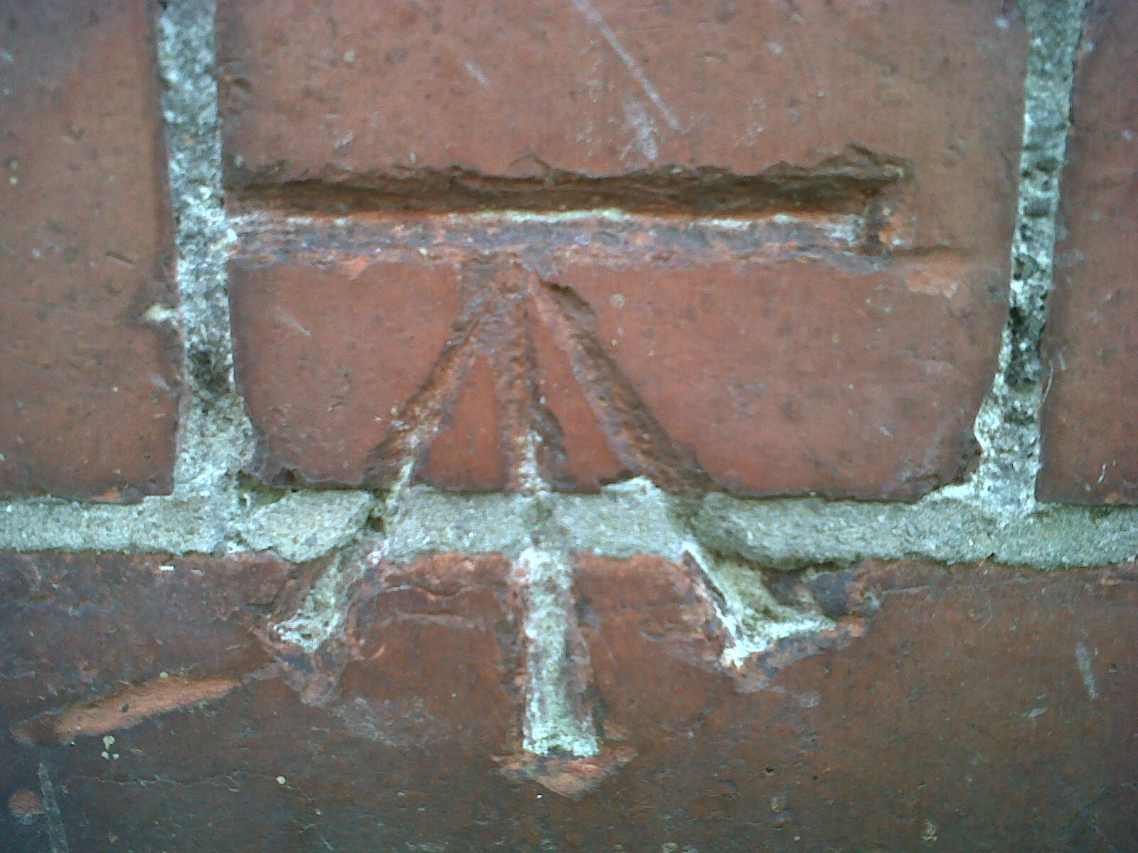

Text alternative for the diagram
Tide observations and a geoid model lead through maintained control to a site benchmark and project level. The physical mark is a realization, not the abstract datum itself.
Ordnance Datum Newlyn was based on mean sea-level observations at Newlyn between 1915 and 1921. That historical averaging period does not mean today's tide at Newlyn reads zero, nor that a builder can transfer the datum by measuring from the nearest beach. Modern GNSS supplies height above a reference ellipsoid; OSGM15 transforms it toward orthometric height in ODN. The ellipsoid is a mathematical surface, the geoid approximates an equipotential gravity surface, and the building's `0.000` is a further local convention. Their numerical differences are not errors when they describe different reference surfaces. [16], [17]

Text alternative for the diagram
An exaggerated earth section distinguishes reference ellipsoid, undulating geoid, terrain and a local building zero. Vertical separation is conceptual, not to scale.
International comparison dissolves the idea of one universal “sea level” still further. Rijkswaterstaat describes Normaal Amsterdams Peil as the common zero for Dutch heights, maintained through tens of thousands of surface marks and hundreds of more stable deep marks. It supports flood defence, construction and monitoring of a moving ground surface. Its historical record shows a local Amsterdam standard becoming a wider reference through administration and measurement. A house can therefore be “above NAP” without its occupant ever seeing the water surface from which the system's history began. [19], [20]
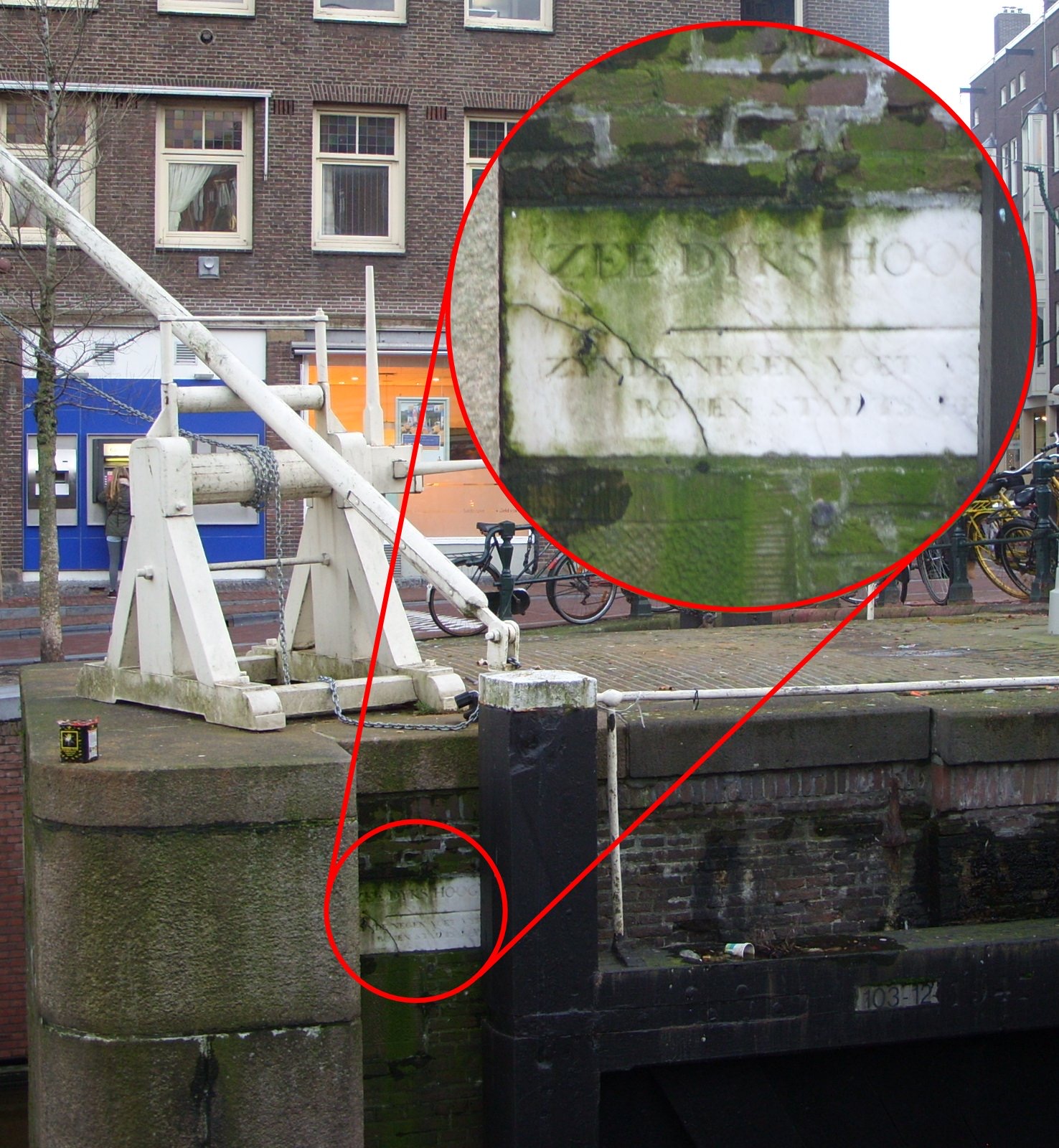
France's IGN says the mainland levelling zero derives from Mediterranean observations at Marseille between 1885 and 1896. It also notes that national systems can differ across borders, which is why European reference work is necessary. Germany's BKG describes DHHN2016 normal heights in relation to Amsterdam and a national levelling network. Connected history does not make the numerical systems casually interchangeable: reference epoch, gravity treatment, network adjustment and transformation still matter. [21], [22]

Text alternative for the diagram
Britain, Netherlands, France, Germany, Japan and the United States appear as distinct named vertical systems with different histories; no conversion values are implied.
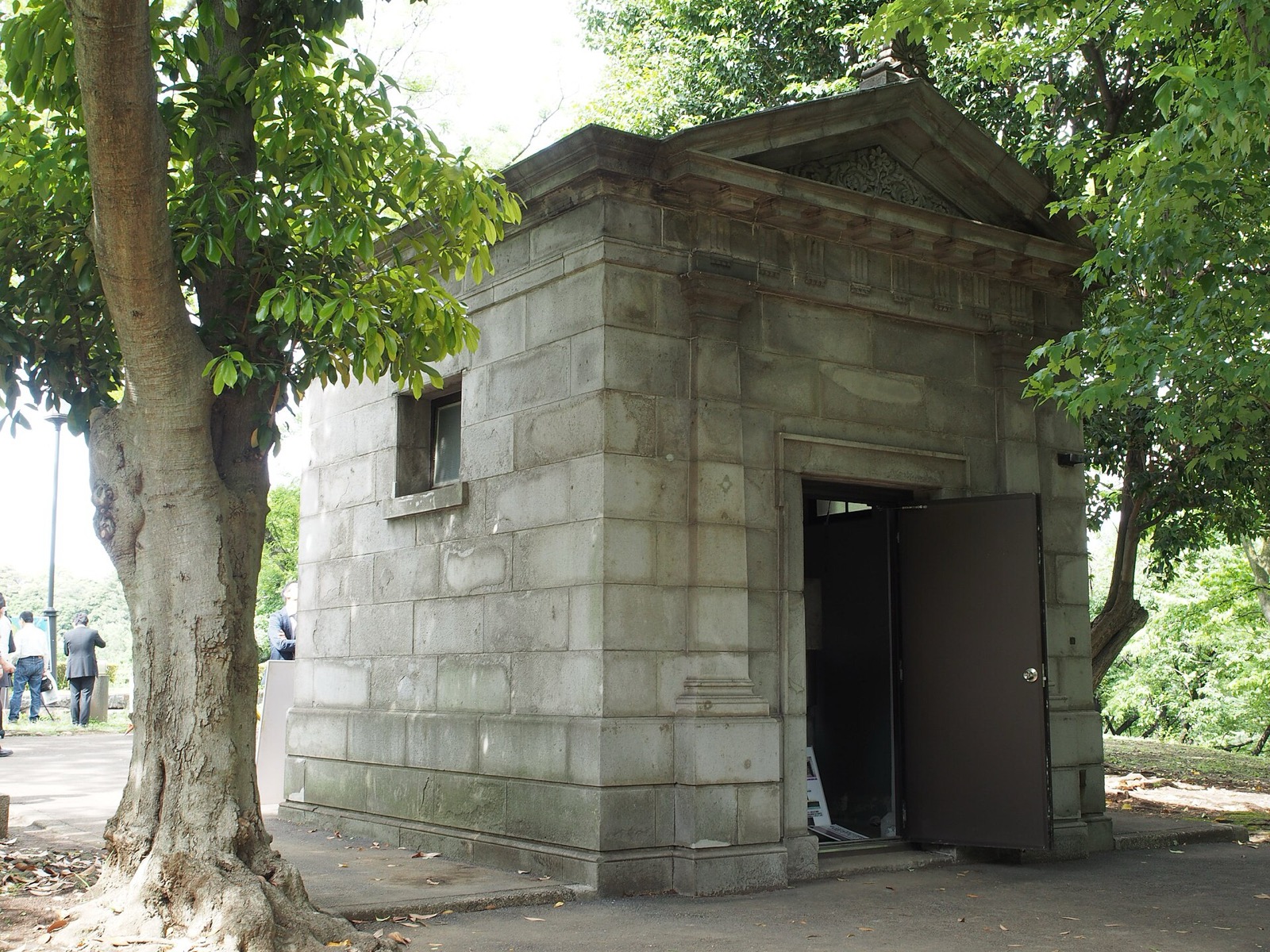
Japan makes the physical and temporal character especially clear. The Geospatial Information Authority explains the national level origin through mean sea observations at Tokyo Bay. Its monumental 1891 origin—stone and brick on a deep foundation—gave a durable reference, but earthquakes and crustal movement required its adopted value to be revised. Japan introduced JGD2024 on 1 April 2025 using its nationwide GNSS control infrastructure. A carefully built monument can be stable relative to a street and still inhabit a moving crust; maintenance of the datum is part of the datum. [23], [24], [25]
The United States likewise uses more than one vertical system. NOAA describes NAVD 88 for the contiguous United States and Alaska alongside separate territorial datums, and distinguishes a GNSS ellipsoid height from an orthometric height obtained using a geoid model. This page records that agency position at the time researched rather than treating current-datum status as permanent. The general lesson is stable: an elevation without datum, units and epoch is not portable evidence. [18]

Text alternative for the diagram
Two identical elevation numbers sit on different vertical references and do not coincide. A safe handover adds CRS, vertical datum, units, benchmark, epoch and transformation.
Where the reference meets bodies and water
An architectural level becomes real at the threshold. Approved Document M for buildings other than dwellings defines a “level” approach as predominantly level but permits a maximum 1:60 gradient in the direction of travel. The wording is a useful warning against everyday absolutes: level can be a bounded performance category rather than perfect geometric horizontality. The same guidance explains that changes of level can be difficult for wheelchair users, people using walking aids and people with impaired sight, and prefers a level threshold at an accessible entrance. US ADA standards regulate floor surfaces and small vertical changes differently within their own jurisdiction. Neither document is a universal global rule, but together they show that a few millimetres can matter more to a body than a dramatic datum line matters to a façade. [26], [27]

Text alternative for the diagram
A flush route, a small abrupt rise and a gradual transition affect passage differently. The diagram is qualitative and does not certify compliance in any jurisdiction.
This creates a genuine design tension at old buildings and wet sites. A raised sill may keep surface water out or preserve historic fabric while obstructing entry. Lowering it may disrupt archaeology, weathering details or internal floors. Adding a ramp can require landings and alter a ceremonial plinth. The responsible response is not to declare “datum versus access,” as if the architectural idea were sacred and people secondary. It is to document existing levels, water paths, significance and routes, then design an inclusive connection with the relevant specialists and current standards. [12], [13], [14], [26], [27], [28]
Flood elevation makes reference provenance a safety issue. FEMA's design guide requires every elevation used in flood calculations to identify its vertical datum. A base-flood elevation from one system cannot safely be compared with a finished-floor elevation from another simply because both values use feet or metres. Survey conversion, subsidence, wave effects, freeboard, changing hazard information and the date of the observations all sit behind the apparently simple instruction to “raise the floor.” [28]

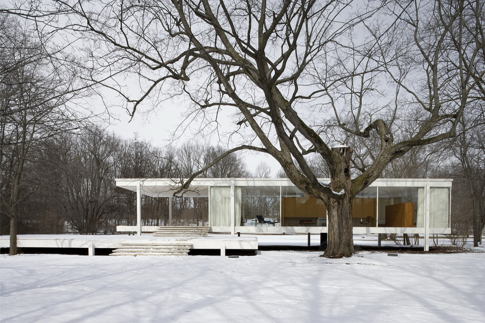
The Farnsworth House beside the Fox River demonstrates the limit of a past observation. The National Park Service says Mies van der Rohe set the finished floor five feet above grade and one foot above the highest flood then recorded. Later floods rose higher, including water more than five feet deep inside in 1996. The building's elevated floor plane remains one of its defining visual relationships, but its height was never a timeless guarantee. The designation record supports the 1951 house's open glass enclosure, steel frame and terraces; it does not show that Mies used Ching's later theoretical label “datum.” That is an explicit analytical reading of the floor, terrace and roof planes. [29], [30]

Text alternative for the diagram
Grade, lower terrace, occupied floor, an earlier recorded flood and later overtopping are separated in a schematic Farnsworth section. It is not a hydraulic model.
Preservation makes the problem harder. Lifting a landmark farther could change its relationship to meadow, steps and river; barriers could protect fabric while transforming views and access; accepting periodic inundation risks material and collections. The lesson is not that elevation failed or that one engineering answer is obvious. It is that every datum embodies a date, evidence base and purpose. When the river exceeds the historical record, the architectural plane stays where it was while the risk reference must be reconsidered. [28], [29], [30]
Horizontal planes in Barcelona, São Paulo and La Jolla
The reconstructed Barcelona Pavilion offers an unusually lucid field of planes. The Fundació Mies van der Rohe records the German Pavilion by Mies and Lilly Reich for the 1929 International Exposition, its dismantling in 1930 and its reconstruction on the original site between 1983 and 1986. Travertine paving and plinth extend beyond the glass and marble enclosures; a thin roof appears to gather freestanding walls beneath it; pools depress reflective planes beside the walking surface. These conditions justify reading floor and roof as datums that relate walls of different lengths and materials. The word is ours, while the authorship, materials and phase come from the custodian. [31]
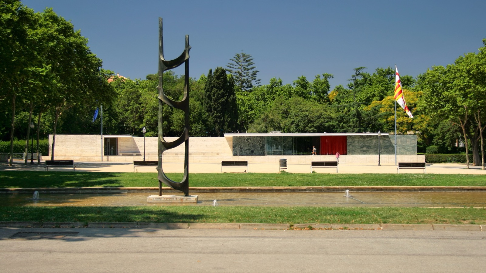

Text alternative for the diagram
Extended plinth and roof planes relate freestanding walls and pools in an intentionally nonmeasured analysis of the reconstructed Barcelona Pavilion.
That phase is not a footnote. A current photograph records a late-twentieth-century reconstruction of a temporary 1929 work. Stone veining, jointing, patina and landscape belong to the rebuilt pavilion's material history, even when the arrangement seeks fidelity to the original. The continuous paving can visually dissolve inside and outside, but glass edges, shallow water, level transitions and controlled visitor paths remain physical conditions. A datum plane orders experience without making every point equivalent. [31]
At MASP in São Paulo, the relationship is vertical and urban. The museum describes Lina Bo Bardi's 1968 building as a glass-and-concrete exhibition volume suspended above the vão livre, preserving an esplanade and belvedere as public space. Its collection record for a preliminary study names a 74-metre free span and the interface between suspended volume and square. The overhead museum can be read as one large volumetric datum, while the ground plane remains open to passage, assembly and views. Yet the preliminary drawing, the completed building and today's use are separate records. [32], [33]
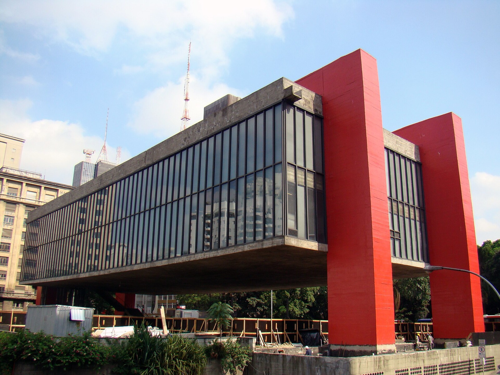

Text alternative for the diagram
A schematic section separates MASP’s lower spaces, public ground, long-span supports and suspended exhibition volume. It is not a structural calculation or traced drawing.
Ana Carolina Tonetti's University of São Paulo dissertation follows the free span as a collective urban void whose occupations change. Markets, demonstrations, encounters or emptiness can all occur beneath the same suspended box. The architecture offers a capacious condition but does not guarantee a single democratic result. Management, policing, events, maintenance and surrounding city life help decide who can use it. The datum reading is therefore spatial rather than moral: a persistent overhead and ground relationship frames variable public action. [32], [33], [34]
The Salk Institute at La Jolla directs a horizontal plane toward distance. The institution describes two mirror-image laboratory wings and a travertine court, with additional levels and service zones shaped partly by coastal height restrictions. Its virtual tour reads the court toward the Pacific horizon, a view reinforced by the narrow central water channel. The Getty Conservation Institute's history shows that laboratory blocks, plaza and material systems emerged through design development rather than one instantaneous diagram. [35], [36], [37]
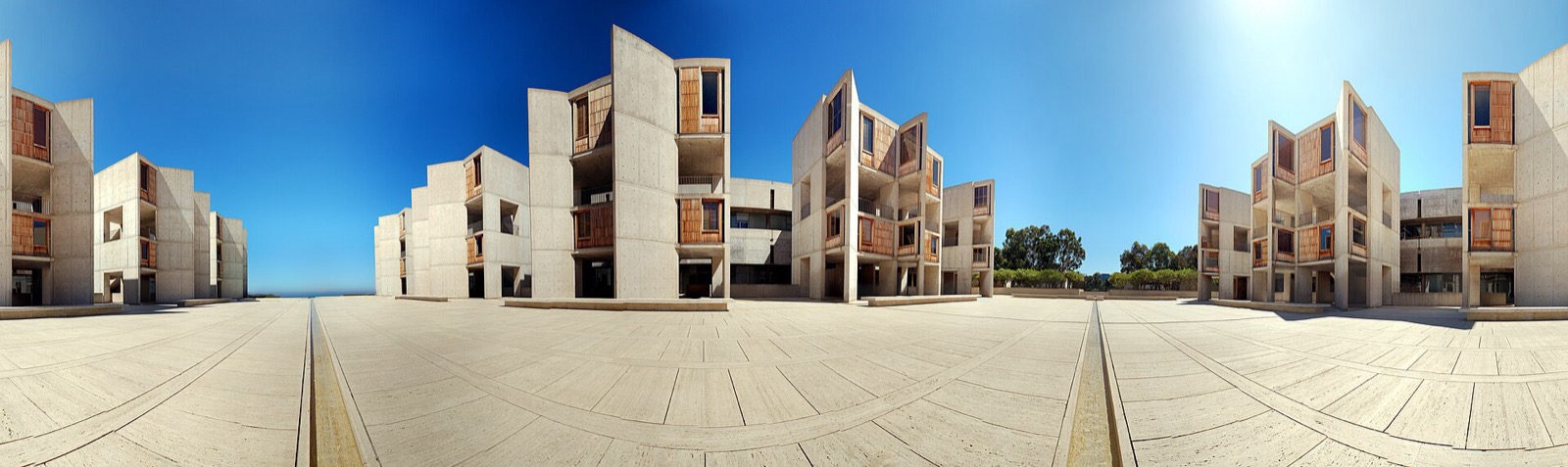

Text alternative for the diagram
Paired wings frame a court, narrow channel and distant horizon. The diagram records an institutional and analytical reading, not a universal perceptual response.
Here the horizon may act as a distant visual datum while the travertine court is an occupied plane. They are not the same kind of reference. One changes with eye position and atmosphere; the other consists of joints, drainage, repaired stone and a conserved pool. The Getty conservation record treats the plaza as significant fabric that has experienced change. Calling the court timeless would erase the work needed to sustain its apparent calm. The Salk video is valuable because movement through the route clarifies a relationship that a centred still image makes almost too perfect. [35], [36], [37], [38]
Repeated volumes and adaptable frameworks
At the Kimbell Art Museum, a datum can be read in three dimensions. The museum describes sixteen cycloid vaults, each 100 feet long and 20 feet wide, grouped in a 6–4–6 arrangement. The vault is not merely a roof profile repeated for visual rhythm. Its concrete shell, slot and reflector organise structure and natural light while the repeated section helps visitors understand gallery sequence. Different uses and enclosures occur within a persistent volumetric rule. [39]
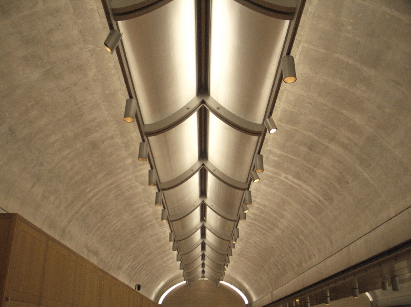

Text alternative for the diagram
Repeated cycloid-like volumes are grouped six, four and six around a central court. They are symbolic rather than a measured or copied Kahn plan.
The overlap with rhythm is real, but the concepts differ. Rhythm describes recurrence through movement; datum describes the stable reference to which changing bays and rooms relate. At Kimbell, one can notice repeated crowns before understanding the plan. Inside, the continuous vault section and light-reflecting system provide a stronger datum than a single façade line. Its usefulness depends on the relationship among structure, illumination and occupation, not repetition alone. [39]
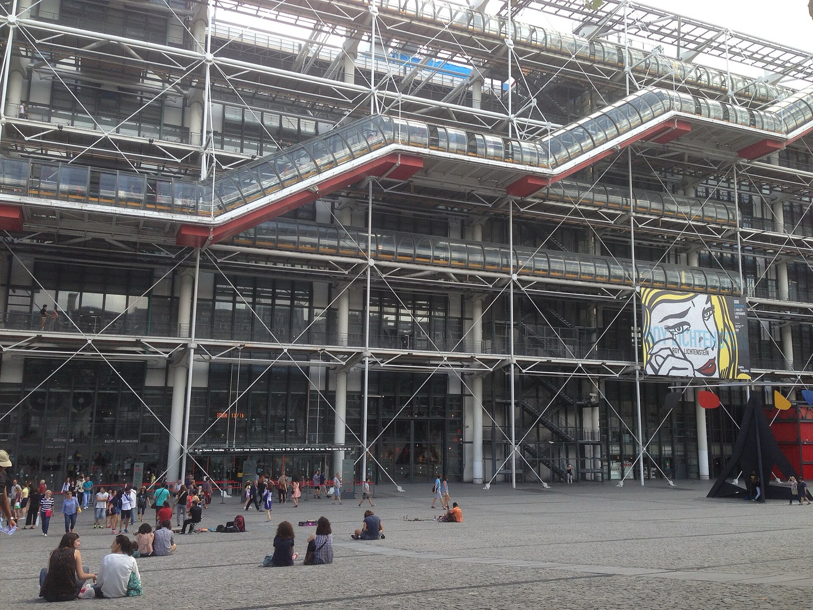
Centre Pompidou in Paris uses a larger exposed framework. The institution records ten levels, an open piazza and colour-coded services placed visibly around the building. Its technical education material distinguishes permanent primary steel from tertiary components designed for replacement and describes five large free floor plates. Persistent structural module and adaptable occupation are not opposites: the regular frame supplies reference precisely so that exhibitions and internal arrangements can change. [40], [41]

Text alternative for the diagram
A persistent primary frame contains broad floor plates, replaceable services and changing occupations. The schematic is not a measured Pompidou bay.
This does not mean the actual floors are empty or infinitely flexible. Fire separation, access, loads, acoustics, conservation conditions and later interventions constrain each use. Nor does the building reduce to coloured pipes: the relationship between piazza, structural bays, broad plates and outward circulation is what allows the frame to function as an urban and architectural datum. The institution's account supports the system; whether a visitor finds it legible is a separate experiential question. [40], [41]
Together Kimbell and Pompidou show two ways a volume or frame can stabilise difference. One repeats a luminous vault section across galleries; the other repeats structural bays around broad adaptable plates. Neither requires that every room look alike, and neither makes the datum neutral. Kimbell's module brings a specific light/structure relationship; Pompidou's frame separates long-life support from changeable equipment while asserting that machinery on the exterior belongs to the public image. [39], [40], [41]
How to read a datum critically
First identify the kind of reference. Is it a visible compositional line, an occupied plane, a repeated spatial volume, a model level, a local coordinate origin, a survey benchmark or a national vertical datum? If several are present, draw the chain rather than calling all of them “the datum.” A parapet can align openings without being the point from which the contractor established floor levels; a project zero can coordinate drawings without being orthometric height. [1], [2], [3], [4], [5], [6], [7], [8], [9], [10], [11], [12]
Second ask how the reference is realised and checked. For design composition, continuity must be perceptible despite interruptions. For measurement, look for benchmark description, witness diagram, units, coordinate reference system, vertical datum, transformation, epoch and closure. For historic work, check whether a plan records lean and settlement or regularises them. If an inherited file supplies a confident numeric height but no provenance, that is an uncertainty to resolve, not a blank to fill by intuition. [9], [10], [11], [12], [13], [14], [15], [16], [17], [18], [19], [20], [21], [22], [23], [24], [25]

Text alternative for the diagram
A reader moves through five checks: identify reference, extent, realization, dependants and evidence of movement or error. Each branch needs different evidence.
Third follow the consequences. Which slabs, stairs, doors, drains, façades or neighbouring models depend on the level? Who crosses the threshold? Which flood elevation is being compared? What changes if the assumed zero is wrong by 100 millimetres—or by a metre because two reference systems were mixed? At MASP and Salk, public use is not produced by a plane alone. At Farnsworth, an elegant raised plane did not hold the river below it forever. [26], [27], [28], [29], [30], [31], [32], [33], [34], [35], [36], [37], [38]
Finally separate description from interpretation. It is factual that Kimbell has sixteen documented vaults in a 6–4–6 grouping; calling the repeated section a volumetric datum is an argued reading. It is factual that the Barcelona Pavilion was reconstructed and uses travertine, glass, steel and marbles; reading its plinth as a continuous ordering plane is analysis. Making that boundary visible strengthens architectural history. The datum then becomes neither jargon nor a magical straight line, but a disciplined way to ask how buildings coordinate difference across drawings, matter, land and time. [31], [32], [33], [34], [35], [36], [37], [38], [39], [40], [41], [42], [43]
Companion Pages and Reading
The companion pages on axis, grid, proportion, symmetry, rhythm and massing develop neighbouring kinds of order. Pages on plinths, floors, roofs, thresholds, foundations, surveying, accessibility, flood-resilient design and the individual buildings discussed here show how a reference enters construction and use. Their terms overlap, but their questions should remain distinct. [1], [2], [3], [4], [5], [6], [7], [8], [9], [10], [11], [12], [26], [27], [28], [29], [30], [31], [32], [33], [34], [35], [36], [37], [38], [39], [40], [41]
The Salk Institute's virtual architecture tour is the primary moving-image feature because movement makes the relation among paired wings, court, channel and horizon easier to test than a centred still. Rijkswaterstaat's NAP page adds an institutional Dutch explanation of how a national height reference is maintained and used. Neither video is evidence that every viewer shares one response; each extends a source already bounded in the article. [19], [35], [36]
For books, Francis D. K. Ching's Architecture: Form, Space, and Order provides the wider design vocabulary behind line, plane, volume and ordering principles. Peter Swallow, Ross Dallas, Sophie Jackson and David Watt's Measurement and Recording of Historic Buildings turns toward levelling, sketching, instruments, plotting and fabric. Their publisher records are recommendations, not substitutes for the directly checked standards and institutional cases above. [42], [43]
Explore RELATED Artworks and Records

Ordnance Survey benchmark
A physical legacy reference mark
N Scott; Wikimedia Commons
Amsterdam Peil stone
A surviving historic level marker
Hans Erren; Wikimedia Commons
Japanese leveling origin
A national reference monument
Kestrel; Wikimedia Commons
Seine high-water marker
A dated event level on a building
Daniel Case; Wikimedia CommonsWatch: Reference in Motion
Salk’s court and Rijkswaterstaat’s NAP explanation show architectural and geodetic reference at different scales. [19], [35], [36]

Salk Institute Virtual Architecture Tour
The institution’s moving tour tests court, route and horizon beyond a centred still.
Original schematic preview; no video still reused.
Normaal Amsterdams Peil
Rijkswaterstaat explains the maintained Dutch national height reference and its uses.
Original schematic preview; no video still reused.Frequently Asked Questions
No. A compositional datum may be a line, plane or volume in different orientations, while a geospatial datum defines a reference system. [1] [2] [3] [9] [10] [11]
Not necessarily. It is often a local project level whose connection to a site benchmark and vertical datum must be stated. [4] [9] [10] [11] [12] [16] [17]
No. An axis supplies direction, a grid repeats coordinates, and a datum supplies continuity or reference, though they can overlap in one design. [2] [3] [4] [5]
Only after its identity and present validity are verified; a surviving legacy mark is not automatically maintained control. [12] [15] [16] [17]
The observations may use different vertical datums, units, epochs or transformations. Those metadata are part of the measurement. [9] [10] [11] [15] [16] [17] [18] [19] [20] [21] [22] [23] [24] [25]
Because a floor or threshold is bodily terrain. Small abrupt level changes can obstruct a route even when a drawing appears continuous. [26] [27]
The sources used here do not establish that wording. The page marks this as an analytical reading and sources its physical and flood history separately. [29] [30]
References
- Wiley, Architecture: Form, Space, and Order, fifth-edition excerpt Source record.
- University of Strathclyde, architectural dissertation Source record.
- Elizabethtown College, Architecture lecture: Ching Chapter 7 Source record.
- Autodesk, Model Layout Source record.
- Autodesk, Add Levels and Grids Source record.
- Autodesk, About Levels Source record.
- Autodesk, Element Behavior in a Revit Modeler Source record.
- Autodesk, Datum Visibility and Extents Source record.
- buildingSMART, IfcMapConversion Source record.
- buildingSMART, IfcProjectedCRS Source record.
- buildingSMART International, Geo-referencing BIM, version 2.0 Source record.
- Historic England, Geospatial Survey Specifications for Cultural Heritage Source record.
- Historic England, Drawing for Understanding Source record.
- Library of Congress, HABS/HAER/HALS technical note Source record.
- Ordnance Survey, benchmark archive Source record.
- Ordnance Survey, A Guide to Coordinate Systems in Great Britain Source record.
- Ordnance Survey, Coordinate transformations Source record.
- NOAA National Geodetic Survey, Vertical Datums Source record.
- Rijkswaterstaat, Normaal Amsterdams Peil Source record.
- Rijkswaterstaat, Drie eeuwen Normaal Amsterdams Peil Source record.
- IGN France, Le nivellement Source record.
- BKG Germany, Deutsches Höhenreferenzsystem Source record.
- Geospatial Information Authority of Japan, Japanese vertical datum Source record.
- GSI Japan, Leveling Origin Source record.
- GSI Japan, Japanese Geodetic Datum 2024 Source record.
- UK Government, Approved Document M Volume 2, 2024 amendments Source record.
- US Department of Justice, 2010 ADA Standards for Accessible Design Source record.
- FEMA, Building Designer's Guide to Calculating Flood Loads Source record.
- US National Park Service, The Farnsworth House Source record.
- National Park Service, Farnsworth House National Historic Landmark documentation Source record.
- Fundació Mies van der Rohe, El Pabellón Source record.
- MASP, Sobre o MASP Source record.
- MASP collection, preliminary study for the belvedere Source record.
- University of São Paulo, Ana Carolina Tonetti, O vão livre do MASP Source record.
- Salk Institute, Architecture Source record.
- Salk Institute, Virtual Architecture Tour Source record.
- Getty Conservation Institute, Louis I. Kahn: Designing the Salk Institute Source record.
- Getty Conservation Institute, Salk Institute Conservation Management Plan Source record.
- Kimbell Art Museum, Kahn Building Detail Source record.
- Centre Pompidou, Une architecture iconique Source record.
- Centre Pompidou, Structure et modules Source record.
- Wiley, Architecture: Form, Space, and Order, fifth edition Source record.
- Routledge, Measurement and Recording of Historic Buildings Source record.
Explore RELATED Architecture
These built places require documentary, material and lived evidence beside formal principles.
Proportion
Relationships among dimensions are not the same as a locating reference.
Symmetry
Reflection and correspondence can operate around, but do not define, a datum.
Rhythm
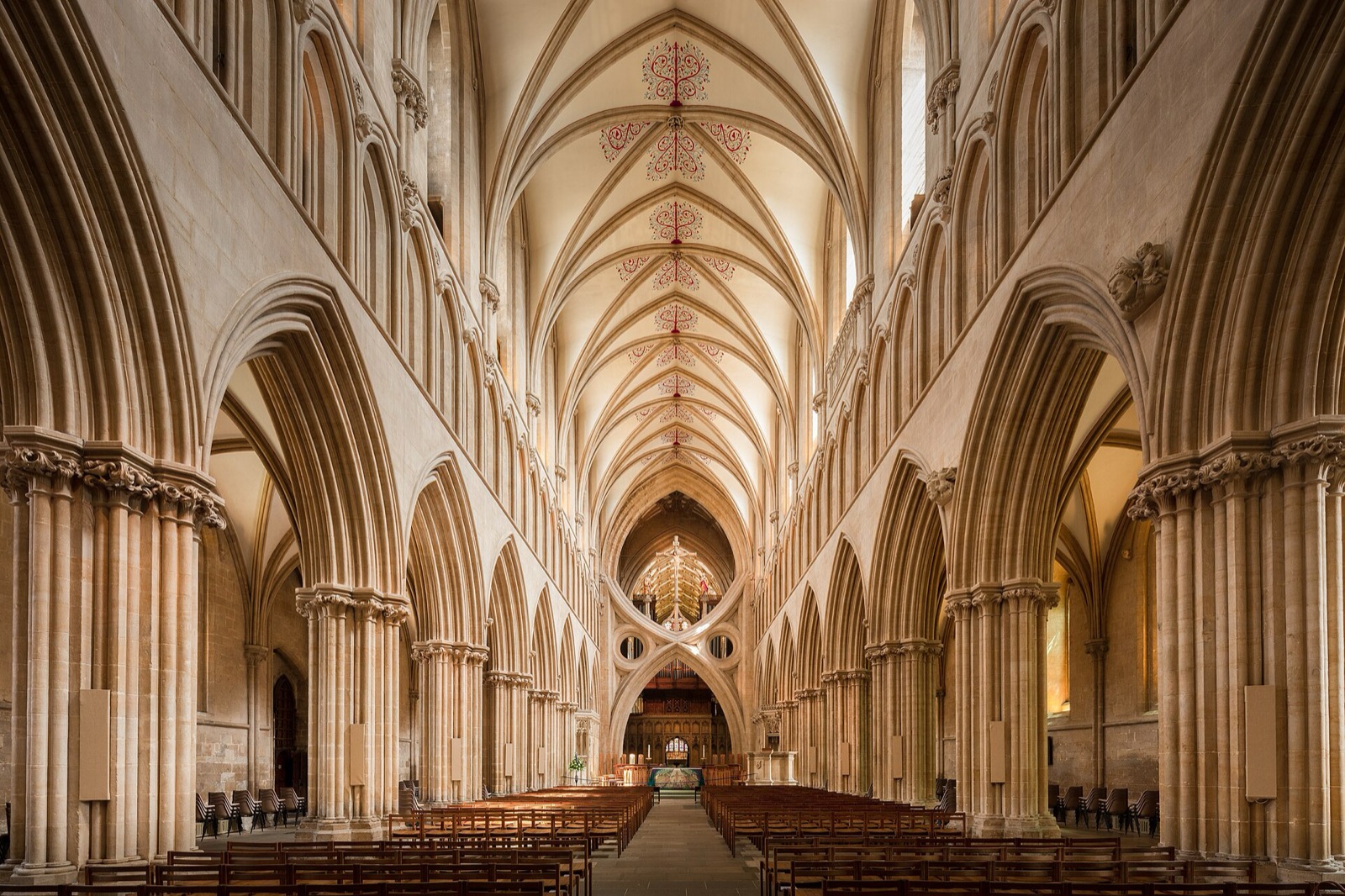
Repeated bays may use one datum while varying in interval and emphasis.
Massing
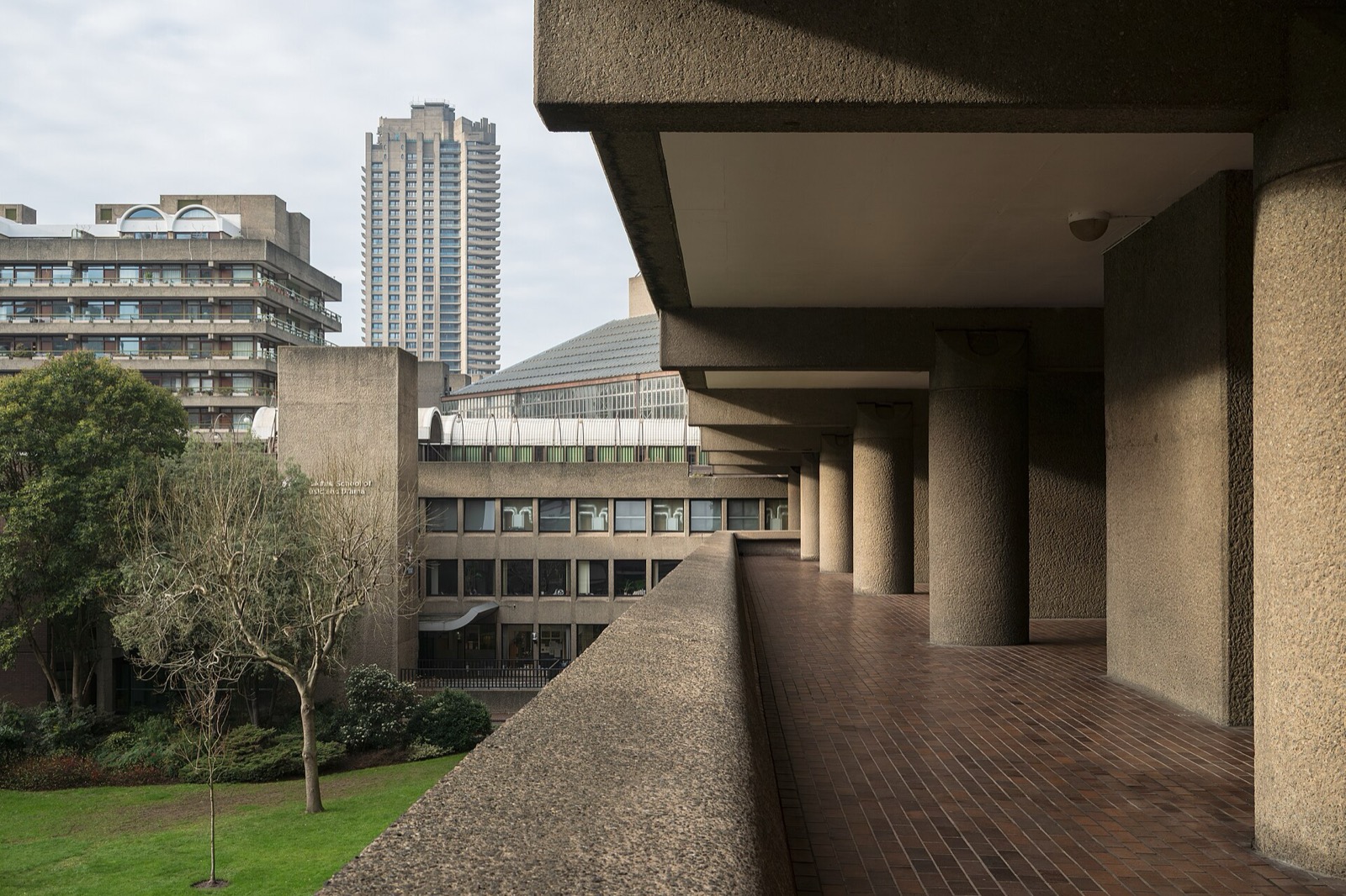
Bulk and void can be organised from shared planes and grids.
Pantheon
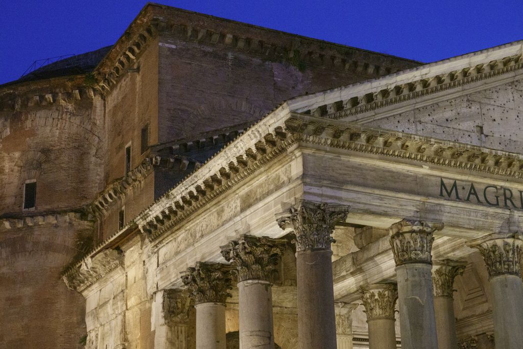
Rotunda, portico and threshold are read from different reference conditions.

Alhambra
Courts and water planes coordinate changing rooms and routes.
Forbidden City
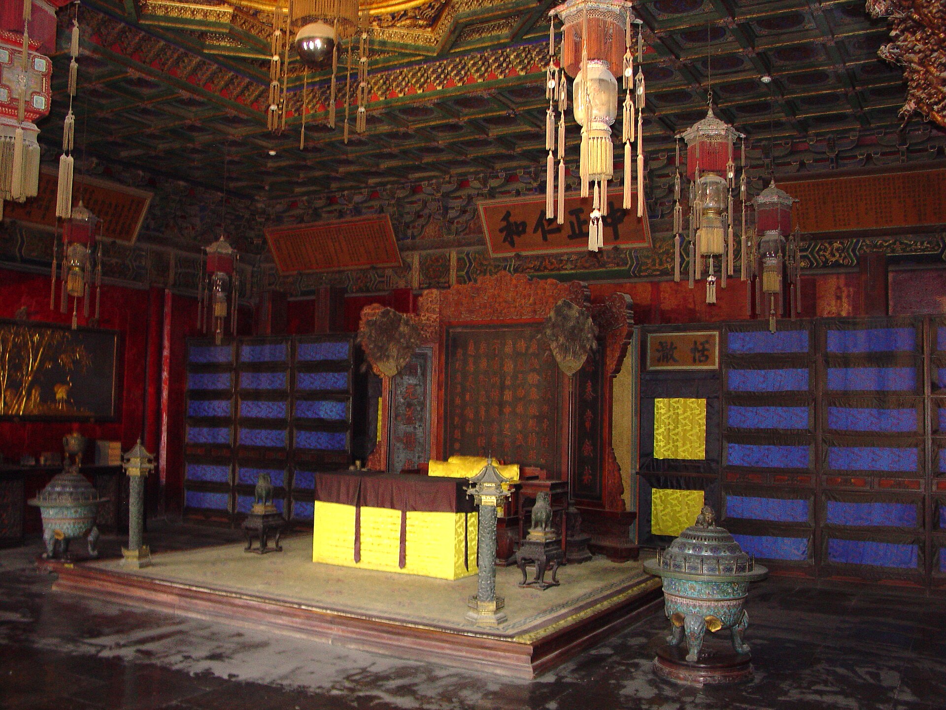
An imperial axis is directional order, not merely a floor level.
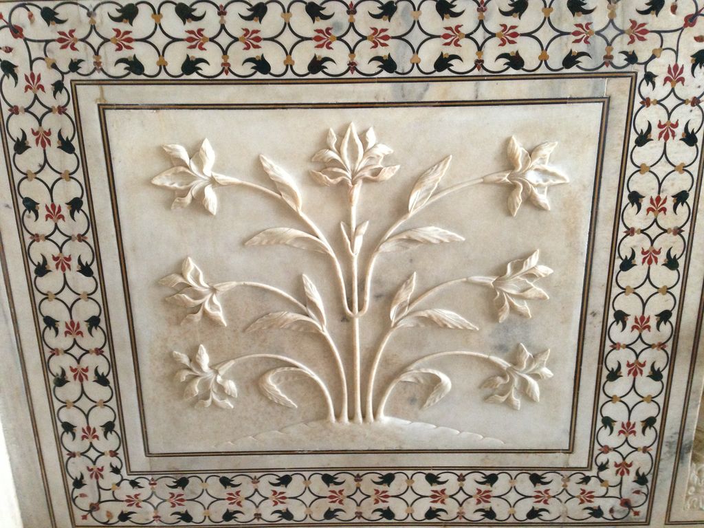
Taj Mahal
A strong axis and raised platform operate at different scales.