by Tom Gurney
Tom Gurney BSc (Hons) is an art history expert with over 20 years experience
Email: tomgurney1@gmail.com / Phone: +44 7429 011000
An Inca Ridge and a Larger Sanctuary
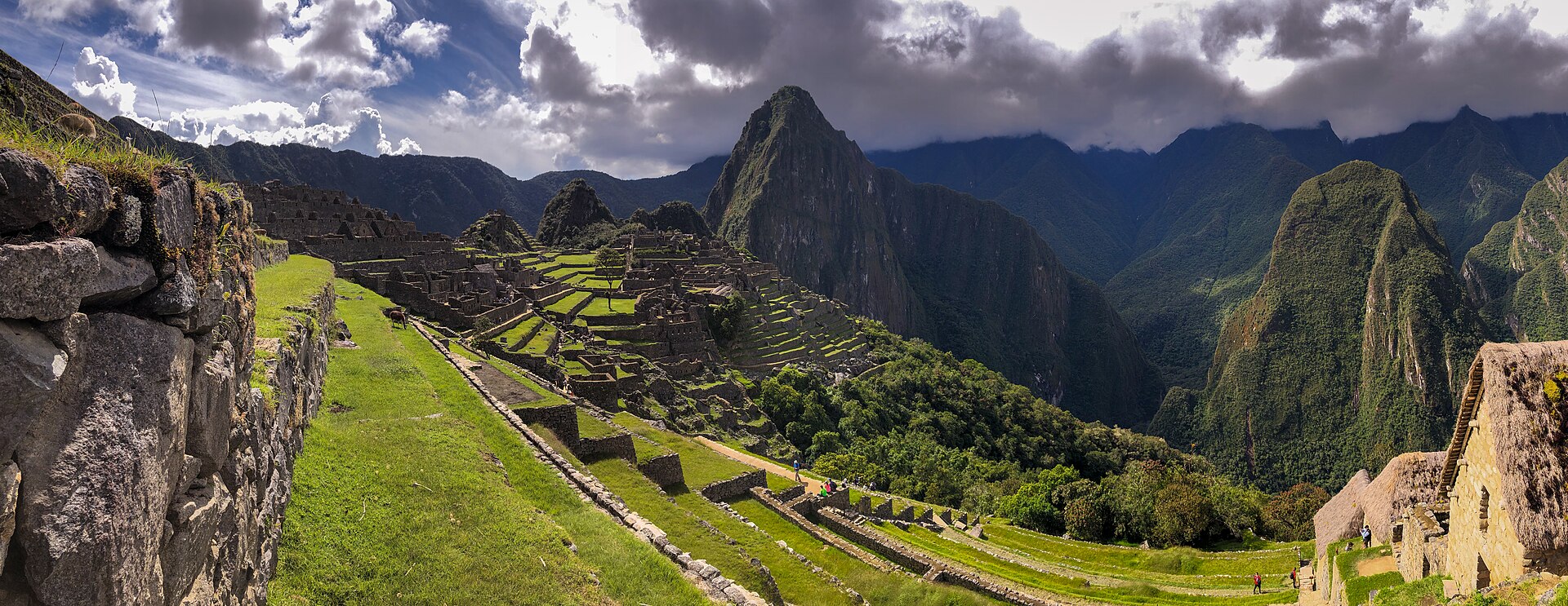
Machu Picchu is an Inca-built ridge settlement above a bend of the Urubamba River, but the familiar aerial view compresses a much larger place. Its walls belong to a llaqta of terraces, houses, plazas, carved rock, springs, fountains, stairs and gateways. Roads and subsidiary sites carried people and supplies through the surrounding mountains. Cloud forest, river watershed and high-Andean habitat are part of the Historic Sanctuary's cultural and natural value, not a scenic border around a stone “citadel.” To understand the architecture, the elevated city and its working landscape have to be read together. [1][2][5][6][7][12][15][22]
The settlement is often explained as an estate of the ruler Pachacuti. Historical holdings, elite architecture and later archaeological work make that a strong interpretation. It does not provide an Inca dedication naming the purpose of every room, or a construction date written into a wall. Burials now indicate occupation from about AD 1420 into the early sixteenth century; the more precise founding dates still repeated in guidebooks outrun that evidence. A royal household, ritual places, maintenance, agriculture and administrative movement could coexist on the ridge. [6][8][9][16][17]
The site known today is also a product of Inca alterations, local use, twentieth-century excavation and later restoration. A dry-stone wall seen in a photograph may combine ancient fabric with a Peruvian conservation intervention; a modern name such as “Temple,” “Royal Tomb” or “Prison” may outlive the argument that gave it currency. The best way through Machu Picchu is to follow what its slopes, stones, water and excavated lives establish, while keeping plausible interpretation distinct from certainty. [2][6][10][13][18][23]
At a Glance
- PlaceA granite ridge at about 2,430 metres above sea level, between Machu Picchu and Waynapicchu peaks and above the winding Urubamba/Vilcanota River. [1][2][6][7]
- Built landscapeAn Inca llaqta of approximately 200 structures in UNESCO's broad inventory, with terraces, plazas, dwellings, gateways, worked rocks, roads, spring-fed fountains and drains. The inventory is approximate, not an exact room count. [1][6][7][11][12][13]
- AgeImperial Inca construction and occupation in the fifteenth and early sixteenth centuries. Radiocarbon dates on burial remains indicate activity from about AD 1420 to 1532; they do not date each building's completion. [8][9]
- FunctionA royal-estate association with Pachacuti is well supported, while residential, ceremonial, productive and administrative roles are not reducible to one name for the whole site. [2][6][8][9][16][17]
- PlanAgricultural terraces and an urban sector separated by a major drainage line; within the urban area, upper and lower groups, plazas, stairs, kancha and natural rock were fitted to uneven ground. [1][7][11][12]
- WaterA spring-fed gravity canal served sixteen principal urban fountains, while other spring/drainage-fed water features and extensive terrace drainage formed a wider system. [7][11][13]
- Local and modern historyAgustín Lizárraga visited in 1902; local families lived and farmed around the site before Melchor Arteaga led Hiram Bingham there in 1911. Peruvian and local workers made the later clearing and excavation possible. [6][23]
- ProtectionThe Historic Sanctuary of Machu Picchu, a UNESCO mixed cultural/natural World Heritage property since 1983. Its current UNESCO data-panel area is 38,160.87 hectares, far larger than the llaqta alone. [1][2][3]
Contents
- A ridge shaped by river, stone and forest
- Building and occupation: what the dates can tell us
- Approaching through terraces and gates
- Terraces as foundations, fields and drainage
- Quarrying, masonry and the surfaces we no longer see
- The spring, canal and sixteen principal fountains
- Upper plazas and the modern “Temple” names
- The Torreón and the limits of solar precision
- Condor, mortars and rooms used by people
- More persuasive instruments: Intimachay and Inkaraqay
- The people behind the royal estate
- Before and after Bingham's 1911 visit
- Conservation of a cultural and natural sanctuary
A ridge shaped by river, stone and forest
The Inca buildings occupy a narrow shoulder between the older peak Machu Picchu and Waynapicchu, the younger summit that rises behind many views of the ruins. Below them the Urubamba loops around steep mountain flanks. The slope offers both a striking outlook and a formidable construction problem: there is little level ground until retaining walls and stepped fills make it. The city therefore does not sit on a ready-made platform. Its architecture manufactures platforms, stair routes and drainage in a landscape of fractured granite. [1][2][6][7][11][12]
Granite of the Vilcabamba batholith supplied much of the masonry. Natural fractures gave stoneworkers exploitable blocks and outcrops; some large rocks were left in place and incorporated into walls or carved settings, rather than cleared away. Quarries and preforms within the settlement show shaping still in progress. A worked boulder can have structural, topographic and sacred significance at once. Andean huacas could include rock, mountain and spring, but a conspicuous stone should not automatically be declared a clock or solar instrument. Its setting and documented modifications matter. [7][12][13][20][24]
The surrounding sanctuary is not the archaeological core enlarged on a tourist map. UNESCO's present property record gives 38,160.87 hectares for the mixed World Heritage site; older text on the same page and in some institutional material prints smaller historic areas. That difference reflects changing property figures, not several equally current sizes of the city. Cloud-forest canopy, orchids, birds, the Andean bear and highland and riverine ecosystems contribute to the reasons for protecting the area. Natural cover also makes the archaeological landscape harder to map: lidar has detected terraces, roads and a more complex Mandor wall pattern over a broad survey, yet dense vegetation obscured some results. [1][5][15][22]

Text alternative for the diagram
Ridge llaqta includes terraces, urban groups, water and worked rocks. Intipunku and satellite sites connect it to valleys. The much larger current 38,160.87-hectare UNESCO sanctuary includes Urubamba watershed, mountain and cloud forest.
This distinction of scales changes a basic architectural question. The ridge's terraces could grow crops and prevent erosion, but a photographed set of plots cannot explain every meal or every journey of stone, wood, fibre and food. Roads, satellite settlements and valley installations connected the place to imperial Cusco and to its immediate mountain economy. Chachabamba and Choqesuysuy may have begun development at overlapping or even earlier moments than the high llaqta, though the charcoal-date models remain broad. Machu Picchu was a node within an Inca landscape, not an isolated island of granite above a river. [1][6][9][11][15]
Building and occupation: what the dates can tell us
Written accounts of Pachacuti's fifteenth-century expansion and documents referring to Picchu-region holdings help explain the site's elite associations. The emperor's political reach, the quality of selected masonry and the ridge's controlled routes fit a royal-estate model advanced in modern archaeology. Yet Patallaqta as the site's original name, or the identification of a particular cave as Pachacuti's mausoleum, remains disputed; some historians place the relevant named estate or burial in Cusco instead. No excavated inscription settles the question. It is possible to take royal patronage seriously without converting a historical model into the proper name and function of every building. [2][6][25]
Radiocarbon work has made the older neat chronology less defensible. AMS dates on human remains from burial caves indicate people at Machu Picchu from roughly AD 1420 through AD 1532, earlier than an argument that necessarily starts construction after a conventional 1438 accession. Burials record people and use, not the day a terrace wall was first laid. A second Peru–Poland study modeled eleven dates from Machu Picchu and nearby Chachabamba and Choqesuysuy. Much of its material was charcoal, whose wood can be older than the moment it burned. Its probabilistic first-activity windows are consequently wide; the high city and Chachabamba may overlap, and Choqesuysuy may be earlier, but more short-lived samples are needed. The evidence expands the possible early history rather than replacing one exact founding year with another. [8][9]
Excavated construction changes tell a related story. Builders altered precinct dimensions, responded to block movement and modified water channels. At some upper structures, dressed stone and wall ends look unfinished; elsewhere a roof-end form that looks incomplete to a modern visitor may have been a finished alternative. The llaqta was not a single plan executed without revision and then frozen. Its surviving fabric records decisions across time, and later rebuilding adds another layer whose date must be recognised. [6][7][10][13]
Approaching through terraces and gates
Routes from Cusco and the valley climbed into a wider network of Inca roads, stations and shrines. Intipunku, the Sun Gate on the approach from the southeast, positions the llaqta in that network rather than making it a self-contained summit. The path enters a working topography of agricultural terraces before passing into the urban area by a controlled gateway. From the ridge, stairs, street-like passages and plaza edges steer movement between upper and lower groups. These changes of level can frame Waynapicchu and the river, but their exact ceremonial choreography is a reconstruction, not an Inca route manual. [1][6][7][11][12][15]
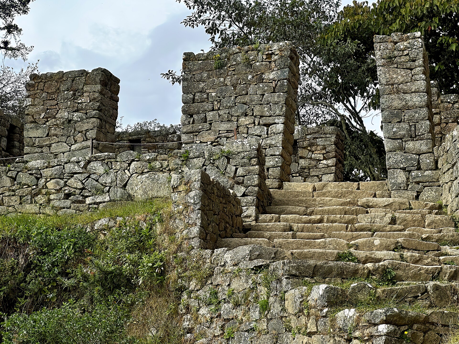
A broad dry ditch or main drain separates the agricultural slopes from much of the dense urban fabric. It carries rain away from terraces and buildings, so it is more than an arbitrary dividing line drawn on a plan. Inside, irregular topography prevented a rigid rectangular grid. Gavazzi's architectural survey describes a nested arrangement of natural outcrops, platforms, kancha courtyard groups, paths, pauses and viewing points. A stair may be a main connector in one precinct and a restricted approach in another. Portals, doubled jambs, wall heights and turns can signal access hierarchies, yet a narrow doorway by itself cannot identify a specific social rank. [1][7][11][12]
The different spaces were not visually equal. Some upper court buildings have carefully fitted stone, broad trapezoidal openings and views across the ridge; many dwellings and service spaces use less refined or varied masonry. Work on the royal-estate hypothesis must include this contrast without treating rustic walls as insignificant. They kept food, people and water moving. A collection of kitchens, stores, workshops and houses is architectural evidence of a functioning settlement just as surely as the best-photographed carved rock is. [6][7][10][12][16][17]

Text alternative for the diagram
Road and terrace approach reaches an urban gate. A main drain divides terraces from upper plaza/temple-labelled groups and lower houses, work rooms, carved rocks, stairs and fountains. It is a conceptual plan, not measured.
Terraces as foundations, fields and drainage
The agricultural terraces are often introduced as an elegant staircase of gardens. Their construction is less decorative and more vital. Builders raised retaining walls on the steep flank, backfilled them with graded layers of large stones, smaller stones and soil, and created cultivable tops. Rain could infiltrate and move through the coarse layers instead of pressing unrelieved against the stone face. Drains and the main ditch carried excess water downslope. The surfaces supported planting, but they also helped hold a constructed city on steep ground. Wright and Valencia's survey measured about 4.9 hectares of principal agricultural terraces; that figure is for a defined terrace sector, not the whole sanctuary's agriculture. [7][11][20]
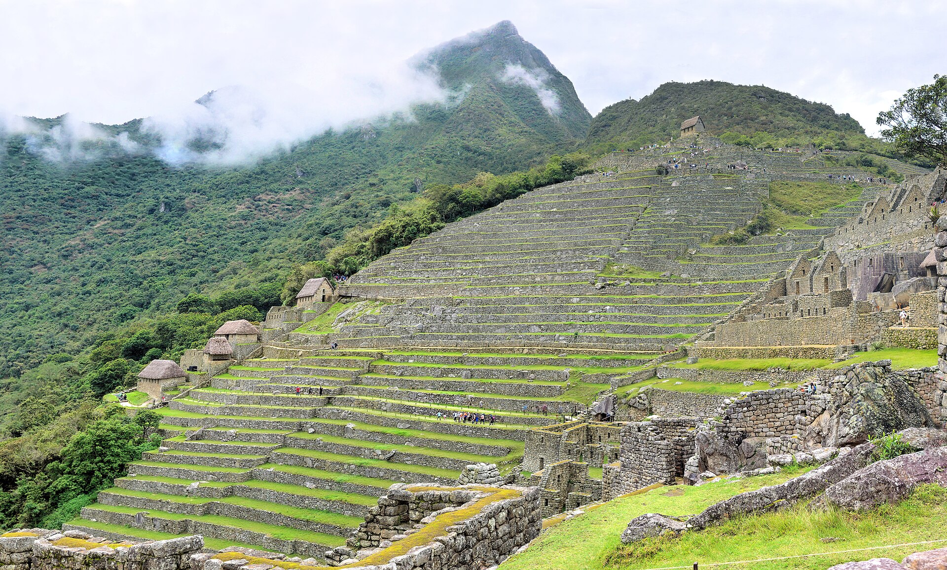
Dry-stacked stone does not mean random piling. In a geotechnical study of selected Machu Picchu, Pisac and Moray walls, digitally surveyed Machu Picchu specimens showed mixed-size stones with numerous frictional contacts, contributing to stability under the modelled conditions. Graded fill and drainage behind retaining walls are equally important to the result. That study explains surveyed examples, not an eternal guarantee for every ancient or restored wall. It also shows why “earthquake-proof” is an overstatement: movement, settlement, vegetation and water still affect particular walls. [11][20]
There is no observed branch from the principal domestic fountain canal into Wright's mapped agricultural terraces. This does not mean crops had no water: rainfall and the terrace's own infiltration/drainage system are part of their engineering. Nor should every hillside terrace be reduced to food output; some platforms carry buildings, paths or lookouts and demand separate reading. The first stage of construction often required a wall and levelled fill before a room could exist above it. Astete's lower-to-higher sequence is supported by wall relationships and the logistics of building on a slope, although no Inca blueprint specifies every stage. [7][11][12]
Quarrying, masonry and the surfaces we no longer see
Stone was gathered from the site's natural fractures and local quarry zones, broken into workable sizes and dressed in stages. Preforms, tool traces and unfinished joints make labour visible. Fine masonry can join blocks so closely that a thin seam becomes the chief visible mark; elsewhere irregular pirka walls use differently sized pieces and mortar or packing. An architectural survey found technological variation even among coherent precincts. The contrast is not a simple division of “elite” versus “inferior”: wall role, exposure, available block, changing plans and subsequent restoration also matter. [7][10][12]
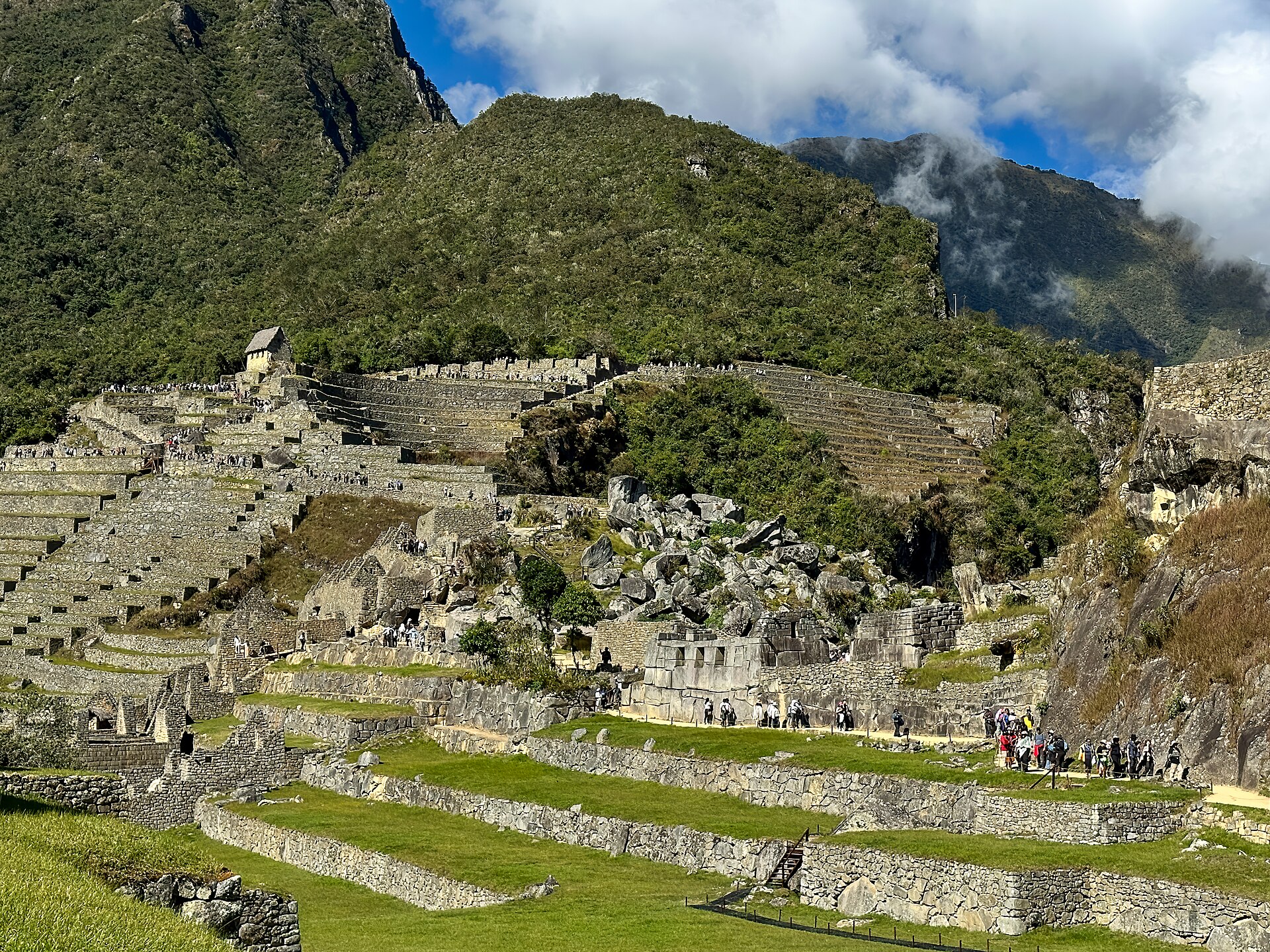
Trapezoidal doors and windows, narrow niches and sometimes double-jamb portals are conspicuous elements of the surviving stone. Their taper is an architectural geometry used repeatedly in Inca construction; the double jamb can lend a threshold extra emphasis. Still, open masonry is only part of the original enclosure. Roofs of timber, thatch and other organic components are almost entirely gone. Roof support positions and wall ends help infer their slopes, while the absence of wood makes some reconstructions uncertain. One supposed astronomical light effect at the “Mortars” disappears when a plausible original roof is returned to the model—an instructive example of how the modern roofless ruin changes what sunlight appears to do. [6][7][10][11][12][24]
Today's pale granite may also misrepresent original surface colour. Gibaja recorded rare surviving mud, plaster and red, yellow or ochre pigment traces in several complexes. These findings do not justify painting every wall bright red in imagination; they do prevent treating the present exposed stone as a universal original finish. The buildings once combined stone texture, openings, organic roofing, changing light and perhaps patches of coloured surface. Photographs taken after clearing and rebuilding can show the stone admirably while withholding much of that inhabited visual condition. [6][10]
The dimensions themselves resist an easy story of universal standardisation. A Wrocław architectural-metrology study tested building outlines and found no statistical evidence that a single fixed module governed them. Earlier niche and interior-spacing observations suggested particular smaller measures in selected elite and service contexts; neither finding proves a universal unit for the whole city. Slope and existing rock constrained where an outline could be laid. The measured negative result makes the design no less deliberate: it shows that builders repeatedly adapted geometry to land, stone and access rather than stamping out identical building rectangles. [12][19]

Text alternative for the diagram
Rain enters planting soil and finer fill, travels through coarse stone below, and is carried off by retaining-wall outlets or drains. A dry-stacked mixed-size wall holds the layered platform. This is a conceptual section, not a measured excavation drawing.
The spring, canal and sixteen principal fountains
Water starts above the houses, at a spring captured on the Machu Picchu side of the ridge. A gravity canal carried that source to a descending chain of sixteen principal urban fountains. Stone spouts, receiving basins and short connecting channels made water available at successive levels. This is a material line one can follow through the architecture, not merely a symbolic “water cult.” The first fountain and adjoining upper buildings were not as freely accessed as every lower basin; Fernández records an added fountain, 1A, whose arrangement could restrict collection to people with privileged access. That hierarchy follows built thresholds and route relationships, though exact users cannot be named from a water spout. [7][11][13]
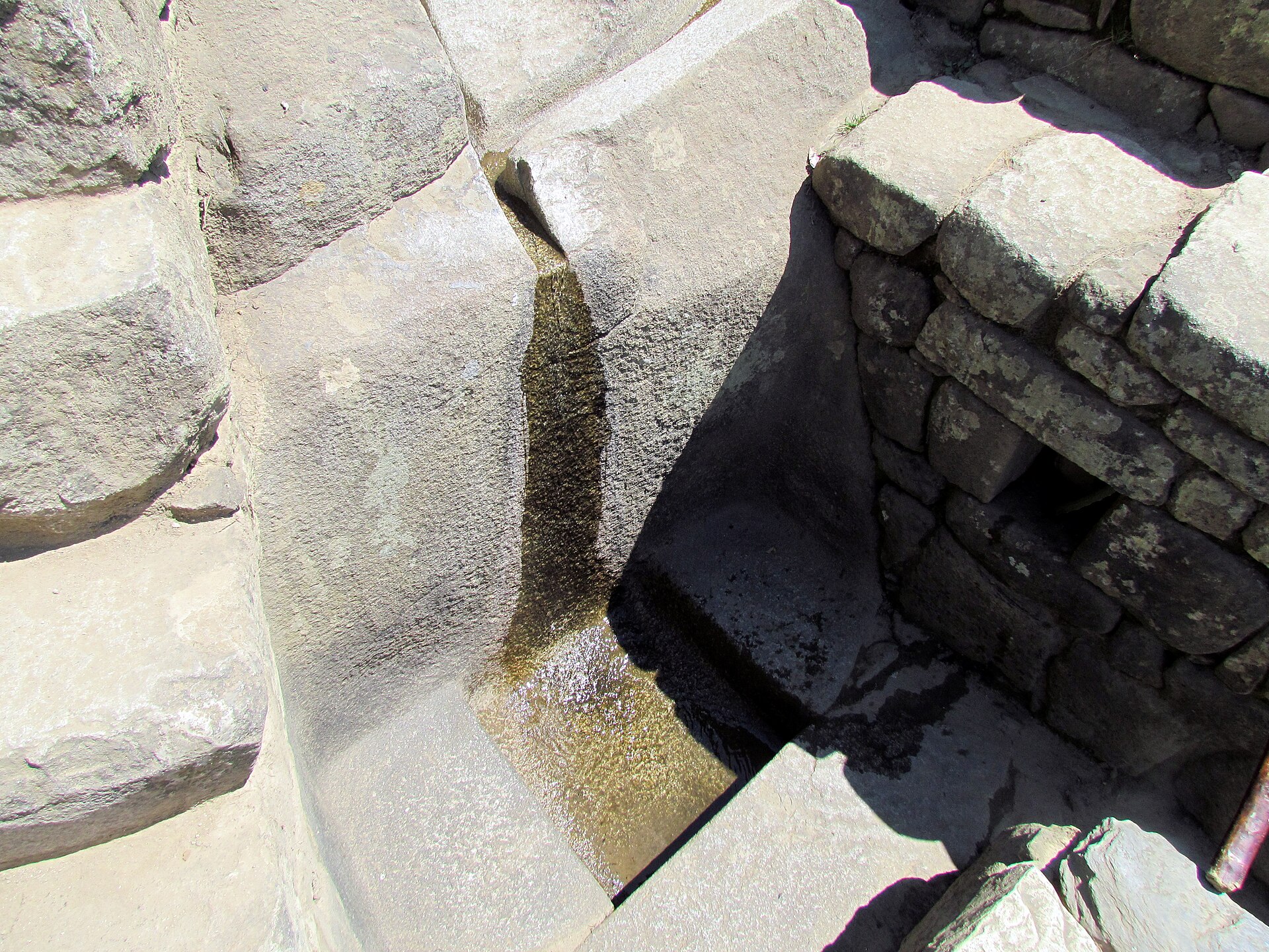
Water also had ceremonial possibilities. Some phaqcha are placed near distinguished precincts and worked rock, and Andean springs could be sacred as well as useful. But sixteen is the number of principal fountains on one urban supply line, not the total number of water features on every terrace. Fernández identifies other features fed by springs and drainage in the eastern areas. A strict chart assigning “domestic” to one basin and “ritual” to the next would ask masonry to speak beyond its archaeological context. The same water could sustain a working household and a formal act. [11][13]
The canal was altered during Inca use. Excavation indicates a secondary supply adjustment after block movement. Planned replacement stones, designed to reduce leakage, revise an older engineering interpretation that those prepared pieces were for a new branch to further fountains. The disagreement is useful because it arises from newly examined fabric, not simply from rival adjectives applied to a pristine system. Settlement, sealing and water loss were practical problems that builders faced. Today's visible spouts are thus evidence of an evolving hydraulic arrangement, while terraces relied heavily on graded rainwater drainage rather than a documented irrigation branch from this principal canal. [11][13]

Text alternative for the diagram
Captured spring feeds an altered Inca gravity canal, then a descending sixteen-fountain urban sequence including selective upper fountain 1A. Other eastern spring/drainage features and terrace rainfall drains are separate from the principal count.
Upper plazas and the modern “Temple” names
The upper precinct around the Sacred Plaza contains walls of particularly careful construction, the building conventionally called the Main Temple and the Temple of Three Windows. Their position, finished openings and dense stonework distinguish them architecturally from many service buildings. The names “Temple” and “Sacred Plaza” have become convenient labels, but they do not prove an exclusive original use. Excavation has found domestic, storage or working material near structures once interpreted only through mythic titles. One should describe the buildings' deliberate public fronts and possible ceremonial role without banishing the people who repaired, guarded or supplied them. [6][7][10][11][12]
The Main Temple presents a three-sided stone enclosure on the plaza. Its well-dressed blocks and broad front openings make a formal room, yet differential settlement has displaced part of the masonry. Excavation and later geophysical survey help account for structural failure and altered wall lines. A few apparently unfinished details may also belong to construction changes; they should not automatically be called proof that the entire city was abruptly deserted mid-project. The room reveals both refined work and the vulnerabilities of building on steep, drained ground. Modern stabilisation affects how that fabric appears today. [6][10][12][18]
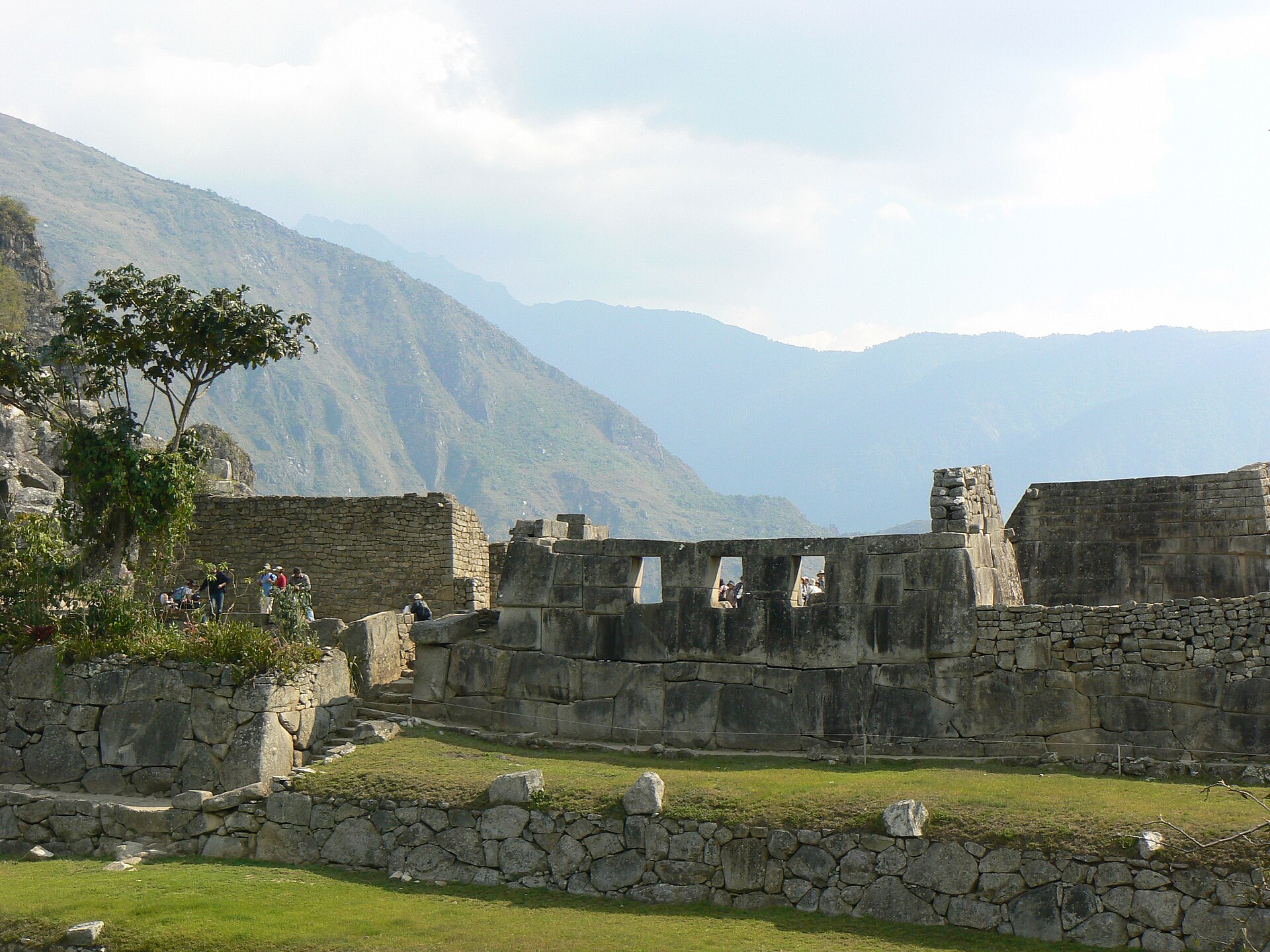
Three enormous trapezoidal windows in the neighbouring building open a considered composition toward the horizon. They organise light, view and an elevated architectural presence. Bingham connected the three openings to Tamput'oqo, the mythic place of Inca origin, but a resemblance between a story's “three windows” and these three actual apertures is not a secure identification of that legend's location. The modern name describes an unmistakable feature; it is not a recovered Inca caption. Stone-fitting differences and unfinished areas add to the evidence that the upper group changed while being built. [6][10][11][12]
At a high overlook, the carved rock now called the Intihuatana rises from an arranged stone platform. Its cut planes, pillar-like projection and relation to distant peaks invite a reading of horizon and ritual attention. The widely repeated claim that it was a precise “sun-tying” calendar gnomon has not been demonstrated. Bingham applied the present name by analogy with other Andean stones; no clear apparatus or ancient description tells us exactly how this one was observed. Horizon marking and ceremonial focus remain possible, but the worked object should not be allowed to certify every theory visitors have projected onto it. [11][12][24]
The Torreón and the limits of solar precision
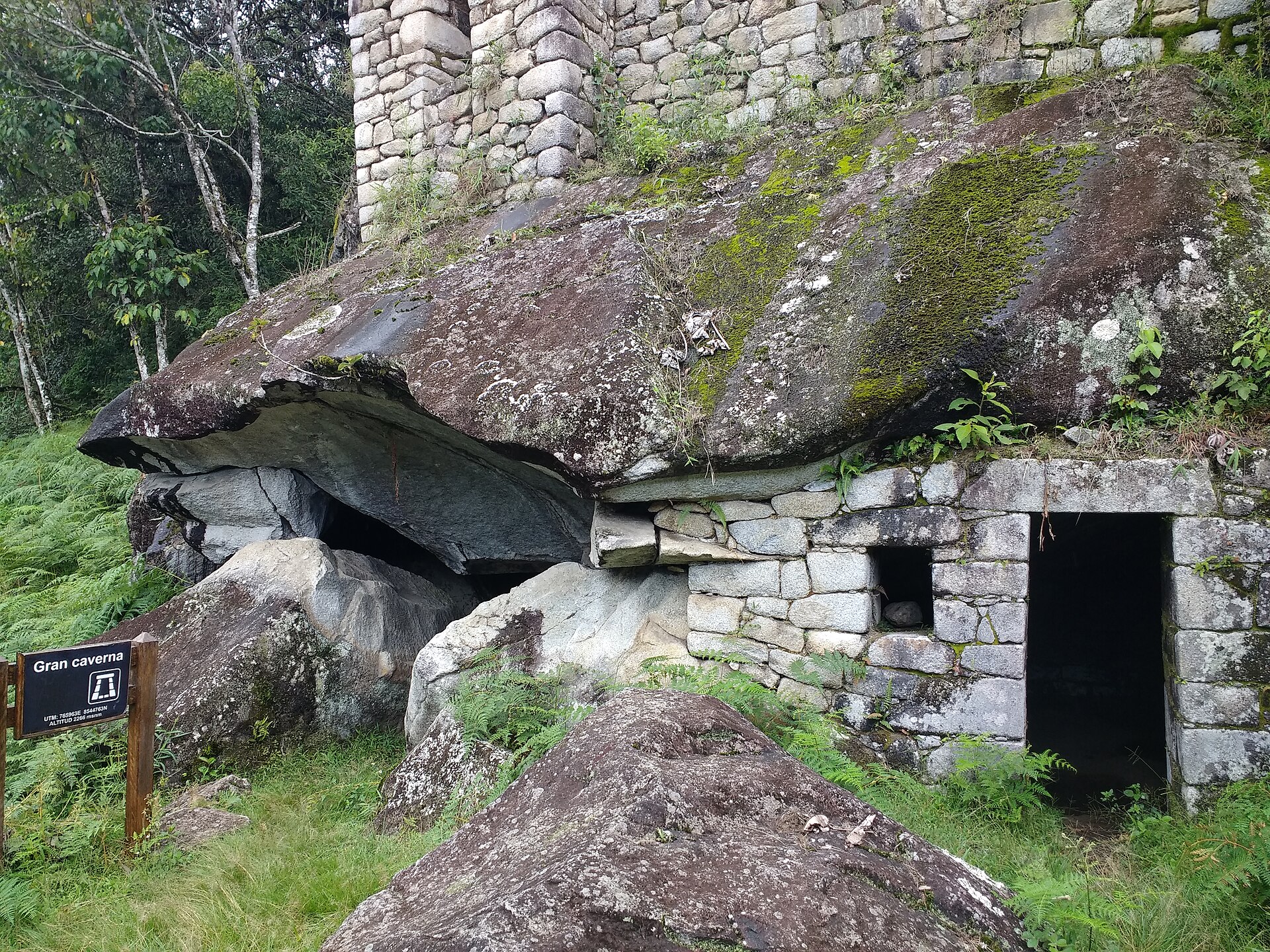
The semicircular wall known as the Torreón or Temple of the Sun wraps around a natural carved granite feature above a cave-like space. Its fine masonry curves where most Inca walls are angular, and its windows create marked solar effects. Field surveying and 3D modelling support a June-solstice light effect and other light interactions during zenith-sun periods. Thus a blanket dismissal of its solar design is as unhelpful as claiming a complete observatory. The building binds living rock, engineered wall, controlled access and sunlight in a single composition. [7][11][24]
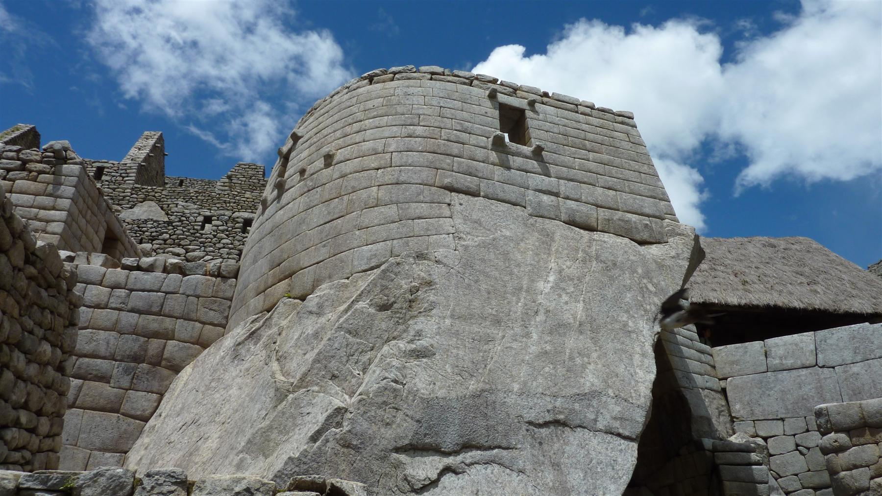
What the newer survey does not support is the familiar description of the Torreón as a precision instrument for calculating the calendar. One proposed suspended plumb-device system has no recovered apparatus or firm historic documentation. The length and breadth of a light patch, the original roof and the precise viewing stance matter when asking whether a window could yield a date more precise than a ceremonial season. A model can confirm an orientation without supplying its exact Inca operating instructions. The rock and curved wall may have made sun, place and high-status activity visible; they cannot on their own prove one exact measurement practice. [24]
Below, the area traditionally called the “Royal Tomb” or a mausoleum has a worked cave and niches, but its identity as the burial of Pachacuti is a contested hypothesis. A funerary use at a rock cavity may be plausible in Andean context without tying it to one emperor. Similarly, a visually prominent carved boulder elsewhere can be a huaca or a composed rock setting without yielding an astronomically measured purpose. The famous labels are useful for locating remains. They become misleading when the tour-map name is treated as the final argument. [6][12][24][25]
Condor, mortars and rooms used by people
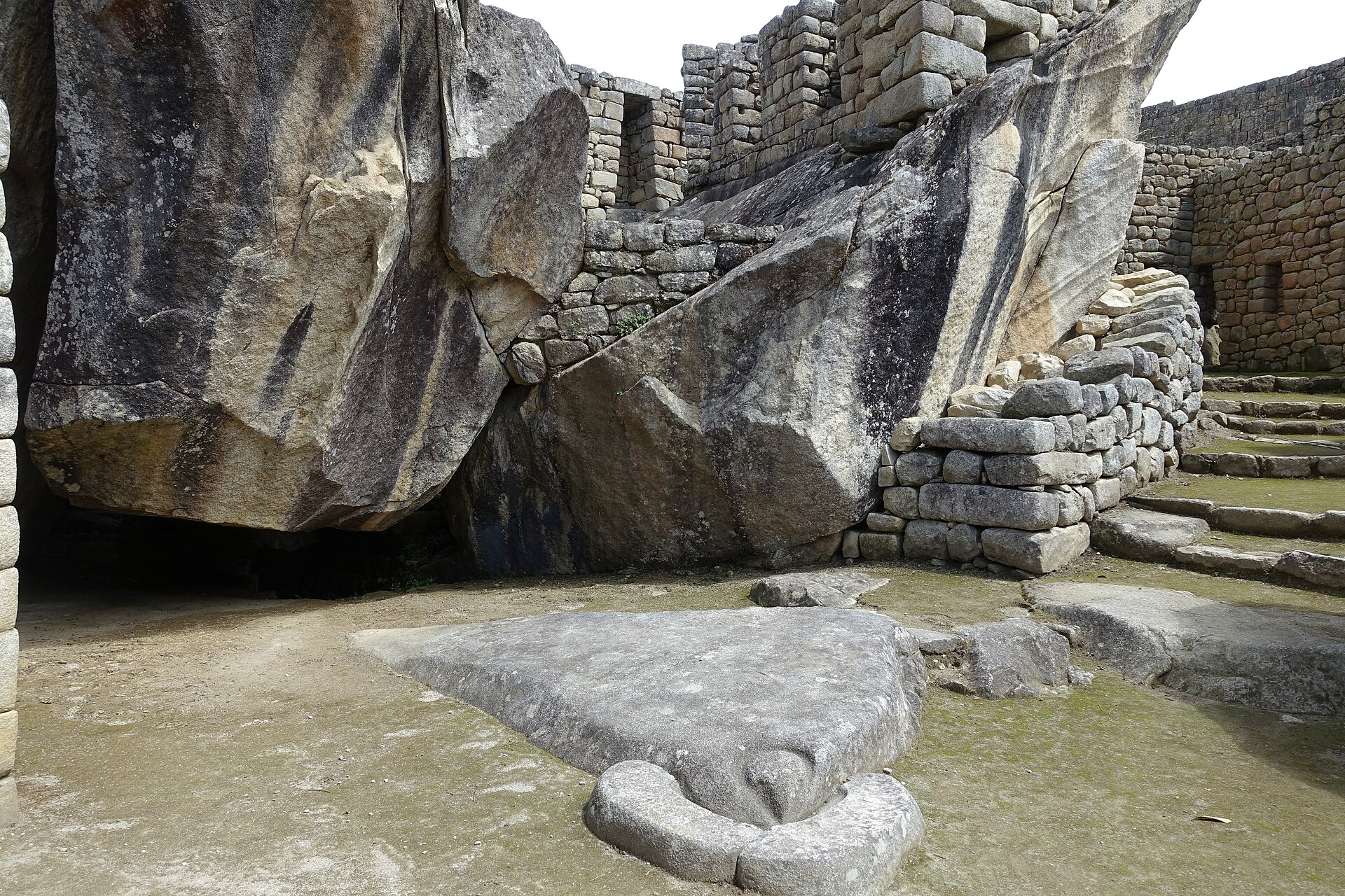
In the lower precinct, a shaped ground stone and surrounding rocks suggest the head and spread wings of a condor. That resemblance is visually intelligible, and models show solar illumination near parts of the complex. But no proven precision markers turn it into an exact calendar machine. The area's caves and niches invite ritual interpretations; excavated material in adjacent rooms also speaks of domestic use, while modern interventions disturbed some contexts. A single phrase, “Temple of the Condor,” cannot describe all the work and movement around the rock. [6][11][24]
Another building is popularly called the “Mortars” or “Water Mirrors.” The basins may once have held water or objects; their exact purpose remains unresolved. A previously proposed equinox-sun effect ceases to work when the lost roofing is represented in the 3D study. This is not evidence that Inca builders paid no attention to skies. It is evidence that a roofless modern ruin can present light paths that no original occupant saw. In a city of kitchens, workshops and planned stores, a basin's material and room setting need to be examined before a picturesque sky explanation prevails. [6][10][24]
Room groups around these lower places contain ceramics, textile tools, milling equipment and other traces of ordinary maintenance and production. Spindle whorls and vessels are not a footnote to stone temples. They imply work surfaces, storage, food preparation, fibre handling and people moving between courtly and service precincts. The named architectural groups may have supported combined activities, and their populations changed. Even where an elite household shaped access, keeping that household functioning required labour which the most polished photograph rarely shows. [6][10][16][17]
More persuasive instruments: Intimachay and Inkaraqay
Solar attention at Machu Picchu is not all at one evidentiary level. Intimachay, a worked granite cave, has a cut eastward tunnel whose geometry registers sunrise near the December solstice. A north opening may also admit light associated with the June solstice and a northern major lunar standstill. Field measurement and 3D scans support these effects, while the exact posture of an observer and their ceremonial or practical purpose remain open. The distinction matters: a demonstrable beam through a prepared aperture is better evidence than naming any projecting rock a sundial. [14][24]
On Waynapicchu, Inkaraqay's viewing tubes offer another stronger case for deliberately structured sky observation. The tubes' geometry is more instrument-like than the open Intihuatana. This does not make every terrace, cave or wall on the peak an observatory. Waynapicchu has steep constructed paths, platforms and worked rock settings; the so-called Temple of the Moon is a cave architecture with a cautiously proposed funerary role, compromised by disturbed burial contexts. Ridge and adjacent peak have to be connected in an architectural account, but not flattened into one solar machine. [6][9][12][14][24]

Text alternative for the diagram
Intimachay's east tunnel supports December-solstice sunrise; Inkaraqay has viewing tubes. Torreón windows show seasonal light but no precision apparatus. Condor light may be ritual without exact markers. Intihuatana gnomon remains unproved. Mortars equinox effect fails after restoring the lost roof.
In the Torreón, observable seasonal light and an unproven precision calendar can coexist as conclusions. At Intimachay a crafted opening has measured solstitial evidence; at Inkaraqay the tubes are still more device-like. At the Intihuatana, a projected calendar function is not secure. At the Mortars, lost roofs negate a supposed equinox effect. At the Condor, modelled light does not establish a precise marker. These are not contradictions to be solved by choosing either “everything is astronomy” or “nothing is.” Inca builders could compose sacred stone, mountain horizon, light and useful observation in different ways in different places. [14][24]
The people behind the royal estate
An older claim that Machu Picchu housed only female “Virgins of the Sun” grew from flawed early readings of skeletons and the desire to give every room an exotic function. Later osteological reanalysis found mixed sexes and ages. Ancient DNA from thirty-four Machu Picchu burials indicates people with ancestries linked to different parts of the empire and Amazonia, consistent with a heterogeneous group of attendants or retainers. The burials are not a census of everyone who worked or lived here; genetic ancestry does not by itself tell us a person's self-identity, job, gendered role or legal status. But it decisively shifts attention from an imagined homogeneous palace population to a more varied inhabited site. [16][17]
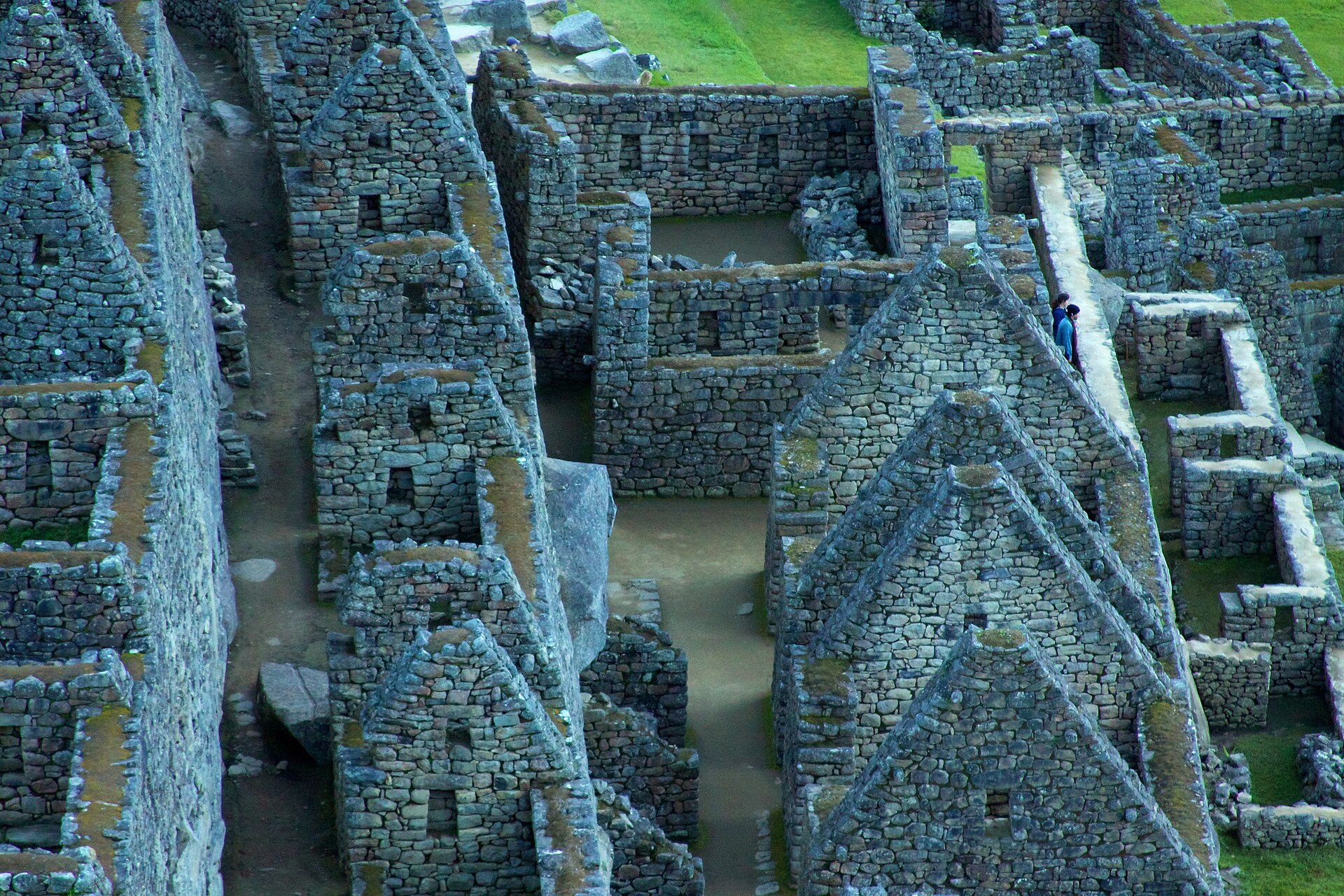
Burial, textile, ceramic and domestic assemblages make the architecture human at a different scale. A fountain has to be reached with a container; a roof has to be built and re-thatched; a mortar or kitchen needs care; terraces must be planted and drained. The estate interpretation is strongest when it can account for these activities as well as royal ceremonial display. Elite residence did not remove physical labour from the ridge. Nor were lower-status walls “background” architecture: their position in access and supply routes helped determine how a royal centre could operate. [6][10][11][12][13][16][17]
Before and after Bingham's 1911 visit
The site was not unknown to the people living and travelling in the mountains when Hiram Bingham arrived in 1911. Colonial records used Picchu or Picho for a territory, although the exact Inca name for today's named complexes is not securely recoverable from those references. Agustín Lizárraga and companions visited in 1902 and left “Lizárraga 1902” in charcoal, photographed by Bingham but later cleared from the wall. Local families occupied or cultivated around the remains. Melchor Arteaga guided Bingham to the ridge; Toribio Richarte, Anacleto Álvarez and Tomás Fuentes, with their families, were among those present. The often-told story of one foreign “discoverer” therefore has to give way to an account of local knowledge and a later international publication. [6][23]
Bingham's Yale expedition did bring the llaqta to global scholarly and public attention, cleared vegetation and undertook extensive excavation. Local and Peruvian workers made that undertaking possible. Angel Lizárraga and others helped clear; Richarte and Álvarez assisted in locating and excavating burial caves. Their names matter because archaeology is not only the camera and notebook of the visitor who publishes a result. It is also path knowledge, cultivation, clearing, labour and interpretation in place. The early expedition's “Lost City” and female-only stories were not neutral descriptions of what those collaborators already knew or what subsequent osteology found. [6][16][23]
The excavation collections and photographs then acquired another history. Objects and human remains taken to Yale were the subject of long negotiations; under an agreement, material was returned to Peru in 2011–12 and curated at Casa Concha, the Machu Picchu Museum in Cusco. Twentieth-century Peruvian excavations and conservation campaigns also changed how visitors encounter the walls. Some blocks were reset, filled or stabilised. Restoring a structure may save it while also complicating a claim that every joint visible today has remained untouched since the Incas. Martín Chambi's sweeping ca.1930s photograph offers a Peruvian, Quechua photographic vision of the site in this evolving modern afterlife, not merely another overseas explorer's view. [6][10][21][23][26]
Conservation of a cultural and natural sanctuary
World Heritage inscription in 1983 applied to the whole Historic Sanctuary on both cultural and natural criteria. The granite settlement, connected roads, dramatic Urubamba setting and cloud-forest ecosystems are treated as interdependent values. Moisture, root growth, slope movement, local wall settlement, fire risk and visitor pressure affect different parts of that landscape differently. Geophysical anomalies may guide investigation but remain indirect until excavation verifies structures; lidar under a forest canopy remains incomplete. Conservation requires measuring specific fabric and land, not assuming that the fame of the site keeps each terrace stable by itself. [1][2][3][6][15][18][20][22]
The governance of visitation is presently unsettled. Peru's conservation report submitted in January 2026 describes an internally validated 2026–2030 management plan and a 4,500 regular/5,600 temporary-peak daily visitor scheme. UNESCO's 2026 Committee decision nevertheless asks for the plan to be finalised and submitted, and states that current admissions exceed the levels approved by the 2015 carrying-capacity study. It seeks an updated evidence-based capacity assessment, monitoring, dispersal and infrastructure adaptations rather than treating a new quota as already demonstrated to be safe. The two documents describe different positions in a review process; internal validation should not be translated into UNESCO clearance. [3][4]
Visitor-centre and nearby airport proposals likewise require heritage-impact scrutiny because new transport and buildings change approach, pressure and setting even when they are placed outside the most famous stone terraces. This is a question of architecture and landscape, not a suggestion that Machu Picchu should become a frozen ruin without contemporary access. Its first builders changed rock and water on the ridge; later farmers, photographers, archaeologists and conservators have changed its meaning and presentation. What survives is an exceptional Inca construction in a living, vulnerable sanctuary, whose stones can be admired most fully when their structural, social and historical layers remain visible. [1][3][4][6][13][21][22][23]
Watch: Machu Picchu and its Sanctuary
See the stone city from above and consider how its built terraces relate to the wider forest sanctuary.
Historic Sanctuary of Machu Picchu
UNESCO/NHK's World Heritage film surveys the Inca city and its mountain-forest setting; Arabic, Spanish, French and Russian versions are offered.
Editorial photograph: Brian Jeffery Beggerly, source; CC BY 2.0.Historic Sanctuary of Machu Picchu — UNESCO record
The 2023 TBS film gives a second visual introduction to the Historic Sanctuary.
Editorial photograph: joiseyshowaa, source; CC BY-SA 2.0.Explore RELATED Artworks
Inca objects provide comparisons; Martín Chambi records the site itself. The museum objects shown here were not excavated at Machu Picchu.
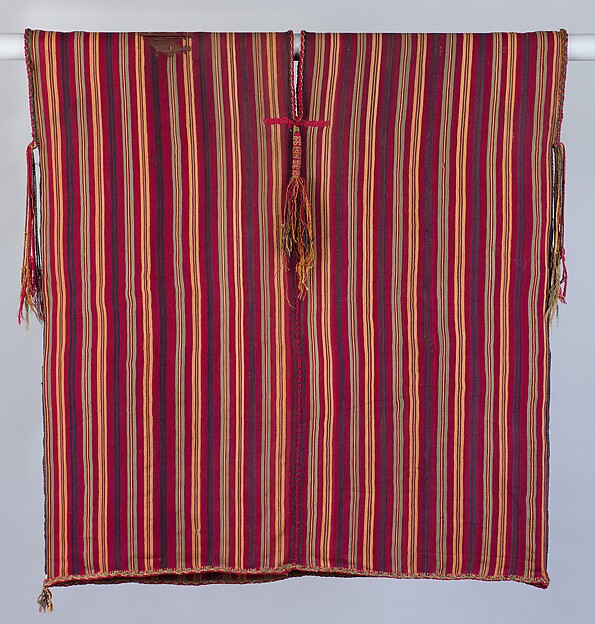
Inca tunic
Camelid-fibre textile, Peru, 1400–1530; a contextual comparison, not a Machu Picchu excavation find.
The Met · Public Domain image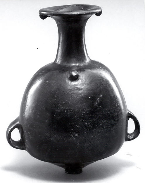
Inca storage jar
Ceramic aryballos, fifteenth–sixteenth century; useful for thinking about movement and storage, not a site-specific vessel.
The Met · Public Domain image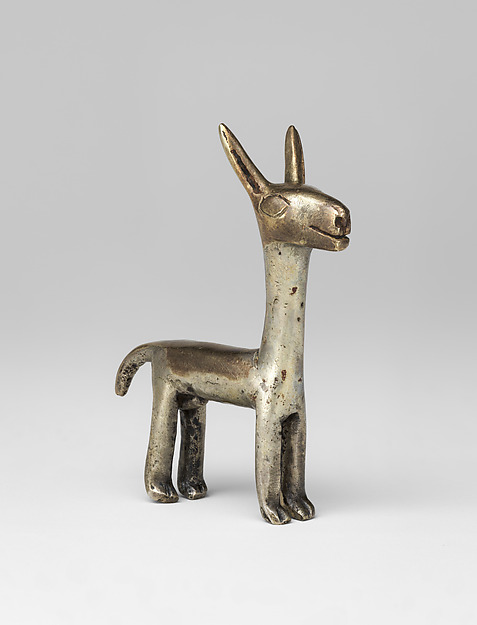
Inca camelid effigy
Metal portable sacred object from the Inca sphere; its geography is broad and no Machu Picchu provenance is claimed.
The Met · Public Domain imagePanorama of Machu Picchu
Quechua Peruvian photographic vision, ca.1930s. View Chambi’s photograph in the museum collection.
The Met · link onlyFrequently Asked Questions
Inca construction belongs broadly to the fifteenth century. Burial dates indicate people there from about AD 1420 into the early sixteenth century, but do not fix each wall's construction year. [8] [9]
A Pachacuti-linked royal estate is a strong historical and archaeological interpretation, not a surviving dedication that proves the use of every room. [2] [6]
No. Local people knew and farmed around the site; Agustín Lizárraga visited in 1902 and Melchor Arteaga guided Bingham there in 1911. [6] [23]
No. Later osteology and ancient DNA describe mixed sexes, ages and regional ancestries in the burial collection. [16] [17]
Wright and Valencia found no canal branch to their surveyed main agricultural terraces. Rain infiltration, graded fill and drains were important to those slopes. [11] [20]
Sixteen principal fountains belong to the urban spring-fed canal. Other spring and drainage-fed water features exist elsewhere. [11] [13]
Its carved rock and horizon setting are real, but a precision calendar gnomon function has not been demonstrated. [12] [24]
Its windows produce measured seasonal solar light, including a June-solstice effect; a precision calendar apparatus has not been established. [24]
Its deliberately cut aperture has field-measured December-solstice sunrise evidence; some other openings may register further solar or lunar events. [14] [24]
References
- UNESCO World Heritage Centre, Historic Sanctuary of Machu Picchu
- ICOMOS, 1983 advisory evaluation of Machu Picchu
- UNESCO World Heritage Committee, 2026 decision 48 COM 7B.65
- Peru State Party, 2025 conservation report submitted January 2026
- Peruvian Ministry of Culture, Machupicchu Investigaciones Interdisciplinarias
- Bastante et al., “Estado de la cuestión: historia y arqueología de la llaqta”
- Astete Victoria, “Llaqta de Machupicchu: sacralidad y proceso constructivo”
- Burger et al., “New AMS dates for Machu Picchu,” Antiquity (2021)
- Ziółkowski et al., “When did the Incas build Machu Picchu and its satellite sites?,” Radiocarbon (2021)
- Gibaja, “Aspectos constructivos en Machupicchu”
- Wright and Valencia, “Machu Picchu: maravilla de la ingeniería civil”
- Gavazzi, “Tecnomorfología… levantamiento arquitectónico y paisajístico”
- Fernández Flórez, “Materialización del culto al agua…”
- Ziółkowski, Kościuk and Astete, “Observaciones astronómicas en Intimachay”
- Fletcher, Hofer and Mudbidri, preliminary Machu Picchu lidar survey
- Verano, Peabody skeleton-collection reanalysis
- Salazar et al., ancient DNA and lifeways at Machu Picchu, Science Advances (2023)
- Italian CNR, Capozzoli et al. geophysical survey record
- Kubicka-Sowińska, architecture/metrology study, Architectus (2024)
- Vallejo and Estrada, selected Inca wall geotechnics, ISSMGE (2019)
- Yale Peabody Museum, anthropology collections and repatriation
- SERNANP, Historic Sanctuary of Machupicchu
- Bastante, Yale Peruvian expedition and local actors
- Ziółkowski and Kościuk, “Astronomical Observations at Machu Picchu,” Springer (2022)
- Lumbreras, “Machu Piqchu, mausoleo del emperador”; Martín Rubio, “Sobre su función”
- The Metropolitan Museum of Art, Martín Chambi, Panorama of Machu Picchu