


 by Tom Gurney
Tom Gurney BSc (Hons) is an art history expert with over 20 years experience
Email: tomgurney1@gmail.com / Phone: +44 7429 011000
Beyond the Temple Pyramid: Reading Maya Architecture through Cities, Households and Living Stewardship
Maya architecture belongs to living peoples as well as to archaeology. Millions of Maya people live today in southern Mexico, Guatemala, Belize, western Honduras, El Salvador and communities farther abroad. They speak many Maya languages, build homes and civic places, practise religious traditions, manage land and debate how ancestral sites should be researched and presented. A history that ends when a Classic-period court lost power mistakes political change for disappearance.
The term also covers a very long span. Settled communities appeared by the second millennium BCE; monumental centres developed during the Preclassic; numerous kingdoms shaped the Classic period; and different cities flourished, contracted or reorganised during the Terminal Classic and Postclassic. Spanish invasion and colonial government altered settlement, worship and construction without ending Maya history. The National Museum of the American Indian’s Living Maya Time project makes this continuity and the range of present homelands explicit [2].
Present borders cross older cultural regions. This guide uses current country names for location and historically specific polity or community names where evidence allows. Getty vocabularies can help stabilise English terms, but they cannot decide identity or heritage authority [1].
Contents
- Many Regional Traditions
- Preclassic Building
- Cities Beyond Ceremonial Cores
- Households
- Material Systems
- Water and Movement
- Political Courts
- Orientation
- Later Regional Histories
- Multiple Transformations
- Spanish Invasion
- Recommended Books
- Watch Architecture
- Conservation
- Living Maya Stewardship
- How to Read
- Evidence Tests
- Frequently Asked Questions
- Discussion
- References
One region contained many building traditions
The Maya area extends from the limestone lowlands of the Yucatán Peninsula and northern Guatemala into the volcanic highlands and Pacific piedmont, with river valleys and Caribbean zones between. Rainfall, stone, soil, forests and reliable surface water vary sharply. So did language, political organisation and connection to trade.
There was no enduring Maya empire that issued one architectural code. Classic cities were usually capitals of competing kingdoms linked by diplomacy, marriage, exchange and war. Their builders shared techniques and signs, yet composed plazas, façades and neighbourhoods differently. Regional labels such as Puuc, Río Bec or Petén describe patterns useful to comparison, not sealed cultures.
Smithsonian material on Uxmal and the Puuc region connects close-fitted masonry and mosaic façades to a particular northern landscape and period [3]. It should not become a checklist for identifying every Maya building.
Chronology is built into the fabric
Platforms and buildings were frequently enlarged, resurfaced or enclosed by later work. A visible temple may conceal several earlier stages. Floors seal deposits that can be dated; wall junctions show where rooms changed; buried façades preserve plaster and pigment. Construction history therefore comes from sequences rather than a single finished view.
At Tikal, temple buildings accumulated over earlier work on broad raised platforms. The Met’s account of the North Acropolis describes repeated enlargement, plastered masonry and modelled stucco during the late Preclassic and Classic periods [20]. Similar acts could renew dynastic memory while also responding to altered use.
Preclassic builders reshaped settlements
Early villages already joined houses, storage, cultivation and communal spaces. Over time, some settlements invested in levelled plazas, earthen fills, paved surfaces and monumental platforms. These projects required quarrying, basket transport, lime production, water and scheduled labour long before the most familiar tall temples.
Tak’alik Ab’aj, in present Guatemala’s Pacific piedmont, preserves a long sequence connected to exchange between different Mesoamerican regions. Its World Heritage record is valuable precisely because it documents transition and interaction rather than an isolated origin point [5]. Kaminaljuyu in the Guatemalan highlands and major northern lowland centres developed other trajectories.
Preclassic scale does not prove central command over an entire region. Large works could be sponsored by rulers and courts while depending on households, farmers, craft specialists and communities whose names are rarely recorded.
Cities extended beyond ceremonial cores
Older plans often concentrated on a central group of temples and palaces because these masonry buildings remained visible. Survey now reveals broader cities: household compounds, neighbourhood shrines, quarries, terraces, field systems, roads, reservoirs and defensive earthworks. The monumental core was one part of a lived landscape.
Detailed ground mapping at Tikal recorded thousands of structures grouped across many square kilometres, giving archaeologists evidence for population and neighbourhood organisation [18]. Airborne laser scanning can detect low relief beneath forest cover and has expanded that picture across northern Guatemala, including causeways, terraces and fortifications [22]. It does not identify a building’s date or function by itself; excavation and field inspection remain necessary.
Plazas organised different publics
Plazas could host audiences, markets, processions, games and court ceremony. Their scale, access and surrounding buildings shaped who could gather and who was separated. Raised platforms made some activity visible while stairs controlled approach.
Ballcourts were architectural settings for a game with political and ritual meanings, but not every court served one programme. Palaces could include reception rooms, residences, storerooms and administrative space. “Temple” is likewise a functional interpretation, not a description guaranteed by height.
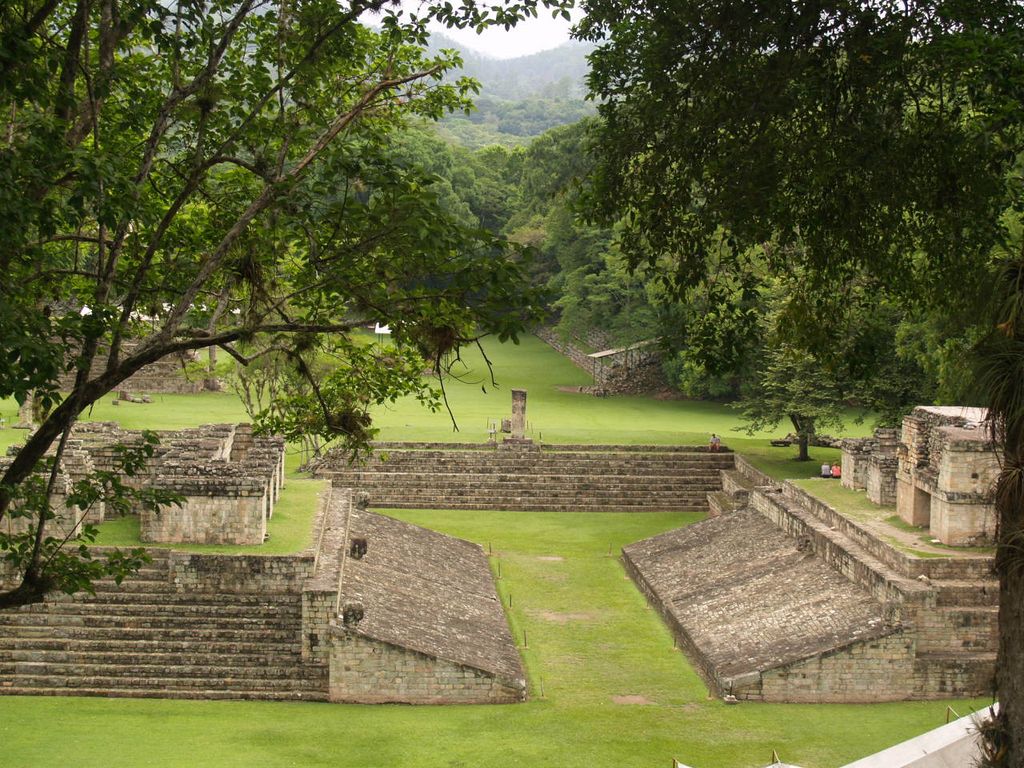
Copán's ballcourt in Honduras, photographed by Adalberto Hernandez Vega in June 2009. Sloping playing walls, stepped edges and the long central court organised a particular public and political programme within a much larger city. Adalberto Hernandez Vega, Ballcourt at Copán; CC BY 2.0. JPEG prepared; no crop or retouch.
At Tikal, UNESCO records palaces, ceremonial platforms, residences, ballcourts, terraces, roads, reservoirs and numerous plazas within a much larger forest landscape [4]. This variety is a better starting point than the idea of an empty sacred centre.
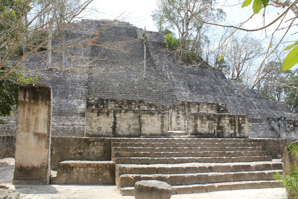
Structure I at Calakmul, photographed by Arian Zwegers in May 2013, rises through dense forest in Campeche. The surviving monument belongs to a much larger city of residences, roads, reservoirs and working landscapes now joined to a protected tropical forest. Arian Zwegers, Calakmul, Structure I; CC BY 2.0. JPEG prepared; no crop or retouch.
Households sustained urban life
Most Maya people lived in compounds rather than palaces. Buildings often stood around a shared court on low platforms, with spaces for sleeping, food preparation, storage, craft and family ritual. Perishable wall and roof materials leave slighter traces than masonry, so preservation can exaggerate elite architecture.
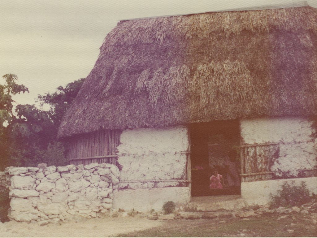
A Maya thatched house on the outskirts of Mérida, photographed by Infrogmation of New Orleans in June 1973. The steep roof, pole framing and wall panels record one household building at a particular date; they are evidence of continuing knowledge and change, not an unchanged ancient type. Infrogmation of New Orleans, Maya thatched house near Mérida; CC BY-SA 3.0. JPEG prepared; no crop or retouch.
Penn Museum’s regional synthesis distinguishes lowland masonry from greater use of earth and timber in many highland settings, while emphasising that common houses across regions often relied on poles, earth and thatch [17]. A house compound could be rebuilt many times as families changed.
Living Maya houses are not unchanged replicas of ancient ones. UADY’s discussion of the Maya house treats knowledge, forest materials, family use and transmission as present questions [15]. Concrete block, metal roofing, services and new room expectations can enter a continuing tradition without erasing community authorship.
Labour was skilled and organised
Stone cutters, plaster makers, carpenters, painters and sculptors worked with people carrying fill, preparing food, tending fields and maintaining water. Some labour was probably attached to households, tribute or court obligations; other work involved specialists supported by patrons. Evidence differs by site and date.
Architecture records decisions but seldom identifies every maker. Inscribed rulers may claim dedication of a monument, while the physical result depended on many unnamed workers. Public interpretation should not turn elite authorship into solitary design.
Materials formed linked systems
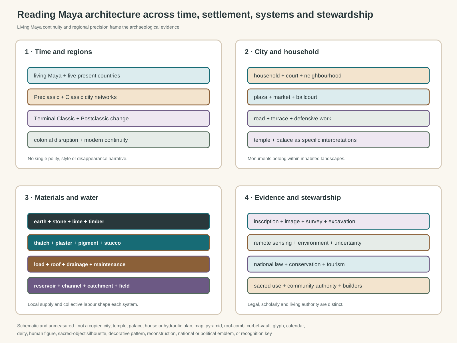
Original unmeasured evidence diagram. It is not a copied city, temple, palace, house or hydraulic plan; map; pyramid, roof-comb, corbel-vault, glyph, calendar, deity, human figure or sacred-object silhouette; decorative pattern; reconstruction; national or political emblem; or visual identification key.
Text alternative for the diagram
The diagram separates living Maya and five-country geography from the Preclassic, Classic, Terminal Classic, Postclassic, colonial and modern periods; nests household, neighbourhood and city programmes; connects earth, stone, lime, timber, roofing and water maintenance; and distinguishes inscription, survey, environmental, legal and community evidence.
Lowland builders quarried limestone for blocks, rubble and lime. Producing lime plaster required fuel, controlled burning and careful mixing. Plaster sealed floors, protected walls and provided grounds for modelling and paint. Repeated recoating was maintenance as well as visual renewal.
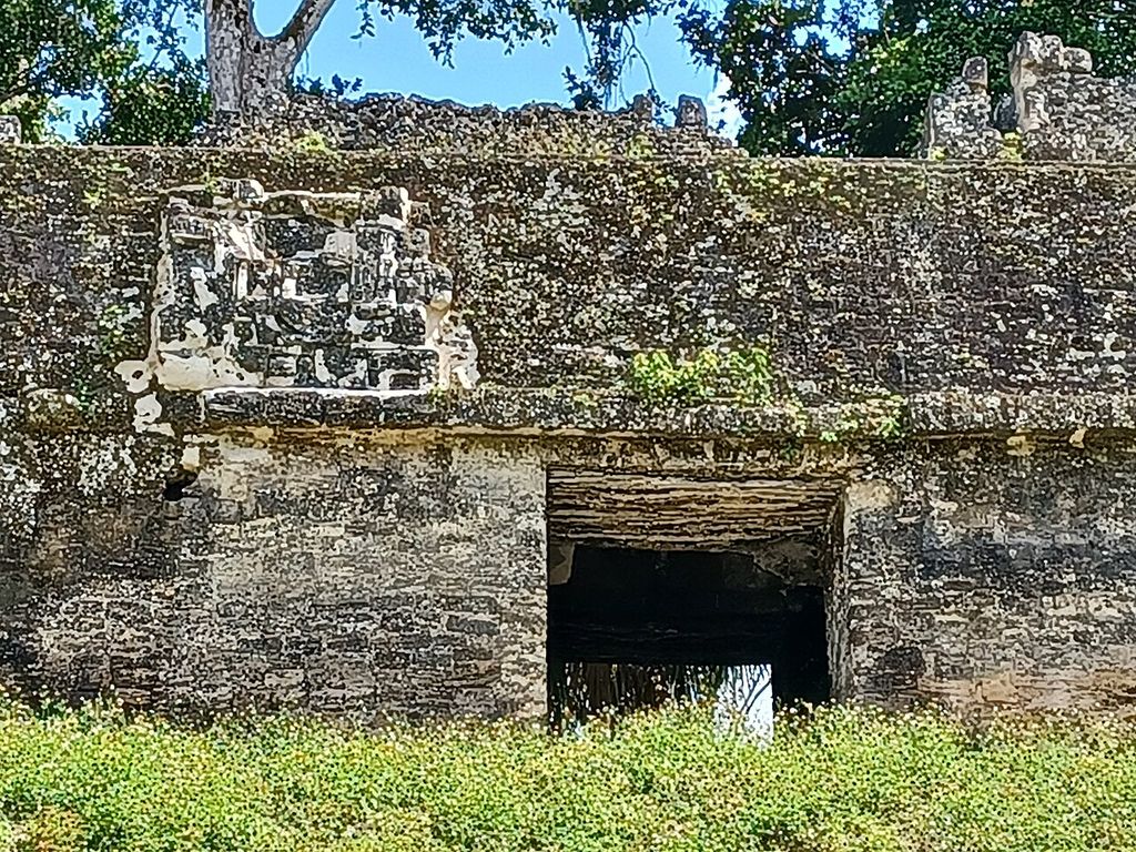
Palace Structure 5D-91 on the Plaza of the Seven Temples at Tikal, photographed by Simon Burchell in May 2022. Exposed masonry, a layered lintel zone and remnants of modelled surface work show how present ruins retain construction and loss while concealing former plaster and colour. Simon Burchell, Palace Structure 5D-91 at Tikal; CC BY-SA 4.0. JPEG prepared; no crop or retouch.
In volcanic and highland regions, builders also used locally available stone and earth. Timber spanned rooms, framed doorways and supported roofs; thatch covered many houses. Pigments and stucco made façades legible in ways that bare ruins no longer show.
Corbelled rooms managed weight
Masonry roofs commonly narrowed inward in successive courses until capstones bridged the remaining gap. Calling this a corbel vault describes how the load steps toward thick supporting walls. It is neither a failed imitation of a semicircular arch nor proof of one universal Maya solution.
Rooms were relatively narrow because heavy masonry roofing generated substantial forces. Cracking can reveal settlement, weak bonding, water entry or later alteration. INAH’s analysis at Oxkintok examines structural failure as evidence needed for informed restoration [14]. Rebuilding a clean profile without understanding movement can hide the actual problem.
Roof combs raised masonry screens above certain buildings, increasing visibility and carrying modelled decoration. They added weight and wind exposure, so surviving fragments require cautious structural reading rather than silhouette-based dating.
Water shaped construction and movement
Some cities had access to rivers, lakes or springs; others relied heavily on seasonal rain. Builders graded plazas and roofs to direct runoff, cut cisterns, sealed reservoirs and connected channels. Water systems served households and public institutions while also concentrating labour and authority.
At Uxmal, UNESCO records reservoirs and a raised causeway connecting the centre with Kabah [9]. PNAS research synthesises dams, berms, spillways, channels, filtration media and constructed wetlands across Maya sites [21]. These were locally adjusted systems, not evidence that every city followed one hydraulic master plan.
Maintenance mattered. Silt, damaged plaster, vegetation and contaminated catchments could reduce capacity. Reservoirs might buffer dry seasons yet become vulnerable during prolonged drought. Water engineering therefore shows both resilience and continuing dependence on collective work.
Courts made architecture political
Classic kingdoms used buildings and monuments to stage access, succession, tribute and alliances. Elevated rooms and restricted courtyards could separate rulers and attendants from larger audiences. Building dedication tied a patron to place, ancestors and a political history.
Palenque’s surviving civic and ceremonial buildings show refined masonry, relief and drainage within a capital that grew powerful in the Usumacinta region [7]. At Copán in present Honduras, an acropolis, plazas, ballcourt and inscribed stairway accumulated through successive dynastic programmes [10]. Quiriguá in Guatemala reorganised its principal spaces and erected major carved monuments during the eighth century [11]. Each was a distinct polity.
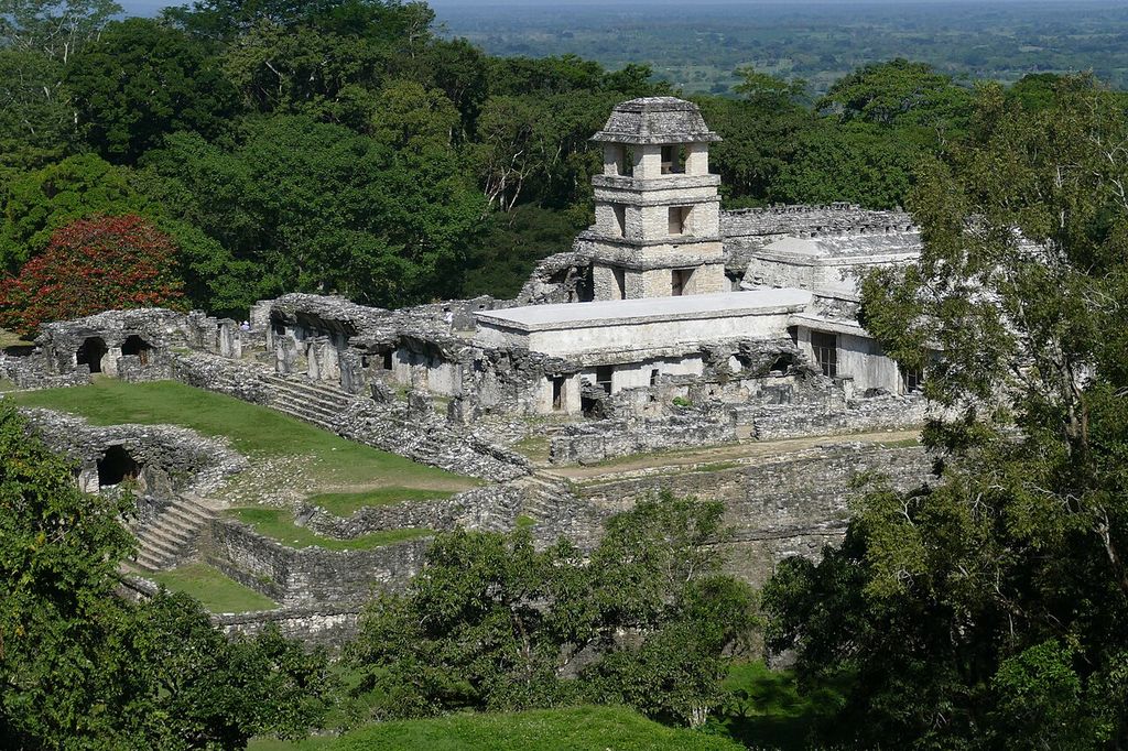
The Palace at Palenque, viewed from the Temple of the Cross in Bernard DUPONT's February 2020 photograph. Linked ranges, courts, platforms and the tower form a civic and ceremonial complex within a forested capital; individual room uses and phases require archaeological evidence. Bernard DUPONT, The Palace at Palenque from the Temple of the Cross; CC BY-SA 2.0. JPEG prepared; no crop or retouch.
Inscriptions are powerful but partial evidence
Maya writing can name rulers, dates, wars, ceremonies and building dedications. The Harvard Corpus documents inscriptions from many sites and materials, creating a research record rather than a complete political archive [16]. Surviving texts disproportionately represent courtly choices.
Glyphs should not be treated as pictures whose meaning is self-evident. Readings develop through language, context and comparison; damaged passages remain uncertain. Likewise, painted and carved images follow conventions and cannot serve as literal photographs of rooms or events.
Copán’s Hieroglyphic Stairway demonstrates both value and vulnerability. Getty’s conservation project combined archival records, material analysis, environmental monitoring and treatment trials, while acknowledging that many fallen blocks had been reassembled during twentieth-century work [23]. Interpretation depends partly on that intervention history.
Orientation requires site-specific evidence
Some architectural alignments relate to solar observations, calendrical events or ritualised landscape. Uxmal’s World Heritage account, for example, notes astronomical knowledge in the disposition of buildings [9]. Such evidence does not justify assigning one cosmic diagram to every plaza.
Orientation can also respond to terrain, drainage, earlier structures, routes and neighbouring compounds. A convincing claim states the measured alignment, horizon event, date and uncertainty. General phrases about Maya astronomy cannot substitute for those particulars.
Northern and highland centres followed later histories
Political contraction in parts of the southern lowlands during the eighth to tenth centuries did not end Maya urban life. Population moved; some courts failed; other centres grew. Northern cities and highland polities continued through the Postclassic, with different alliances and exchange routes.
Chichén Itzá in present Yucatán brought monumental precincts, residential areas, roads and water sources into a powerful northern centre whose architecture also registers wider Mesoamerican connections [8]. Uxmal and related Puuc towns followed their own chronology [9]. Neither should be used as the universal endpoint of Classic traditions.
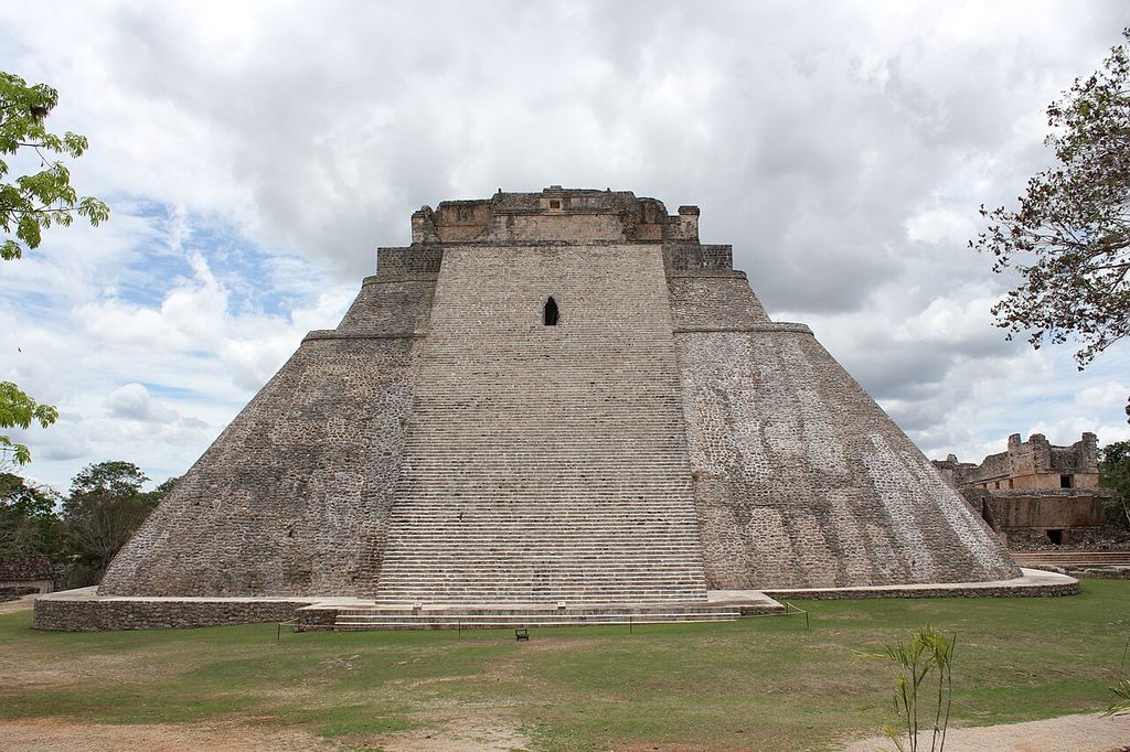
The east side of the Pyramid of the Magician at Uxmal, photographed by Arian Zwegers in May 2013. Its steep stair and accumulated mass belong to a northern Puuc centre with its own chronology, water systems and road connections rather than a single universal Maya style. Arian Zwegers, Pyramid of the Magician, Uxmal; CC BY 2.0. JPEG prepared; no crop or retouch.
Q’umarka’aj in Guatemala was a K’iche’ capital at the time of Spanish invasion and remains a sacred place. Current preservation work involves ancestral leaders and public authorities, showing that archaeological management must accommodate living practice [12].
There was no single Maya collapse
The phrase “Classic Maya collapse” names major political and demographic changes in some regions, not extinction. Inscriptions ceased at different dates, royal building declined, settlements contracted and people migrated. Elsewhere communities persisted or new centres became important.
Drought affected water and agriculture during parts of this transition, but its consequences depended on local reservoirs, land use, political conflict and access to exchange. Warfare, unstable dynasties and altered routes also mattered. Penn Museum’s reassessment emphasises interconnected cities and many competing kingdoms rather than one civilisation falling at one moment [19].
A responsible account separates the end of a court from abandonment of a neighbourhood and the relocation of people from cultural disappearance. It also avoids treating modern forest as proof that the landscape was always unoccupied.
Spanish invasion transformed the built landscape
Sixteenth-century campaigns brought violence, epidemic disease, forced labour, tribute and religious suppression. Colonial authorities concentrated some communities into new towns organised around churches and administrative buildings. Maya builders adapted masonry, carpentry, courtyards and domestic practice under unequal conditions.
Older sacred places could be damaged, reused, avoided or continually visited. New Christian buildings might contain Indigenous labour and knowledge without making colonial rule a harmonious fusion. Documents, archaeology and community histories are needed together.
Later states divided land, sponsored excavation and turned ruins into national monuments and tourist destinations. These processes preserved some fabric while displacing objects, opening tunnels or privileging monumental centres over community claims.
Watch: Maya Cities, Knowledge and Architectural Reading
Begin with Maya cities, knowledge and living legacy, then widen the view to structure, enclosure and movement without reducing a diverse region to temple pyramids or a single collapse narrative.
Ancient Maya 101
National Geographic's concise introduction links Maya cities with mathematics, astronomy, agriculture and living Maya communities. Use it alongside the page's archaeological cautions about regional difference, household life and multiple historical transformations.
Watch on YouTubeConservation joins material and social decisions
Masonry and plaster face roots, moisture, salts, heat, intense rain and biological growth. Exposed excavation can accelerate decay that burial once limited. Shelters may protect carved surfaces but alter air movement and appearance. Repair mortar must be compatible with historic fabric.
Getty’s regional conservation study frames Maya sites as a shared technical and management challenge across national systems [24]. At Copán, Honduras’s IHAH is the responsible national institution, not a supporting footnote to international research [13]. Mexico, Guatemala, Belize and El Salvador likewise maintain their own laws, agencies and site practices.
World Heritage status does not transfer ownership to UNESCO. Calakmul’s listing joins a major ancient city to protected tropical forest in Campeche, Mexico [6]. Tikal is both a cultural and natural property in Guatemala [4]. Forest conservation, community livelihoods, wildfire, illegal extraction and visitation can intersect rather than forming separate agendas.
Looting removes knowledge as well as objects
An unrecorded object loses its architectural layer, neighbouring materials and lawful chain of custody. Tunnels destabilise structures and disturb sacred or funerary contexts. Museums and researchers must publish provenance and avoid making an attractive carving seem detached from extraction.
Human remains require particular care. Scientific access, storage, display and possible return should follow law and consultation with relevant descendant or affiliated communities. Public writing does not need spectacle to explain burial architecture.
Tourism can fund jobs and maintenance while concentrating wear, traffic and commercial pressure. Visitor routes, limits and interpretation should protect active sacred use and allow residents a role in decisions. At Palenque, UNESCO identifies material decay and heavy visitation among management concerns [7].
Living Maya stewardship changes the question
The central question is not only how an ancient building looked. It is who may research, conserve, enter, name and interpret the place now. Legal ownership, ancestral authority, religious use and professional responsibility may overlap without being identical.
Living Maya testimony should appear as knowledge, not merely as colourful continuity beside archaeological expertise. The Smithsonian project includes a Yucatec Maya architect speaking about shared ties to homeland amid local difference [2]. Guatemala’s work at Q’umarka’aj records direct coordination with ancestral authorities [12]. These examples establish participation as part of accuracy.
Contemporary builders continue to adjust houses to hurricanes, heat, services, land pressure and available forest material. Conservation of vernacular knowledge may involve apprenticeships, access to suitable timber and thatch, safer details and community-defined change. Freezing a house at an imagined ancient date would deny the adaptation that kept it useful.
How to read Maya architecture
Start with current country, historical period and named polity. Ask whether the evidence comes from a household, neighbourhood, public plaza, palace, temple, road, field or water system. Do not let a tall platform stand for the whole city.
Then trace construction. Look for fill stages, wall bonds, plaster floors, roof loads, drainage, pigment and repair. Separate original fabric from excavation, consolidation and reconstruction. A restored edge may tell as much about modern conservation as ancient workmanship.
Finally compare sources. Inscriptions describe selected court histories; settlement survey recovers wider populations; environmental records reveal constraints; national agencies document legal care; living communities hold language, practice and authority. The strongest account keeps these forms of evidence in dialogue and states where uncertainty remains.
Maya Architecture: Five Evidence Tests
Begin with region, date, community and programme, then connect masonry and surface to household life, routes, water, political history and living stewardship.
| Evidence | What it can establish | What else to verify |
|---|---|---|
| Region and chronology | Lowland, highland, northern and southern centres followed distinct environmental and political histories. | A formal label cannot date every building or imply one Maya state. |
| Programme and household | House, court, palace, ballcourt, temple, road and reservoir organise different labour and access. | Monumental cores are only part of inhabited cities. |
| Material and surface | Limestone, rubble, lime plaster, timber, earth, paint and maintenance reveal construction choices. | Separate surviving core from lost roofs, plaster, colour and later repair. |
| Route, water and landscape | Causeways, terraces, reservoirs, drains, fields and forest connect buildings to working territories. | Site-specific evidence is needed before assigning one hydraulic or cosmic plan. |
| Transformation and authority | Dynastic change, migration, invasion, reuse, conservation and tourism shape present evidence. | Living Maya communities are contemporary authorities, not archaeological afterthoughts. |
Frequently Asked Questions
No. Their built environments included houses, courts, markets, palaces, ballcourts, roads, terraces, reservoirs, fields, defensive works and many forms of workshop and storage space.
No single empire governed the Maya area for its entire history. Many periods contained competing polities linked by diplomacy, trade, marriage and war.
Courses projected inward until capstones closed the gap. Thick walls carried the resulting load, while timber and thatch remained important for many other roofs.
Builders repeatedly enlarged platforms, buried earlier rooms and resurfaced plazas. Those layers can record changing patrons, programmes and political memory.
Drought contributed to stress in some places and periods, but political conflict, migration, changing trade and local water systems affected outcomes. Maya peoples and cultures continued.
Some are active sacred places for Maya communities. Access, research and interpretation should recognise the relevant community and site-specific authority.
It detects subtle ground forms under vegetation, but dating and function still require ground survey, excavation and comparison with other evidence.
National and local institutions hold legal duties, while Maya communities, site workers, conservators and researchers have distinct knowledge and responsibilities. UNESCO listing does not replace them.
Discussion
Which Maya city, household or landscape most clearly shows why region, programme, material, water and living authority must be read together?
Reader Insights
Which place, period, institution and community make the example historically specific?
How do masonry, plaster, platform, court, route, water and working landscape operate together?
What changed through rebuilding, political transformation, invasion, conservation, tourism or continuing sacred use, and which communities and authorities shape interpretation now?
Join the Conversation
Share a documented Maya example below, noting its place, community, programme, makers, materials, date, archaeological limits and living stewardship.
References
- Getty Research Institute, “Getty Vocabularies,” View source
- Smithsonian National Museum of the American Indian, “The Maya World — Living Maya Time,” View source
- Smithsonian National Museum of the American Indian, “Uxmal and Puuc — Living Maya Time,” View source
- UNESCO World Heritage Centre, “Tikal National Park,” View source
- UNESCO World Heritage Centre, “National Archaeological Park Tak’alik Ab’aj,” View source
- UNESCO World Heritage Centre, “Ancient Maya City and Protected Tropical Forests of Calakmul, Campeche,” View source
- UNESCO World Heritage Centre, “Pre-Hispanic City and National Park of Palenque,” View source
- UNESCO World Heritage Centre, “Pre-Hispanic City of Chichen-Itza,” View source
- UNESCO World Heritage Centre, “Pre-Hispanic Town of Uxmal,” View source
- UNESCO World Heritage Centre, “Maya Site of Copan,” View source
- UNESCO World Heritage Centre, “Archaeological Park and Ruins of Quirigua,” View source
- Ministry of Culture and Sports of Guatemala, “Preservation of the sacred Maya site Q’umarka’aj,” View source
- Institute of Anthropology and History of Honduras, “Copán Archaeological Park,” View source
- Instituto Nacional de Antropología e Historia, “Structural failures in Maya architecture: Oxkintok, Yucatán,” View source
- Universidad Autónoma de Yucatán, “La casa maya a debate,” View source
- Peabody Museum of Archaeology & Ethnology, Harvard University, “Corpus of Maya Hieroglyphic Inscriptions,” View source
- Penn Museum, “Who Were the Maya?,” View source
- Penn Museum, “Understanding the Ancient Maya,” View source
- Penn Museum, “Strangers in the Land: Rethinking the Classic Maya Collapse,” View source
- Metropolitan Museum of Art, “Tikal: Sacred Architecture,” View source
- Proceedings of the National Academy of Sciences, “Ancient Maya reservoirs, constructed wetlands, and future water needs,” View source
- Science / National Science Foundation Public Access Repository, “Ancient lowland Maya complexity as revealed by airborne laser scanning of northern Guatemala,” View source
- Getty Conservation Institute, “Hieroglyphic Stairway at Copán,” View source
- Getty Conservation Institute, “Archaeological Sites in the Maya Area: A Conservation Challenge,” View source