


 by Tom Gurney
Tom Gurney BSc (Hons) is an art history expert with over 20 years experience
Email: tomgurney1@gmail.com / Phone: +44 7429 011000
Built Bulk, Lived Space
Two buildings can contain much the same amount of floor area and look radically unlike from the street. One may form a continuous deep block; another distributes its rooms among narrower wings, stepped terraces and an open court. The difference is not just their decorative finish. In architectural design, massing concerns how a building's three-dimensional bulk is shaped and arranged, and how that form makes space around and within it. The UK's National Design Guide distinguishes bulk, or volume, from massing, the shaping of that bulk into form. It separately names layout, scale, proportion and appearance. These distinctions are useful because a low stone building can appear monumental, a high one can be visually divided into parts, and a raised concrete volume may seem to float even though its structure carries a considerable load. [1], [2]
Massing is never only a view of an isolated object. A courtyard removes apparent solid from the centre of a block but may admit light, organise entrances and preserve an open meeting place. A tower may give a city a distant landmark yet overshadow a neighbour or make wind uncomfortable at its base. A hillside can make the same building read as one storey from above and several from below. Buildings also change: a reconstructed palace, replastered mosque or strengthened cantilever is not a single untouched formal gesture. The question is therefore not “is this shape attractive?” but what its volumes and voids do for site, programme, construction, climate and people, and which part of that relationship a drawing or photograph can actually show. [1], [3], [4], [5], [6], [7], [8], [9], [17], [18], [19], [20], [21], [33], [34], [35], [36], [37], [38], [39], [40]
At a Glance
- MeaningMassing is the shaping and arrangement of three-dimensional building bulk, considered with the spaces it defines; it is not a synonym for weight, height or façade decoration. [1], [2]
- A reading scaleA room, building, housing estate, block and city can each have a different relation between built volume and open space. [1], [20], [21], [27], [31]
- Positive and negativeCourtyards, light wells, undercrofts, gaps and terraced roofs can be as consequential as the visible solids surrounding them. [13], [14], [15], [16], [22], [27], [54]
- A model's limitPhysical or digital massing studies simplify a proposal; useful daylight and shadow judgements require context, neighbours, surfaces and sky conditions. [3], [4], [24], [25], [26], [42], [43], [44]
- A lifted volumeVilla Savoye's principal white box stands on pilotis above a curved car-arrival ground floor, but “floating” is a visual impression, not a structural fact. [16]
- A repaired projectionFallingwater's terraces cantilever over Bear Run from a stone core; later strengthening is part of the building visible today. [17], [18]
- A reduced prototypeHabitat 67's 354 modules made 158 original homes in a stepped ensemble, not the much larger mixed-use proposal that preceded it. [27], [50], [51], [52], [53]
- A climatic trade-offBuilding depth, spacing, privacy, shade, daylight and ventilation often pull form in different directions; a single diagram cannot settle them for all climates or occupants. [3], [5], [6], [7], [8], [9], [10], [11], [12], [35]
- A historical cautionPotala's dominant White and Red Palaces are largely seventeenth-century rebuilding, while the present Great Mosque at Djenné is a 1907 structure on an older site. [33], [34], [35], [36], [37], [38], [39], [40]
- An access questionAsk how a mass meets the ground, where its entrance and usable routes lie, and whether a visual model is the only way to understand it. [20], [21], [35], [41], [54]
Contents
- From volume to form
- Courts inside monumental envelopes
- Lifted boxes and projecting terraces
- Housing estates, streets and shared walls
- Civic form, openings and the museum as sculpture
- Massing under climate and planning constraints
- A hill absorbed into rooms: Therme Vals
- Reading mass without losing the building
From volume to form
Bulk is how much three-dimensional volume a building occupies; massing asks how that bulk is composed. The distinction is clearer if one imagines the same amount of accommodation in a solid rectangular slab, a ring around a court or several stepped wings. Their total floor space could be similar, yet they would present different edges to a street, different roofscapes and different degrees of enclosure. The open court is not merely “missing mass”: its walls frame a space that can bring light and air to rooms, set apart uses or create a route through a site. Nor is a shallow façade treatment automatically a change of massing. A dark panel may reduce the apparent bulk of a wall in a photograph while its actual height, depth and effect on daylight remain the same. [1], [2], [9]

Text alternative for the diagram
Three invented plans contrast a solid slab, a ring enclosing a court and separated wings. Their occupied areas are not drawn as equivalent; no actual building, shadow or floor-area calculation is represented.
Form also differs from scale and proportion. Scale relates a building's height, length and width to surroundings and to the size of its parts; proportions describe relationships among dimensions. A wide podium with narrow towers can relate to several scales at once. A terraced housing estate may supply high density without a tower because its sections, not only its plans, are stepped. Appearance includes materials, colour and detail, which can change how a shape is read but cannot by themselves reveal the arrangement of occupied rooms or the size of open spaces. This is why a street-level perspective, an aerial photograph, a plan and a section can disagree without one being fraudulent: each makes a different relation legible. [1], [19], [20], [21], [25], [26]
Architects have long used models to make those relations visible before construction. RIBA's collection describes almost 400 physical models spanning five centuries of design history, most created by architects or their collaborators as part of design work. The Canadian Centre for Architecture records a Studio Mumbai model in which contours, foliage and building typologies are present alongside volume: its purpose is not merely to display a pretty miniature but to test a site relationship. MIT's architecture studios similarly show changing student massing studies before final projects. A model, whether cardboard, timber or software, remains a chosen simplification; a particular scale, material and viewpoint bring certain facts forward and leave others out. Matthew Mindrup's history of architectural models treats them as miniature, prototype and stimulus, rather than as exact copies of finished experience. [25], [26], [42], [43], [44]

Text alternative for the diagram
Aerial, street, plan and section symbols give different evidence of one imagined court building: roofs, apparent edge, enclosed opening and interior depth.
For environmental studies this limit becomes more exacting. A Toronto application model is integrated with a municipal context model so staff can examine scale and sun/shadow in surrounding streets. MIT's daylight teaching asks how much interior can receive light given a building's overall shape and neighbouring context; its simulation checklist includes trees, adjacent structures, wall thickness and material behaviour. Students also test physical massing models with a heliodon. Leaving neighbouring buildings or the ground plane out is not a neutral artistic choice if the model is meant to support a daylight claim. Nor does a calculation under a selected sky condition prove what a room will feel like throughout a year. [3], [4], [42]

Text alternative for the diagram
An invented daylight scene identifies adjacent block, tree, wall thickness, ground, sky and viewpoint as explicit inputs; it reports no calculated daylight result.
Courts inside monumental envelopes
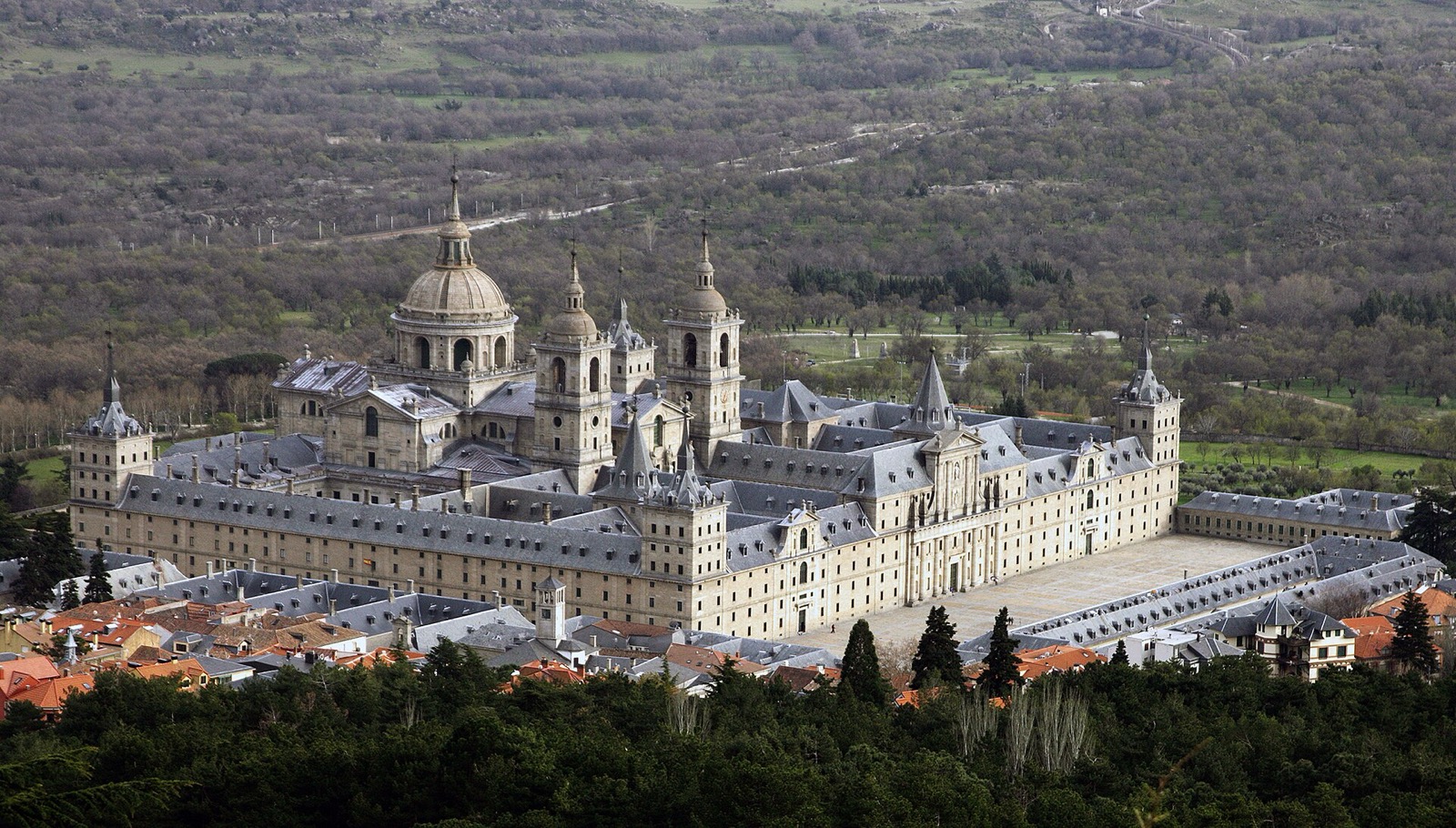
The monastery and royal site of El Escorial offers a striking lesson in the apparent solidity of an ensemble. From a distant view its granite exterior can seem a continuous, immense stone object. UNESCO's description instead locates a monastery, church, palace, school, seminary and library within that overall volume, organised around eleven principal and three service courtyards. The courts make distinct zones and bring exterior conditions into a seemingly closed building. The site extends beyond its walls to gardens, an esplanade and service buildings, with eighteenth-century additions altering its urban setting. A silhouette that names only the outer rectangle misses much of its architecture. [13]

Text alternative for the diagram
A deliberately nonmeasured outer rectangle contains several conceptual courts to remind readers that UNESCO records eleven principal and three service courts; this is not El Escorial’s plan.
Its Royal Library provides a room-scale check on that claim. Patrimonio Nacional describes windows and balconies toward the Patio de los Reyes as well as windows toward the western Lonja. This particular room is lit in relation to an internal court and exterior forecourt; it would be wrong to conclude every room in the broad ensemble has the same daylight. Sixteenth-century prints in the national collection show the site in plan, elevation and perspective, allowing comparison of how its form could be represented during its early history. Yet a period engraving still expresses a chosen view rather than a measured record of today's condition. The familiar idea that the plan resembles St Lawrence's grill is reported by UNESCO as something “some say”; it is no substitute for the documented functions and courts of the complex. [13], [14], [15]
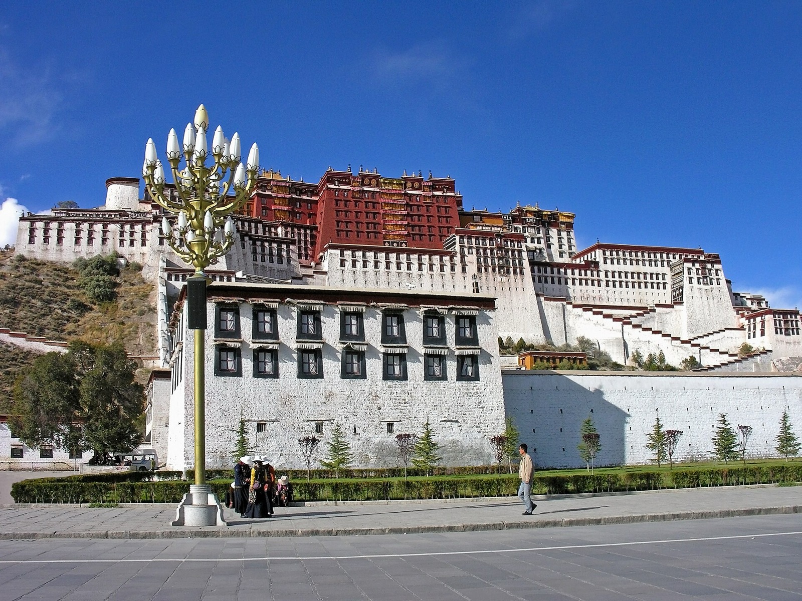
The Potala Palace at Lhasa shows the opposite danger: a skyline that seems to rise naturally from a mountain can be misread as a single timeless fabric. UNESCO locates the White and Red Palaces and ancillary buildings on Red Mountain, with the Red Palace higher and farther west. The mount and the built compound work together: the low approach, enclosing walls, differentiated wings and summit roofs form a vertical hierarchy that no isolated front elevation captures. But the dominant extant palaces are not untouched seventh-century walls. The heritage nomination describes the White Palace's seventeenth-century rebuilding from 1645 and the Red Palace's completion in 1694, with later works continuing. A photograph may show an enduring topographic composition without proving one original date or one unchanging use. [33], [36]

Text alternative for the diagram
A nonmeasured hill section distinguishes the White Palace’s lower mass from the higher western Red Palace and marks the dominant surviving seventeenth-century phase.
The larger setting matters as well. An early UNESCO conservation report calls for nearby building height, volume, colour and style to harmonise with the palace landscape. This does not prove all development has obeyed it, nor does it supply current planning law; it demonstrates why heritage massing reaches beyond protected walls into views and the scale of new neighbours. A later planning image could preserve one postcard silhouette while changing another approach or the ordinary urban life beneath it. [37]
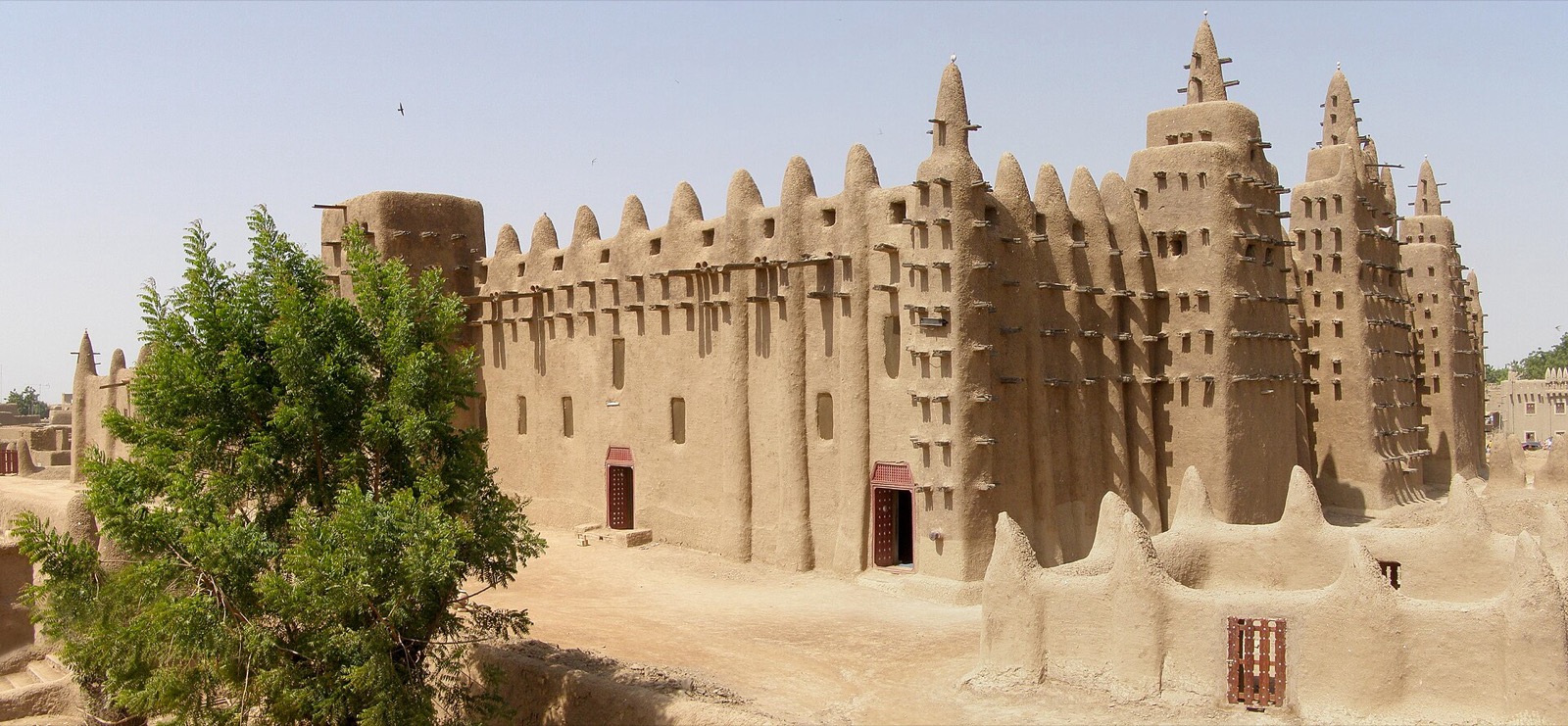
Djenné turns apparent mass into a lesson about maintenance. UNESCO describes an old town whose domestic buildings and landmark mosque use earth intensively, with buttresses accentuating vertical façades. Its French urban heritage atlas identifies the Barey-ton association of traditional masons and the continuing work that keeps earthen houses and roofs. The present Great Mosque is a 1907 structure on the site of an earlier mosque, not a medieval form that happened to survive without repair. Annual application of protective banco plaster is part of how its exterior persists; UNESCO's report of 2009 consolidation notes structural weakness despite recurring surface care. Earth is neither a generic “heavy” aesthetic nor a permanent sculptural material. It requires skills, seasonal work and collective decisions that a photograph of a freshly coated front cannot reveal. [34], [38], [39], [40]

Text alternative for the diagram
A conceptual earthen buttress receives a renewable outer plaster layer. It is not a technical wall section or dated survey of the Great Mosque.
These three ensembles are deliberately unlike. El Escorial's monumental shell contains many courts and programmes; Potala's mass is built into a hill and remade in phases; Djenné's earth-based silhouette survives through continually renewed material work. None supplies a universal “historic massing” formula. Each asks where the solid is, what spaces it protects or frames, and which record establishes the age and upkeep of the form being seen. [13], [14], [15], [33], [34], [35], [36], [37], [38], [39], [40]
Lifted boxes and projecting terraces
Villa Savoye in Poissy made its major domestic volume seem detached from the ground. Fondation Le Corbusier describes the structural post-and-slab system that allowed a freer plan and façade; pilotis lift the main white box while the ground floor curves to accommodate the Savoyes' motor car approaching the entrance and garage. That curve is not an arbitrary decorative flourish: the owner estate gives the car's turning route as a fundamental design problem. The raised mass, darker recessed ground, roof terrace/solarium and curved service base therefore answer different functions and scales. The estate also records unsuccessful proposals and a reduced final solarium, so the final outline should not be presented as the architect's single inevitable sketch. [16]

Text alternative for the diagram
An invented section separates pilotis, raised living volume, curved car-arrival path and roof terrace; dimensions, post count and accessibility are not surveyed.
Le Corbusier framed the villa as a promenade in which ramp, rooms, framed views and roof condition unfold through movement. This complicates its most reproduced image: the distant white rectangle does not tell a reader how one reaches or occupies it. It also should not be assumed to provide a universally usable route; the architect's designed sequence responded to a specific family and motor-car programme. “Weightlessness” describes visual effect, not actual structural load, and today's visitor access cannot be read backwards as every original worker's or household member's route. [16]
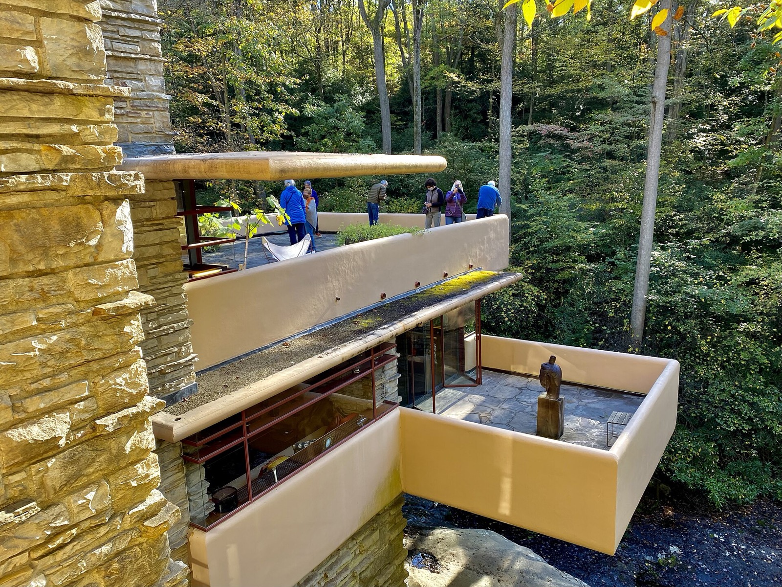
Fallingwater's projected planes produce a different apparent defiance of gravity. The building's custodian describes Wright's stacked, cantilevered concrete terraces in relation to the natural ledges of Bear Run and a central sandstone chimney mass. The stone core stabilises a reading of place while the horizontal trays extend over the waterfall; garden, water, shelter and house appear to interpenetrate. Yet an overhang is not an unsupported miracle. The terraces depend on reinforced concrete and steel connections, and the institution records early repair problems, monitoring and major cantilever strengthening in 2002. Its standing massing is as much an engineered and maintained relationship as a visual correspondence with rock. [17], [18]

Text alternative for the diagram
A conceptual stone core and two projecting concrete plates show apparent extension while indicating the need for structural support; this is not an engineering calculation.
The pairing shows why massing is not simply “solid versus light.” Villa Savoye appears raised because the bulk of its living floors stands above a recess; Fallingwater appears extended because terraces reach out from anchorage. Both have a material gravity that their iconic perspectives conceal. The environmental and social setting also differ: a suburban family car's circular approach and a woodland waterfall site's seasonal freeze-thaw/repair cannot be reduced to a shared modernist wish to float. [16], [17], [18]
Housing estates, streets and shared walls
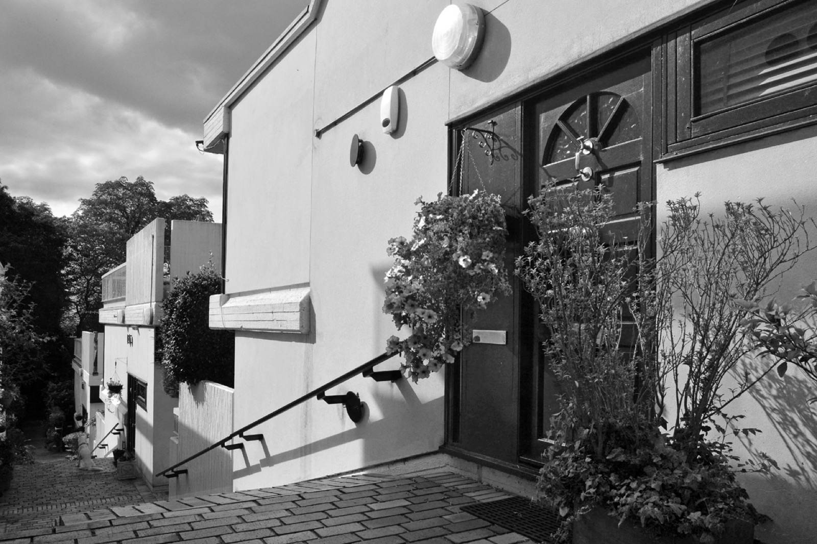
At housing scale, a skyline can disguise how many dwellings, levels and paths it contains. The Branch Hill Estate in London, designed by Benson and Forsyth, is described by Historic England as a low-rise, high-density scheme whose complex stepped section fits a sloping site and restrictive covenants. This is not the same as putting a small decorative step in a façade: the homes and terraces are distributed vertically through the land, so the contour helps determine the building. The listing praises the design but offers no direct assessment of residents' lives; the historical record supports a claim about form and site, not a promise that this arrangement works identically for everyone. [19]
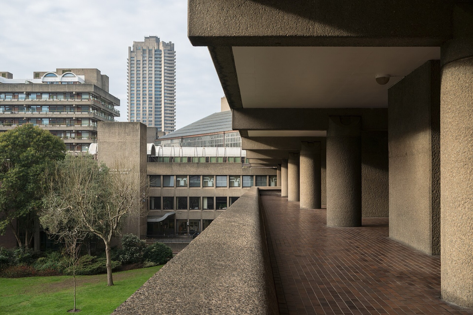
The Barbican Estate's familiar towers likewise tell only part of its massing. Historic England describes a residential composition on a raised pedestrian podium, with predominantly seven-storey terrace blocks and three triangular towers of 43 or 44 storeys. Parking and service areas sit below pedestrian levels, while gardens and water occupy parts of the podium ensemble. The high towers act differently at distant skyline scale from the broad terraces at the scale of a courtyard or walkway. Cross-walls and columns support the terrace blocks, whereas the towers' lift/stair cores and peripheral framework answer a different vertical demand. There are varying unit plans, distinctive blocks and even changes in podium level; an aerial view of repeated terraces should not be mistaken for a single uniform floor plan or effortless route. [20], [21]

Text alternative for the diagram
Two nonmeasured options compare slope-following low-rise homes with a raised podium and tall tower; they do not plot Branch Hill or Barbican survey dimensions.
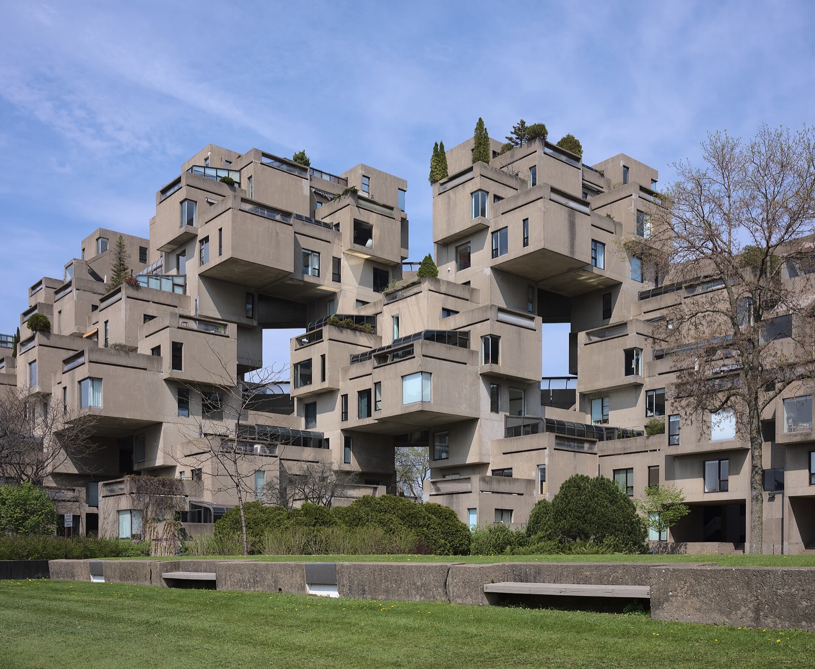
Montreal's Habitat 67 is another lesson in the difference between a repeated part and a repeated whole. Québec's heritage register describes 354 prefabricated modules of common dimensions organised into three irregular stepped pyramids and 158 original apartments. Lift and stair cores, horizontal walkways and flat roofs that become terraces complete the residential system. The modules repeat; the larger outline and the apartments they form do not. Safdie Architects says the stepping was intended to bring sun, air and a private garden terrace to each home while retaining the amenities of denser urban housing. That is a design intention, not independent proof that every current resident receives equivalent light or that each apartment remains the size and layout of its Expo-era counterpart. Some original flats have been combined since. [27], [28]

Text alternative for the diagram
Uniform graphic modules combine into stepped, differently sized symbolic apartments and roof terraces; this is not a Safdie plan or count of 354 built modules.
The archive at McGill University makes the story still more revealing. Safdie's first Habitat proposal was a much larger mixed-use urban system: inclined residential planes on A-frame supports, public facilities beneath, generous light/air gaps and planned sections of twelve and twenty-two storeys with roughly 1,200 homes. The Canadian government chose only a smaller portion, and the eventual twelve-storey, 158-home Habitat was redesigned rather than simply cut out unchanged from the first drawings. In the built scheme McGill describes prefabricated units, pedestrian streets and lift cores all acting structurally, with elevated streets served by lifts stopping at intervals. A model of the proposal, a diagram of the revised project and a photograph of the completed buildings therefore do not show the same mass. [48], [50], [51], [52]
Columbia architectural historian Inderbir Singh Riar documents the competing ambitions and criticisms of this prototype. Organisers treated even partial construction as a demonstration of a possible future city, while 1967 critics questioned whether the high cost and relatively small built number of homes had produced an affordable construction system. These concerns do not erase Habitat's inventive roof terraces or its historic status; they prevent a claim that the visible form, by itself, fulfilled every original economic and civic aspiration. McGill's archive and the historian report different cost figures with likely differing accounting scopes, so a simple unqualified “cost per home” comparison would mislead. The architectural point is more precise: repeated industrial parts can create rich massing, but repetition does not automatically make housing inexpensive or the first urban programme real. [27], [28], [29], [46], [50], [51], [52], [53]
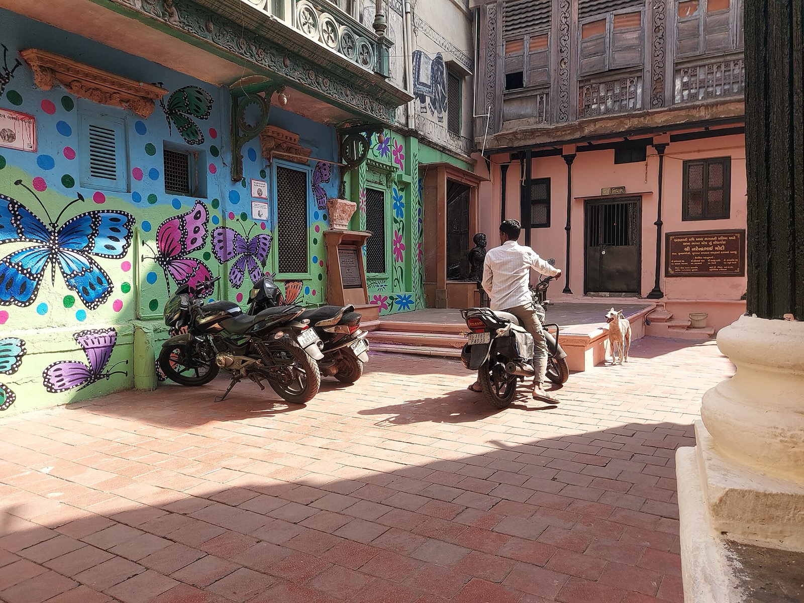
A different housing urbanism is visible in Ahmadabad's historic pols. UNESCO's heritage atlas, drawing on local Ahmedabad institutions, describes densely packed houses sharing walls along gated residential streets, with inner courtyards in traditional dwellings and communal places such as wells and bird feeders. A house can be visually dense from the lane and spatially open around its own chowk; the street becomes a public or shared void between close-set fronts. The city's heritage record describes one haveli where that court and historic water harvesting are legible. Such domestic voids are not equivalent to El Escorial's court of ceremony or Habitat's terrace in the sky. Nor is the old city an unchanging mass: UNESCO notes changes in heights and building fabric across generations, mostly within inherited limits, with some aberrations. Reading its urban form means recognising living use, joined walls and phased repair rather than assigning one universal pattern to every Indian home. [31], [32]

Text alternative for the diagram
A typological shared-wall lane schematic opens an inner court in one house and a small public street void; it identifies no particular Ahmedabad property.
These housing examples unsettle a habitual visual shortcut. A low rise may be dense, a tall tower may occupy little footprint, a stack of repeated boxes may yield irregular homes, and a tightly packed lane may contain interior courts. To discuss the social result one must go farther than counting external volume: entrance, sunlight, privacy, shared and private space, structural connections, upkeep and affordability can make similar outer shapes function differently. [8], [9], [19], [20], [21], [27], [28], [29], [30], [31], [32], [35], [50], [51], [52], [53]
Civic form, openings and the museum as sculpture
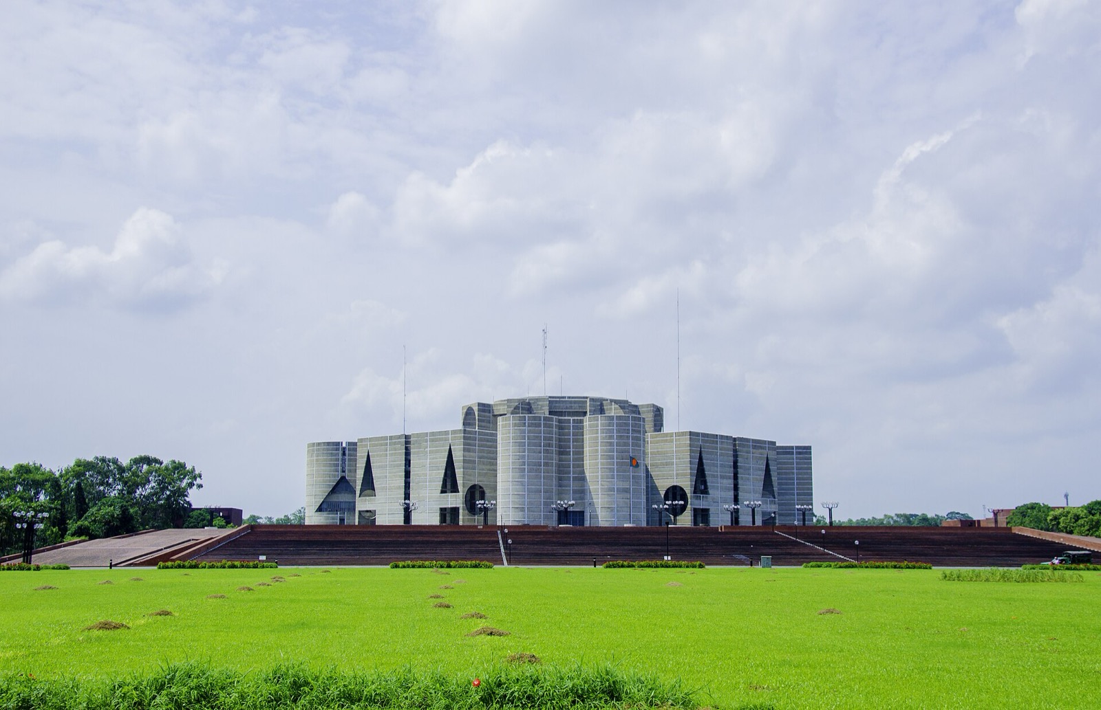
Louis Kahn's National Assembly Building in Dhaka uses massive-looking walls without making the civic programme one solid block. The Aga Khan Award's record identifies a central domed assembly chamber and library, with eight light-and-air courts and supporting spaces around them. Monumental geometric openings become part of how daylight reaches and animates the interior. MoMA preserves a large cardboard study model of the building; its curator describes how squares, circles and triangles organise a fortress-like exterior around a more complex light-bearing interior. A photograph of one façade shows the openings, but a model or section is needed to see how they sit relative to chambers and courts. [22], [24]

Text alternative for the diagram
An abstract central chamber, light-air court and geometric aperture distinguish open spaces from solid enclosure without copying a Kahn plan.
The building also has a layered construction history. It was designed before independent Bangladesh and completed in 1983, after Kahn's death, with later architects named in the Aga Khan record. Its present status as a national parliament is important, yet a monumental composition does not prove all members of a public enjoy identical access or that civic politics can be inferred from abstract geometry. The model gives evidence of a studied form; the completed structure, its actual routes and its later national meaning require separate accounts. [22], [24]
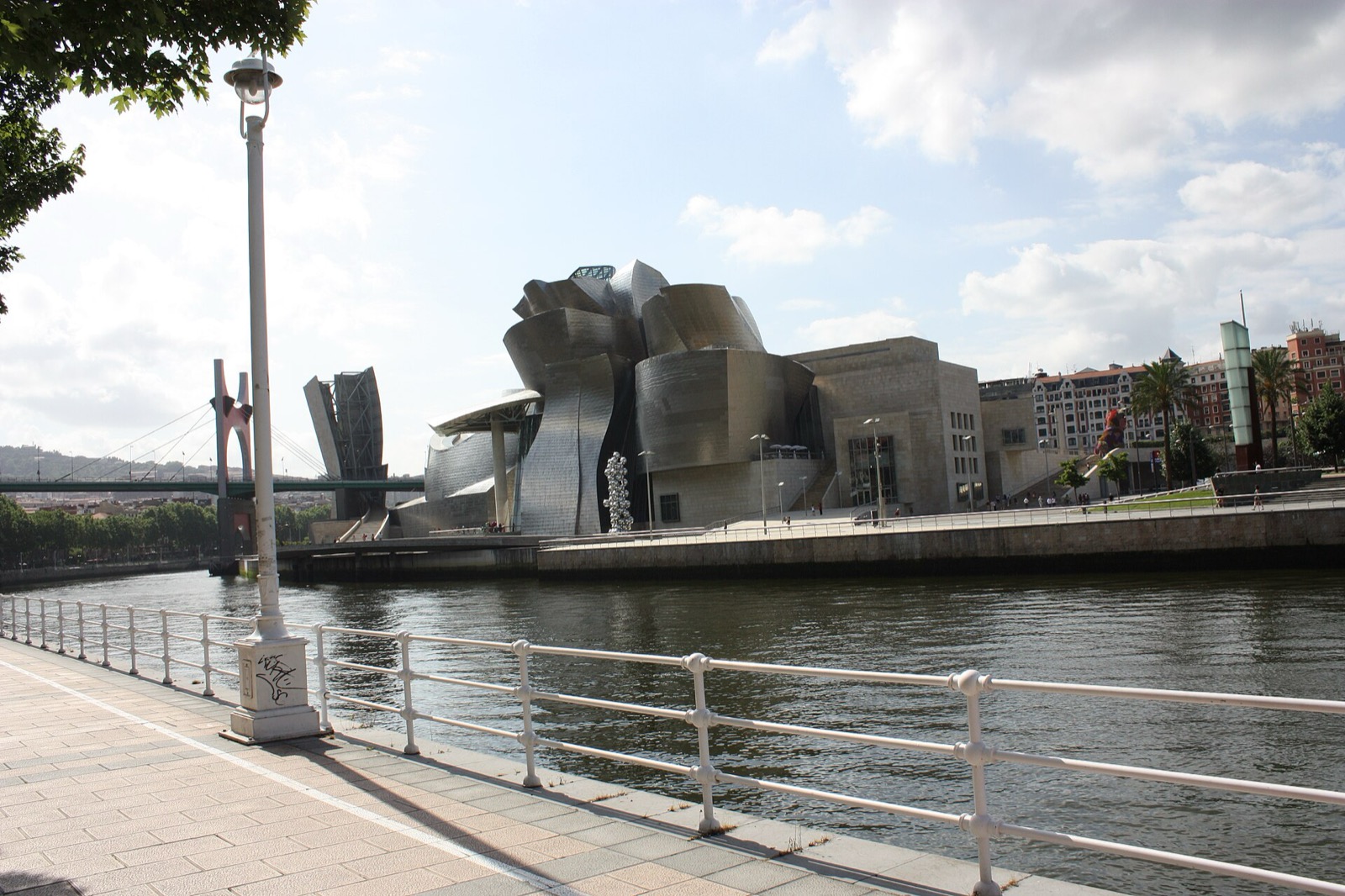
The Guggenheim Museum Bilbao offers an almost opposite surface: a building often described as a sculpture rather than a fortress. The museum itself places Gehry's curvilinear volumes on a former industrial wharf at a bend in the Nervión, with three levels organised around a central atrium and connected by curved walkways, lifts and stairs. The pale limestone elements, glazed openings and titanium-clad surfaces meet at different scales and angles; the museum's construction record says computer-aided modelling was needed to translate the complex shapes into buildable structure. The thin titanium sheets change tone under light and weather, but that appearance is not a building whose geometric volume literally changes each afternoon. A skyline image should also make room for the riverbank and the internal atrium that gathers the galleries. [30]

Text alternative for the diagram
A loose cluster of curved and orthogonal symbolic volumes surrounds an atrium; surface colour differentiates skin from three-dimensional geometry, not a museum survey.
One further museum record complicates the idea that massing is wholly visual. Guggenheim Bilbao reports collaborating with ONCE Euskadi on tactile models of Gehry's building for visually impaired visitors, alongside subtitled/signed video guidance for deaf visitors. This does not establish that every part of the museum is universally accessible. It shows that three-dimensional form can be communicated through touch and that a dramatic exterior photograph is not the only interpretive medium. A building's memorable profile and an actual person's path through its atrium are different experiences, even when both belong to the same architecture. [30], [41]
Massing under climate and planning constraints
The difference between shaping bulk and simply maximising it becomes tangible in planning records. Toronto asks developers to submit a 3D building mass model within the existing city context for assessment of scale and sun/shadow. Singapore's Urban Redevelopment Authority requires Punggol Digital District forms to relate to undulating land, waterfront approaches, tropical climate and planted courts; along key edges it discourages a wall-like continuous development and seeks physically and visually porous smaller-scale parts. Its residential building-length rule also recognises that spacing between blocks can interrupt a large-looking development and make room for air movement. These are particular public decisions about sites and activities, not commands for every architect to make an identical picturesque silhouette. [4], [5], [6]

Text alternative for the diagram
Two invented street sections contrast continuous bulk with separated blocks and height variation. No equal floor area, real street survey or environmental performance value is asserted.
The UK's National Design Guide explains why conspicuously taller or bulkier proposals require attention to their position, townscape, views, ground-and-sky composition, daylight, shade and wind. BRE's daylight guide adds a subtlety that a “make it lower” slogan misses: a tall obstruction can leave light around its sides if it is narrow or discontinuous, while a fully enclosed court may appear pleasantly bounded but darken rooms near its corners. Screens placed for domestic privacy can diminish natural light; gaps introduced for sun can sometimes accelerate wind; ground-level access and vehicle routes claim space of their own. These are trade-offs to examine with a real site, not numerical rules that make one form objectively best. BRE expressly describes its advice as non-mandatory rather than planning policy. [1], [2], [9]
Japan's original architectural research provides another warning about form produced by rules. One study models building placement and inter-building spacing against exterior wall illumination; another concludes that a sky-exposure criterion combined with volume maximisation can favour taller, more separated and centrally placed forms. Those are particular analytical scenarios, not evidence that residents prefer the resulting skyline or that El Escorial, Habitat 67 or Bilbao were shaped by that Japanese rule. Singapore's current city planning similarly describes using environmental models to guide forms that channel wind toward some streets; a projected reduction in heat is not observed performance of every future block. [7], [10], [11]
A UCL architectural dissertation makes the competing claims more human. At the university's Marshgate campus project, some academics wanted nobody more than nine metres from a window for view, daylight and ventilation. Designers argued that much deeper floorplates were needed for laboratories, workshops, large teaching spaces, flexibility and collaboration, within massing parameters already set by the wider master plan. The author documents these arguments; she does not thereby prove that either a deep plan or a shallow one is universally superior. The case is valuable because the sculptural ambition of a mass encounters occupied programme, institutional priorities and disagreement. A light-filled edge seen in one perspective does not reveal the conditions of every room farther inside. [35]
Nor can climate be reduced to orientation alone. An original simulation study of a hypothetical office in Cairo, Alexandria and Aswan varied building form alongside skylights, glazing and shading and found different trade-offs between useful daylight and thermal energy demand in the three hot-climate settings. Some trends in its scatterplots were weak. It would misrepresent the experiment to say massing by itself delivered its reported percentages, or that an optimised model had been built and measured. The stronger lesson is that the form of a building interacts with envelope, sky, programme and place; an apparently generous daylight opening may increase solar load or glare elsewhere. [12]
A hill absorbed into rooms: Therme Vals
Peter Zumthor's thermal bath at Vals makes a building's absence from one panorama a deliberate massing choice. A Swiss architectural survey says the bath was set into a slope so hotel views remained open. Its grass-covered roof joins the hill from above, while fifteen stone-wrapped concrete-core blocks and their narrow roof-plate gaps structure interior pools, passages and shafts of light. The region's source, local stone, water temperatures and sounds make the site more than a skyline silhouette. From the hillside the form can seem reticent; within it, the blocks and intervening water create substantial enclosed volume. [54], [55], [56]

Text alternative for the diagram
A conceptual hillside section shows a planted roof, several block-like interiors and light gaps under the visible topography; it is not Zumthor’s measured section.
This example also cautions against equating quiet appearance with free access. The Swiss survey describes a stair approach and hotel-side underground entry; different visitors do not necessarily take the same route into the bath. Its enthusiastic suggestion that stone and water are “for all” is an interpretation, not a site accessibility audit. Nor do the operator's descriptions of perfect balance provide a measurement of experience. Set beside Potala's mountain-built hierarchy and Branch Hill's slope-following residences, Vals demonstrates that topography can determine how much volume is visible, where a structure meets the ground and what its interior affords, but each site has a different programme and public condition. [19], [33], [54], [55], [56]
Reading mass without losing the building
Begin with the actual occupied site, not the drama of one image. Compare an external view with a plan and section, and identify which mass appears near the ground, which rises, which overhangs and which remains hidden in a slope. Then identify its negatives: courts, gaps, undercrofts, passages and roof terraces. At El Escorial the outer envelope contains many organised courts; in a pol house the inner court is domestic; at Dhaka the light-and-air courts work alongside a national chamber. All are openings, but they do not have one social meaning. [13], [14], [15], [22], [31], [32]
Next ask how the form came to be. A prefab module can repeat at Habitat while the finished dwellings and skyline differ; a constraint on a London slope can lead to stepped housing; a parliamentary commission can be completed after its first architect's death. Material is not only colour: earth at Djenné, stone and concrete at Vals, and repaired reinforced concrete at Fallingwater each condition structure and upkeep. Before asserting “original intent,” distinguish proposal, as-built structure and present repair. [17], [18], [19], [22], [27], [28], [29], [34], [35], [36], [37], [38], [39], [40], [50], [51], [52], [53], [54], [55], [56]
Finally test what the volumes do rather than assigning a universal emotional adjective. Does a wall define a useful street or obstruct it? Does an inner court bring light to adjacent rooms while leaving corners dark? Where does an overhang cast shade, and where does a roof terrace sit above another home? Whose entrance, wheelable route or sensory interpretation is available? The UK design and BRE guidance, the UCL dispute and Bilbao's tactile models make these questions concrete without guaranteeing identical answers. Good massing may be monumental, porous, buried, stepped or outward-reaching when those choices serve a particular place and its users. What makes the word worth using is its capacity to connect visual form to space, construction and life beyond the postcard. [1], [2], [3], [4], [5], [6], [7], [8], [9], [10], [11], [12], [20], [21], [35], [41], [54]
Companion Pages and Reading
The companion Theory, Proportion, Symmetry and Rhythm pages describe other forms of architectural order. The routes on courtyards, colonnades, halls, roofs, terraces, medieval and modern styles, city planning and the individual buildings discussed here extend the question at more specific scales. Similar silhouettes need not share a structural or social rule. [1], [2], [13], [14], [15], [16], [17], [18], [19], [20], [21], [27], [30], [31], [32]
Fallingwater's own preservation video shows why its projecting concrete should be discussed with repair and stewardship, not only with the classic exterior photograph. MIT's lecture on city form and process can place isolated building masses beside the public decisions that make a city, although its scope is broader than architectural massing at building scale. Ching's Architecture: Form, Space, and Order introduces elemental design vocabulary; Mindrup's The Architectural Model asks what a miniature or prototype can and cannot represent. Safdie's Beyond Habitat gives a first-person account of the struggle to move from housing concept to built demonstration, to read alongside Québec's official heritage register and McGill's proposal/built records rather than as an unchallenged verdict on success. [25], [27], [42], [43], [44], [45], [46], [47], [48], [50], [51], [52], [53], [57]
Explore RELATED Artworks and Records

El Escorial architectural photograph
Aerial-looking outer mass and forecourt
Hans Peter Schaefer; Wikimedia Commons
Djenné architectural photograph
Earth-built landmark beside a town edge
BluesyPete; Wikimedia Commons
Desai ni Pol street record
House façades framing lived outdoor space
Riyas16; Wikimedia Commons
Bilbao museum record
A river-side view of unlike volume types
Ardfern; Wikimedia CommonsWatch: Mass and City Form
Fallingwater’s preservation record [47] and MIT’s city-form lecture [57] offer two distinct moving contexts for these buildings.

Fallingwater: World Heritage Preserved
The owner’s film puts the famous terraces beside repair and stewardship.
Original schematic preview; no video still reused.
MIT: City Form and Process
A graduate lecture asks how public decisions and civic processes affect city form.
Original schematic preview; no video still reused.Frequently Asked Questions
No. Massing concerns shaped three-dimensional bulk and its relation to space; structural load is a different physical quantity. [1] [16] [17]
Colour can alter apparent bulk in one view, but it does not necessarily change the actual volume, shadow or room depth. [1] [9]
No. A deep, fully enclosed court can shade rooms near corners; glazing, sky, orientation and neighbours also matter. [3] [9] [15]
No. Standardised modules were combined into apartments of unlike arrangements, and the original much larger mixed-use scheme was not built as drawn. [27] [50] [51]
Its site has a much older history, but the dominant surviving White and Red Palaces were rebuilt and completed mainly in the seventeenth century. [33] [36]
No. The present earth-built mosque dates to 1907 on an earlier site and depends on recurring plaster maintenance and repairs. [34] [39] [40]
References
- UK Ministry of Housing, National Design Guide. Source record.
- UK National Model Design Code guidance notes. Source record.
- MIT OpenCourseWare, C. Reinhart, “Massing Studies & Rules of Thumb,” 2012. Source record.
- City of Toronto, Building Mass Model terms of reference. Source record.
- Singapore URA, Punggol Digital District urban-design guidelines. Source record.
- Singapore URA, Building Length rule. Source record.
- Singapore URA, 2025 Master Plan “Enhancing City Neighbourhoods”. Source record.
- London City Hall, housing design guidance. Source record.
- BRE, Site Layout Planning for Daylight and Sunlight: A Guide to Good Practice (BR 209, 2022 edition), publisher record. Source record.
- Japanese Architectural Institute original study, 勝又済・三木保弘・石井儀光, “建物形態・隣棟間隔と壁面照度の関係の定量的分析,” 2008. Source record.
- Japanese Architectural Institute original study, “天空率規制下で建築ボリューム最大化により誘導される建物形態,” 2010. Source record.
- UCL Discovery / International Building Performance Simulation Association, Mohamed et al., Egyptian-climate form/envelope optimisation study, 2023. Source record.
- UNESCO World Heritage Centre, Monastery and Site of the Escurial. Source record.
- Spain Patrimonio Nacional, El Escorial historical exhibition and sixteenth-century prints. Source record.
- Patrimonio Nacional, El Escorial Royal Library. Source record.
- Fondation Le Corbusier, Villa Savoye, Poissy 1928–31. Source record.
- Fallingwater, design history. Source record.
- Fallingwater, preservation history. Source record.
- Historic England statutory listing, Branch Hill Estate. Source record.
- Historic England statutory listing, Barbican Estate. Source record.
- Historic England registered landscape, Barbican. Source record.
- Aga Khan Award for Architecture / AKDN, National Assembly Building, Dhaka. Source record.
- MoMA collection, Louis Kahn study model for Dhaka Parliament. Source record.
- RIBA, Architectural Models in the RIBA Collections. Source record.
- Canadian Centre for Architecture, Studio Mumbai/Bijoy Jain Weavers' Studio site model. Source record.
- Québec cultural-heritage register, Habitat 67. Source record.
- Safdie Architects, Habitat 67 project record. Source record.
- Bureau International des Expositions, Moshe Safdie / Expo 67. Source record.
- Guggenheim Museum Bilbao building. Source record.
- UNESCO Urban Heritage Atlas, Ahmadabad. Source record.
- Ahmedabad Municipal Corporation, heritage house record. Source record.
- UNESCO, Potala Palace historic ensemble. Source record.
- UNESCO, Old Towns of Djenné. Source record.
- Emma Louise Gribble, Architectural briefing and argumentation, UCL Ph.D.. Source record.
- UNESCO/ICOMOS Potala original nomination/evaluation. Source record.
- UNESCO 2003 Potala conservation-periodic report. Source record.
- UNESCO Urban Heritage Atlas, Djenné. Source record.
- UNESCO 2009 Djenné conservation report. Source record.
- UNESCO 2019 Djenné solar/maintenance account. Source record.
- Guggenheim Bilbao, 2021 social-responsibility report. Source record.
- MIT OpenCourseWare, Daylighting syllabus and modelling method. Source record.
- MIT OpenCourseWare student massing-model project. Source record.
- Matthew Mindrup, The Architectural Model, MIT Press publisher record. Source record.
- Francis D. K. Ching, Architecture: Form, Space, and Order, fifth-edition Wiley publisher excerpt. Source record.
- Canadian Centre for Architecture library record, Moshe Safdie, Beyond Habitat. Source record.
- Fallingwater, “World Heritage Preserved” project video. Source record.
- McGill University Canadian Architecture Collection, Moshe Safdie Archive. Source record.
- McGill University Moshe Safdie Archive, Habitat original proposal. Source record.
- McGill University Moshe Safdie Archive, built Habitat 67. Source record.
- McGill University Moshe Safdie Archive, undergraduate thesis record. Source record.
- Inderbir Singh Riar, Expo 67, or the Architecture of Late Modernity, Columbia Ph.D. 2014. Source record.
- Swiss Architekturbibliothek, “Felsen-Therme” technical building survey. Source record.
- 7132 Therme operator, German landscape/material account. Source record.
- Graubünden Tourism / Visit Vals, 7132 Therme. Source record.
- MIT OpenCourseWare, Julian Beinart, “Lec 15: City Form and Process”. Source record.
Explore RELATED Architecture
These built places require documentary, material and lived evidence beside formal principles.
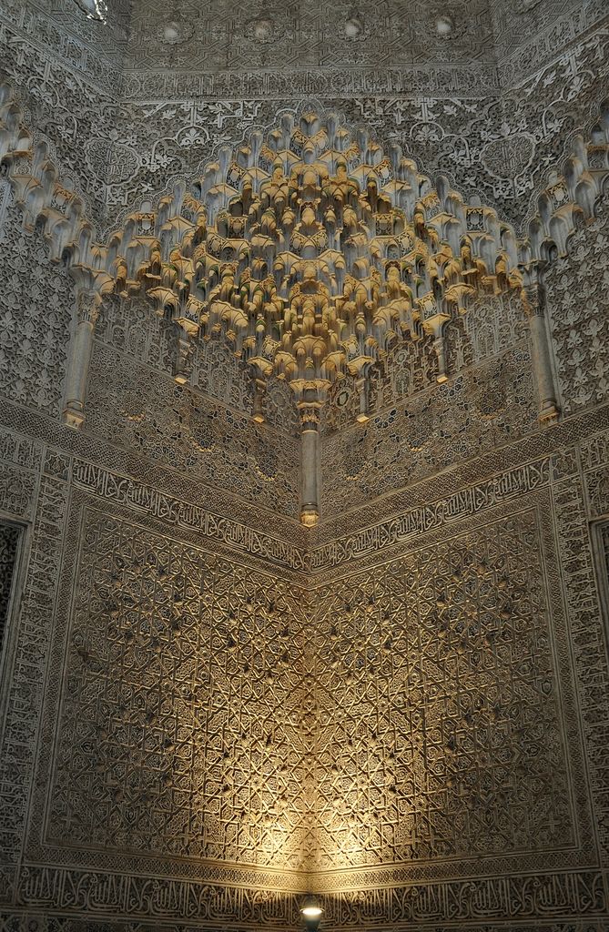
Alhambra
Courts and perimeter volumes change how an ensemble is read.
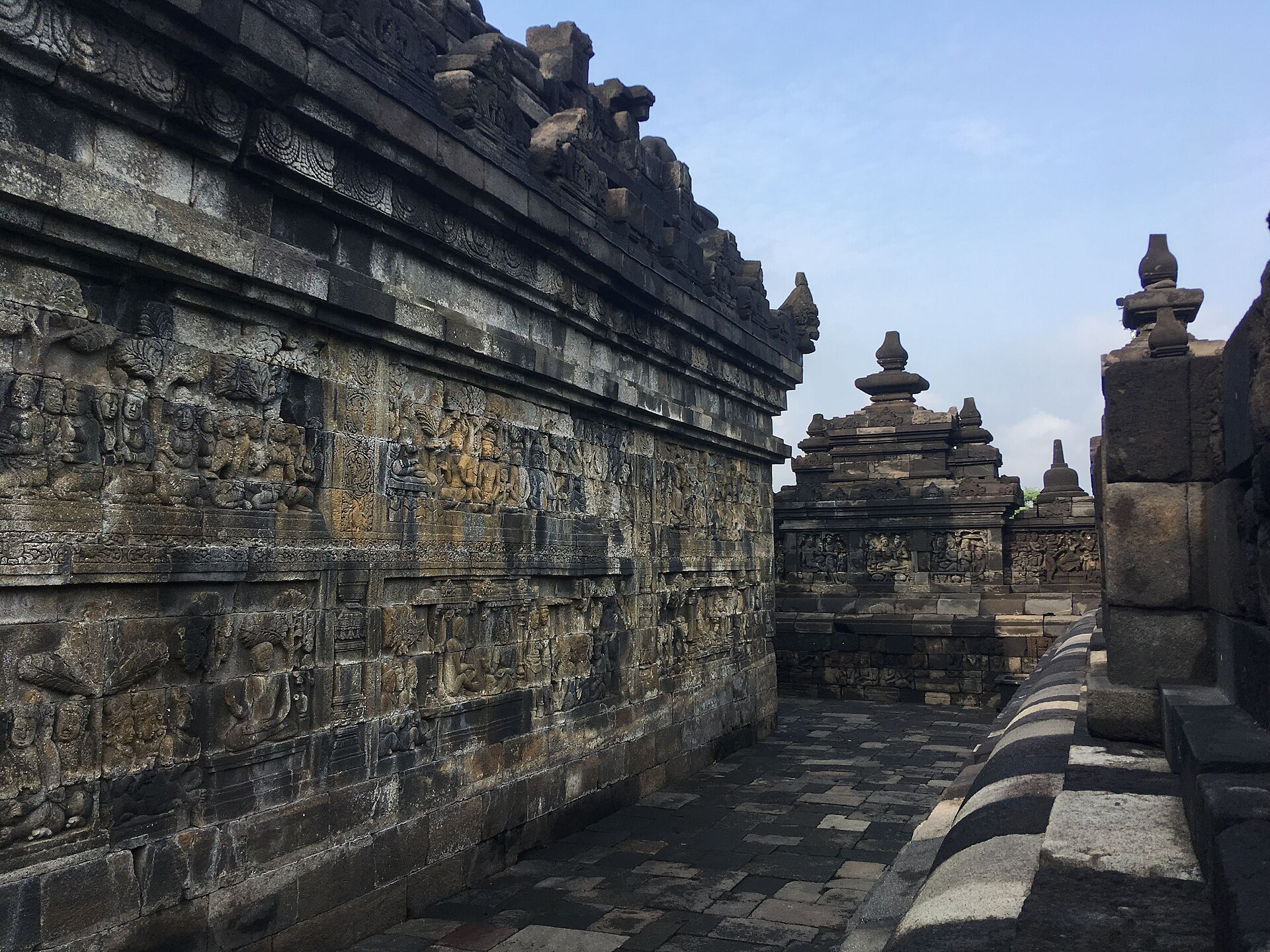
Borobudur
Terrace profiles are also a sequence of occupied routes.
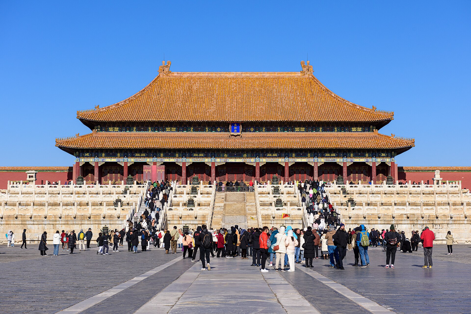
Forbidden City
Court sizes and building ranks make unlike thresholds.
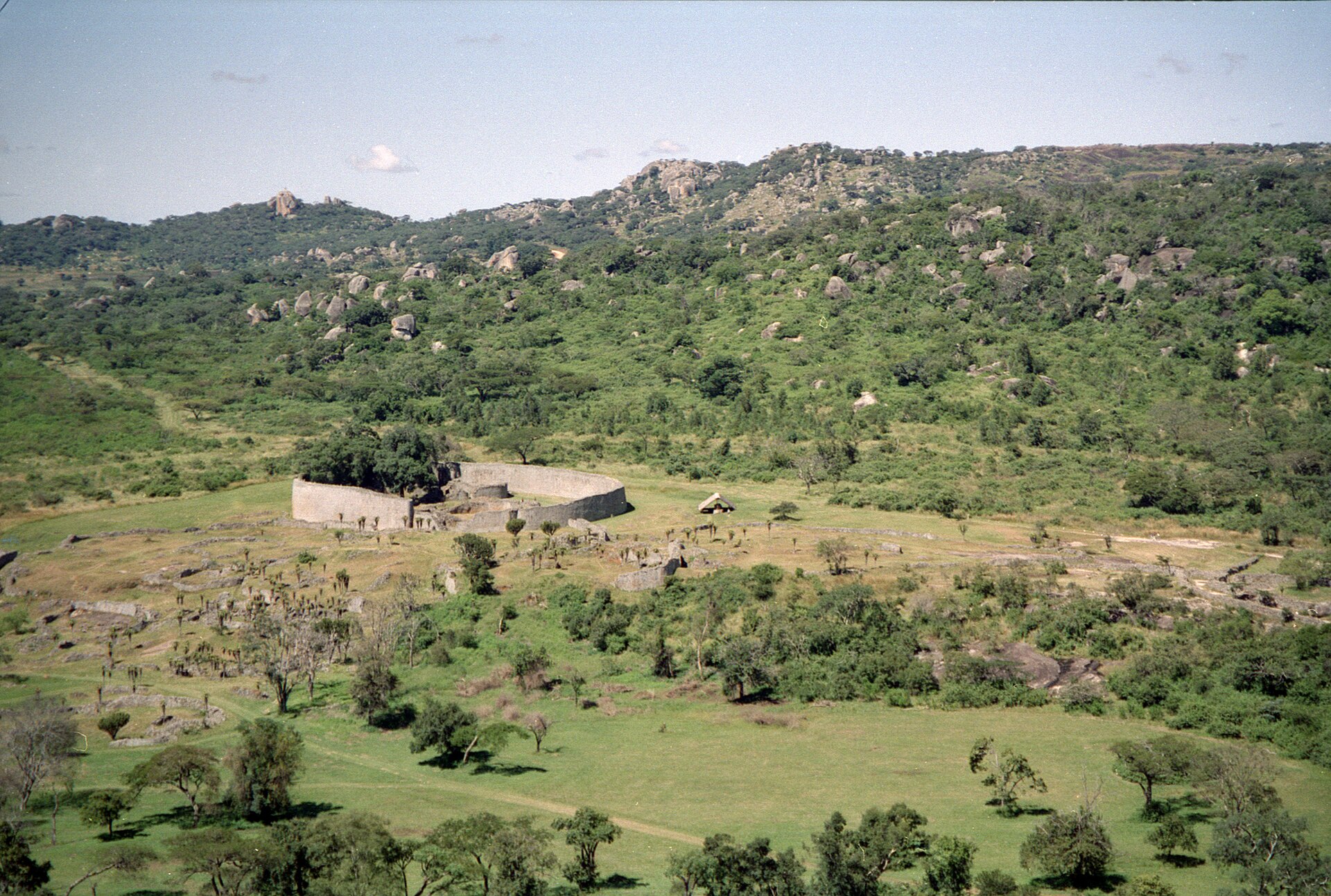
Great Zimbabwe
Stone enclosure must be read with terrain and use.
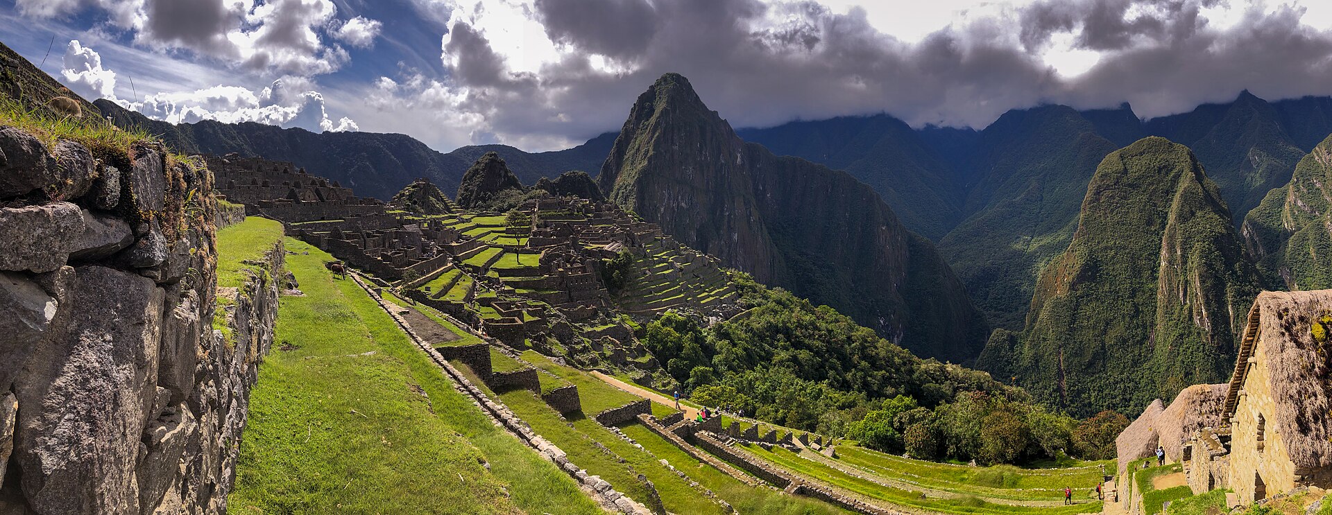
Machu Picchu
The hillside makes one view unlike another.
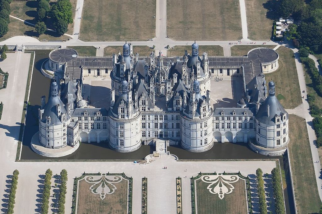
Château de Chambord
A roofscape can divide apparent volume into many parts.
Pantheon
A portico and rotunda make one monument read at two scales.
Colonnade
An open edge has material supports and passage space.