by Tom Gurney
Tom Gurney BSc (Hons) is an art history expert with over 20 years experience
Email: tomgurney1@gmail.com / Phone: +44 7429 011000
An Ancient City Beyond Its Pyramids
Teotihuacan was a vast planned city in the Basin of Mexico, northeast of present-day Mexico City. Its broad avenue and three celebrated pyramids are only the most conspicuous part of an urban landscape of residences, workshops, plazas, waterways and altered ground. The name itself was bestowed later by Nahuatl-speaking peoples; the inhabitants' own city name, principal language and rulers remain unidentified. At its height the city may have held around 100,000 people, according to a model built from mapped housing and excavated dwellings, not an ancient census. To read its architecture well, a visitor must move between the scale of a pyramid and the scale of a courtyard, and between a monument's surviving stone and the paint, plaster, timber and built-over layers that are now largely gone. [1], [2], [3], [4]
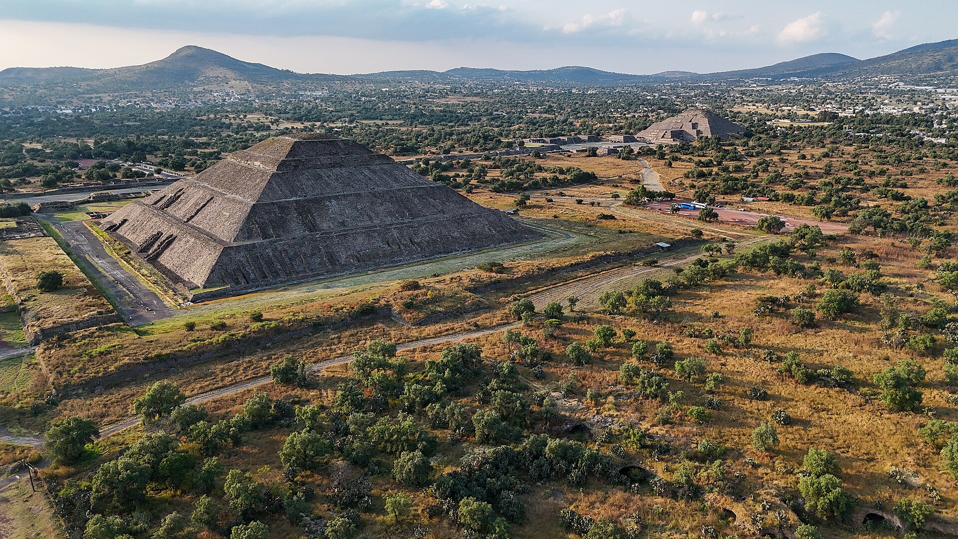
The familiar view along the Avenue of the Dead seems to promise a simple story: a Sun Pyramid to one side, a Moon Pyramid at the far end, and a Feathered Serpent Temple within the southern Ciudadela. Yet the Avenue's Nahuatl name also arrived after the city's great building age. Archaeologists find overlapping building episodes inside the Moon Pyramid, an added platform that concealed the Serpent Temple's carved frontage, and neighbourhoods whose architecture changed long after the major pyramids rose. The visitor route is a powerful modern selection from a once much wider inhabited city. Exposure, reconstruction and selected public access shape what we think the ancient city looked like. [1], [5], [6], [7], [8], [9]
At a Glance
- PlaceBasin of Mexico, northeastern edge of present-day Mexico City's region; a later Nahua name for an earlier multiethnic city. UNESCO inscription in 1987. [1], [2]
- Urban scaleAncient peak extent is estimated at roughly 36 km² by UNESCO, whereas its 250-ha inscribed property, 3,118.15-ha buffer and INAH's roughly 264-ha open visitor zone describe different modern boundaries. [1], [5]
- PeopleAbout 100,000 at peak is a 2019 housing-based estimate with model assumptions; older estimates range more widely and no ancient population register survives. [3]
- Growth and changeSettlement began by about the last century BCE; major ceremonial works rose in the early centuries CE, with large-scale apartment-compound construction particularly important from the third century. Political decline and neighbourhood reuse were uneven in the sixth and later centuries. [4], [10], [11]
- PlanA main avenue is aligned about 15°25′ east of north; plazas and compounds form a wider grid. Cerro Gordo, altered ground and diverted rivers are part of the plan's reading, not proof of a single solved astronomical formula. [1], [6], [12]
- BuildingsSun and Moon Pyramids, Ciudadela and Feathered Serpent Temple are accompanied by a diverse city of multi-family apartment compounds and barrio centres. Some present walls reveal later rebuilt faces or archaeologically exposed earlier layers. [7], [8], [9], [13]
- MaterialsEarth/adobe core, volcanic tezontle and tuff, stone facing, lime stucco, timber roof members, relief and mineral colours made a city far less bare than today's ruins. Quarry, imported lime and wood supply were significant. [14], [15], [16]
- Evidence and conservationExcavation, bone dating, lidar, geophysics and mural conservation yield different scales of evidence. Batres-era reconstruction of the Sun Pyramid even added a disputed fifth tier. [1], [11], [12]
Contents
- A city before its famous monuments
- The avenue, the grid and the mountain backdrop
- River diversion and the worked landscape
- The Sun Pyramid: soil, surface and restoration
- The Moon Pyramid: seven building episodes
- The Ciudadela and a temple made to be obscured
- Talud-tablero, colour and what a façade carried
- Apartments: the largest part of urban life
- Barrios, occupations and a multiethnic city
- The painted apartment and the fragment in a museum
- Fire, departure and later reoccupation
- Excavation, preservation and the present visitor city
- What Teotihuacan's architecture can and cannot tell us
A city before its famous monuments
Occupation in the Teotihuacan Valley began before the monuments that define the present visit. Ceramic and settlement evidence places early growth in the Patlachique phase, roughly the last century BCE; population rose sharply in the first century CE. Scholars debate why people concentrated here. Volcanic activity and settlement displacement elsewhere in central Mexico, access to a broad gently sloping surface, nearby building stone, agricultural opportunity and the prestige of a mountain-and-cave setting are all pieces of a regional explanation. None alone demonstrates a single founder's decision or an exact migration day. The later name Teotihuacan tells us far more about the city's sacred afterlife among Nahua peoples than about the language spoken when the Sun Pyramid was built. [1], [4], [15], [17]
Teotihuacan's first centuries remade terrain rather than merely occupying it. The great pyramid cores demanded enormous quantities of soil and stone; later architectural surfaces, streets and dwellings drew on other materials and a changing labour network. Geophysical research in the northern city shows depressions and tunnels associated with volcanic-stone extraction. The UNAM materials study argues that accessible tezontle influenced urban siting and that nearby extraction reduced some hauling distances. This is a persuasive physical relationship, but its particular quarry-volume and labour estimates are models based on mapped features. Their precision should not be mistaken for excavated baskets counted by ancient builders. [15], [16]

Text alternative for the diagram
An early settlement and monumental sequence begins by the last century BCE. Major pyramids and plazas grow in the early centuries CE, apartment compounds intensify later, and some neighbourhoods are reused after political change. Dates are approximate and not the construction dates of every building.
The city's monumentally regular appearance can also mislead about political order. The ability to mobilize ground shaping, long axes and large facades implies coordination; it does not automatically yield the names or number of rulers. Household and barrio research suggests corporate groups, diverse occupations and different levels of collective labour. A published labour study argues that apartments combined externally supplied labour, centrally organised nonlocal materials and neighbourhood cooperation to differing degrees. The orderly grid was thus not necessarily the product of one uniform state work crew, nor was every compound built entirely by its future residents. [18], [19]
The avenue, the grid and the mountain backdrop
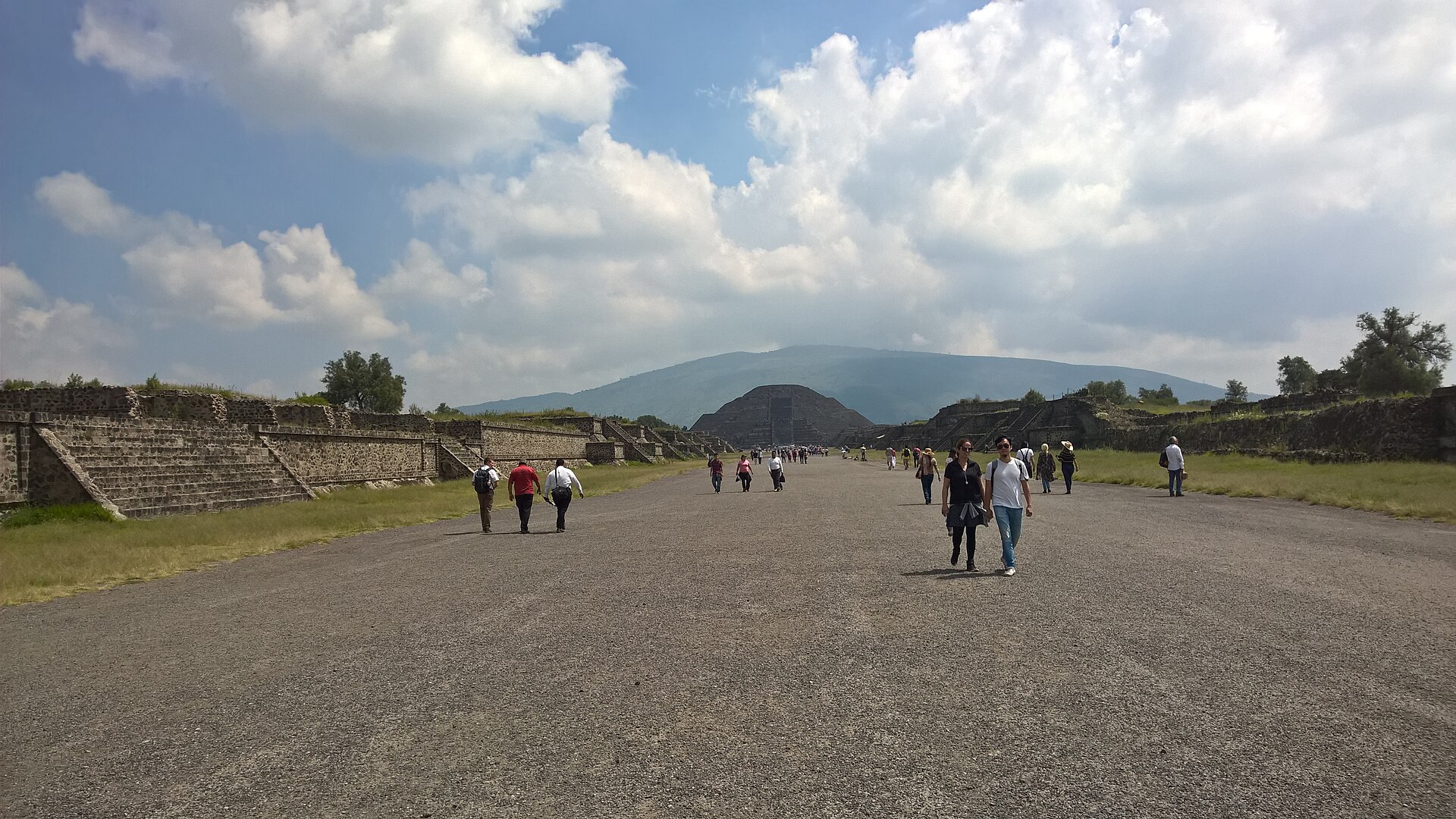
The Avenue of the Dead made a sustained architectural line between the Ciudadela and the Moon Plaza, with monuments, raised basamentos, cross routes and stepped spaces along it. INAH gives the orientation as roughly 15°25′ east of true north. The line is not only a visual device for looking at the Moon Pyramid: different courts and platforms mark sequences of approach, gathering and separation. The built corridor is often imagined as an uninterrupted flat road; in fact its height changes and repeated terraces make ceremonial movement as important as straightness. Southward work in the Tlajinga district extended the line by cutting underlying volcanic tuff, evidence that an ideal axis could require deliberate subtraction of ground. [6], [12], [20]
At the avenue's northern end, Cerro Gordo supplies a conspicuous backdrop above the Moon Pyramid. Alignment studies have proposed horizon and solar correspondences, including a recent Moon-plaza solstitial reading. These are worth considering as archaeological interpretations, not as a proof that all buildings were calibrated astronomical clocks. A measured rotation from north is a secure plan fact; assigning it to one exact ritual date requires a different chain of evidence. The mountain's presence can be spatially powerful without every terrace being an instrument. [6], [21]

Text alternative for the diagram
The Moon Pyramid is at the northern end of the avenue, the Sun Pyramid lies beside it, and the Ciudadela occupies the southern district. Cerro Gordo is the northern mountain backdrop. This is a relational diagram, not a measured map or proof of one astronomical design.
The grid was also unequal at different scales. Broad planned corridors and district alignments sit alongside individual apartments whose excavated rooms and walls could be irregular. Remote-sensing work in Tlajinga finds a more rectangular district frame than the neat older mapped outlines of certain compounds. The old mapping project remains indispensable for city-wide patterns, but its reconstructed rectangles should not be mistaken for a single exposed-floor survey of every contemporary wall. Even where many avenues and property lines align, there were differing construction campaigns; a complete city plan is a scholarly assembly of evidence across time. [3], [12], [20]
River diversion and the worked landscape
Two waterways make the city's planning less abstract. The San Juan River was deliberately reoriented through the ceremonial centre, and lidar research describes about three kilometres of its engineered course. The same study finds a longer altered reach of the San Lorenzo River with a different orientation. These lines join settlement, runoff and agricultural terrain rather than serving as painted lines beneath a pyramid diagram. The investigators' maps show how ancient changes can persist in later canals, streets and property divisions. Persistence is not identity: a modern road sharing the ancient orientation does not make every paving stone Classic-period fabric. [1], [12]
Survey beyond the visitor core brings the ancient city into view as a landscape, not just a UNESCO polygon. A 2015 lidar survey over 165 km² identified hundreds of mounds and structures, many terraces and quarry-like depressions, with thousands of potential features beyond Millon's older mapping footprint. The study's own ground-verification table varies by feature type; terraces in particular are difficult to date from relief alone. Its finding is not that more than six thousand certain Teotihuacan terraces were suddenly discovered, but that urbanism, land shaping and later reuse need inquiry outside the celebrated precinct. Modern mining and development have removed or obscured parts of that evidence. [12]

Text alternative for the diagram
The San Juan and San Lorenzo watercourses were engineered within an urban grid. The drawn curves do not reproduce GIS alignments, dates for each reach or precise lengths.
The researchers also found local pits, tunnels and altered paleosols under building precincts. Filling low points and lowering high ground could help buildings conform to a plan and make the visually continuous terraces possible. Reconstructions of how many cubic metres moved differ with geometric assumptions and construction stages; the environmental effect is nonetheless substantial. Neither the avenue nor the pyramids simply sat upon a passive valley floor. A great city managed surfaces, slopes and water at multiple scales, and its residential growth put further pressure on the same material landscape. [12], [15]
The Sun Pyramid: soil, surface and restoration
The Sun Pyramid is the city’s most visually dominant single mass. Its core contains accumulated earth, sediment, adobe and volcanic material beneath later surfaces; stone facing and plaster made its appearance different from the open rubble and reconstructed terraces of today. INAH describes colour on its early external finish, while geological study emphasizes the relationship between earth core and local volcanic material. A named ruler's tomb has not been established within it. Early dedicatory burials and offerings, including infants reported in some pyramid-body/corner contexts, are evidence of ritual making that must be described soberly, without treating all remains as identical or inferring a precise theological script. [14], [15], [16]
A chamber and tunnel below the pyramid are among its most difficult clues. INAH's later interpretation describes a natural cavity subsequently modified and enlarged; UNAM geologists argue the known cavity's form is anthropogenic. The difference affects claims that the mountain and cave were simply waiting to be monumentalised. Both readings recognise human work at the subsurface; neither proves an identified royal grave or explains every intention behind the pyramid's original position. An interpretation of sacred descent is reasonable to attribute, but the structure's precise dedication remains uncertain. [22], [23]

Text alternative for the diagram
The large Sun Pyramid contains an earth and adobe core, volcanic stone in some facings and former plastered and coloured surfaces. Its present silhouette includes restoration decisions. The cave underneath has a debated natural-versus-human origin.
Present shape is not the ancient shape read without interruption. During the 1905–10 presentation works, Leopoldo Batres arbitrarily added a fifth tier to the Sun Pyramid, a problem UNESCO records under authenticity. Archaeological exposure, protective repair and visitor stairs changed its surface further. The striking photograph of a bare stepped pyramid is consequently a photograph of surviving ancient material in an interpreted and rebuilt form. That does not make the monument fictitious; it requires attention to which stage a photograph documents. A historic finish of stucco and pigment would also have changed the play of light across slopes and platforms. [1], [14]
The Moon Pyramid: seven building episodes
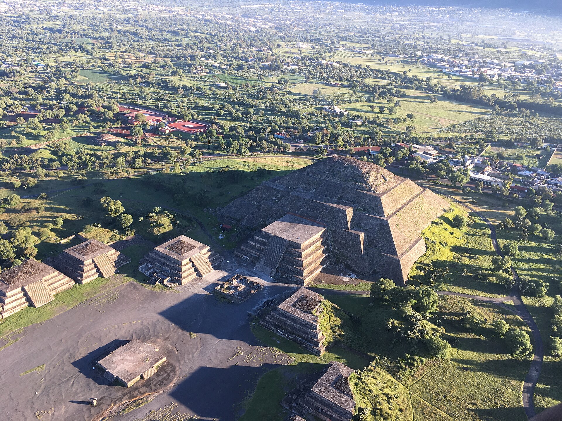
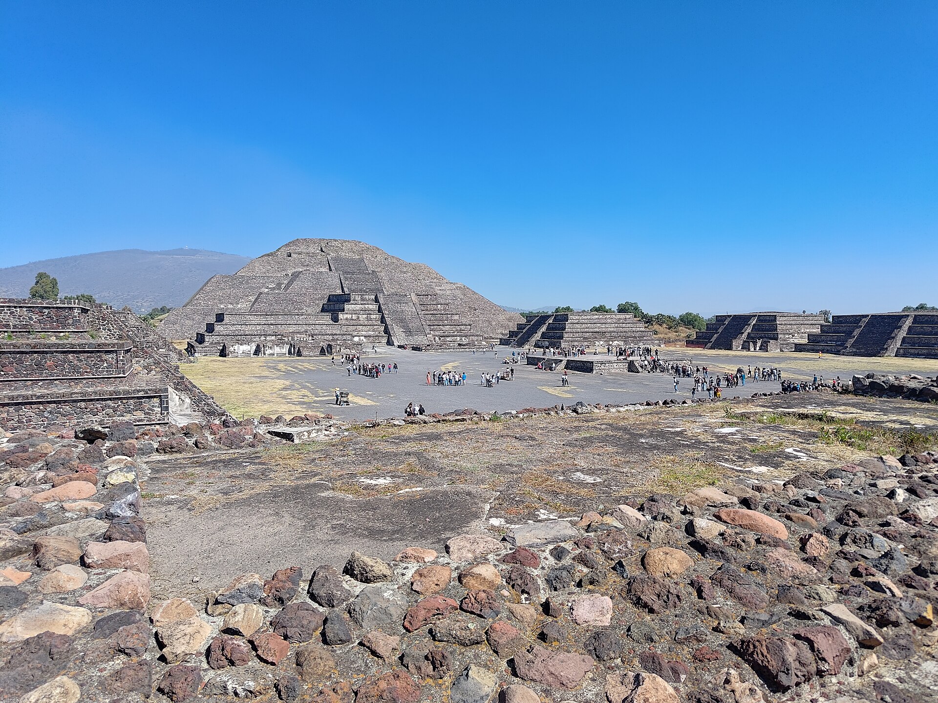
The Moon Pyramid anchors the northern plaza against Cerro Gordo, but its present large exterior is the result of a sequence. The ASU-led Moon Pyramid Project exposed seven superimposed building episodes. The earliest known footprint was not a scaled-down copy of the final form, and at least one subsequent expansion increased mass greatly. New facings and fills buried earlier edges and rooms. The plaza's smaller flanking pyramidal basamentos also changed across stages, so the apparent composition of one finished ensemble is a historical accumulation. [8]

Text alternative for the diagram
Excavations identified seven building stages one over another. The nested shapes are not measured profiles, construction durations, excavation stratigraphy or exact dates.
Excavated burials and offerings within construction phases included people, predators, birds and other animals. Their careful placement shows that enlargement involved ceremonial acts as well as structural engineering. The evidence does not identify an individual monarch behind each phase, and no exposed current terrace is a direct aerial view of all seven embedded plans. It is possible to discuss power and violence through the deposits without turning them into a neat roster of reigns. The corridor leading here created a visible northern focus; excavation made visible the invisible history inside that focus. [8]
The Moon Plaza is not just the pyramid's foreground. Raised platforms, smaller buildings, passages and the nearby Quetzalpapálotl group complicate the northern terminus. Courtyards and carved columns in the latter are often presented as “palace” architecture. The label can express their quality and proximity, but a suite of sculpted rooms alone does not reveal a named occupant or guarantee that every court served royal residence. Northern civic and residential settings must be read as different built environments whose relationships changed. [8], [24]
The Ciudadela and a temple made to be obscured
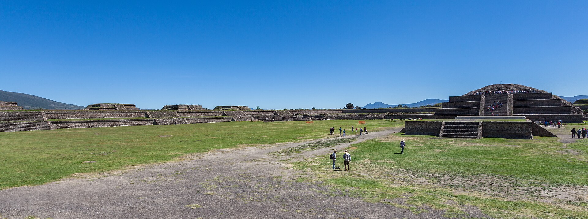
The southern Ciudadela is a broad, low-lying enclosure facing the Great Compound across the major avenue. Its stepped perimeter and multiple temple platforms bound an immense open court, with the Feathered Serpent Temple at the eastern end. Its name, “citadel,” is a later label that does not prove a garrison or a defensive purpose. INAH places the major plaza works within the Miccaotli period, broadly the second and early third centuries CE. The court's capacity for assembly is not the same as an ancient attendance list; its geometry nonetheless reveals that public gathering and controlled entry were conceived on a scale unlike a residence's private courtyard. [7]
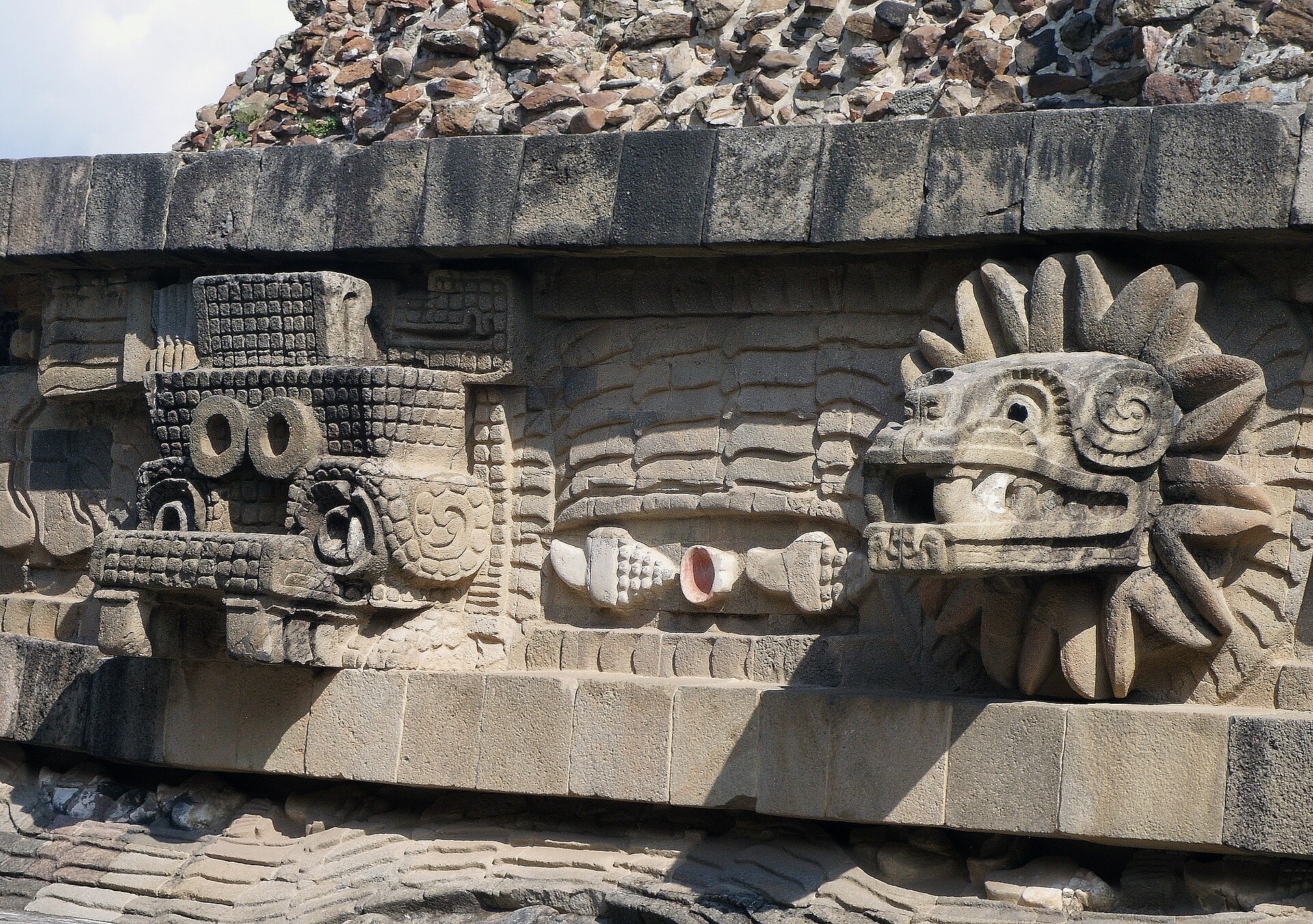
The Serpent Temple makes sculptural facing into architecture. Its inclined talud below a framed vertical tablero was enriched with repeatedly placed projecting heads, shell and conch signs, painted blue and red surfaces, and in some contexts reflective obsidian. To a present visitor the reliefs may look like bare carvings added to a stone staircase. Originally face, pigment, inset and repetition worked together across a stepped volume. The precise identities of both sets of projecting heads remain debated; “Quetzalcoatl” is a later Nahua deity name rather than a secure dedication inscription from the building age. Talud-tablero has smaller earlier antecedents elsewhere in central Mexico, though Teotihuacan made an especially monumental, angular iteration. [9], [16], [26], [31]

Text alternative for the diagram
The diagram separates an inclined talud from a framed tablero and depicts carving and colour. This is a profile shorthand, not a universal load-bearing recipe or a survey of the Serpent Temple.
Excavation found more than 136 human burials associated with the temple's dedication. A proposed total near 260 is reconstructed by symmetry and missing contexts, not 260 bodies each separately excavated. Obsidian weapons, mirror elements and in some burials marine ornaments make this an architectural programme of violence and far-reaching acquisition. Isotopic and dental research suggests that some victims spent earlier lives outside the Basin of Mexico, possibly including Maya regions, but that does not confirm every person's birthplace or military identity. A ceremonial badge with Pacific Spondylus material in the national museum gives a more tangible sense of distant substances assembled at this built place. [9], [27], [31]
The temple was subsequently altered in a way that changed how it could be seen. A broad added platform concealed much of the richly carved frontage. INAH dates the addition broadly to the fourth century, with nearby public accounts differing on a more exact construction year. The architectural fact is the covering: an earlier conspicuous programme became a partly hidden history inside a newly staged approach. Whether the act deliberately repudiated one governing faction, changed ritual preference or solved other practical requirements is harder to decide. The present excavation exposes something later viewers of the covered building could not have seen. [25]

Text alternative for the diagram
A later, broad added platform concealed much of the earlier carved Serpent Temple frontage. Covering is archaeologically secure; motive and exact year are uncertain. Modern excavation exposes faces that later ancient viewers no longer saw.
Below the Ciudadela, an intentionally excavated and sealed tunnel also carried offerings. A rain-induced opening in 2003 led INAH to excavate a passage and chambers with tens of thousands of catalogued materials: shell, obsidian, mirrors, plant and animal remains, mineral spheres and wood. Interpretations of a model underworld, celestial glitter or political investiture deserve attribution to excavators and analysis, not conversion into a documented room label. Claims about tunnel length even vary across popular institutional pages; its underground relationship to the temple is more secure than a single exact measurement repeated without context. No named royal occupant has emerged from these objects. [9], [22]
Talud-tablero, colour and what a façade carried
The inclined talud and framed upright tablero are often used as shorthand for “Teotihuacan architecture.” They were a adaptable façade grammar, not a single load-bearing recipe followed identically by every builder. The temple walls and stairways combine these profiles with masonry, fill, plaster and sometimes sculptural inserts. An ancient ceramic temple model in the Museo Nacional de Antropología preserves a small-scale image of a coloured stepped façade, but it is an art object, not a surveyed working drawing of the Serpent Temple. Earlier modest forms elsewhere in Puebla and Tlaxcala mean that the city should be credited for monumental elaboration, not declared the sole inventor of all sloped-panel building. [16], [26], [31]
Architecture also communicated beyond the Basin. By the third century, Teotihuacan-associated talud-tablero variants appeared at Tikal and later elsewhere in the Maya region. Similarity may indicate contact, adaptation, prestige and political relations; it cannot by itself identify a migrant mason or prove that every receiving city submitted to Teotihuacan. Archaeological evidence for Mexican obsidian, Maya-style works at Teotihuacan and monument exchange complicates one-directional “influence.” The city was both a source and a participant in a network of people and materials. The martial and mirror-centred reading of this network in recent scholarship is an argued interpretation with important unresolved details, not a settled map of colonial provinces. [31]
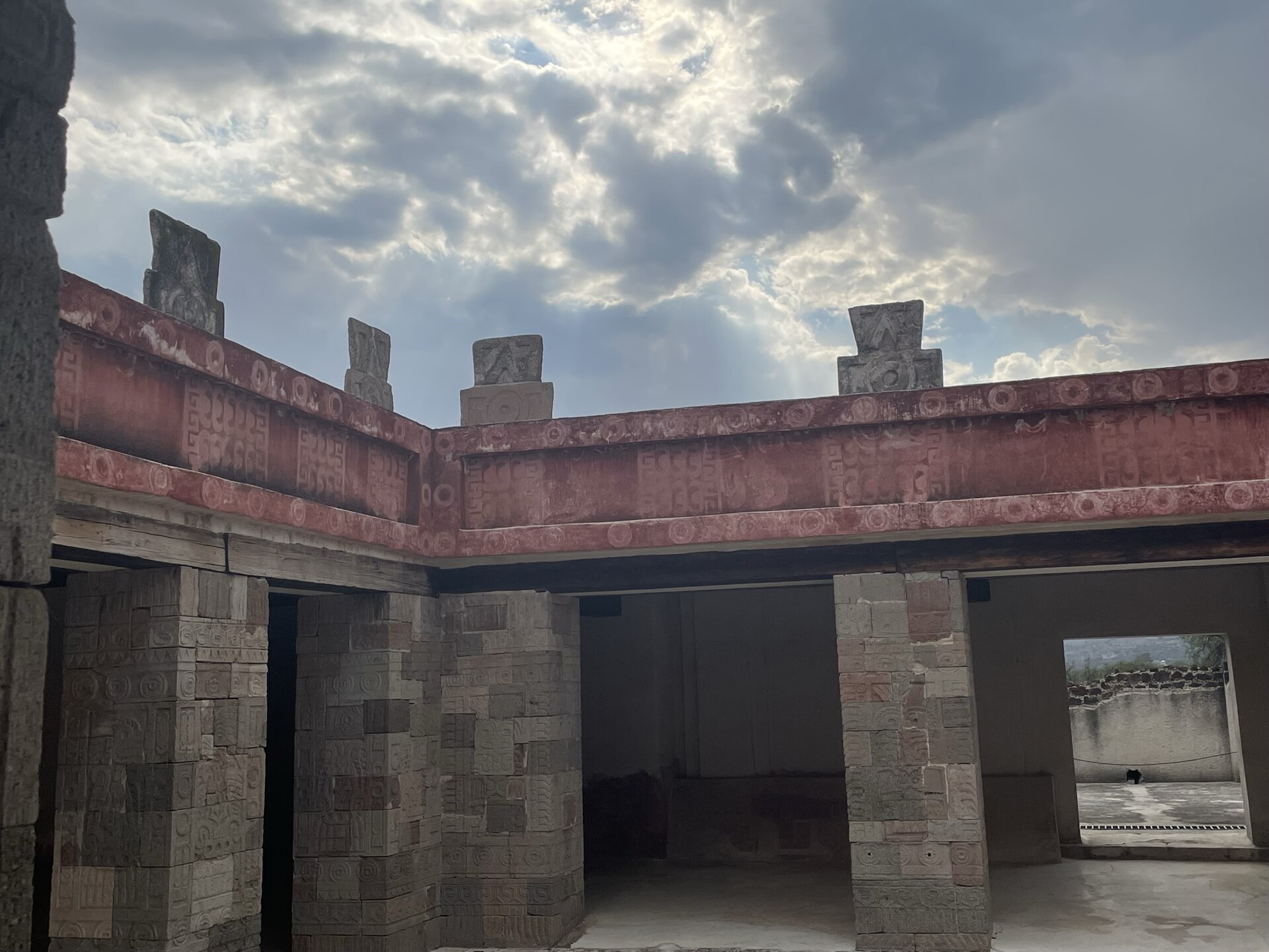
Behind an external profile was material economics. Volcanic scoria could be light enough for hauled facing and robust enough for masonry; compacted soil and adobe made large cores; lime supplied flat, protective and paintable surfaces. Timber members held roofs and posts in apartments and temple structures that are often now open to the sky. The materials study suggests local quarries for much volcanic stone but nonlocal lime and some timber supply, with substantial labour required to transport, transform and apply them. Its high-volume energy estimates depend on assumptions about plaster thickness, fuel, household population and time; the physical diversity matters more than a falsely exact total tonnage. [15], [19]
Apartments: the largest part of urban life
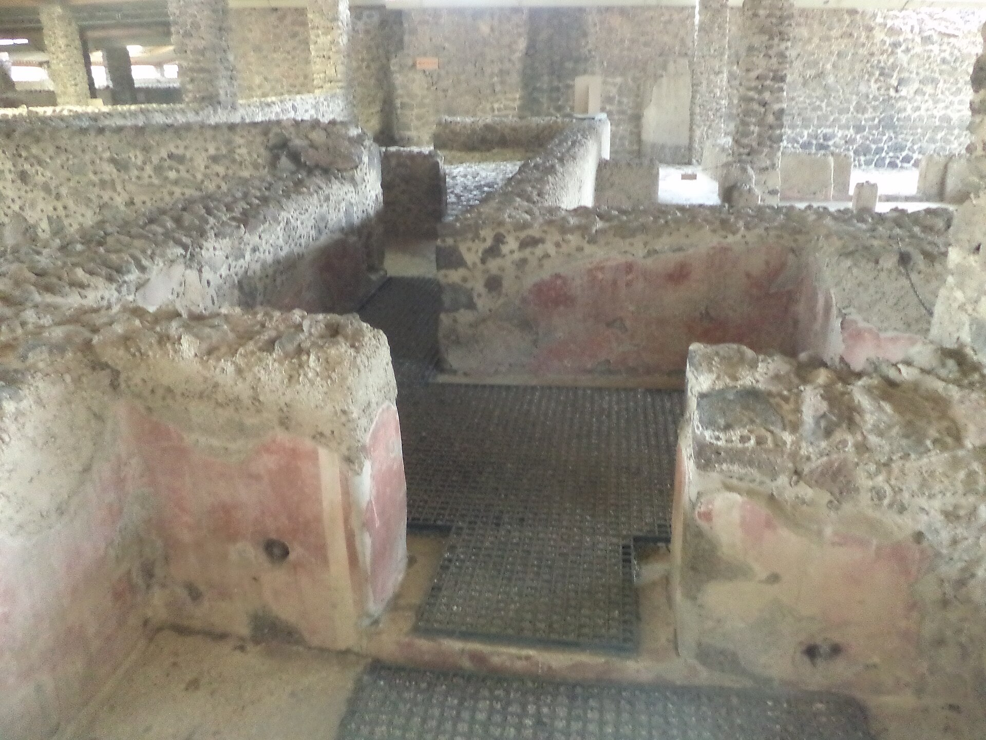
The astonishing change in the city's third-century architecture was the large-scale making and renewal of walled, multi-family apartment compounds. Public monumental works did not cease, but residences filled much of the urban grid. A compound was not a modern corridor apartment building: families occupied different room groups around open courts, with shared walls, controlled entrances, cooking and storage areas, work places and small ritual settings. Courtyard size, finish and room connectivity differed. The 2019 population study made these differences central by measuring excavated dwellings and then extrapolating to mapped residences, rather than assuming every footprint housed exactly the same number of people. [3], [10], [13]

Text alternative for the diagram
A representative enclosing wall frames rooms around a courtyard, with possible work, ritual and entry spaces. Actual Teotihuacan compounds vary and this is neither a survey of Tetitla nor a fixed plan for every family.
At Oztoyahualco, Manzanilla's excavations associate certain residents with lime-stucco craft and distinguish multiple household activity areas. Domestic ritual, funerary practice and occupation may overlap inside one enclosing wall. An open courtyard brings light, water and circulation into room groups; it may also stage a household altar or a communal ceremony. It is tempting to call all compounds egalitarian because so many people occupied masonry and plastered rooms, but room size, access to fine goods, mural quality and neighbourhood position vary. Conversely, a big footprint alone cannot serve as a guaranteed measure of wealth. Archaeology reveals patterned differences without reducing the city to a simple rich-versus-poor street map. [3], [13]
The Tlajinga district south of the ceremonial centre demonstrates why ordinary urban life demands its own excavation. Investigators found significant occupation before apartment compounds became the dominant house type there, cut through tuff to continue the avenue and excavated an obsidian-blade workshop at Compound 17:S3E1. Finer materials including shell and polychrome pottery reached some residents beyond the central elite precinct. Microstratigraphy and geophysics also show that a district's orderly alignment can hold compound plans whose internal walls are less schematic than the older city map. A monumental avenue was therefore a corridor through a labouring inhabited city, not a white strip ending where ceremony ended. [20]
Barrios, occupations and a multiethnic city
The city’s barrios were more than clusters of equivalent houses. Manzanilla distinguishes household compounds from barrio centres that could assemble ritual, administration, specialised craft, storage and public exchange. At Teopancazco, marine materials and tailoring/headdress production link local rooms to distant coasts; at La Ventilla, separate sectors suggest craft, cult, residential and administrative activity. Her account argues that patio spaces and networks gave some centres wider responsibilities than a family dwelling. Particular room functions are inferred from excavated residues and contexts, however; one should not label every surviving empty room as a proven office or military billet. [13]
Oaxacan urn burials, Gulf Coast-linked building and goods, western shaft forms and migration studies complicate the idea of a single homogeneous population. These do not produce a complete map of ethnic identities pasted over each house. Some residents maintained distinct practices; others participated in shared city-wide building and mural idioms. Multiethnicity makes urban architecture a negotiated setting: a familiar court or talud-tablero profile might bind an immigrant group to the city while a burial practice marked continuing ancestry. The coexistence of different practices is better evidence than a claim that every neighbourhood housed only one language group. [13], [17]
The city's government is even harder to draw. Public buildings, managed supplies and a strong axial plan imply organised authority. Repeated individual ruler portraits and a secure roster of royal names, by contrast, are absent. Manzanilla has proposed corporate sectors and co-rulership on material and iconographic grounds, while other readings argue for powerful central elites. Neither should become a definite statement that the city had no rulers or that the Serpent Temple was built by a known emperor. It is enough to say the built environment joined household, barrio and ceremonial power at different scales. [13], [18]
The painted apartment and the fragment in a museum
Murals belonged to architecture, not just movable art. Stuccoed apartment walls at Tetitla, Atetelco, Tepantitla, Techinantitla and other compounds carried colour and repeated images. Figures associated with water, plants, animals, procession, weapons and precious substances could structure a room's ritual and social life. A dark red background and mineral-colour application recur in some programmes, yet a colour should not be assigned one universal chemical ingredient without painting-specific analysis. At Tetitla, INAH describes an early geometric design on a sloping façade that may represent buildings or a year sign, a qualified reading of a particular painting rather than a literal plan. [28], [29], [30], [35], [36]
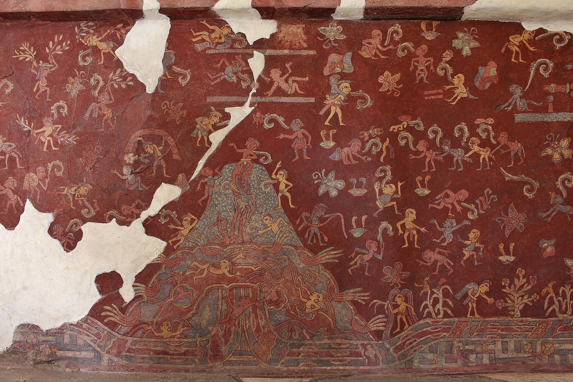
Tepantitla makes room-specific programmes especially clear. Large paintings there have later been called the “Tlalocan” and “red Tlálocs”; the names bring a post-Teotihuacan Nahua vocabulary to imagery that may have had other ancient identities. Its finish and size suggest a privileged compound, but the inhabitants are not named. Paintings can transform a portico into a rhythmic field of deities, water and human action; they can also imply ritual obligations and ranked access to rooms. The unpainted masonry of most excavated compounds is a poor guide to their former visual density. [29], [30]
The Metropolitan Museum's Techinantitla fragment, dated around 500–550 CE, is probably part of a repeated interior programme. Its abstract figure has been read as a deity or even an undeciphered logogram; the museum records both possibilities. Because the fragment was removed from its architectural room, it now helps us see a painting surface but not the exact sequence of approaches, occupants and furnishings around it. Museum collection records may be linked as related artworks; visible digital object photographs do not automatically licence their use as our own page illustrations. [28]
Fire, departure and later reoccupation
Teotihuacan did not remain a dense capital indefinitely. From the sixth century its governing institutions, population and building uses changed; fires and deliberate destruction occurred at some public and elite places. Older narratives, including UNESCO's broad record, can sound like a simultaneous c650 conflagration followed by a vacant ruin. Excavation supplies a more uneven picture. INAH reports selective burning at Xalla and other precincts, whereas La Ventilla sectors sampled in a radiocarbon study show no destructive fire. Burned building faces do not always mean the same civic catastrophe: some may be renewal or ritual closure, and different last-heating dates are emerging. [1], [4], [11], [34]
The La Ventilla researchers directly dated 78 human bones in burial contexts and modelled ceramic phases. Their results suggest that Late Xolalpan and Metepec pottery overlapped, and that a phase boundary cannot be equated with the day government fell. Some parts of La Ventilla were abandoned and later used by groups with Coyotlatelco ceramics, potentially by around 600 CE. LV2 and LV3 may have departed and been reoccupied at different times, but small late-context samples make that stagger tentative. At least in this neighbourhood, a buried older wall can become the floor or pit context of a later household. Decline was a changing architectural occupation, not merely a city's switch from populated to empty. [4]
A 2025 archaeomagnetic survey of six burned structures along the avenue derives many last-heating estimates in the fourth or fifth centuries, earlier than the traditional later “Great Fire.” Its authors note alternative model ages and reference-curve disagreements and allow deliberate burning as part of building renewal. Six surfaces cannot overturn the date of every fire in a city spanning many square kilometres. They do establish that a story with one city-wide burn date is too blunt to carry all the evidence. Climate variability, conflict, changed exchange and internal institutions are possible contributors to later political decline; no single environmental cause has been demonstrated by the architecture alone. [4], [11], [15], [34]
Excavation, preservation and the present visitor city
Modern archaeology gave the ruins much of their present public shape. Excavators opened superimposed buildings, cleared courts, stabilised walls and reconstructed selected roofs and platforms. Quetzalpapálotl's courtyard, for example, was reconstructed in the 1960s for teaching and visitor access; the palace overlies an earlier feathered-shell structure that can be visited separately. These choices make the dense later court and buried older building intelligible, but a caption must distinguish ancient in-situ stone, conjectural reinstatement and modern protective fabric. A reconstructed portico does not make the ancient paint and curtains magically survive. [24], [32]
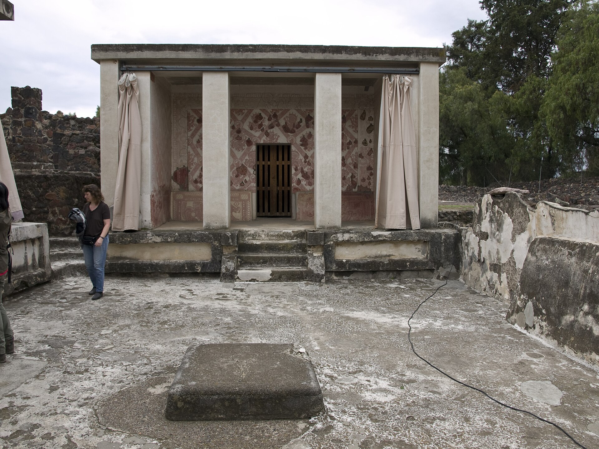
UNESCO records a particularly important caution at the Sun Pyramid: Batres's early-twentieth-century work added a fifth tier without sound evidence. Earlier cement and polymers elsewhere affected conservation. INAH and university projects continue studying murals, underground chambers, ground layers and neighbouring districts; the open visitor zone presents only a selected portion of the city's extent. This is not a reason to distrust every monument. It is a reason to ask what a photograph shows, how an exposed wall was dated and why some material is sheltered in a museum rather than left outside. [1], [5], [32], [33]
The Museo de Murales Teotihuacanos Beatriz de la Fuente and the Museo Nacional de Antropología preserve paintings and objects in contexts different from their original rooms. Technical work at Tetitla investigated pigment deterioration, including soot-black on Portico 25, and conservation analyses may reintegrate missing colour. A responsible reading recognises both the ancient skilled painted surface and the modern decisions that keep it legible. Ancient quarry scars, present agricultural terraces and modern roads around the archaeological core similarly coexist. A visitor can see one fragment of a much larger landscape, but it is scholarship—not a panoramic tourist photo—that reconnects the fragments. [12], [33], [36]
What Teotihuacan's architecture can and cannot tell us
The city's architecture is unusually articulate about scale. It shows the ability to redirect waterways, move earth, accumulate huge masses, repeat a sculptural façade, shelter multiple families in plastered courts and connect neighbourhood workers to distant stone, lime, marine shell and obsidian. It is less articulate about personal names and single motives. A serpent head cannot by itself settle a deity's name; a burnt floor cannot date the failure of an entire state; a formally aligned plaza cannot prove an exact sunrise festival. Repeated building phases are evidence of changing priorities rather than a key to a complete political chronicle. [8], [9], [12], [13], [15], [31], [34]
Teotihuacan's particular achievement lay in joining monumental and ordinary architecture. Seen from the Moon Plaza, the city can feel like a procession designed for a distant pyramid. Seen from an apartment courtyard, it is a sequence of kitchens, painted porticoes, work, burial and family ceremonies. Seen through lidar, river works and quarried stone continue beyond the fence and even beneath later land divisions. No one scale cancels the others. The most accurate image is not a frozen, uniformly bare city but an inhabited, painted, repeatedly altered terrain whose surviving surfaces allow strong conclusions in some places and careful uncertainty in others. [1], [3], [12], [13], [15], [20]
Related artworks and architecture
The Museo Nacional de Antropología's temple model gives a small-scale, coloured talud-tablero image; its Feathered Serpent burial badge preserves marine materials tied to ritual dedication. The Metropolitan Museum's Techinantitla mural fragment lets a viewer study a painted room surface while reminding us that the room itself has lost its original visual programme. Related architecture at Tikal and other Mesoamerican cities may be compared for adapted talud-tablero profiles, but a similar façade does not imply identical local builders or politics. [26], [27], [28], [31]
Books and video
George Cowgill's Ancient Teotihuacan offers an archaeological synthesis; Barba Pingarrón and Córdova Frunz's UNAM book concentrates on materials, energy and landscape; Manzanilla and Chapdelaine's Domestic Life in Prehispanic Capitals includes the excavated household/barrio study used here. The UNAM–INAH “La Antigua Ciudad de los Dioses” reconstruction project supplies an institutional video and modelled architectural sequences. Its moving images are interpretations based on evidence, not footage of the ancient city. [13], [15], [32], [37]
Watch: La Antigua Ciudad de los Dioses
The UNAM–INAH architectural reconstruction video is an evidence-based model, not ancient footage. The preview photograph is a separate licensed site view, not a film still.
La Antigua Ciudad de los Dioses
Hosted by UNAM FES Aragón with INAH collaboration.
Separate editorial photograph: MIKHEIL, source; CC BY-SA 4.0.Frequently Asked Questions
No. Early monumental stages, later pyramidal rebuilding, major apartment-compound growth and neighbourhood reuse extend across centuries. [4] [8] [10] [11]
No. Ancient peak extent, World Heritage property, buffer and open visitor zone are different boundaries and must not be equated. [1] [5] [12]
A 2019 housing-based model suggests about 100,000 at peak, but it is not an ancient census and depends on compound occupancy assumptions. [3]
No. Large earth and adobe volumes, volcanic stone, plaster and lost colour contribute; the present surface is also affected by restoration. [14] [15] [23]
Excavation has found seven superimposed construction episodes beneath the later visible pyramid. [8]
More than 136 dedication burials were excavated; a figure near 260 is a symmetry-based reconstruction, not a count of 260 individually found bodies. [9] [27]
No single dated burn event proves site-wide collapse. Neighbourhood dating and newer archaeomagnetic evidence point to uneven change, reuse and possible earlier fires. [4] [11] [34]
References
- UNESCO, Teotihuacan — English World Heritage property record
- UNESCO, Teotihuacan — French World Heritage property record
- Smith et al., “Apartment Compounds, Households, and Population,” Ancient Mesoamerica 2019
- Buckley et al., “Refining Ceramic Chronology and Epiclassic Reoccupation at La Ventilla,” Radiocarbon 2023
- INAH, Teotihuacan archaeological visitor zone
- INAH, Calzada de los Muertos
- INAH, Ciudadela
- Arizona State University, Moon Pyramid Project 1988–2004
- INAH, Feathered Serpent Temple
- INAH, Rituality and Urbanism of Teotihuacan
- INAH, Teotihuacan's final collapse reconsidered
- Nawa Sugiyama et al., lidar and geomorphology study, PLOS ONE 2021
- Linda Manzanilla, “Corporate Life in Apartment and Barrio Compounds,” in Domestic Life in Prehispanic Capitals 2009
- INAH, Sun Pyramid
- Barba Pingarrón and Córdova Frunz, Materiales y energía en la arquitectura de Teotihuacan, UNAM 2010
- UNAM–INAH, architectural characteristics of Teotihuacan
- UNAM Global, Manzanilla on Teotihuacan's multiethnic origins
- UNAM Institute of Anthropological Research, Manzanilla's corporate-life excavation chapter
- Tatsuya Murakami, labour mobilisation and apartment construction, Latin American Antiquity 2019
- Ancient Mesoamerica 2019 Tlajinga fieldwork issue, constituent research abstracts
- INAH, Teotihuacan alignment and cosmos; INAH, Moon Plaza solstice-orientation proposal
- INAH, tunnels and subterranean ritual
- UNAM, geological analysis of the Sun Pyramid cavity in Materiales y energía
- INAH, Quetzalpapálotl complex
- INAH, Plataforma Adosada
- Museo Nacional de Antropología, ancient temple model
- Museo Nacional de Antropología, burial ceremonial badge
- The Metropolitan Museum of Art, Techinantitla mural fragment
- INAH, “The Walls That Speak,” mural interpretation
- INAH, Tepantitla residential complex
- Barnes, “The Maya Ajawtaak and Teotihuacan Hegemony,” Cambridge Archaeological Journal 2025
- UNAM FES Aragón–INAH, “La Antigua Ciudad de los Dioses,” architectural reconstruction and video
- INAH, Tetitla mural conservation report abstract; INAH, Tetitla Portico 25 technical analysis abstract
- García Ruiz et al., “Fire Along the Street of the Dead,” Quaternary 2025
- INAH, Tetitla early architectural-design mural
- Museo Nacional de Antropología, Teotihuacan mural research and museum locations
- Cambridge University Press, George Cowgill, Ancient Teotihuacan, publisher record
Explore RELATED Architecture
These routes offer architectural comparisons, not a claim that Teotihuacan influenced every listed tradition.