by Tom Gurney
Tom Gurney BSc (Hons) is an art history expert with over 20 years experience
Email: tomgurney1@gmail.com / Phone: +44 7429 011000
A Sacred City Beside the Nile
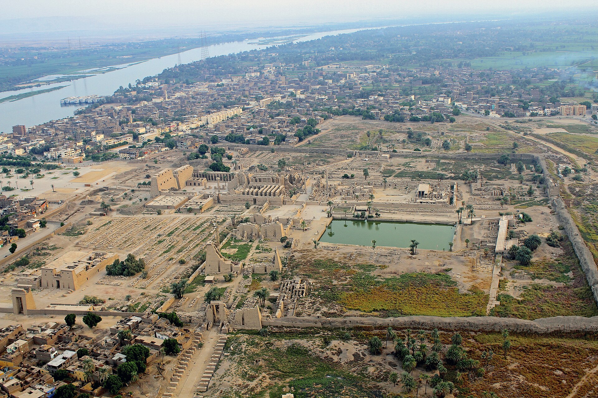
Karnak is not one ancient building completed to a single plan. On the east bank of the Nile at Thebes, now Luxor, the great sanctuary of Amun-Ra grew beside temples of Mut and Montu, shrines of Khonsu, Ptah and Opet, courts, lakes, quays and processional roads. Pharaohs, priests and other patrons repeatedly changed the boundaries and entrances over more than two millennia. A visitor entering between the colossal western towers can still follow an eastward line through the Great Hypostyle Hall towards Amun's inner sanctuary; another ancient axis turned south towards Mut and Luxor Temple. Their crossings, side buildings and reused stones are the point of Karnak. They show a sacred city adapting to changing riverbanks, rituals and political power rather than a timeless diagram of “the Egyptian temple.” [1][3][10][20][21][42][45]
The name Ipet-sut, often translated as the “Most Select of Places,” belongs especially to Amun's sanctuary. The whole Karnak complex extends beyond it. Its famous hall contains 134 papyrus-shaped columns, but that hall is only one stage in a much wider architectural story. Early mudbrick and limestone structures partly disappeared beneath later foundations or medieval quarrying. Hatshepsut's and Senusret I's chapels now seen in the Open Air Museum were reconstructed from blocks ancient builders had buried in other monuments. The late outer pylon was never finished. A central shrine was replaced during the Macedonian period, while nearby Opet received major Ptolemaic and Roman carving. The present view therefore holds original, adapted, removed and re-erected fabric in close proximity. [1][12][13][14][15][26][34][37][45]
At a Glance
- LocationKarnak, on the east bank at ancient Thebes, within modern Luxor, Upper Egypt. [1][2]
- ScopeA complex of Amun-Ra, Mut and Montu precincts and smaller temples; Ipet-sut particularly names Amun's sacred centre. [1][20][42]
- Earliest stagesEleventh-Dynasty sanctuary/settlement evidence and a c.2050 BCE excavated garden precede the larger Senusret I stone plan; exact first founding and garden use are uncertain. [20][21][22][34]
- Long developmentMajor Middle Kingdom, New Kingdom, Kushite, Saite, Late, Macedonian, Ptolemaic and Roman construction/reuse, with later domestic and quarrying phases. [1][10][19][26][36][37][38][39][40][41][42]
- Main routesAmun's west–east axis, a southward branch towards Mut and Luxor, a northern approach through Ptah/Montu and connections with Nile quays. Their courses and access arrangements changed. [1][3][11][35][38][45]
- Great Hypostyle Hall134 columns—12 tall open-papyrus examples along its nave and 122 shorter papyrus-bud examples—between Pylons II and III; most original roofing slabs have fallen. [1][2][5][10][43]
- Hall datesPossible earlier beginnings are discussed; the principal surviving hall and main decoration belong to Seti I and Ramesses II, with much later recutting. [1][5][6][7][43]
- ObelisksHatshepsut erected a pair in the Wadjet Hall; the northern granite obelisk remains upright, nearly 30 metres high. [1][25]
- AkhmenuThutmose III's eastern Festival Hall with tent-pole columns, starry ceiling, ancestor and botanical images, and rooms of varied, sometimes uncertain use. [15][28]
- Sacred waterAmun's lake south of the inner courts and Mut's horseshoe Isheru are distinct basins with different relationships to their temples. [16][42]
- UNESCO statusKarnak forms part of the serial World Heritage property Ancient Thebes with its Necropolis, inscribed in 1979; there is no separate Karnak-only listing. [2][41]
Contents
- A sanctuary built on a changing river island
- Two axes, ten pylons and many boundaries
- The First Court: resting the gods before departure
- The Great Hypostyle Hall: a stone roof of papyrus
- Carved faces, repeated names and changing visitors
- Wadjet Hall, obelisks and the changing stone centre
- The Akhmenu: royal memory beneath a starry ceiling
- Barks on roads, barks on the Nile
- The south axis was not one unbroken shrine row
- Mut and the horseshoe Isheru
- Ptah and Montu: northern sanctuary and working treasury
- Late Karnak remained inventive
- What stone, water and excavation have left
A sanctuary built on a changing river island
The flat modern approach hides an unstable ancient landscape. Geomorphological work at Karnak has recovered river sands, older channels and a raised terrace beneath and around the sanctuary. A 2025 study using sixty-one new cores, broader coring and luminescence dates favours a fluvial island or terrace bounded at different times by channels on east and west. The deposition date of some terrace material—about 2520 BCE with a large uncertainty—is a date for land formation, not an inscription marking when a temple was founded. Earlier accounts saw a Nile-bank gezirah with no island, or placed the river several hundred metres away. The new cores substantially alter those older reconstructions, though exact banks and stages still need local testing. The ground was neither an unchanging desert platform nor proof of a Predynastic masonry sanctuary. [20][21][23]
The early river setting matters architecturally. A mound above floodwater could carry a shrine, while silting and channel movement created land for forecourts, roads and enclosures. Deep trenches in the northern Ptah area have exposed domestic levels and early riverbank conditions as well as sanctuary evidence. A recently excavated garden within the first Amun level, dated around 2050 BCE, offers a rare glimpse of planted ground among the earliest installations. Whether it was a sacred preparation garden or secular space is unresolved. Later personnel and tomb pictures attest temple gardening, yet neither a painted basin nor an ancient tree planter is a measured plan of that first garden. The familiar idea that Karnak was deliberately chosen to embody creation's “primeval mound” is a theological interpretation; geology can show a raised landform, not its builders' private intention. [10][20][21][22]
The planted landscape did not vanish when stone courts enlarged. A later Theban tomb picture shows a garden basin and rows of trees associated with Amun's domain; surviving planters along processional approaches and a Nectanebo-period planting inscription offer different kinds of evidence for managed outdoor space. Sennefer and Nakht appear in temple-garden personnel records, reminders that shade, water, offerings and maintenance required workers as well as royal patrons. A tomb painting is selective image-making, while a name documents a person, not the full daily schedule of every garden bed. Taken together with the excavated early plot, they show that the hard sandstone route was embedded in a cared-for, changing green environment. [10][22]

Text alternative for the diagram
In the later expanded complex a western approach from the shifting Nile bank leads past Pylon I toward Amun’s hall, sanctuary and eastern Akhmenu. A northern route passes Ptah toward Montu, work areas and a quay; southwest lie Khonsu and Opet, while a southward pylon avenue leads to Mut and, farther away, Luxor Temple. Amun’s Sacred Lake is south of his inner courts. Mut’s horseshoe Isheru encircles her precinct and is a different basin. The roof section places twelve taller open-papyrus columns along the Hall’s centre under raised gridded windows; the remaining 122 shorter columns occupied lower side aisles under stone roofing, most now lost. Neither depicted distance nor the drawn number of support lines is a survey tally.
An Eleventh-Dynasty named colonette and early foundations show construction before Senusret I. That king enlarged the older Amun platform with a limestone foundation raft roughly four times the footprint of the predecessor, an Osiride facade, court and three inner rooms. Four granite thresholds still survive where the court met those chambers. They are far more reliable guides to the circulation of that Middle Kingdom stone plan than the restored limestone mass, much of which was burned for lime in medieval times. A calcite pedestal associated with the former gilded-wood shrine was reset in a position the excavation team now says is incorrect on the present central axis. It would be misleading to stand beside it and imagine every cult object remains in precisely its ancient setting. Some specialists infer a winter-solstice orientation for the early court, while newer river-focused work questions whether the very first sanctuary even faced west–east as later Karnak did. Early alignment and ideological purpose are not settled by the surviving late corridor. [20][21][34][35]
Two axes, ten pylons and many boundaries
Karnak's numbered pylons are monumental paired-tower gateways, their sloping faces edged by torus mouldings and curved cornices. Recesses could anchor towering timber flagstaffs and banners, now vanished. Some carved scenes show a ruler overpowering foreign enemies, projecting royal ability to maintain order; others show him giving offerings. The western facade of Pylon II is a clear warning against the rule that a pylon was always a smiting billboard. Such gateways marked thresholds between exterior, court and more controlled areas, but their relation to the sacred perimeter shifted each time an enclosure wall or processional route was extended. [3][4][8][10]
Ten monumental pylons belonged to Karnak's expanded form, yet they do not form one straight east–west row. Several face the main Amun approach, while Pylons VII to X articulate a southward sequence. Mudbrick walls and subsidiary doors also regulated movement around them. Thutmose III's inner enclosure, in places originally more than nine metres high, had few openings and sparse early carving; Ramesses II later filled its faces with offering scenes. A visitor looking at a solid wall with Ramesside relief may thus be looking at an earlier physical boundary whose visual language was transformed generations later. [3][10][28][45]
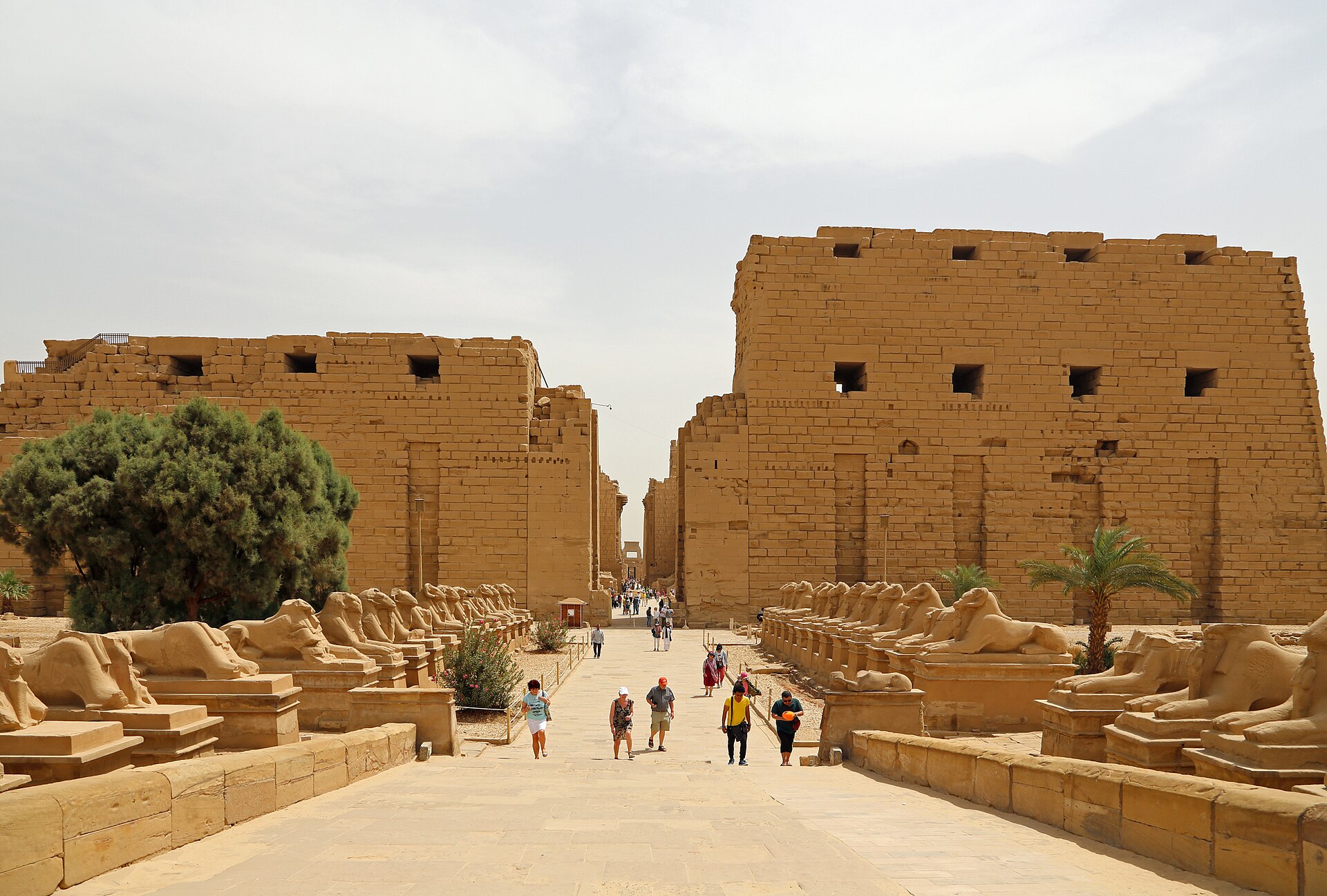
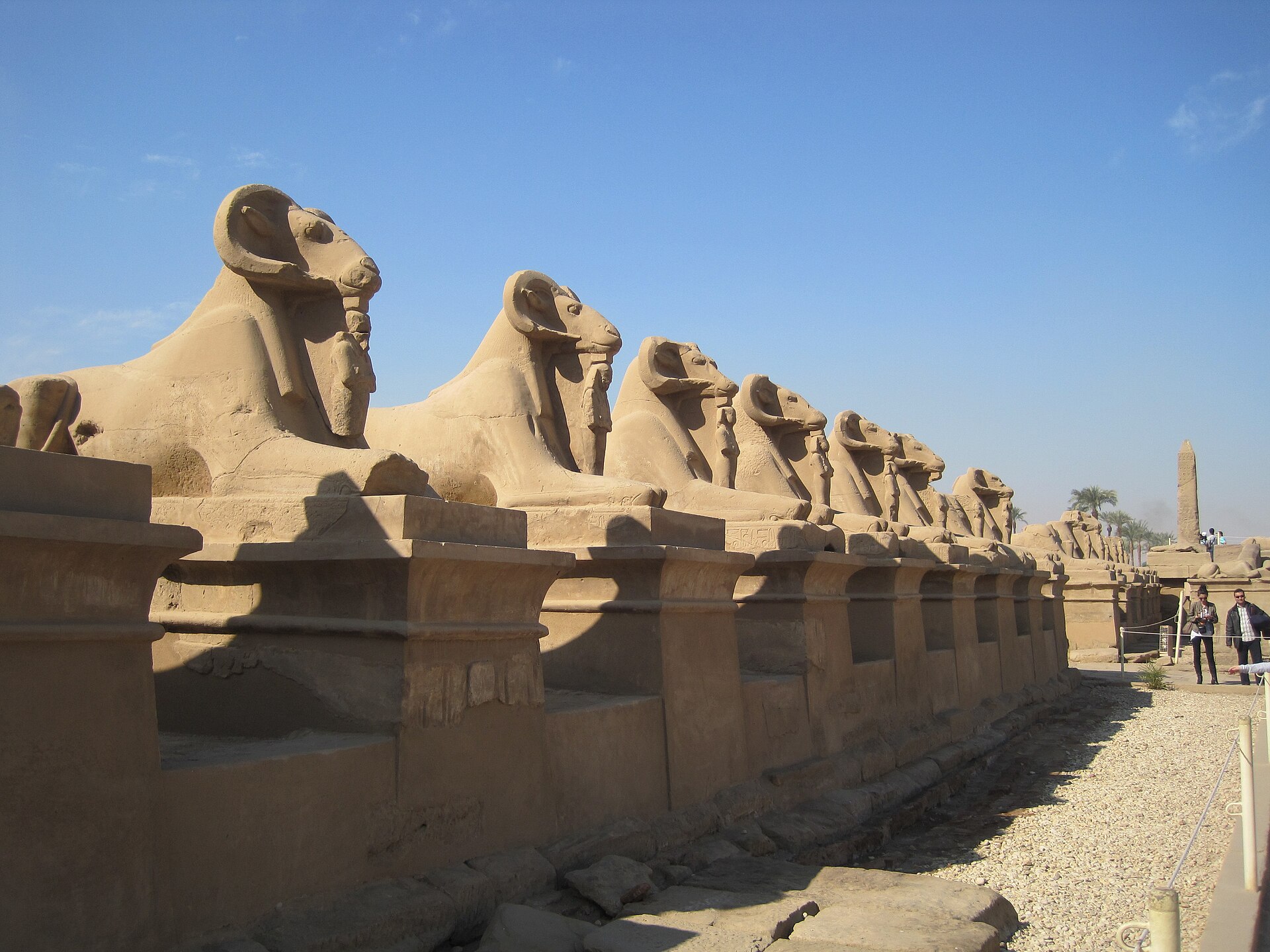
Today's first pylon at the west is a paradoxical “first” only because it is the outermost on the modern approach. Its towers were raised in the late age of Nectanebo I and left unequal and incomplete: the south rose much higher than the north, and mudbrick construction ramps remain behind the facade. The court and western gateway it surrounded had earlier Shoshenq-period stages; attribution of that older central gate specifically to Shoshenq I is probable rather than proved by every stone. Earlier rams and sphinxes marked approach lines from a quay, and their positions were reworked as royal kiosks and new forecourts occupied the river-facing edge. Nectanebo's enormous wall also drew Ptah, Khonsu and Opet into Amun's later precinct outline. It was an ambitious spatial expansion, not a finished set of every planned entrance. [12][43][45]
At different dates, the Nile's accessible bank lay closer or farther from the western approach. Shoshenq-period quay and revetment works, a Taharqa ramp and late walls responded to water and procession, not just visual symmetry. The sandstone sphinx bases, ram heads, painted traces and modern restaging along the approach should be read with those changing river margins in mind. Nor does the broad late mudbrick enclosure mean every earlier house under its footprint was always sacred ground. Excavations have found domestic remains below the southern pylons and northern temples, evidence that expansion absorbed land previously lived or worked on. [20][21][35][38][45]
The First Court: resting the gods before departure
Crossing Pylon I leads into a great court filled by monuments of different sizes and reigns. A small three-part resting chapel of Sety II stood among the routes; a much fuller temple-like station of Ramesses III rose against the south side; and Taharqa's large papyrus-column kiosk added a Kushite centrepiece near the entrance to Pylon II. Each served a world of portable divine images and royal self-presentation, but they were not three identical shelters built at once. Their coexistence makes the court a map of changing ritual infrastructure. [10][27][43]
Ramesses III's first-court bark temple is oriented north–south rather than simply extending Amun's eastward inner rooms. One passes its own little pylon and peristyle of Osiride pillars, rises by a ramp to a portico and smaller columned space, then reaches three inner shrines for Amun, Mut and Khonsu's ceremonial barks. The outer campaign imagery suggests a phase after the king's Libyan-war representations; it should not be turned into a precise groundbreaking date. This building is separate from Ramesses III's later Khonsu Temple farther southwest. The court itself was not just empty waiting ground for the famous hall: it accommodated platforms, sheltered barks, colonnades and sightlines toward both processional directions. [17][27]
Pylon II forms the east edge of the court and the hall's west entrance. Its origin remains disputed in detail, but the facade was complete by Ramesses I and the gateway was repeatedly decorated. A later collapse damaged its passage roof and reliefs. Ptolemy VI recut the wall scenes, often preserving Ramesside subjects and old cartouches while replacing the original relief surface with Hellenistic carving. Careful recording has recovered names of Ramesses I underneath later Ramesses II cartouches. The visitor's present “Ramesses” scene can therefore be a Ptolemaic recreation of an earlier image containing still earlier royal traces. Repair here was both conservation of iconographic memory and loss of physical carving. [4][7][43]
The Great Hypostyle Hall: a stone roof of papyrus
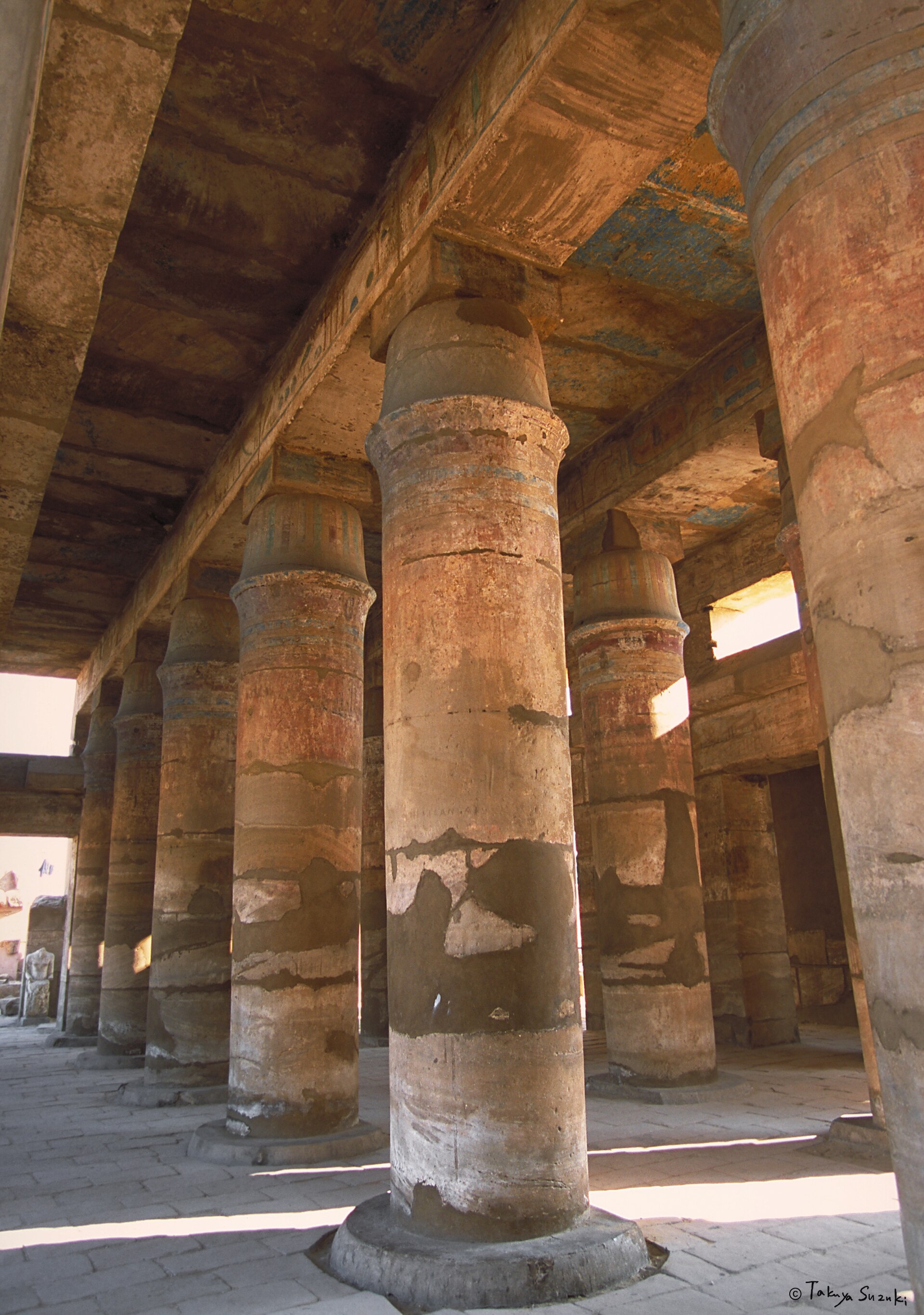
Immediately beyond Pylon II, twelve huge sandstone columns open their papyrus capitals along the central aisle. On either side stand 122 shorter columns with closed-bud capitals, giving the celebrated total of 134. The high central rank carried a raised nave; the smaller ranks carried lower roofs. Giant stone architraves sat across the abaci atop the capitals, and masonry window grilles filled the height difference between nave and flanks. Much of the roof slab system has fallen, leaving sunlight to flood a space whose ancient side aisles were considerably dimmer. Some stone beams and grilles still survive overhead, while others lie as fallen fragments. The original hall must be imagined from the load-bearing remnants, not from the present bright open sky alone. [1][2][5][10][43]
The centre columns rise roughly twenty to twenty-one metres. Their broad open-bloom capitals measure about 5.4 metres across in the university project; UNESCO's often repeated 3.4-metre figure refers to the shafts, not the capital tops. Two institutional tallies give the hall footprint as around 102 by 53 or 103 by 52 metres, both describing the same enormous room through slightly different measures. The shorter columns expose a more serious published conflict: the Egyptian ministry gives about fifteen metres, while the University of Memphis and another university architectural essay give about twelve. It is safest to distinguish them by their shorter rank and capital form, and to attribute a height if one is needed, instead of asserting a falsely exact single measurement. [1][2][5][10][43]
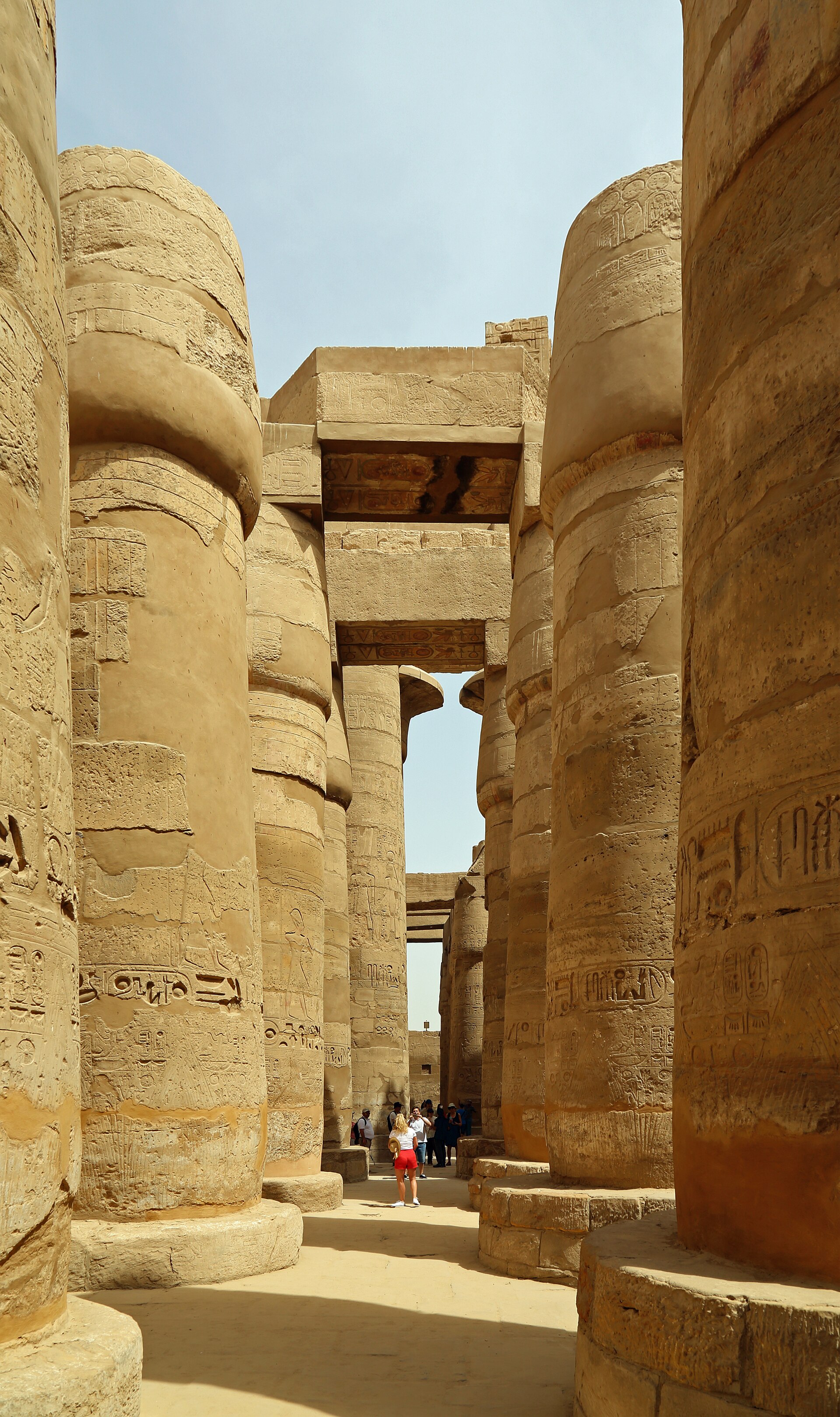
The roof and its light belong to the hall's religious meaning. A narrow band of stone-grid windows illuminated the great central way, while roof slabs limited light elsewhere; some slabs may have had small openings. Column shafts, capitals, soffits below the beams and window piers carried carved and painted programmes. Preserved colour in sheltered soffits and passages rebukes the picture of an entirely bare golden sandstone interior. Monumental scale came from a carefully unequal section—tall nave, lower flank, filtered light and progressively controlled access—not merely from multiplying big columns. The hall was both a formidable stone structure and an atmosphere for the appearance of sacred barks. [5][6][10][43]
Its building date cannot be compressed into a single founder. The Egyptian ministry speaks of possible beginnings under Amenhotep III, and some scholarship has imagined an Horemheb colonnaded predecessor. The most secure major surviving hall stages are Seti I's construction and decoration and Ramesses II's continuation, much inserted between older Pylons II and III. That difference matters: evidence for an earlier use of the space is not evidence that all 134 standing columns were designed and carved under the earlier ruler. The university digital reconstruction excludes a hypothetical Horemheb peristyle because the physical case has not been settled. [1][5][6]
Stone supply, foundation and lifting were immense practical questions. Sandstone was quarried at Gebel el-Silsila, granite at Aswan; other features used Hatnub calcite and quartzite from Gebel Ahmar, while timber, paint and gilded fittings supplied movable and finishing elements. The hall's foundations rested over a substantial sand bed. Builders could set column bases and lower courses, fill around them with earth, then haul new courses up mudbrick ramps as the building rose. Afterward the banks were removed and rough faces dressed. The distribution of full-height Seti and Ramesses reliefs indicates that sculptors worked from scaffolds after much construction fill came out rather than decorating all lower levels as a single mound descended. A few high clerestory texts could have been cut while the banks still granted access. Surviving ramps and tool marks demonstrate techniques, while a complete day-by-day ancient contractor plan is absent. [9][10][43]
Carved faces, repeated names and changing visitors
The hall's carved history is more layered than the conventional statement that Seti I built it and Ramesses II finished it. Seti's northern ritual scenes used raised relief; southern scenes of Ramesses were often sunk or were converted from an earlier raised state. Ramesses II recarved some of his father's columns, enlarged cartouches and modified his own early royal names. Ramesses IV later added scenes, titles and dense cartouche bands to spaces originally left relatively plain; Ramesses VI sometimes overwrote him; High Priest Herihor added inscriptions near bases. Other changes extended into Ptolemaic repairs. A shaft today may carry several campaigns of cutting, plaster infill and repainting, not a single design faithfully repeated 134 times. In some south-west columns, death or unfinished work preserved a sparer initial programme beside heavily inscribed neighbours. [6][7][43]
This visual density was arranged around bodies moving on Karnak's two axes. The earliest mid-shaft offering scenes often face an approaching viewer; some columns at the crossing have two scenes to serve both directions. The king in the image commonly turns inward towards the core while gods face outward. Inner ritual images present offerings, crowns, incense and contact with Amun, Mut, Khonsu and other deities. Outer walls carry war and victory scenes, linking royal conquest to protection of the gods' realm. The contrast should not make the hall an army archive on the outside and a purely abstract prayer room inside. Its architrave dedication calls it a rest and appearance place for Amun and the divine company, anchoring the grand architecture in actual or represented ceremonial circulation. [6][7][8][43]
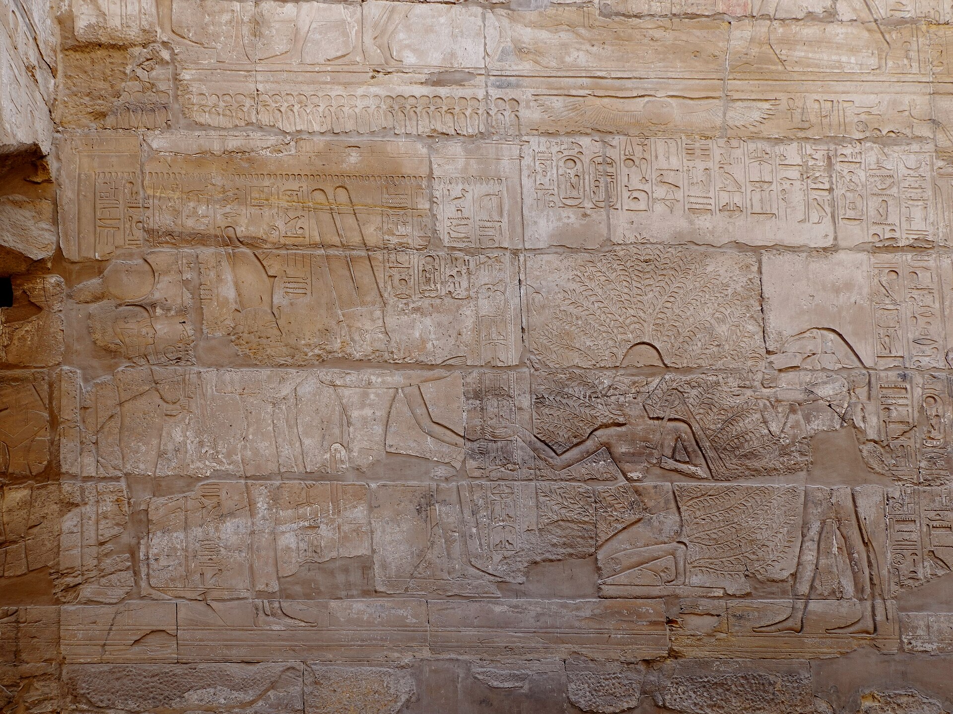
Who could see that circulation varied. Lapwing-like rekhyt birds at column bases are shown worshipping royal cartouches and can signify “all the people adore the king.” The Memphis research team suggests the motif may signal that ordinary people entered the hall on certain festival occasions. It cannot by itself establish unrestricted entry every day. Most visitors rarely reached the hall and did not enter the innermost sanctuary. Yet devotion was not confined to a priestly invisible interior: exterior walls, courts and gateways accumulated privately cut god-images and grooves where worshippers scraped stone associated with holy power. Fixing holes around some divine images indicate vanished protective screens; these may have been opened on selected rites. Karnak is easier to understand as a sequence of differently accessible spaces, sometimes opened and sometimes covered, than as a hard binary between a public plaza and a sealed temple. [43]
Wadjet Hall, obelisks and the changing stone centre
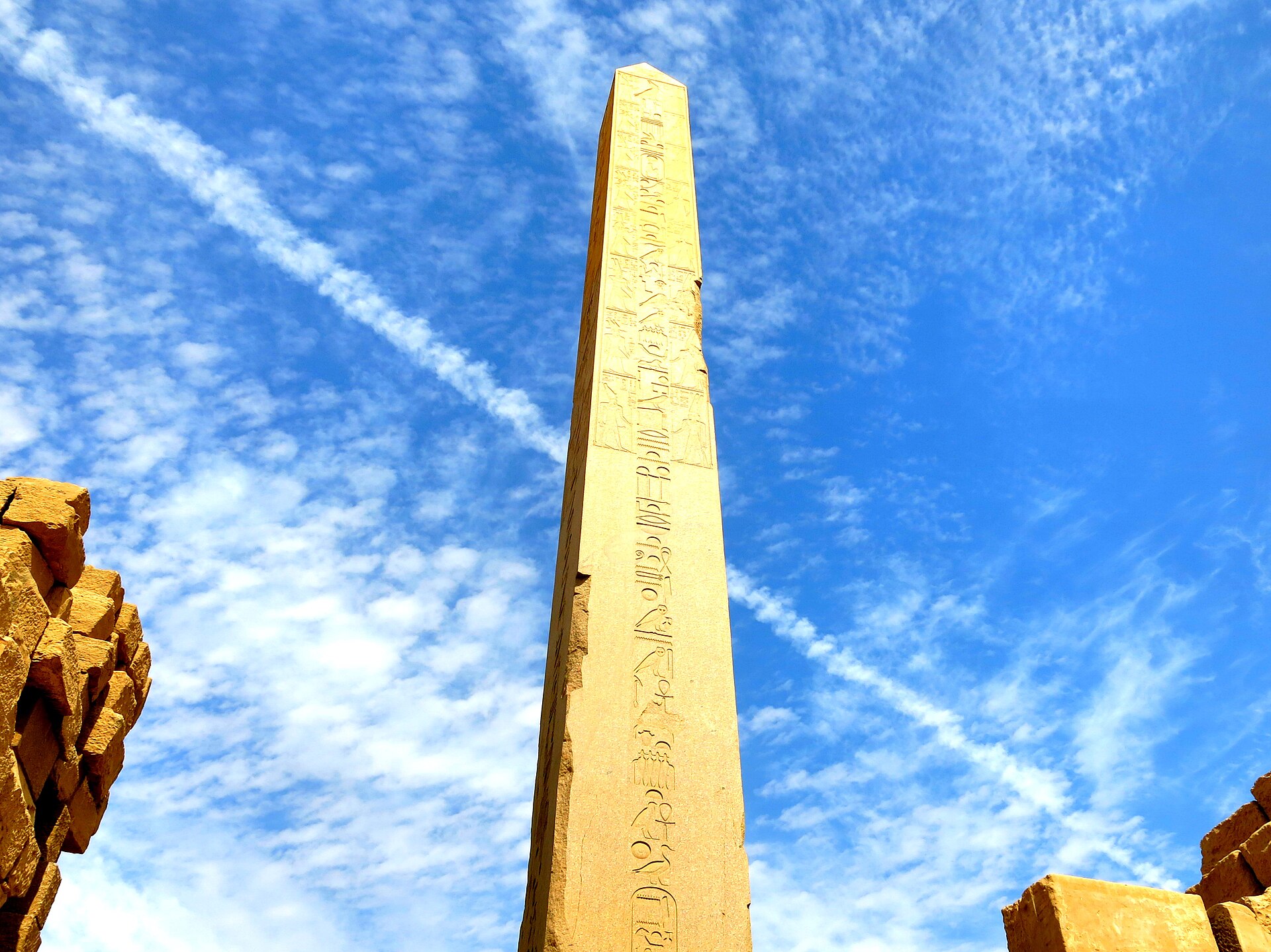
East of the great hall, Pylon III leads towards the older core. A series of Eighteenth-Dynasty builders changed the courts and gateway sequence. Thutmose I's fifth pylon and adjoining open space had a sandstone heart with limestone and red-granite facing. Thutmose III later narrowed circulation through it with partition walls, turning a broad court into a more concentrated approach. Hatshepsut had already radically altered the neighbouring Wadjet Hall with high obelisks, a redesigned interior and ceremonial bark sanctuary. The present north granite obelisk rises nearly thirty metres; its companion's fallen upper segment lies near the lake. These stones originally stood as a pair in an active building programme, not as one picturesque isolated needle framed by the open modern sky. [1][10][25]
The obelisks also demand a distinction between sculpture and structure. Red granite had to be cut, transported, stood up and integrated into existing walls and timber/stone ceiling relations. Hatshepsut's northern shaft remained visible after later buildings enclosed or altered parts of its setting. Text and later carved additions can survive on a physically earlier monolith. Its present singular appearance is therefore the result of standing, falling and rebuilding around the pair over centuries. [1][10][25]
The small White Chapel of Senusret I and the red-quartzite chapel of Hatshepsut are now legible in Karnak's Open Air Museum, but neither is a transparent in-situ room on the route it once served. White Chapel blocks went into Amenhotep III's Pylon III and were recovered and assembled in the twentieth century; its original position is unknown. Hatshepsut's Red Chapel contained two chambers for a sacred bark and processional reliefs but was taken apart under Thutmose III and later reassembled from reused stone. Its reliefs are exceptionally valuable for festival routes; its modern location is not evidence that every festival bark stopped at that museum spot in antiquity. The ancient builders' dismantling and modern teams' reconstruction are different kinds of reuse, visible together. [11][13][14]
Farther inward, the Amun bark shrine itself did not freeze in Hatshepsut's age. Thutmose III constructed and enclosed a central stage, and Philip Arrhidaeus later replaced its resting shrine with a granite building in a related position within the “Palace of Ma'at” setting. The Macedonian-period monument still carried an Egyptian sacred function. Legrain rebuilt parts of it, while modern conservators fixed surviving polychromy in the 1990s. A current polished or reassembled surface may preserve ancient colour yet stand in a modern stabilised configuration. This is neither evidence of worship ending with the New Kingdom nor licence to call every visible face untouched. [26][28]
The Akhmenu: royal memory beneath a starry ceiling
At Amun's eastern end, Thutmose III's Akhmenu or Festival Hall extends the temple in another language of columns. Its famous hall uses forms likened to tent poles, with a painted blue ceiling of stars. A different visual programme includes botanical representations, a list of royal ancestors, spaces associated with solar and Sokar cults, and multiple chambers reached through corridors. Some rooms were restricted and later received Ptolemaic decoration. They are commonly called “storerooms,” but excavation and inscription projects caution that storage is not proven for every chamber. The eastern addition made room for royal ancestor, cosmic and seasonal meanings as well as ritual movement; it is too various to be summarized as a single banquet hall or botanical museum. [15][28]
Processional carving adds another spatial question. Scenes for the wehem-ankh rite show royal statues of Thutmose III and queen Sat-Yah, the Amun–Mut divine company, priests, and male and female singers. Corridors and doorways constrain how shoulders, images and groups could have moved, but no complete ancient route plan tells us each turn. Architectural dimensions and sculpted participants together make the ceremony more imaginable than either source alone. They do not turn a suggested route into a witnessed event. [11][15]
South of the inner court is Amun's Sacred Lake. An account attributes its digging to Thutmose III, though an earlier basin is possible and Taharqa altered surrounding features. One university measured description gives the basin at about 128 by 83 metres. Water served purification and ritual/boat activities, while the perimeter also held chapels, magazines, work areas, an aviary and later measuring structures. The lake was therefore part of a functioning temple landscape, not a mirror placed merely to reflect the columns for visitors. The water level shown in a modern digital reconstruction is arbitrary; it should not be mistaken for a known ancient depth or shoreline. Mut's separate Isheru to the south had a horseshoe shape and different relation to its sanctuary. [16][42]
Barks on roads, barks on the Nile
Karnak's halls, doorways and quays were linked by moving cult images. Portable boat-shaped shrines with deity-specific prow and stern emblems rested on priestly carrying platforms on land and could be transferred to larger river vessels. Amun's ram-headed bark, Mut's crowned head and Khonsu's falcon/lunar emblem were rendered in temple scenes, and their journeys required stations, ramps and passable gates. The hall itself was dedicated by Seti as a place where Amun and his company might appear and rest. Bark architecture thus gives the monumental colonnades a use in time, not just a form in space. [11][14][43]
The Beautiful Feast of Opet brought the divine company from Karnak to Luxor Temple. Hatshepsut's Red Chapel shows an outward land route with six depicted stopping places and an apparent Nile return. Only a few stops can be tied securely to surviving material shrines; the ancient pavement, quays and exact water access cannot be drawn as a fully excavated continuous line. Later representations change the picture. Tutankhamun's scenes distinguish separate divine boats; Ramesside images may show a single great festival vessel and waterborne outward and return journeys. Festival duration also lengthened in one university reconstruction from around eleven days under Hatshepsut to more than three weeks under Ramesses II. These are surviving periods of evidence, not proof that every year followed one fixed itinerary or timetable. Opet's first explicit surviving record in Hatshepsut's reign likewise does not establish that she invented it. [11][14][27]
The Beautiful Feast of the Valley, sometimes translated Wadi, crossed toward western Thebes and Deir el-Bahri, with visits to memorial temples and family tombs. Its Karnak exit and quay cannot be fixed for every period, and later royal building altered west-bank destinations. Festival images, named singers and tomb banquets show that journeys involved people beyond the king sculpted at the front of every wall. They also show why the Nile should be treated as sacred transport and a working crossing at once. An unsupported claim that a particular earthquake ended the rite forever is not needed to explain the surviving road and river setting. [11][44]
The south axis was not one unbroken shrine row
The sequence of Pylons VII–X turned ritual and display southward, yet buildings beside the path were often rebuilt out of older fragments. On the east side of the court by Pylon X, an edifice displays Amenhotep II's name. Its current plan was assembled after the Amarna age from blocks of his own monument and other reused stones; the former location is unknown. Some restored carvings lie over even earlier scene traces. Although the edifice sits near a procession line, its plan and relief do not establish that it was a three-bark resting station. A name on a visible block can identify the age of its first cutting without dating the construction around it. [48]
Between Pylon X and Mut's precinct, Taharqa and Tantamani placed a sandstone chapel of Osiris-Ptah Neb-ankh east of the ram-headed sphinx avenue. Two decorated, almost-square rooms and a short four-column forecourt were already known; more recent excavation exposed traces of a third mudbrick room, enclosing walls, sandstone floor and column placements. Some remains are in original position, some are uncertain, and a protective wooden roof was supplied in the early twentieth century. The chapel is a modest but precise sign of Kushite investment along the Amun–Mut connection. It keeps the later south route from being told only through great royal pylons. [39]
The south avenue itself changed after Akhenaten's religious programme. A university study proposes that some ram-headed sphinxes reused older human-headed monuments associated with the Aten, reworked under Tutankhamun. The shapes and reuse merit notice, but their exact first locations are reconstructed. Similar cautions apply to talatat: Akhenaten's small Aten-temple blocks were stripped from eastern Karnak and incorporated in later pylons. Pylon IX's west core has yielded reassembled carved fragments showing freighters, rigging, mooring and crews from the early Akhenaten years. A seemingly blank pylon mass could therefore hold very detailed pictures of an abolished building and of river work. North of the Great Hall, a Ramesses III doorway carries visible relief over Amenhotep III carving on its side faces, with Akhenaten talatat packed inside. Those three reigns occupy a few metres of masonry. [10][46][47]
Mut and the horseshoe Isheru
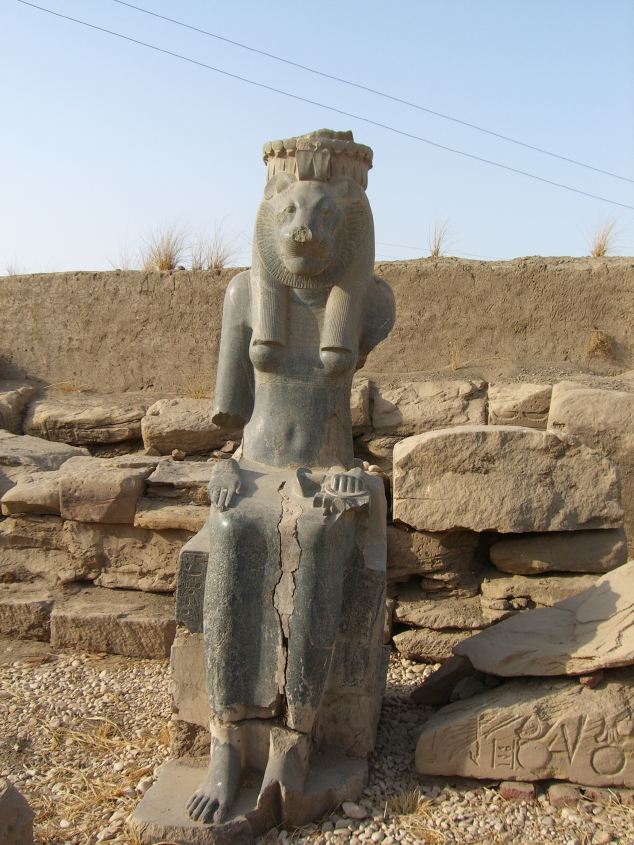
Mut's precinct to the south should not be treated as a mere end point of Amun's avenue. Its temple curves around the horseshoe Isheru, a sacred lake distinctive to goddesses in the Eye of Ra group. A guide by the excavators describes Nile-linked underground feeding, changing water levels and probable earlier stone-faced shores; two launching quays are inferred from a tomb relief, not both preserved as complete surveyed landing stages. The basin offered a route for Mut's bark as well as a boundary around her building. Under surviving Hatshepsut and Thutmose III structures, the Johns Hopkins expedition found evidence of a Middle Kingdom predecessor. Inscribed drums from a colonnaded “portico of drunkenness” commissioned by Hatshepsut and Thutmose III were later found beneath the west temple. They locate communal ritual and music in built space rather than in an abstract festival name. Hundreds of Sekhmet figures, many commissioned by Amenhotep III, add the lioness goddess's fierce and protective aspect to Mut's setting. How every statue was originally arranged cannot be inferred from the modern ranks alone. [32][42][44]
The precinct's borders changed dramatically. Temple A to the northeast, with a Ramesses II forecourt and pylon, and Ramesses III's temple southwest of the Isheru initially stood outside the narrower Mut enclosure. Ramesses II's Temple A used colossi and stelae carved or assembled from earlier Amenhotep material, and it later developed a birth-house role. In the Kushite age Taharqa's gateway and walls took Temple A and northern ground into the precinct. Fourth-century-BCE works under either Nectanebo II or early Ptolemaic authority pushed the huge enclosing wall round the other satellites and the lake's southern ground. The present broad precinct outline is therefore not the plan of Hatshepsut's initial Mut court. [42]
Individual later patrons are visible in that entrance. Montuemhat, a powerful priest and civic official, recorded a twenty-four-column colonnade that excavation revealed as two twelve-column porches flanking Mut's pylon. Ptolemaic builders repaired and altered their ends with large Bes reliefs. A small hut-ka chapel for Montuemhat's son Nesptah was made within the west pylon side. The God’s Wife Nitocris I received a chapel within Temple A's forecourt, while a healing chapel of Horwedja was later broken into fragments, reused, then reconstructed elsewhere. Such additions shift the architectural story from exclusively royal names to priests, women, families and local healing. [42]
The late enclosure also made space for other lives. When Taharqa's gateway was blocked, houses grew between it and the newer western wall from the later third or second century BCE into the Roman age. Temple A's forecourt acquired a kiln, a ceramic-pipe-fed well and other industrial structures; north of Mut's own pylon stood vaulted rooms, ovens and a possible kiln. Excavators can identify coins, bricks, jars and fire phases without proving every vaulted room's exact domestic or storage use. These areas show working and dwelling within and against a monumental sanctuary, not a sudden universal abandonment. [31][40][42]
The current Mut walk is also partly a conservation project. Brooklyn, Johns Hopkins, Egyptian teams and ARCE have cleared, repaired and reopened parts of the site, including the 2014 public reopening; rams, sphinxes, Sekhmet statues, gateway and contra-temple faces were restaged or rebuilt where stability demanded it. Some statue bases now deliberately separate granite from wet ground. Protective paving may lie over degraded ancient pavement, and modern paths make the lake accessible. These interventions preserve reading, but a present row of lioness statues or gate face cannot automatically be used as a photograph of Hatshepsut's original placement. [31][33][42]
Ptah and Montu: northern sanctuary and working treasury
Ptah's temple stands near the north edge of Amun's later enclosure, on a route toward the Montu precinct. Thutmose III's stone building replaced a mudbrick predecessor with three rear chambers and a western court. Excavation recovered the earlier foundation-grid beneath the standing sandstone plan; a central room and narrower flanking rooms closely resemble his later arrangement, but their axes differ by about six degrees. Nearby Middle Kingdom domestic layers lie below both. Ceramic material places the mudbrick sanctuary after late Seventeenth/early Eighteenth-Dynasty phases and before Thutmose III's replacement, without naming an exact founder. A displaced, partly restored Antef-era stela mentions Ptah but cannot identify who erected this particular predecessor. The motive for rotating the new stone axis may have been topographical or urban; it is not established as a deliberate solar realignment. [35][36]
Thutmose III's dedicatory text says he found the older brick and timber building decaying and ordered a new sandstone one. Renewal inscriptions can exaggerate predecessor decay to legitimise a king's work, yet archaeology confirms an earlier structure was indeed replaced. His new central shrine is described as a station where Amun's bark might rest during northward outings, with Ptah and Hathor served at its sides. Because the mudbrick floor plan was similar, the excavators propose that it too may have accommodated the same gods and procession. That is a reasoned analogy, not an inscription surviving from the earlier brick rooms. A stela for the mason Djehuty and selected older materials in the foundations hint at skilled people and material from adjacent civil/work spaces, but do not name him architect of the sanctuary. [35]
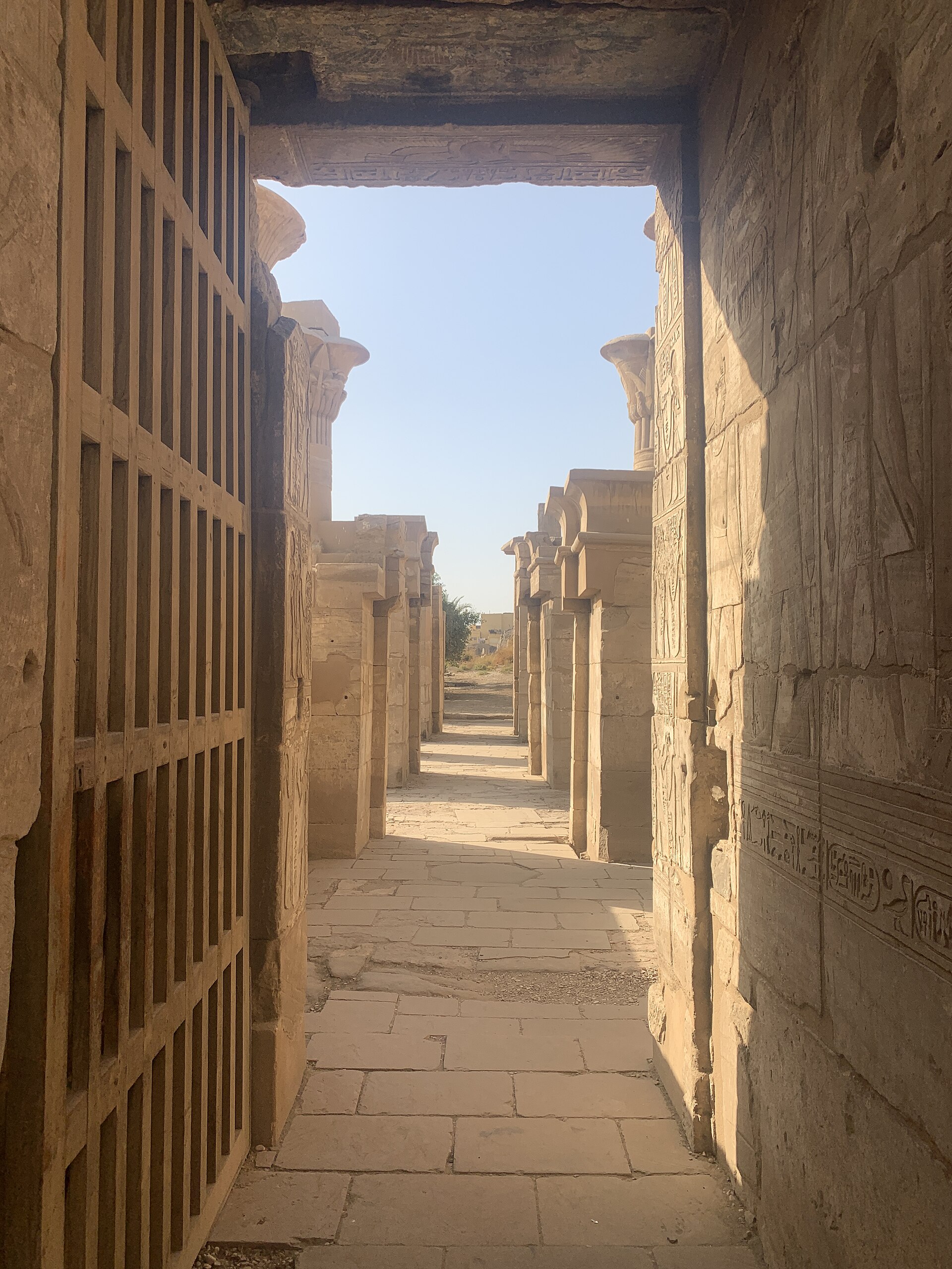
North of Amun's present wall, the Montu enclosure includes a temple of Amun-Ra-Montu, shrines to Ma'at and Harpre, a Ptolemaic monumental gate, a sphinx approach and a quay at the northern end. The Montu building's rooms changed use. IFAO field analysis suggests an Amenhotep III bark station for the Amun–Mut–Khonsu company was adapted to Montu-Ra: former rooms associated with Mut and Khonsu had their doors narrowed. The later Ptolemy III/IV gate and sphinx-lined route are additional construction, not proof that the Eighteenth-Dynasty arrangement had always been a purpose-built Montu complex. [29][30][38]
The excavated Thutmose I Treasury nearby is a particularly revealing lost building. It occupied about 2,200 square metres in fine limestone but lies now mostly as floors and fragments roughly three metres below modern ground. Its west-facing plan joined a cult/bark sanctuary to an eastern magazine court. Hatshepsut added a mudbrick enclosure around the stone structure, creating surrounding zones for bakers, workshops or store functions. Ramesses II dismantled the limestone and built a smaller sanctuary; Ramesses III and Pinedjem I made further sacred stages, and Ptolemaic domestic deposits followed. Roman workers cut deep trenches along buried limestone to burn lime. The name “Treasury” must not conjure a full standing warehouse of gold today: the foundation plan and fragments reveal where cult, storage and work once met. No Christian house was identified in this northern excavated sector, while late Roman–Byzantine houses were found beside Ptah farther south. Those are local differences, not contradictory histories. [36][38]
Late Karnak remained inventive
New Kingdom grandeur can eclipse the site of later building. Kushite rulers erected porches, kiosks and Osirian chapels in both north and south; Saite and Third Intermediate patrons, including Divine Adoratrices of Amun, developed northern Osiris shrine routes with distinct relief and deposits. Ptolemaic builders changed gates, rebuilt earlier carved scenes, installed porches and catacombs, and refashioned shrines rather than simply allowing the place to decay. A central Macedonian granite bark station replaced an older one. These acts can be read as continuing cult investment, even when they reused material and names from much older courts. [19][26][30][39][42][43]
The southwestern Khonsu Temple is a further reason not to treat Amun's core as the entire site. Ramesses III began a separate temple for the lunar god above earlier construction, and later rulers continued its carving and changes. Its own gateway, columned rooms and sanctuaries create an independent sequence rather than a small side cell in Amun's great hall. The Ramesses III bark temple in Amun's First Court is another, quite different building; the two should not be merged merely because their royal patron's name recurs. Khonsu's architectural proximity to Opet later made a secondary doorway from Opet's below-sanctuary Osiris chapel significant. The link belongs to a much later spatial arrangement, not proof that Ramesses III planned the Ptolemaic high plinth. [17][27][37]
The Opet Temple next to Khonsu in Amun's southwest precinct is an especially strong late architectural answer to the claim that Karnak stopped changing after Ramesses II. Blocks attest an Eighteenth-Dynasty Opet monument, while the surviving temple was built and decorated chiefly between the fourth century BCE and first century CE. Its ruined forecourt/pylon led by ramp up to a well-preserved high podium. A two-column hypostyle retains incomplete upper carving, and passages lead to a roof stair, linen room, flanking chambers and the goddess's axial sanctuary. Crypts occupy its plinth and sanctuary walls; some retain paint. Under the sanctuary's east side sits an Osiris chapel linked by a secondary doorway towards Khonsu. Ptolemaic kings and Augustus decorated different parts, including exterior geographical and Osirian scenes. Restoration has fixed selected walls and colour. This interlocking vertical section—court, high hall, roof access, crypt and below-shrine chapel—is not a diminished copy of the Great Hypostyle Hall. [1][10][37]
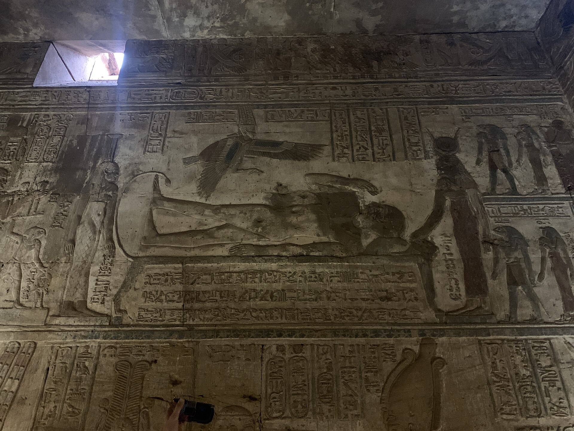
People other than kings also survive in the stone and buried objects. In the “Cachette” near Pylon VII, Legrain's early-twentieth-century excavation found more than seven hundred stone statues and seventeen thousand bronze figures in the IFAO inventory, many belonging to priestly individuals and spanning New Kingdom to late Ptolemaic ages. The numbers refer to that excavation corpus, not to statues currently on view. A lost diary and dispersed photographs complicate exact recovery context; the statues nevertheless give names and families to a sanctuary often described solely through royal campaigns. A late-Ptolemaic deposit behind Ptah contained thirty-eight objects and a decommissioned New Kingdom Ptah image among later bronze Osirian figures. Nearby fourth–fifth-century houses and Christian occupation show one northern sector repurposed after the old cult phases, without proving every Karnak shrine closed on the same day. [18][36]
What stone, water and excavation have left
Karnak's material history is neither a simple collapse nor a simple rescue. Ancient builders dismantled chapels and reused relief-bearing blocks in pylons; some Akhenaten carvings survived precisely because later builders packed them into cores. Ptolemaic sculptors recut damaged walls while preserving iconographic subjects. Roman and medieval lime makers quarried buried or standing limestone. Nineteenth- and twentieth-century clearing exposed foundations, reliefs, priests' statues and column damage; it also sometimes buried less prominent monuments under spoil, as happened to the north Ramesses III doorway during hall works before Chevrier uncovered it in 1937–38. George Legrain's re-erections, Benson and Gourlay's Mut excavation, and later Brooklyn/CFEETK programmes have shaped today's landscape of display. The monument is not one archaeological “after” photo of the age of Seti I. [13][18][34][38][42][46]
Today's connected walk has its own dates. An Egyptian accessibility-project account records the southern route from the Cachette court towards Pylon X and Mut opening to visitors in 2018 through a paved pathway, and describes newer sandstone or wood surfaces connecting the hall axes, lake, Akhmenu, Khonsu and Opet. A modern ramp bridges Opet's high threshold. Arabic and English Braille information and sign-language films in the visitor centre were also part of that programme. The author's approximately 2,700-metre accessible-route claim describes conditions at publication time; it is not a present guarantee that every historic room is independently navigable or that all ancient paving survives beneath the new surfaces. The present path helps visitors read several precincts, but it should not be projected unchanged into an Opet festival map. [49]
Water remains a structural danger. The ancient terrace and changing Nile channels gave Karnak its buildable ground but also put sandstone and brick near moisture, flood layers and rising groundwater. At the hall, salt brought upward in porous stone can crystallise under carved surfaces and detach relief. Excavated fired-brick wells near the west quay, southern precinct and Pylon IX show how later houses and workshops obtained water, and how halite and sodium-sulfate salts damage the same service fabric. The 1899 fall of some hall columns has competing explanations involving weak reused fill, foundation conditions and excavation drainage changes; one neat cause is not established. Surface recording and facsimile drawings preserve information from carvings at risk, but documentation does not itself stop the salt or the visitor abrasion noted on early platforms. [9][21][24][34][40][43]
Current World Heritage governance concerns the much larger Ancient Thebes with its Necropolis property. A 2025 UNESCO committee decision requested fuller integrated management, risk and sustainable-tourism planning, review of underground-water and Karnak access works, and a further conservation report due in December 2026. That decision is a dated request to assess interventions; it is not proof that every proposed project was approved or completed. It fits a site where ancient geology, river movement, discarded limestone, current visitors and deliberate restoration all influence what can still be read. Karnak survives most intelligibly when its impressive hall is kept in view alongside its vanished working north, living south, late high-plinth temples and stone palimpsests. [2][21][24][34][38][41][42]
Watch: Karnak in Time and Space
Institutional films are linked at source; previews are separately licensed editorial photographs.
Phase-by-Phase: Plan View
UCSC Digital Karnak · a university model of Karnak’s successive development. Modelled or restored forms are reconstructions, not film of surviving ancient elevations.
Editorial photograph: Ahmed Bahloul Khier Galal, source; CC BY-SA 4.0. Film footage and film thumbnails are not reproduced.Hypostyle Hall & Clerestory Lighting
UCSC Digital Karnak · a short reconstructed impression of the roofed hall and its unequal light.
Editorial photograph: Marc Ryckaert, source; CC BY-SA 4.0. Film footage and film thumbnails are not reproduced.Ancient Thebes with its Necropolis
UNESCO World Heritage Centre · an official property film that places Karnak with Luxor and west-bank Thebes; film rights remain with its producer.
Editorial photograph: Marc Ryckaert, source; CC BY-SA 4.0. Film footage and film thumbnails are not reproduced.Explore RELATED Artworks at Karnak
Relief and sculpture records at the institutions studying the monument.
Frequently Asked Questions
No. Amun’s main sanctuary is joined by Mut, Montu, Khonsu, Ptah, Opet and other precinct buildings built and changed over many reigns. [1] [38] [42]
134: twelve taller open-papyrus columns in the nave and 122 shorter papyrus-bud columns to the sides. [1] [5] [43]
The main surviving hall belongs chiefly to Seti I and Ramesses II. Earlier use or a precursor colonnade is debated, so its present columns should not all be credited to one speculative founder. [1] [5] [6]
No. Stone beams and window grilles remain in places, but most roof slabs fell, making the surviving hall much brighter than its ancient side aisles. [5] [10] [43]
No. Both were dismantled in antiquity, their blocks reused, and their present Open Air Museum structures reassembled; the White Chapel’s first location is unknown. [13] [14]
No. The main Amun approach runs broadly west–east, while Pylons VII–X belong to an intersecting southward sequence. [3] [10]
No single unchanged route is established. Hatshepsut’s scenes depict an outward land procession and apparent water return; later images show different bark and river arrangements. [11] [14]
No. Amun’s basin sits south of the inner courts; Mut’s horseshoe Isheru curves around her separate temple precinct. [16] [32] [42]
No. Kushite, Saite, Macedonian, Ptolemaic and Roman patrons built, altered and reused parts of the complex, including the high-plinth Opet Temple. [19] [37] [39]
References
- Egyptian Ministry of Tourism and Antiquities, Karnak, Arabic and English monument records. View source
- UNESCO World Heritage Centre, Ancient Thebes with its Necropolis. View source
- CFEETK, Power and architectural markers at Karnak. View source
- CFEETK, Pylon II western-facade study. View source
- UCSC Digital Karnak, Great Hypostyle Hall. View source
- University of Memphis, Karnak Great Hypostyle Hall Project. View source
- University of Memphis, 1992–2002 Hypostyle field report and 2011 season report. View source
- University of Chicago ISAC, Great Hypostyle Hall wall-relief publication. View source
- Elaine Sullivan, Construction, UCSC Digital Karnak, 2008. View source
- Elaine Sullivan, Architectural Features, UCSC Digital Karnak, 2008. View source
- Elaine Sullivan, Processional Routes and Festivals, UCSC Digital Karnak, 2008. View source
- UCSC Digital Karnak, First Pylon and Shoshenq I Court. View source
- UCSC Digital Karnak, White Chapel; CFEETK archive record. View source
- UCSC Digital Karnak, Hatshepsut's Red Chapel; CFEETK archive record. View source
- UCSC Digital Karnak, Akhmenu; CFEETK Akhmenu programme. View source
- UCSC Digital Karnak, Sacred Lake. View source
- Egyptian Ministry of Tourism and Antiquities, Khonsu Temple. View source
- IFAO, Karnak Cachette database history. View source
- IFAO, Karnak Osirian chapels project. View source
- Charloux, Abady Mahmoud and colleagues, “The shifting Nile and the origins and development of ancient Karnak,” Antiquity, 2021. View source
- Graham and colleagues, “Conceptual origins and geomorphic evolution of the temple of Amun-Ra at Karnak,” Antiquity, 2025. View source
- French state archaeology, Karnak: from city to temple. View source
- CNRS Images, 2011 Karnak geomorphology caption. View source
- University of Memphis, Threatened monuments at Karnak. View source
- UCSC Digital Karnak, Fifth Pylon and Court and Wadjet Hall obelisks. View source
- CFEETK, Central bark shrine of Philip Arrhidaeus. View source
- CFEETK, Ramesses III first-court bark temple. View source
- CFEETK, Thutmose III enclosure and Akhmenu programme. View source
- IFAO, 1996–97 Karnak North archaeology report. View source
- IFAO, publisher record for the Montu northern propylon. View source
- Richard Fazzini, Preliminary Report on the 2006 Season of the Mut Precinct Project, Brooklyn Museum. View source
- Richard A. Fazzini and Betsy M. Bryan, The Precinct of Mut at South Karnak: An Archaeological Guide, American University in Cairo Press, 2021 publisher record and excerpts. View source
- Brooklyn Museum, Mut precinct institutional history. View source
- CFEETK, Excavations in the Middle Kingdom Court. View source
- Charloux, Abady Mahmoud and colleagues, “Le temple « primitif » de Ptah à Karnak,” BIFAO 117, 2018. View source
- CFEETK, Ptah Temple excavation programme. View source
- CFEETK, Opet Temple topographical archive. View source
- IFAO, Karnak-Nord excavation account. View source
- Essam Nagy, “Recent Discoveries South of the Tenth Pylon at Karnak”, IFAO congress proceedings, 2023, pp. 265–70. View source
- El-Badry, “Deterioration Mechanisms Affecting the Bricks Used in the Building of the Water Wells at Karnak Temples,” EJARS 9(1), 2019. View source
- UNESCO World Heritage Committee, Decision 47 COM 7B.166, 2025. View source
- ARCE and Brooklyn Museum, Mut Temple excavation and conservation project. View source
- University of Memphis, Smaller hypostyle columns, sacred-bark stations, marginal decoration and construction studies. View source
- Betsy Bryan, Johns Hopkins/ARCE lecture on Mut and festivals. View source
- UCSC Digital Karnak, First Pylon and western approach and enclosure studies. View source
- CFEETK, Ramesses III north doorway conservation study. View source
- CFEETK, Nautical scenes on Pylon IX talatat, 2025 publisher summary. View source
- CFEETK, Rebuilt Amenhotep II edifice by Pylon X. View source
- Mostafa al-Saghir, “Accessibility of the Karnak Temples for People with Disabilities”, IFAO congress proceedings. View source