by Tom Gurney
Tom Gurney BSc (Hons) is an art history expert with over 20 years experience
Email: tomgurney1@gmail.com / Phone: +44 7429 011000
Reading Medieval Town Planning
Medieval towns were not simply unplanned mazes. Across Europe, settlements grew from inherited Roman centres, castles, monasteries, ports and markets; rulers also founded new towns with laid-out streets and plots. Even an irregular plan could be regulated through property boundaries, market rights, walls, gates and building custom. The useful distinction is not planned versus organic, but how deliberate foundation and incremental adaptation worked together.[1]
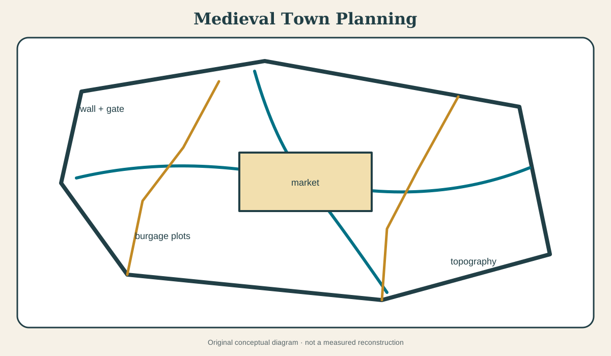
The fabric often preserves this history at a scale smaller than monuments. A later shopfront can occupy a narrow medieval burgage plot. A curved street can follow topography or a vanished wall. A broad market widens where routes meet. Archaeology, documents and plan analysis reveal these layers without pretending that a modern map is an untouched medieval plan.
At a Glance
- Processesdeliberate foundation, plot subdivision, market regulation, fortification and incremental rebuilding.
- Key unitsstreet, burgage plot, market place, parish, precinct, wall, gate, castle and waterfront.
- Agentscrown, lord, bishop, monastery, borough, guild, merchant, household and builder.
- Evidencecharters, rents, cadastral plans, archaeology, standing buildings, earthworks and topography.
- Essential cautionirregularity does not mean no planning; regularity does not prove a scheme was fully built as intended.
Contents
- What “planning” meant before the modern profession
- Reading streets and plots
- Plan analysis and its limits
- Founded towns and Edward I
- Market place and fair town
- Wall, gate and jurisdiction
- Church, monastery and sacred precinct
- Topography and the “irregular” plan
- House, workshop and street life
- Fire, war, plague and rebuilding
What “planning” meant before the modern profession
Medieval Europe had no modern planning department, but it had many powers that shaped settlements. A founder could grant plots and market privileges. A borough regulated trade and street obstruction. Religious institutions enclosed precincts. Walls directed entry and taxation. Property custom governed inheritance and subdivision.
Several authorities often overlapped. Royal land met episcopal liberty; guild rules met household practice; castle jurisdiction met borough rights. Urban order emerged through negotiation and conflict, not one master planner.
Planning could be practical and symbolic. A market place enabled trade and displayed civic autonomy. A straight street connected gate and castle. A church tower oriented travellers. A wall protected, taxed and defined community.
Incremental building adapted this framework. Timber houses were replaced in masonry; backlands filled with workshops; lanes opened through deep plots. The town remained planned at several moments without becoming static.
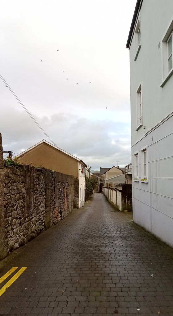
Evan's Lane from James's Sconce. Evan's Lane as seen from James's Sconce. In “What “planning” meant before the modern profession”, this view helps identify medieval burgage plots. Source image dated 2022; that date records the image, not the original construction. A.-K. D., Evan's Lane from James's Sconce; CC0. Resized proportionally; no crop, retouch or upscaling.
Reading streets and plots
The street is public route and property edge. Frontage brings commercial value; doors and stalls animate it. Width responds to market, procession, drainage and traffic but can change through encroachment or clearance.
The burgage plot is a long, often narrow property extending back from the street. Cambridge research on early urban Scotland examines how plot, street line and domestic architecture interact.[2] The plot is not identical across all regions, but it offers a powerful unit of analysis.
Front buildings contain shop, hall or dwelling. Behind may lie yard, kitchen, workshop, garden, privy and later tenements. As population grows, the deep plot intensifies. Passages or closes preserve access.
Plot boundaries can outlast buildings. Party walls and drainage follow them. A modern aerial or cadastral map may reveal repeated narrow bands, but dating requires documents and archaeology. Later subdivision can imitate early rhythm.
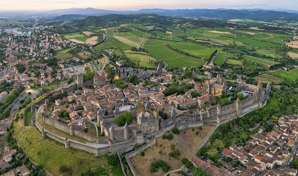
1 carcassonne aerial 2016. aerial panorama of Cité de Carcassonne. In “Reading streets and plots”, this view records the form, material and setting discussed in the passage. Source image dated 2016; that date records the image, not the original construction. Chensiyuan, 1 carcassonne aerial 2016; CC BY-SA 4.0. Resized proportionally; no crop, retouch or upscaling.
Plan analysis and its limits
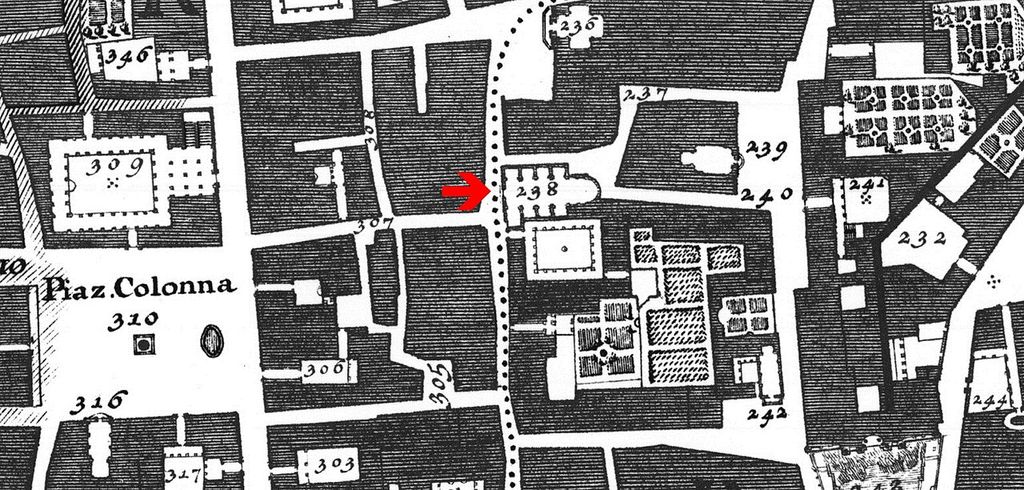
Keith Lilley’s work on mapping medieval cities demonstrates how plan analysis can reconstruct urban design and history.[1] Street alignments, blocks, plots and monuments reveal relationships not visible at ground level.
The method is not simple tracing. Modern maps contain later roads, amalgamated property and rebuilt blocks. Researchers work backwards through dated plans, documents and excavation. A geometric line on today’s map is evidence only after its persistence is established.
Regularity can suggest foundation: repeated plots, consistent frontage and coordinated streets. Topographic survey tests whether the scheme follows contour. Church and market orientation can reveal phases.
Digital GIS makes overlay and measurement easier, but precision can create false certainty. Historical maps have distortion; georeferencing choices move lines. Alternative reconstructions should remain visible.
Founded towns and Edward I
New towns were laid out for political, military and economic purposes. Research on Edward I’s towns in England and Wales uses mapping to investigate their planned landscapes.[3] Such foundations refute the assumption that regular urban planning began in the Renaissance.
A founder might establish a market, allocate plots, build defences and attract settlers through privileges. The plan had to meet terrain, existing roads and finance. Some proposed streets remained incomplete; settlers modified plots.
Bastides in south-western France and planned boroughs elsewhere offer related but diverse examples. Regular grid and central market recur without one universal blueprint. Military frontier, trade and colonisation change interpretation.
Foundation could dispossess existing communities or impose new power. “New town” should not imply empty land. Archaeology may recover earlier settlement beneath the plan.
Market place and fair town
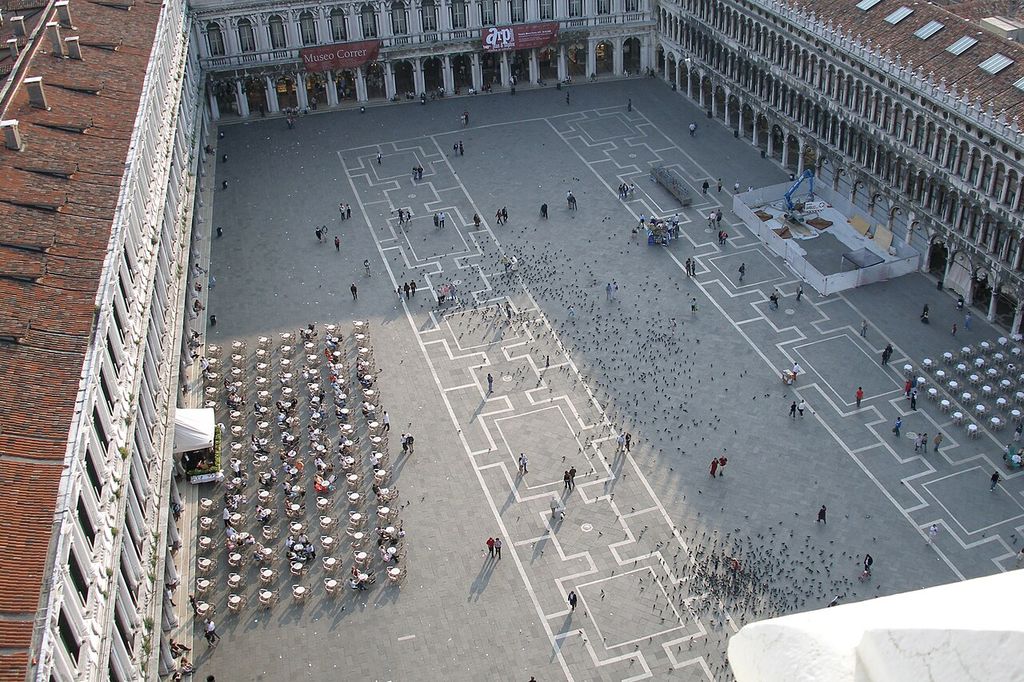
Markets generate space through concentration and circulation. A broad street can host stalls; a square can stand at route intersection; a market hall can divide open ground. Permanent shops grow around the edge.
Provins’s UNESCO record documents a medieval trading town shaped by fairs, routes, specialised buildings and fortification.[4] Its urban form belongs to long-distance commerce, not only local agriculture.
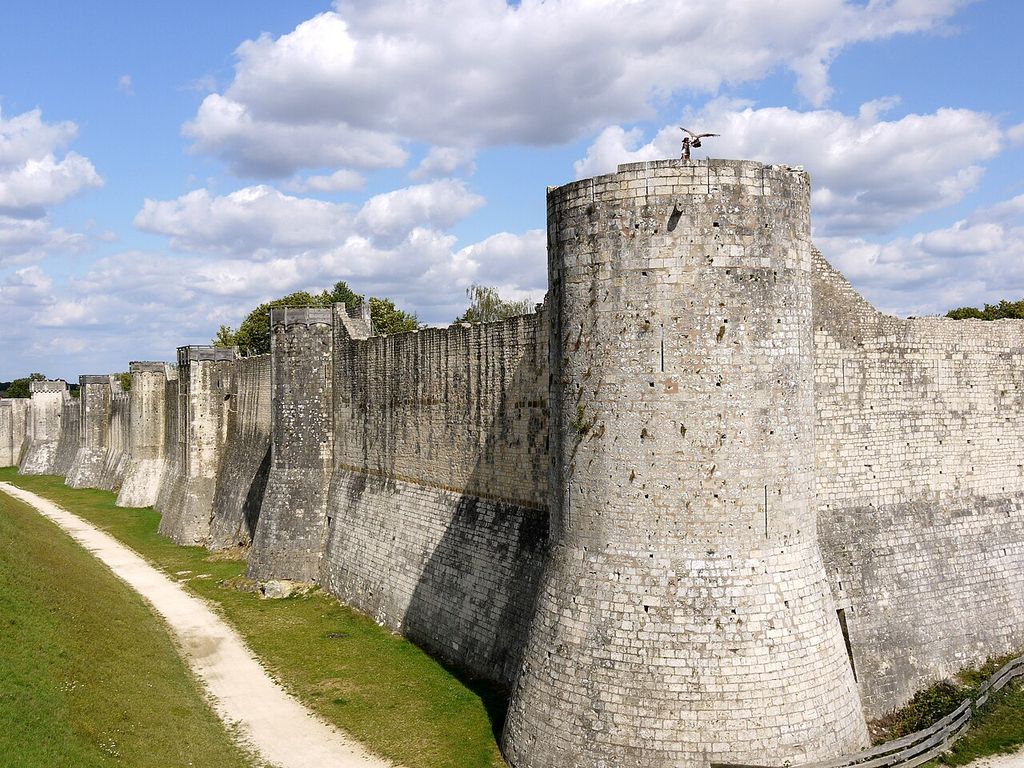
Provins medieval town aerial. Medieval fortifications of Provins, Ile de France, France. In “Market place and fair town”, this view records the form, material and setting discussed in the passage. Source image dated 2011; that date records the image, not the original construction. Pline, Provins medieval town aerial; CC BY-SA 3.0. Resized proportionally; no crop, retouch or upscaling.
Fair times temporarily transform capacity. Inns, warehouses, counting spaces and open ground support merchants. Regulation governs measures, tolls and dispute. The market is an institution made spatial.
Bardejov presents a particularly legible market-centred fortified town.[5] Regular frontages around the open centre create civic coherence, while walls and gates define edge. Its survival results from later conservation as well as medieval planning.
Wall, gate and jurisdiction
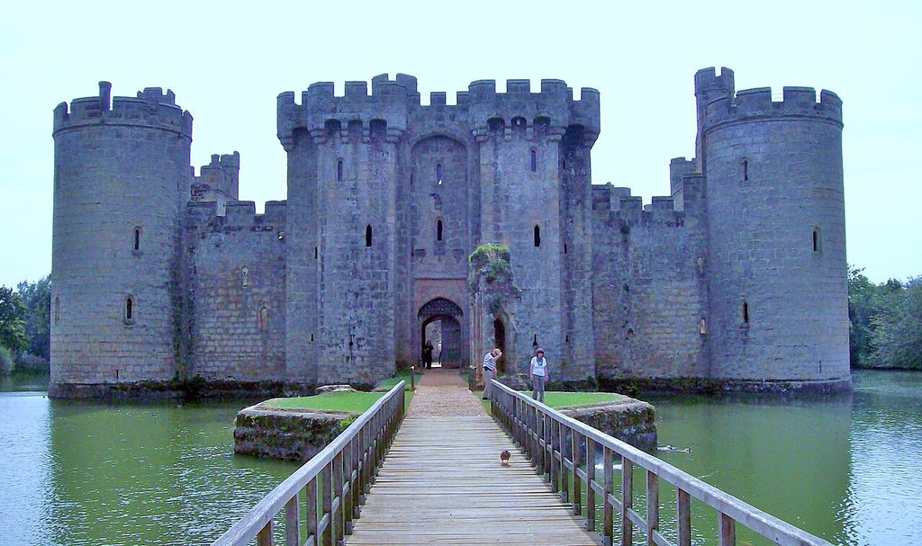
Town walls protect against attack but also control movement, toll and identity. Gates concentrate roads and can host administrative or residential rooms. Suburbs grow beyond them.
The wall’s line shapes later streets even after demolition. Ditches become roads or gardens. Gate names survive. A curved property boundary may preserve a lost defence.
Building and maintaining walls required collective finance and labour. Rights to crenellate, repair obligations and watch duties express governance. Walls could exclude as well as defend.
Expansion creates choices: extend the circuit, develop outside or intensify within. Each changes plot and movement. A town can contain several defensive rings from different periods.
Church, monastery and sacred precinct
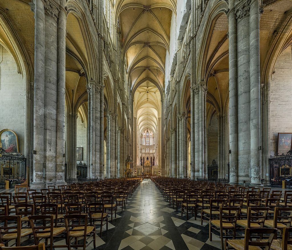
Religious institutions occupy large urban territories. Cathedral closes, monastic enclosures, parish churches, hospitals and cemeteries shape routes. Sanctuary and jurisdiction can create boundaries within the town.
Church towers provide orientation, while processions give streets ceremonial meaning. Market and church may share a square but operate under different authority. Pilgrimage increases lodging and trade.
After dissolution or secularisation, precincts can be subdivided while preserving walls and open ground. Archaeology is essential because later civic buildings may reuse foundations.
The sacred town is not separate from economy. Monasteries owned property, managed water and employed labour. Their gates linked enclosed institutions to streets.
Topography and the “irregular” plan
Edinburgh’s Old Town demonstrates topographic urbanism: a ridge supports a long main route, with narrow closes descending steeply.[6] The form is highly constrained and socially organised, not a random tangle.
Ports follow shoreline and quay. Hill towns use contour and defensible summit. River crossings create bridgehead markets. Existing Roman walls or roads persist unevenly.
Irregular blocks can emerge because several route systems meet, because property accumulated over time or because terrain prevents a grid. Each explanation is historical.
The picturesque modern eye often values winding medieval streets while forgetting drainage, crowding and fire. Beauty and hardship should not be collapsed.
House, workshop and street life
Medieval urban buildings mixed use. Shop or workshop opened to street; hall and chamber lay behind or above; storage occupied cellar and loft. Animals, waste and production shared close quarters.
Timber framing allowed jetties and repeated rebuilding. Masonry party walls improved fire resistance and status. Building regulations could control roofs, encroachment and ovens.
The street accommodated carts, stalls, drainage, animals and processions. Paving and sanitation varied. Narrowness may be a later product of encroachment, not original design.
Archaeology of ordinary houses recovers diet, craft and trade missing from elite documents. Urban planning history needs these lives, not only walls and cathedrals.
Fire, war, plague and rebuilding
Disaster changes urban form. Fire can prompt wider streets and masonry regulation while rebuilding follows old plots. War destroys gates and suburbs. Epidemic changes burial and occupation. Economic decline leaves plots vacant.
Rebuilding rarely begins from zero. Property claims and surviving foundations pull construction back to earlier lines. Emergency measures can become permanent.
Later early modern and nineteenth-century clearance may create the broad square now assumed medieval. Historical maps are necessary. A “medieval town centre” can be a curated mixture.
Continuity is selective. The street name may survive while buildings and population change entirely. The value lies in tracing what persisted and why.
Power, colonisation and social difference
Founded towns could extend royal control into contested regions. Plot grants and legal privilege attracted settlers while marginalising others. Fortification and grid expressed authority.
Within towns, wealth shaped frontage and building material. Marginal trades occupied edges or downstream sites. Jewish quarters, migrant communities and religious minorities faced regulation and violence that changed urban geography.
Gender shaped property, market work and institutional access in ways that varied by legal context. Widows and women traders could hold urban property, while guild and household rules constrained them.
Planning should not be credited only to rulers. Residents adapted lanes, shared wells and built extensions. Their cumulative intelligence is part of form.
How to read a medieval town
- Start with terrain, water, inherited roads and earlier settlement.
- Map market, castle, church, wall and gates as interacting nodes.
- Examine plot rhythm behind current façades.
- Distinguish foundation plan from later subdivision and expansion.
- Identify overlapping jurisdictions and privileges.
- Compare maps with excavation and standing fabric.
- Recover ordinary housing, work and marginal communities.
- Date modern restoration and tourist staging.
Walk boundaries as well as centres. A lost wall, back lane or stream can explain more than the principal monument.
Conservation of living urban morphology
Historic England’s settlement guidance values archaeological deposits, earthworks and standing remains together.[7] In inhabited towns, conservation must also accommodate housing, services, access and commerce.
Protecting plot patterns can be as important as preserving façades. Large amalgamation may erase centuries of grain. New building can respect frontage and passage without imitating medieval style.
Tourism supports maintenance and displaces residents if unmanaged. Sanitised streets can lose everyday trade. Accessibility and fire safety require adaptation within narrow fabric.
The medieval town is not a stage set. Its significance lies in the continuing interaction of planned framework and lived modification. Recognising deliberate medieval urbanism does not deny organic growth; it gives that growth an institutional and material history.
Edward I's new towns as archaeological plans
Research on Edward I's foundations uses geophysical survey and plan analysis to examine towns established within conquest and administration.[3] Regular streets and plots indicate deliberate layout, but the built result did not simply reproduce a perfect surveyor's grid.
Topography, pre-existing routes and the pace of occupation altered schemes. Some plots remained empty or were amalgamated; defences changed; market success varied. The plan records aspiration and adaptation together.
The political context is indispensable. Foundations in Wales belonged to an English programme of conquest, castles, borough privileges and settlement. Calling them planning experiments without naming that power would aestheticise colonisation.
Burgage plots and the depth behind the street
Long narrow plots gave frontage to a street or market while extending back to yards, workshops, cultivation and service access. Subdivision could multiply shops; amalgamation could support an inn or larger house. Scottish urban research shows how plot and domestic architecture inform one another.[2]
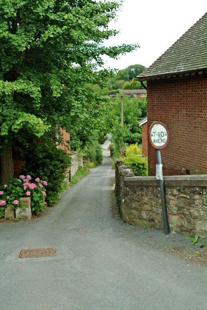
Barkers Lane - geograph.org.uk - 891187. Barkers Lane Much of the central area of Cleobury Mortimer is in a conservation area. In “Burgage plots and the depth behind the street”, this plan helps identify medieval burgage plots. Source image dated 2008; that date records the image, not the original construction. P L Chadwick, Barkers Lane - geograph.org.uk - 891187; CC BY-SA 2.0. Resized proportionally; no crop, retouch or upscaling.
These boundaries may survive beneath later buildings. A broad Georgian façade can span several medieval parcels; a close or alley can preserve former access. Morphology therefore connects standing fabric to buried town.
Plot interpretation requires documentary caution. Similar narrow parcels can emerge in different periods, and modern maps may regularise boundaries. Secure dating draws on excavation, charters, rents and building sequence.
Provins and the infrastructure of the fair
Provins developed as a major town of medieval fairs, with streets, open spaces, storage, defences and buildings supporting long-distance commerce.[4] Trade required more than a market square: merchants needed lodging, secure goods, credit, jurisdiction and routes.
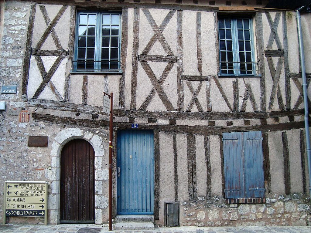
Provins-medieval house in the village. Provins, a town of medieval fairs, became a UNESCO World Heritage Site in 2001. In “Provins and the infrastructure of the fair”, this view records the form, material and setting discussed in the passage. Source image dated 2013; that date records the image, not the original construction. Elena Tatiana Chis, Provins-medieval house in the village; CC BY-SA 4.0. Resized proportionally; no crop, retouch or upscaling.
The fair town was seasonal. Population and activity expanded at particular times, changing how streets and halls were occupied. A present quiet historic centre may conceal that temporal intensity.
Commercial privilege connected local form to European networks. Cloth and coin moved through the town; political protection made exchange possible. Urban architecture materialised those institutions.
Bardejov: market, wall and multi-confessional city
Bardejov's conserved centre is organised around a major market square, town hall, church and defensive system.[5] Its legibility makes it tempting to treat the ensemble as a frozen medieval plan. Buildings and communities, however, continued to change.
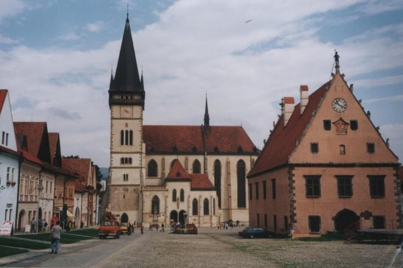
Bardejov square. In “Bardejov: market, wall and multi-confessional city”, this view records the form, material and setting discussed in the passage. Source image dated 2004; that date records the image, not the original construction. Creator not identified in the source record, Bardejov square; CC BY-SA 3.0. Resized proportionally; no crop, retouch or upscaling.
The walls distinguish jurisdiction and protection while gates channel trade. The square gathers civic, religious and commercial claims. Later façades record wealth and rebuilding within older parcels.
The town's Jewish suburb and synagogue complex add a history that a monument-centred account of the market can miss. Social and confessional difference belonged to urban structure, including exclusion and separate institutions.
Waste, water and the ordinary street
Medieval urban life depended on wells, conduits, drains, rivers and repeated regulation of waste. Conditions varied; the cliché of universal filth is no more accurate than an ideal hygienic town. Archaeology reveals surfaces, pits, channels and changing practice.
Street width had practical consequences for carts, market stalls, animals, drainage and fire. Encroachment could be tolerated, licensed or removed. A “picturesque” irregular projection may record a negotiated claim to public space.
Waterfronts and mills linked towns to productive landscapes. Pollution conflicts and flood shaped regulation. Environmental history is not a modern addition to the medieval plan.
Fire, rebuilding and false visual unity
Timber buildings were repaired and replaced repeatedly. Fire could prompt new regulations or wholesale rebuilding; prosperous owners changed fronts while retaining cellars and plots. The streetscape at any chosen date contained several ages.
Modern heritage presentation sometimes harmonises signs, colours and roofs to create a coherent medieval atmosphere. That may support tourism but can conceal the very process of change that makes the town historic.
Edinburgh's Old and New Towns illustrate a particularly clear adjacency of urban periods, though the Old Town itself is layered rather than purely medieval.[6] Conservation should preserve contrast and continuity rather than forcing every element into one stylistic date.
Plan analysis and resident evidence
Keith Lilley's work demonstrates the interpretive power of mapping streets and plots while also locating plan analysis within broader urban history.[1] Shape alone cannot identify patron, date or social use. A regular grid may be ancient, medieval or modern; an irregular line may follow terrain or a lost boundary.
Documents favour property owners and institutions. Household archaeology, artefacts and environmental remains can recover consumption and work at another scale. Names in tax or court rolls populate the abstract parcel.
The best reconstruction therefore moves repeatedly between town plan and excavated room. Planning is visible in the framework; urban life appears in how people occupied and altered it.
Names, languages and legal geographies
Street and place names can preserve market trades, gates, water, religious institutions and former communities. Their language and spelling change under conquest, state reform and tourism. Translation should record variants rather than selecting one name as timeless.
Legal boundaries may not coincide with walls. Parish, manor, borough, liberty and guild jurisdictions overlapped, producing different rules within adjacent streets. A town plan needs these invisible geographies as much as fortification.
Court rolls, charters and property deeds can locate rights, but they privilege institutions able to write and preserve records. Archaeology and vernacular naming help recover people at the archive's edge.
From medieval framework to present housing
Historic plots and buildings remain homes and businesses. Tourism and conservation can protect fabric while raising prices or displacing residents. Vacancy behind a preserved façade is not urban continuity.
Fire safety, accessibility and energy retrofit require intervention in narrow plots and old structures. A coordinated district plan can share services and protect archaeology better than forcing each owner to improvise.
The objective is a living morphology. Streets, plots and mixed use survive most convincingly when communities can adapt them, not when the centre becomes an open-air illustration emptied of ordinary life.
Town walls after defence
When military value declined, walls and ditches became quarries, promenades, property boundaries or development obstacles. Gates could be demolished for traffic while their approach continued to shape streets. Survival is selective.
Later appreciation sometimes isolated a wall from the houses and gardens that had grown against it. Clearance improved visibility but removed evidence of adaptation. A conserved circuit should distinguish medieval defence from its long urban reuse.
Bardejov's powerful enclosure illustrates both defensive identity and heritage presentation.[5] Comparison with open towns avoids making a complete wall the definition of medieval urbanism.
Measuring density without modern assumptions
Population estimates derive from plots, hearths, tax records, food supply and burial evidence, each incomplete. A walled area may contain gardens and vacant ground; crowded houses may extend vertically or into yards. Density changes by season and crisis.
Terms such as overcrowding need contemporary and analytical context. Small rooms do not alone establish household misery, just as a generous market square does not prove abundant private space.
Reconstructing occupation at several dates prevents one maximum estimate from becoming the town's timeless population.
Craft districts and environmental consequence
Tanning, dyeing, metalwork, baking and other trades required water, fuel, ventilation and access. Authorities could cluster or exclude them because of fire, smell and pollution. Craft geography therefore shaped edges and waterways.
Archaeological residues identify production where documents are silent. Workshops also joined home and work, making the modern separation of residential and industrial zones misleading.
This ordinary economy belongs to planning. Markets and walls were supported by material flows through lanes, yards and rivers that monumental maps rarely celebrate.
Food supply stretched farther still. Grain, animals, fish and fuel tied the town to fields, woods and ports. Gates counted or taxed some of that movement, making the urban boundary a point in a regional system rather than a hard separation from countryside.
Seasonal shortage and political interruption could therefore reshape prices and street life without changing the street plan itself.
Migration, citizenship and belonging
Medieval towns attracted merchants, craftspeople, clergy, servants and refugees. Rights to trade, own property or join a guild varied. Newcomers could be economically necessary while legally restricted.
Charters and tax records classify people through institutional categories. Names and objects can reveal wider origins, but identity should not be inferred mechanically. Language, religion and legal status intersected.
This population movement shaped space through inns, worship, workshops and neighbourhood networks. A town was not culturally sealed by its wall.
Sound, smell and regulation
Bells organised time; markets and workshops produced distinctive noise; animals, ovens and waste generated smells. Authorities regulated some activities, and neighbours brought disputes. These sensory conflicts are evidence of urban governance.
Reconstruction can map likely zones without pretending to reproduce an exact soundscape. Trade records and environmental archaeology establish material sources; literary complaint reveals perception but may exaggerate.
The sensory city explains why proximity mattered. Street width and mixed use were lived through sound and smell as well as façade and plan.
Watch: map, fair town and hill city
Choose Assembling Urban Space: An Exploration of Medieval Town ‘Planning’, Introduction to Theory of City Form or The History of Urban Planning as a Historical Project. Together, the films connect architectural form with material, use and historical setting.
Assembling Urban Space: An Exploration of Medieval Town ‘Planning’
An archaeological lecture that directly tests the planned/organic binary
Watch on YouTubeDiscussion
Which building or designed landscape most clearly demonstrates Medieval Town Planning, and what physical evidence supports that reading?
Reader Insights
Name the material, joint, opening, route or view you can observe.
Give the place, approximate date and a reliable source.
Separate documented history from your interpretation.
Join the Conversation
Share a concise observation or useful source below.
References
- Keith Lilley, “Mapping the Medieval City: Plan Analysis and Urban History,” Urban History. View source
- Urban History, “Framework and Form: Burgage Plots, Street Lines and Domestic Architecture in Early Urban Scotland.” View source
- Antiquity, “Mapping Medieval Urban Landscapes: Edward I’s New Towns.” View source
- UNESCO World Heritage Centre, “Provins, Town of Medieval Fairs.” View source
- UNESCO World Heritage Centre, “Bardejov Town Conservation Reserve.” View source
- UNESCO World Heritage Centre, “Old and New Towns of Edinburgh.” View source
- Historic England, Settlement Sites to 1500: Selection Guide. View source