by Tom Gurney
Tom Gurney BSc (Hons) is an art history expert with over 20 years experience
Email: tomgurney1@gmail.com / Phone: +44 7429 011000
Reading Urban Planning in Architectural History
Urban planning is the shaping of settlements through streets, plots, blocks, buildings, infrastructure, public spaces, land rules and institutions. Sometimes it begins with a drawn scheme; often it accumulates through subdivision, regulation, transport investment, defence, rebuilding and everyday adaptation. A city can be planned and emergent at the same time.
That definition changes the history. Medieval towns are not simply unplanned mazes. Renaissance and Baroque rulers rarely wiped every inherited street clean. The nineteenth-century boulevard, City Beautiful civic centre and Garden City diagram all met property, finance and resistance. Plans show intention; urban fabric records implementation.[1]
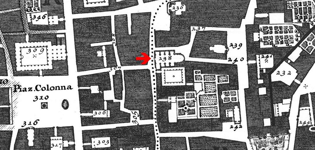
Nolli map Rome urban plan detail. In “Reading Urban Planning in Architectural History”, this map records the form, material and setting discussed in the passage. Source image dated 1748; that date records the image, not the original construction. Giovanni Battista Nolli, Nolli map Rome urban plan detail; Public domain. Resized proportionally; no crop, retouch or upscaling.
At a Glance
- Scalesregion, city, district, block, plot, street, building and room change at different speeds.
- Agentsrulers, councils, landowners, engineers, surveyors, developers, institutions, communities and residents.
- Systemsmovement, water, waste, energy, defence, markets, housing, public space and ecology.
- Evidenceplans, cadastral maps, archaeology, buildings, street sections, law, finance, census, oral history and remote survey.
- Essential cautiongeometric order does not guarantee social justice, and irregularity does not prove absence of planning.
Explore All Urban Planning Guides
Explore all seven urban-planning guides, then connect the subject to Architecture, Building Types, Gardens and Landmarks.
Contents
- Planning beyond the master plan
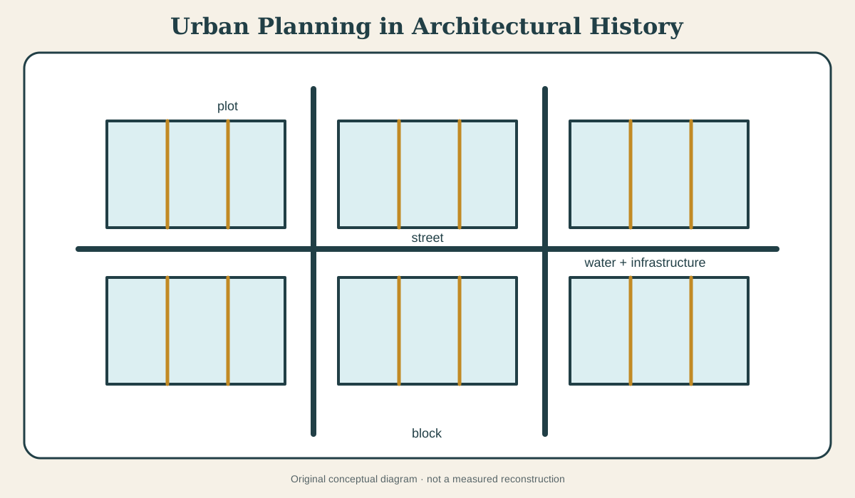
- Street, plot, block and building
- Topography and water
- Infrastructure and unequal access
- Medieval planning without the “organic maze”
- Renaissance and Baroque interventions
- Industrial city and professional planning
- Plan as image and instrument
- Public space and contested publicness
- Segregation, clearance and resistance
Planning beyond the master plan
The master plan is a powerful but narrow image of planning: one author, one date, one total view. Many cities have never possessed such a document. Their form nevertheless reflects countless planned decisions.
A charter establishes a market. A lord subdivides frontage into burgage plots. A council sets a street width. A wall and gate control expansion. A water authority places a reservoir. A railway company builds a station and viaduct. Building rules regulate height and fire materials. Each act reshapes future possibility.
Incremental action does not mean accidental action. Plot owners make deliberate choices within inherited boundaries. Informal settlements can contain sophisticated rules and social organisation even where the state did not draw them. Conversely, a formally planned capital can develop in ways its founders never intended.
The historian should therefore compare proposal, legal authority, finance, construction and occupation. A beautiful plan may remain paper. An uncelebrated sewer may transform the city more completely.
Street, plot, block and building
Urban form is layered because its components endure differently. Buildings are replaced relatively often. Plot boundaries can survive behind new façades. Streets and topography may persist for centuries. Infrastructure is renewed in place because changing the whole route is expensive.
UCL research on London’s urban morphology demonstrates the analytical value of streets and plots.[2] A modern block can retain medieval or early modern parcel rhythms. The façade date alone does not date the urban framework.
The plot mediates individual building and city. Its frontage controls access and commercial visibility; depth accommodates courts, workshops and backland development. Subdivision and amalgamation change density. A planning history that jumps from street to monument misses this property structure.
Blocks organise public and private edges. Perimeter buildings can enclose courts; detached objects create open ground; alleys penetrate. Street section—building height, carriageway, pavement, trees and services—determines lived scale better than plan alone.
Topography and water
Cities occupy ground before planners draw them. Rivers support transport and water but bring flood. Ridges offer defence and prospect. Slopes constrain grids. Marsh drainage and land reclamation create developable territory through major environmental intervention.
Historic water systems influence street and property. Wells, canals, aqueducts and sewers establish routes. Ports generate warehouses and worker districts. Covered streams remain beneath roads.
The UNESCO Historic Urban Landscape approach includes topography, geomorphology, hydrology and open space within urban heritage.[1][3] This broad field prevents conservation from becoming façade preservation.
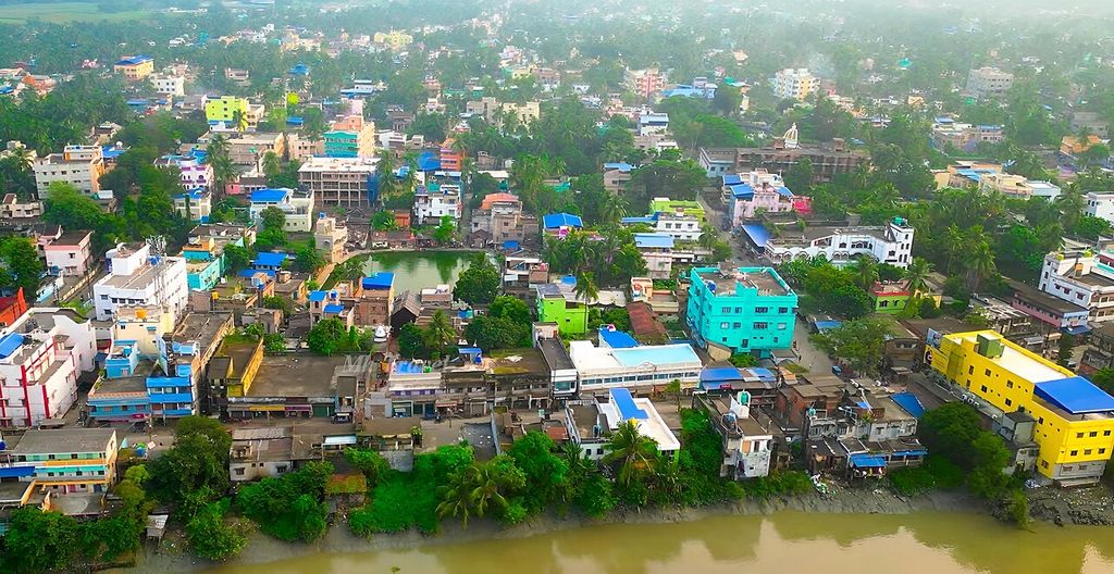
Basirhat aerial view. An aerial tableau of Basirhat, West Bengal, intricating the urban morphology of the city. In “Topography and water”, this view records the form, material and setting discussed in the passage. Source image dated 2024; that date records the image, not the original construction. Soham Bhattacharyya, Basirhat aerial view; CC0. Resized proportionally; no crop, retouch or upscaling.
Climate risk makes historical systems newly relevant. Culverted rivers flood; paved surfaces overheat; old trees offer shade; coastal infrastructure faces sea-level change. Adaptation becomes another urban layer.
Infrastructure and unequal access
Roads, transit, water, sanitation and energy make density possible. They also distribute benefit unevenly. A new boulevard improves movement for some while demolishing housing for others. A sewer may bypass poor districts. A railway can connect region and divide neighbourhood.
Infrastructure is architectural at nodes: station, bridge, market hall, pumping house and interchange. Underground systems still shape street excavation, maintenance and property value. Their designers and workers belong to planning history.
Public health reform drove major nineteenth-century interventions. Clean water and waste removal saved lives, yet reform rhetoric could stigmatise working-class areas and justify clearance. Technical improvement and social control often coexist.
Current planning inherits these alignments. A highway built through a racialised community continues to affect health and wealth. Historical analysis connects map to lived consequence.
Medieval planning without the “organic maze”
Medieval European towns grew from Roman sites, castles, monasteries, ports, markets and deliberate foundations. Some street patterns respond closely to terrain. Others show regular plots and planned market spaces.
Archaeology and plan analysis reveal burgage plots, defences and phases invisible behind later buildings. Historic England’s settlement guidance emphasises buried and standing evidence together.[4]
The word “organic” can describe incremental adaptation but often implies absence of authority. Lords, councils, guilds and religious institutions regulated markets, walls and property. Several jurisdictions could overlap, producing negotiated form.
Founded towns under rulers such as Edward I demonstrate explicit design. The medieval child route develops this evidence. Here the lesson is broader: irregular final form can arise from planned beginning plus centuries of change.
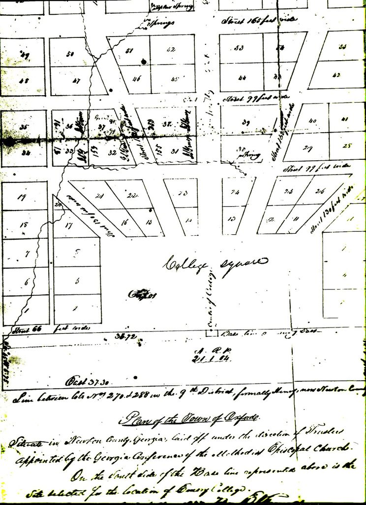
Oxford city plan (1837). A map of the city plan drawn by Edward Lloyd Thomas of the town of Oxford and of Emory College. In “Medieval planning without the “organic maze””, this map records the form, material and setting discussed in the passage. Source image dated 1837; that date records the image, not the original construction. Edward Lloyd Thomas, Oxford city plan (1837); Public domain. Resized proportionally; no crop, retouch or upscaling.
Renaissance and Baroque interventions
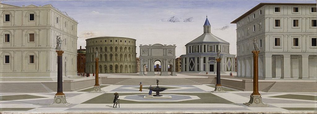
Renaissance urbanism introduced powerful images of geometric and perspectival order, but built examples often concentrated on a square, palace frontage, new district or fortification. Pienza transformed a compact centre; Ferrara added a major extension; Urbino coordinated palace and hill town.
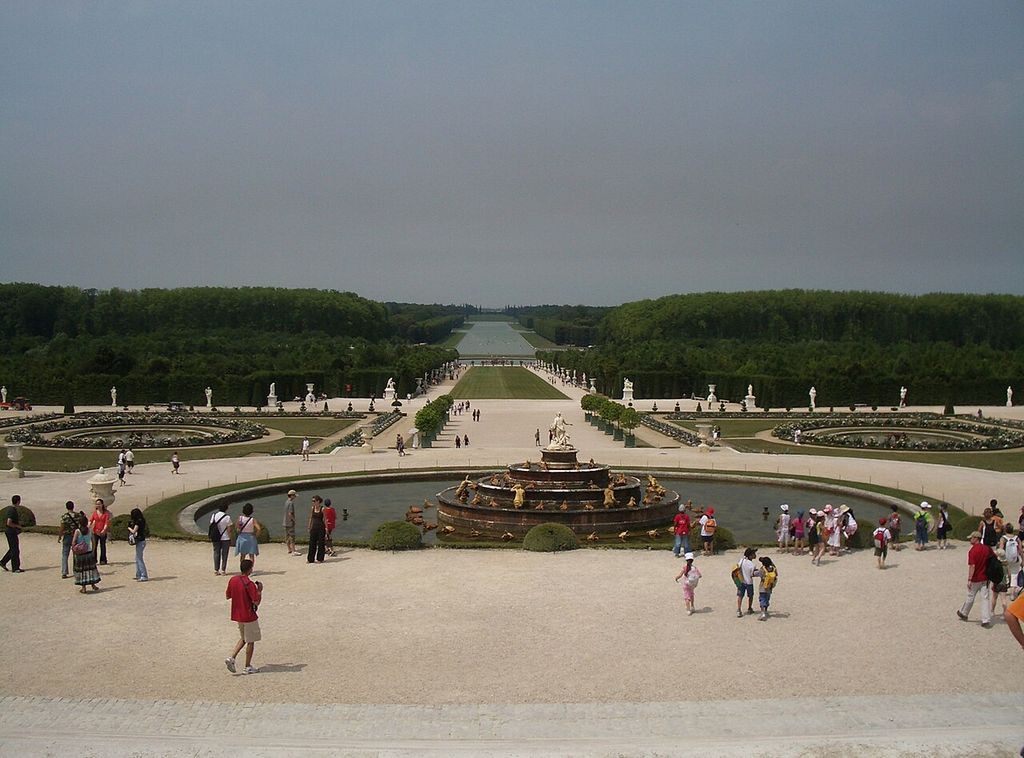
Baroque planning linked routes, monuments and public rooms through movement. Papal Rome used streets, obelisks and fountains across inherited fabric. Nancy coordinated several squares. Versailles joined palace, garden and town axes.
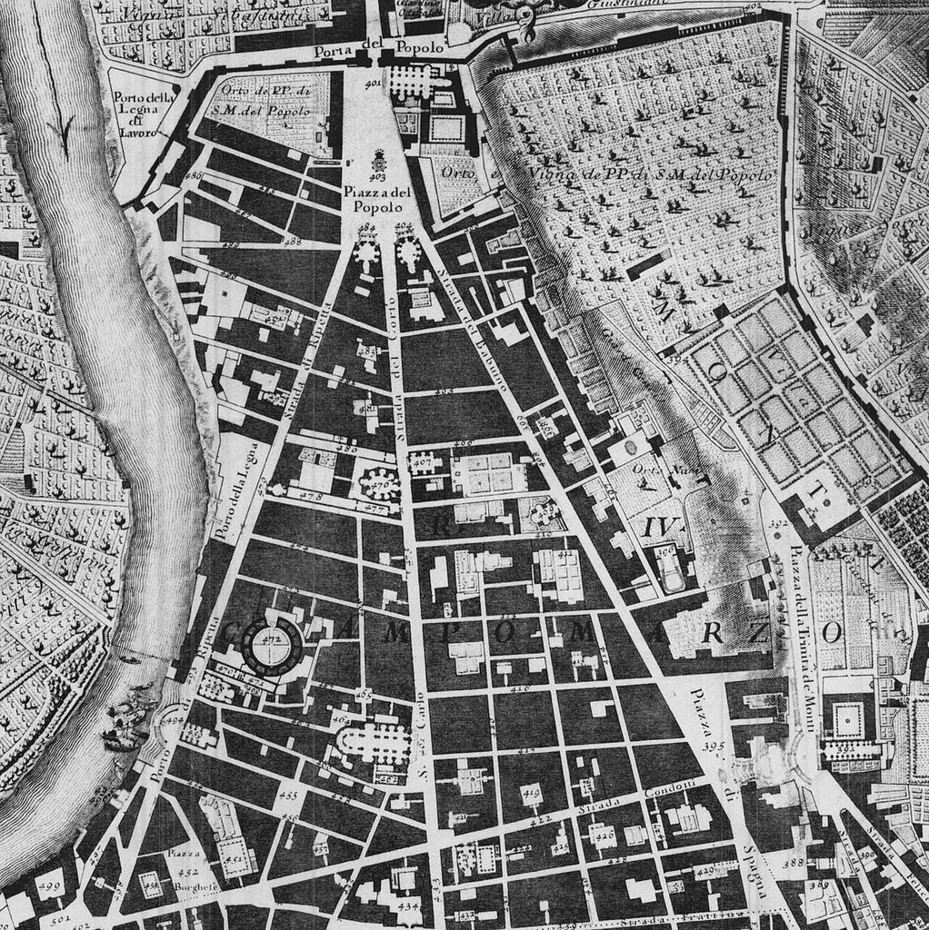
Map of northern Rome, Piazza del Popolo, by Nolli. Karte des nördlichen Roms. In “Renaissance and Baroque interventions”, this map records the form, material and setting discussed in the passage. Source image dated 1748; that date records the image, not the original construction. Giambattista Nolli, Map of northern Rome, Piazza del Popolo, by Nolli; Public domain. Resized proportionally; no crop, retouch or upscaling.
These interventions altered property and movement. The controlled façade could hide irregular plots. Straight streets required clearance. Monumental space expressed court or church authority while enabling circulation and water supply.
The style labels are analytical. Similar geometry can serve different institutions. The child routes keep political and local distinctions visible.
Industrial city and professional planning
Industrialisation accelerated urban growth, pollution and overcrowding. Railways, factories and speculative housing transformed edges faster than many institutions could respond. Sanitary engineering and building regulation expanded.
Planning became professionalised through surveys, commissions and new municipal powers. Reformers linked city form to health, morality and efficiency. Parks, model housing and civic centres offered different remedies.
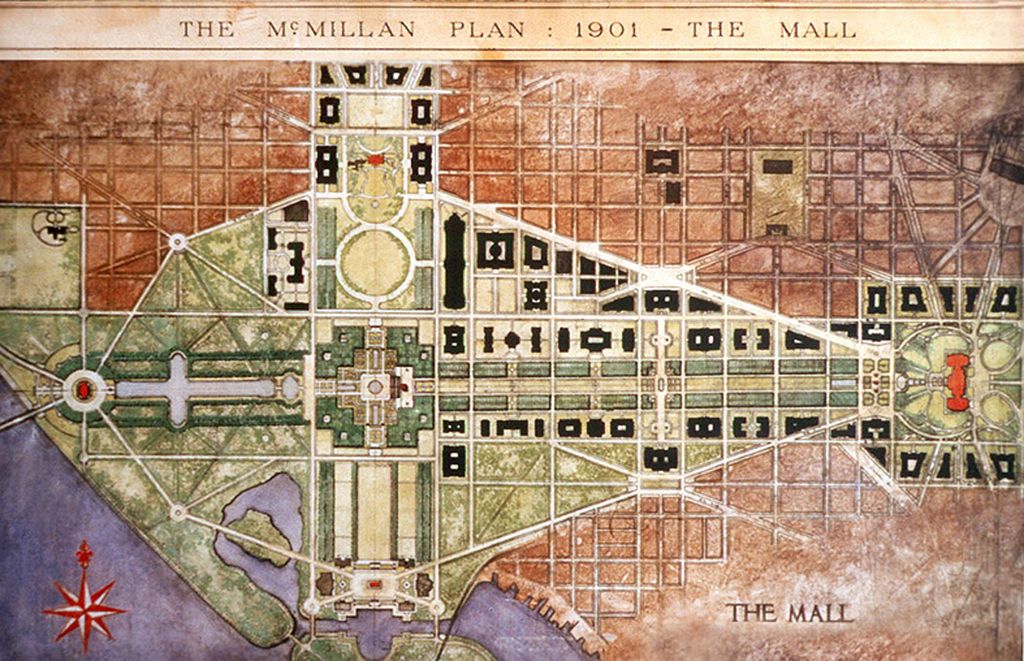
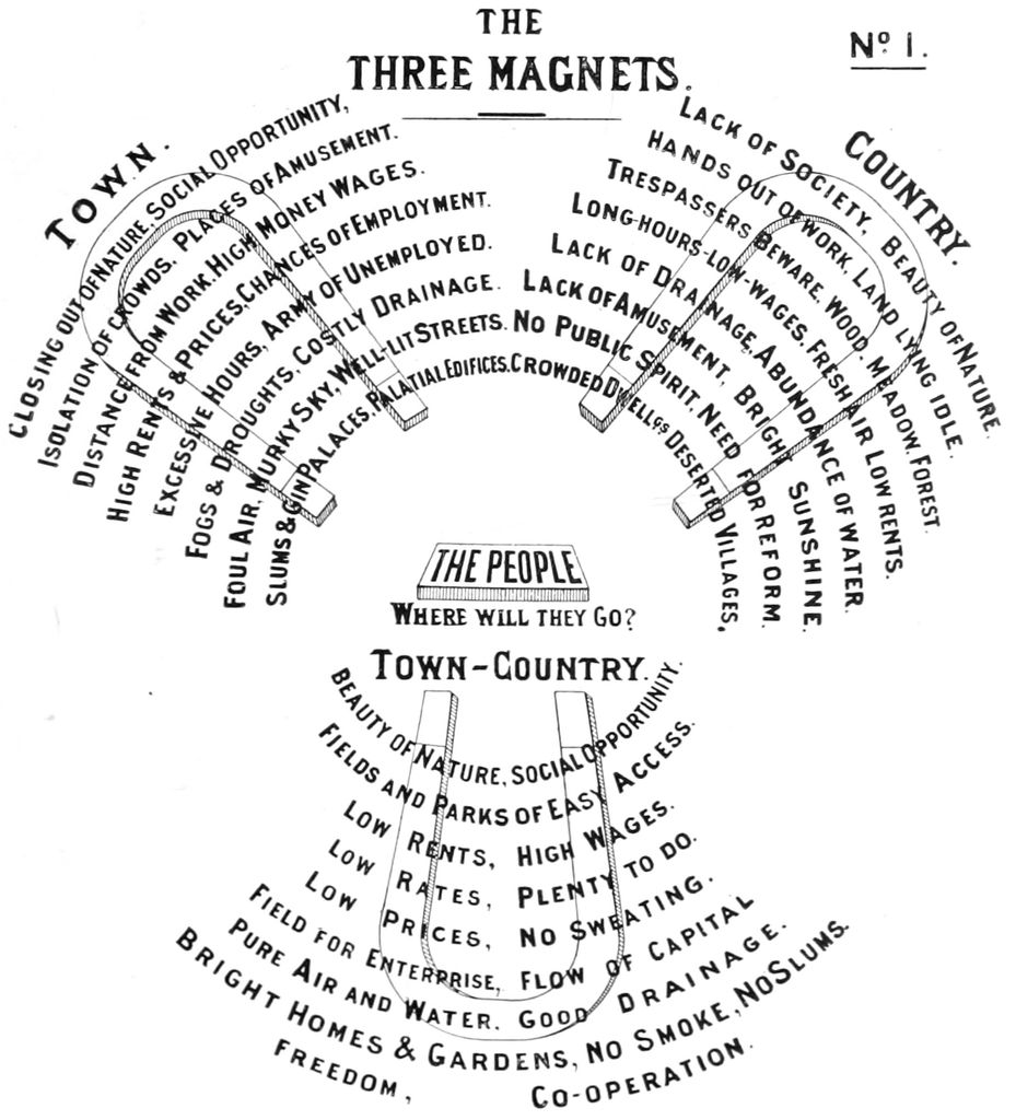
City Beautiful used monumental architecture, parkways and coordinated public space to promise civic improvement. Garden City proposed a more structural town-country settlement with land and economic mechanisms. Neither was simply a style, and both could be diluted into visual branding.
Colonial planning belongs in this history. Grids, cantonments, civil lines and segregated districts were imposed through unequal power, while local communities adapted and resisted. European theories changed in colonial environments and sometimes returned altered.
Plan as image and instrument
Maps appear objective because they use measured lines. They select. A cadastral plan foregrounds property; a sanitary map foregrounds disease; a military survey foregrounds access; a heritage map foregrounds valued fabric.
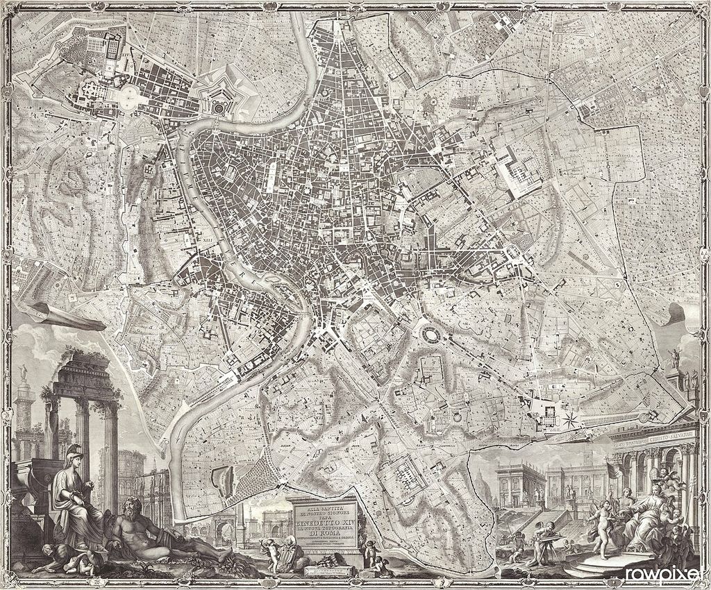
La pianta grande di Roma (The Large Plan of Rome), also known as The Nolli Map by Pietro Campana, Carlo Nolli, and Rocco Pozzi. Original from Yale…. Free download under CC Attribution (CC BY 4.0). In “Plan as image and instrument”, this map records the form, material and setting discussed in the passage. Source image dated 2014; that date records the image, not the original construction. Rawpixel Ltd, La pianta grande di Roma (The Large Plan of Rome), also known as The Nolli Map by Pietro Campana, Carlo Nolli, and Rocco Pozzi. Original from Yale…; CC BY 2.0. Resized proportionally; no crop, retouch or upscaling.
The blank area may not be empty. Informal use, seasonal market, Indigenous land or poor settlement can disappear through cartographic convention. Naming establishes authority.
A proposal plan persuades. Grand axes and coloured zones make intervention seem coherent. Demolition can be shown as clean white space. Three-dimensional renderings present mature trees and active public life before funding or governance exists.
Historians read plans against photographs, law, budgets and resident testimony. GIS overlay can reveal persistence and clearance, but digitisation choices should remain documented.
Public space and contested publicness
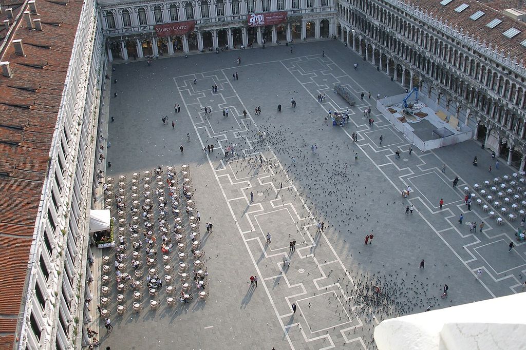
Streets, squares, parks and waterfronts are called public, yet their uses are regulated. Rights to trade, protest, sit, perform or sleep vary. Ownership can be public while management is exclusionary; a private development can mimic a civic square.
Paving, shade, seating and active edges influence daily life. Monumental scale can support assembly or make a space hostile. Security barriers and surveillance change movement without altering historic façades.
The piazza child route examines the urban room in depth. For planning history, the key is that publicness is institutional and social as well as spatial. A square is not public merely because the plan leaves it blank.
Informal appropriation can remake planned space. Street vending, festivals and protest create time-based cities that official maps omit.
Segregation, clearance and resistance
Planning distributes land and movement, so it can segregate deliberately or indirectly. Zoning, covenants, infrastructure and service boundaries shape who can live where. Monumental projects can clear communities in the name of health or beauty.
The City Beautiful history in Washington includes the displacement of the African American community of Reno City under intersecting institutional pressures.[5] That case should not be universalised, but it makes the cost of abstract improvement visible.
Communities are not passive. Residents petition, build, adapt houses, rename places and preserve networks. Informal additions can be rational responses to inadequate official provision.
An ethical history includes both planner and planned-upon. It asks whose evidence survives in archives and whose city is treated as disorder.
Historic Urban Landscape
UNESCO’s 2011 Recommendation on the Historic Urban Landscape responds to the limits of monument-centred conservation.[3] It treats urban heritage as layered cultural and natural values, integrating development and community.
The framework is current policy, not a description ancient cities used for themselves. Its value lies in guiding present decisions: map character beyond landmarks, engage stakeholders, assess vulnerability and integrate conservation with sustainable development.
Córdoba’s UNESCO Urban Heritage Atlas illustrates layered mapping of a city shaped through Roman, Islamic, Christian and modern histories.[6] No single period can own the whole urban landscape.
The approach also raises difficult priorities. Protecting a skyline can constrain housing; tourism can displace residents; climate adaptation can alter fabric. Participation does not eliminate conflict, but it makes values explicit.
How to read a city historically
Work across scales:
- map terrain, water and regional routes;
- identify street hierarchy, gates and infrastructure;
- analyse blocks, plots and building types;
- date plans against actual construction;
- record law, finance and governing institutions;
- identify demolition, displacement and unequal service;
- recover daily use and community adaptation;
- distinguish preserved fabric, reconstruction and heritage staging.
Walk the city as well as mapping it. Slope, noise, shade, crossing time and inaccessible edges reveal what aerial geometry hides.
Urban planning history is most accurate when no one plan is allowed to become the city. Built form is a negotiation among intention, property, infrastructure, environment and inhabitants. Its apparent disorder may preserve long social intelligence; its apparent order may conceal conflict. Both deserve precise evidence.
Who plans: authority distributed across time
Planning histories often arrange a sequence of famous designers. Cities are more frequently produced by interacting powers: landowners release plots, councils regulate streets, utility companies lay networks, developers finance buildings, courts decide disputes and residents modify what results. A single plan may coordinate some of these actors without controlling all of them.
This distribution is visible in the archive. Minutes record decisions; cadastral plans record ownership; engineering drawings show pipes; building applications show negotiation; tax and census records show occupation. No source is a complete urban model.
Informal action is planned action too. Residents subdivide rooms, establish markets and create paths in response to need. State recognition may arrive later. The absence of an authorised drawing does not mean the absence of foresight, rules or collective intelligence.
Property as the hidden geometry
Street façades can change rapidly while plot boundaries persist. A row rebuilt behind a common elevation may retain narrow medieval parcels; an industrial owner may amalgamate them into one deep site; later redevelopment may preserve only the outer block line. UCL's morphological research demonstrates the value of tracing these units through time.[2]
Property constrains ambitious plans. A straight boulevard requires purchase, expropriation or negotiation. Compensation determines who bears cost. Small irregular remnants may survive because acquisition failed, leaving geometry that records conflict.
Land value also follows public investment. A station or park can enrich adjacent owners while displacing tenants through rising rent. Planning history must therefore follow finance after the ribbon-cutting.
Infrastructure has a section and a catchment
A line on a map is not enough to explain water, sewer, transit or road. Engineers work with gradient, capacity, ground and connections. A pipe serves a catchment; a bridge creates approaches; a railway station demands yards and feeder streets.
Infrastructure also creates maintenance territories. Access covers, substations, depots and easements occupy urban space even when hidden from heritage views. Renewal can reopen archaeological deposits or require the removal of mature trees.
Historical inequality persists through networks. A neighbourhood denied sewers or rapid transit carries health and economic consequences long after the original decision. The physical line and the administrative boundary should be mapped together.
Colonial cities and the power to classify space
Colonial administrations surveyed land, imposed grids, created cantonments and separated official, commercial and residential districts. These interventions worked through legal inequality as well as geometry. Indigenous settlements could be labelled congested or unsanitary while European quarters received services and space.
Local builders and residents adapted imposed forms. Markets occupied planned streets; houses altered imported types; political protest claimed ceremonial spaces. Colonial plans never possessed total control.
The archive itself is asymmetrical. Official maps are abundant; displaced communities may survive through oral history, vernacular records and archaeology. Reading only the survey reproduces its authority.
Rebuilding after fire, war and disaster
Catastrophe creates an apparent blank slate, but land ownership, surviving infrastructure and the right of return remain. Post-fire regulations may widen streets and require new materials. War reconstruction may restore historic silhouettes, build modernist districts or combine both.
Speed favours powerful institutions. Emergency clearance can destroy reparable fabric; displaced residents may be excluded from the rebuilt centre. Conversely, infrastructure renewal and safer standards can produce genuine public benefit.
Comparison should separate the disaster from the choices made after it. A rebuilt city is not the inevitable physical expression of loss; it is a political project undertaken under constrained conditions.
Data, models and the contemporary planning archive
Digital twins, mobility traces and environmental sensors promise a continuously measured city. They expand evidence but preserve old questions: who is counted, who owns the data, what behaviour is invisible and which model assumptions guide investment.
GIS overlay is especially valuable for historical work. It can align old cadastral maps, aerial photographs and present parcels to reveal persistence or clearance. Accuracy depends on georeferencing and source scale; a clean composite can conceal metres of uncertainty.
Models should support, not replace, street knowledge. Noise, shade, fear, informal care and social belonging resist easy quantification. The city is both measurable fabric and lived claim.
Climate adaptation as a new historical layer
Flood storage, urban trees, cool surfaces and building retrofit will alter historic places. Monument-only protection can obstruct necessary change; uncritical engineering can erase character and archaeology. The Historic Urban Landscape framework offers a way to consider natural, cultural and social values together.[1][3]
Adaptation should begin with inherited intelligence: old watercourses, arcades, courtyards and tree networks may already moderate climate. Their performance must be tested under future conditions rather than celebrated romantically.
The aim is not to hide the new layer. A floodable square or shaded transit route can be designed with historic grain while clearly belonging to the present. Cities have always changed through infrastructure; the ethical issue is how benefits and burdens are distributed.
A worked reading: Córdoba across layers
The Córdoba Urban Heritage Atlas offers a way to hold Roman routes, Islamic urbanism, Christian institutions and modern development in one analytical field.[6] It does not make those periods equivalent or turn the city into a collage without power. Each layer has its own sources and surviving patterns.
Mapping can show reuse: a route persists under another name; a religious building occupies earlier fabric; a river edge changes with infrastructure. It can also reveal absence, including cleared quarters and uses missing from monumental inventories.
The atlas is most valuable when joined to resident knowledge and field observation. A mapped heritage value may be inaccessible, over-touristed or socially contested. The tool supports decisions; it does not make them automatically.
Writing an urban history without a heroic planner
Begin each intervention with the problem as contemporaries defined it, then identify authority, land, finance, design, construction and consequences. The named planner may connect these stages but rarely controls all of them.
Follow the project after completion. Maintenance, property change and resident adaptation can reverse its intention. A parkway becomes a traffic barrier; a market hall becomes cultural venue; a cleared district becomes a protest site.
This longer chronology produces a more truthful page. Planning is neither the triumph of geometry nor an uninterrupted history of harm. It is a powerful, uneven practice whose physical decisions endure and remain open to democratic revision.
Time budgets and the unequal city
Distance is not experienced only in kilometres. A reliable transit line, safe crossing and shaded pavement change the time and effort required to reach work, school or care. Planning distributes those daily budgets.
Historical maps can be combined with timetables and resident accounts to reconstruct accessibility. A grand avenue may shorten ceremonial movement while a railway barrier lengthens local journeys. Average travel time can conceal burdens carried by one district.
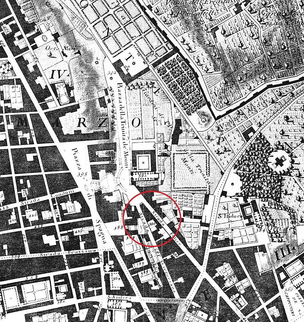
Nolli Map Rome, (1748) Cutout with Palazzo Zuccari. Nolli map from 1748, the Palazzo Zuccari circled in red between Strada Gregoriana (today Via Gregoriana) and Strada Felice (today Via Sistina). In “Time budgets and the unequal city”, this map records the form, material and setting discussed in the passage. Source image dated 2024; that date records the image, not the original construction. Romplan des Giovanni Battista Nolli (1701-1756), Nolli Map Rome, (1748) Cutout with Palazzo Zuccari; Public domain. Resized proportionally; no crop, retouch or upscaling.
This temporal perspective links form to justice without assuming that one compact geometry guarantees equality. Institutions, fares and safety complete the network.
Heritage-led regeneration and displacement
Restoring markets, waterfronts and industrial districts can bring investment and public access. It can also raise rents and replace existing commerce. Preservation and displacement are not opposites automatically.
Baseline evidence should record tenure, business and community use before work begins. Benefits such as repaired housing and cleaner public space are real, but so is the loss of social networks if residents cannot remain.
The Historic Urban Landscape approach is valuable because it connects cultural significance to development management.[1][3] Its promise depends on participation influencing land and finance, not only interpretation panels.
Monitoring must continue after investment. Changes in rent, tenure, business mix and public access reveal whether stated community benefits endured or became promotional language.
Publishing those indicators makes regeneration accountable to the people whose neighbourhood supplied its heritage value.
Night planning and the twenty-four-hour city
Lighting, late transport, licensing and shift work create a city different from the daytime plan. Bright commercial corridors can border dark residential routes; a station that closes early changes access to employment. Historic entertainment and market districts often depended on nocturnal regulation.
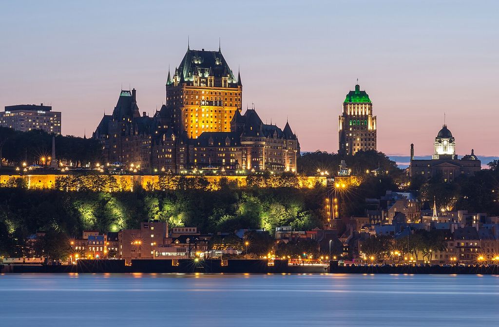
Québec city at night, view from Lévis city. In “Night planning and the twenty-four-hour city”, this map helps identify historic city plan map. Source image dated 2017; that date records the image, not the original construction. Wilfredor, Québec city at night, view from Lévis city; CC BY-SA 4.0. Resized proportionally; no crop, retouch or upscaling.
Night surveys should map light, sound, gendered safety and workers' journeys. Illumination can reveal monuments while harming residents and ecology. The design problem is distribution, not simply more or less light.
This temporal layer also protects against a tourist view in which the historic centre exists only during opening hours. Homes, deliveries, cleaning and care continue when monuments close.
Children and intergenerational planning
School routes, play space and independent mobility test street design at a fine scale. A city that appears connected to an adult driver may be fragmented for a child. Older people experience crossing time, shade and seating differently again.
Historical demographic evidence can show how household patterns changed, though it should not romanticise past street danger. Present engagement with different ages adds needs absent from master-plan archives.
Planning for long lives also changes the time horizon. Trees, housing adaptability and transit investment should be judged across generations, much like the inherited urban fabric itself.
Watch: layers, morphology and conservation
Choose The History of Urban Planning as a Historical Project, Introduction to Theory of City Form or New Urbanism 101: The History of Planning. Together, the films connect architectural form with material, use and historical setting.
The History of Urban Planning as a Historical Project
Vittorio Magnago Lampugnani examines how planning history itself is constructed
Watch on YouTubeDiscussion
Which building or designed landscape most clearly demonstrates Urban Planning in Architectural History, and what physical evidence supports that reading?
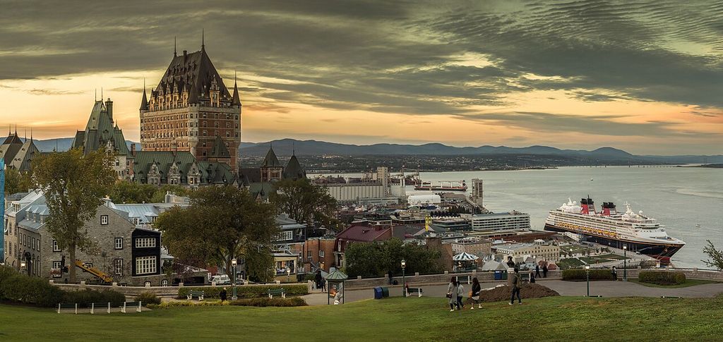
Château Frontenac city at night. The Fairmont Le Château Frontenac, formerly and commonly referred to as the Château Frontenac, is a historic hotel located in Quebec City, Quebec, Canada. In “Children and intergenerational planning”, this map helps identify historic city plan map. Source image dated 2018; that date records the image, not the original construction. Wilfredor, Château Frontenac city at night; CC BY-SA 4.0. Resized proportionally; no crop, retouch or upscaling.
Reader Insights
Name the material, joint, opening, route or view you can observe.
Give the place, approximate date and a reliable source.
Separate documented history from your interpretation.
Join the Conversation
Share a concise observation or useful source below.
References
- UNESCO World Heritage Centre, Historic Urban Landscape portal. View source
- University College London, doctoral thesis on London urban morphology. View source
- UNESCO, 2011 Recommendation on the Historic Urban Landscape. View source
- Historic England, Settlement Sites to 1500: Selection Guide. View source
- US National Park Service, “Fort Reno Park: A Brief History of Reno City.” View source
- UNESCO World Heritage Centre, Córdoba Urban Heritage Atlas. View source