by Tom Gurney
Tom Gurney BSc (Hons) is an art history expert with over 20 years experience
Email: tomgurney1@gmail.com / Phone: +44 7429 011000
Reading Axial Planning
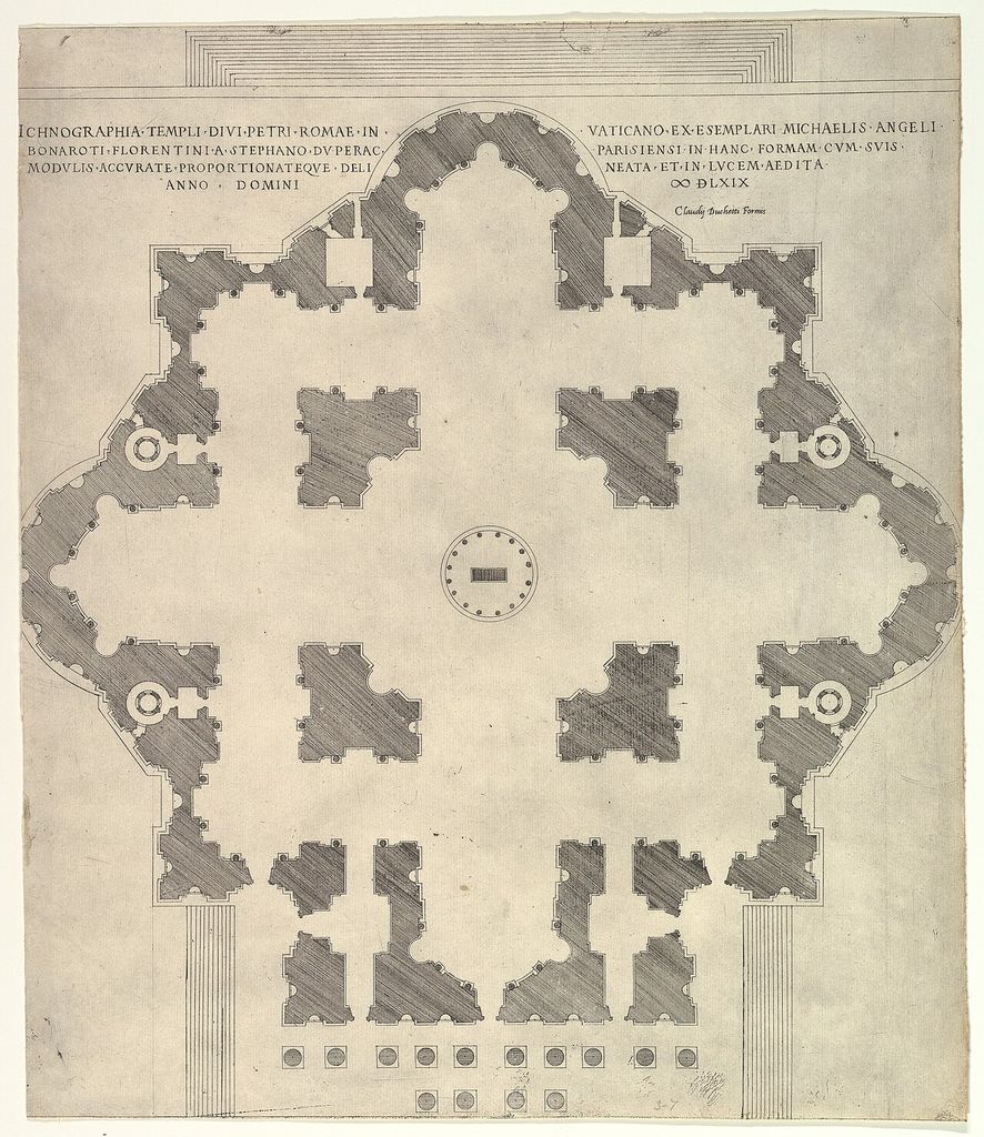
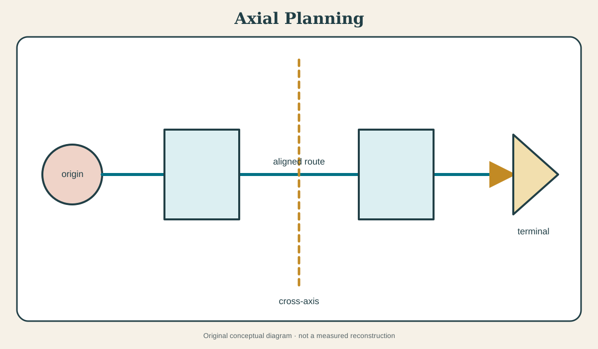
Axial planning organises architecture or landscape along one or more dominant lines of movement, sight, symmetry or ceremony. An axis is not necessarily a physical object. It becomes legible because streets, gates, buildings, monuments, water, trees or horizon align around it. A path can follow the axis; a vista can reveal it; a building can terminate it. None of those terms is automatically identical to the axis itself.
The method appears in many cultures and periods without one universal origin. Beijing’s Central Axis, Versailles, Washington’s National Mall and Brasília all use powerful lines, but they serve different ritual, political and functional systems. Similar geometry is the beginning of comparison, not proof of shared meaning.[1][2][3][4]
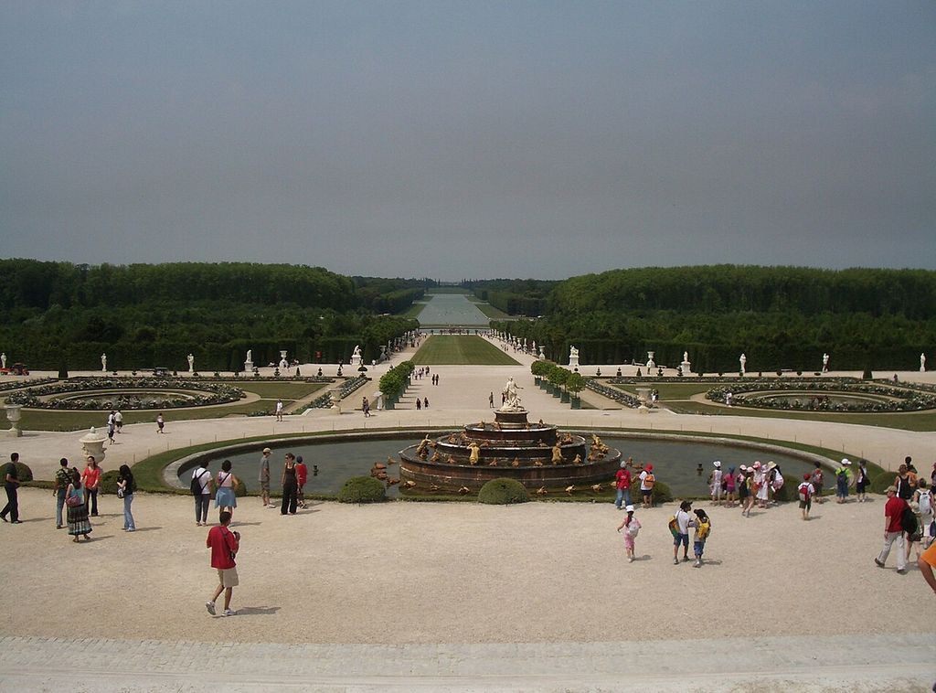
Versailles palace garden axis aerial. The Château de Versailles (or in English, the Palace of Versailles ) is a royal château located in Versailles , 15 km from Paris . In “Reading Axial Planning”, this view records the form, material and setting discussed in the passage. Source image dated 2006; that date records the image, not the original construction. Michael Plasmeier (ThePlaz) [1], Versailles palace garden axis aerial; CC BY 2.5. Resized proportionally; no crop, retouch or upscaling.
At a Glance
- Axisan organising line or directional relationship.
- Routethe path bodies or vehicles can actually follow.
- Vistaa framed view, which may align with an axis but need not be passable.
- Node and endpointcrossings, monuments or buildings that make the line legible.
- Essential cautionaerial symmetry can conceal slope, barriers, lateral life, demolition and incomplete implementation.
Contents
- An invisible line made architectural
- Axis, avenue, vista and grid
- Beijing’s Central Axis
- Versailles: palace as hinge
- Washington: L’Enfant, McMillan and the Mall
- Brasília: intersecting modern axes
- Sacred, ceremonial and everyday movement
- Axis and power
- Construction, clearance and incomplete lines
- Multiple axes and productive contradiction
An invisible line made architectural
Draw a line through a palace door, fountain and distant canal. The line is abstract, but the aligned elements make it perceivable. Shift one object and the relationship changes even if the path remains.
Axes can be bilateral, with mirrored spaces on either side, or directional without strict symmetry. Several axes can cross. A minor cross-axis can organise local access while the principal line carries ceremony.
An endpoint gives direction. A dome, mountain, gate or memorial draws the eye. Some axes continue visually beyond the endpoint; others terminate decisively. A central object can interrupt and redirect.
Section affects legibility. A hill hides the destination until a crest. A sunken route preserves a view while moving traffic. A long flat line exaggerates distance. Plan alone is insufficient.
Axis, avenue, vista and grid
An avenue is a broad route, often lined with trees or buildings. It may lie on an axis. A vista is a composed view, sometimes across inaccessible ground or water. A grid is a repeated network of crossing streets; one street may be emphasised as an axis.
Confusing them produces weak claims. A straight road is not automatically axial planning if it lacks broader organising relation. A ceremonial axis may contain no continuous road. A city can have a grid without one dominant line.
Radial planning sends several routes from a node. Each ray can be axial, but the system’s distinctive logic lies in convergence. Baroque and City Beautiful projects often combine axial and radial devices.
The word is analytical. Historical sources may use another term. Local planning vocabulary should remain visible.
Beijing’s Central Axis
Beijing’s Central Axis is a long north–south ensemble of gates, palace and ritual spaces, public landmarks and urban relationships developed through dynastic and modern history. UNESCO’s nomination dossier supplies detailed Chinese planning concepts, components and chronology.[1]
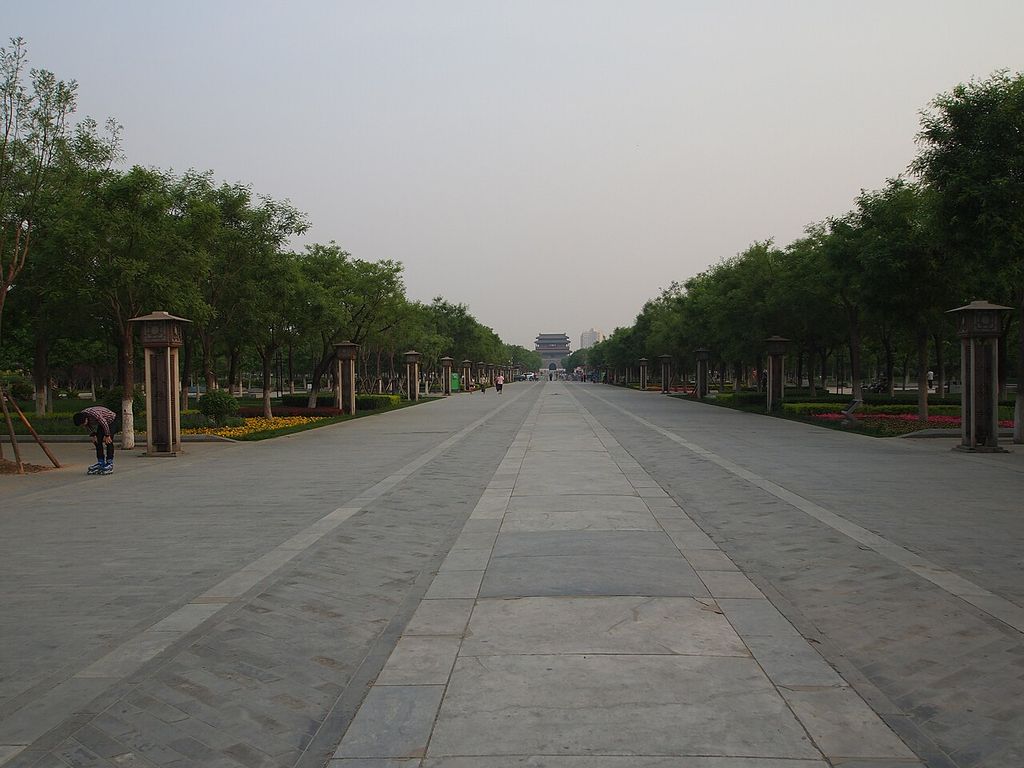
北京中轴线 - Central Axis of Beijing - 2012.05 - panoramio. 北京中轴线 - Central Axis of Beijing - 2012.05. In “Beijing’s Central Axis”, this view records the form, material and setting discussed in the passage. Source image dated 2012; that date records the image, not the original construction. rheins, 北京中轴线 - Central Axis of Beijing - 2012.05 - panoramio; CC BY 3.0. Resized proportionally; no crop, retouch or upscaling.
The axis organises the Forbidden City and extends through a larger capital. Sequence, enclosure and hierarchy matter. Successive gates regulate approach; courtyards make movement episodic; elevated halls occupy controlled positions.
The line belongs to Chinese cosmology, state ritual, geomancy and capital planning on its own historical terms. It should not be described as “Baroque before Europe” merely because it is long and ceremonial.
Modern Beijing transformed portions through roads, public squares and new functions. The axis is not a frozen imperial object. Heritage recognition negotiates living city, state representation and conservation.
Its architecture demonstrates that an axis can be temporally layered while remaining conceptually powerful. Gates or walls may disappear; public access can change; the organising relation persists through reinterpretation.
Versailles: palace as hinge
Versailles coordinates town approach, palace and garden through powerful axes. On the garden side, the principal line passes through parterres, fountains and Grand Canal towards the horizon. Cross-axes and enclosed groves complicate it.[2]
The palace acts as hinge between two spatial systems. Town avenues converge from one side; court landscape unfolds on the other. The king’s rooms and ceremonial routes give the line political hierarchy.
Topography and hydraulics make the abstract order material. Earth was moved, trees planted and water pumped. The axial image of control depended on infrastructure and continuous labour.
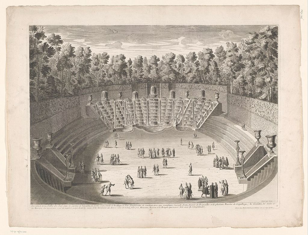
The visitor on foot experiences stages rather than totality. Basins disappear behind level changes. Groves offer local worlds. This difference between sovereign overview and bodily route is central.
Washington: L’Enfant, McMillan and the Mall
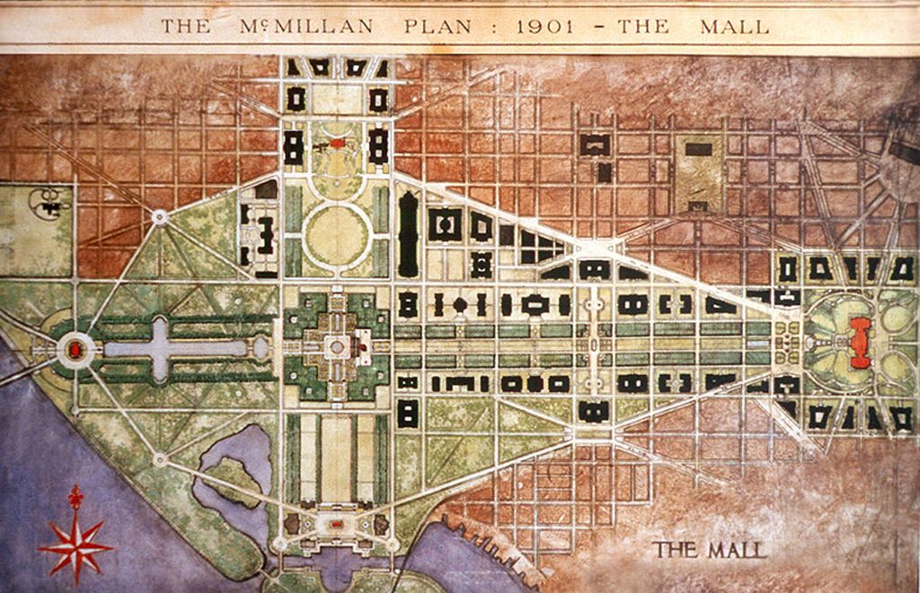
Pierre L’Enfant’s 1791 plan for Washington overlaid a grid with broad diagonal avenues and symbolic sites. The McMillan Commission of 1901–02 reinterpreted its monumental core through City Beautiful and Beaux-Arts ideas. NPS histories distinguish these layers.[3][5]
The National Mall became a long landscape axis connecting major institutions and memorials. Cross-axis relationships and the White House complicate the simple line. Museums, trees, roads and events shape occupation.
Implementation required removal and relocation, including rail infrastructure. It unfolded over decades. Invoking L’Enfant gave historical legitimacy to later choices, but the current Mall is not a literal execution of one founding drawing.
Public use transforms the ceremonial axis. Protest marches, festivals, recreation and tourism make a national stage available to claims that may challenge government. Geometry can support authority and dissent.
Brasília: intersecting modern axes
Brasília, planned by Lúcio Costa with major architecture by Oscar Niemeyer, uses intersecting axes to organise a new capital. UNESCO recognises its modern urban design.[4]
The Monumental Axis contains governmental and civic institutions. The curved residential axis organises superquadras and movement. Their crossing establishes the urban centre.
The popular description of the plan as an airplane or bird is memorable but incomplete. Costa’s conceptual diagrams and the city’s functional organisation matter more than resemblance. Metaphor should not substitute for street scale and occupation.
Built life exceeded the pilot plan. Satellite cities, commuting, inequality and adaptation complicate the monumental image. The formal axis remains powerful while the metropolitan region develops another geography.
Brasília shows that a clearly planned line does not guarantee convenient pedestrian experience or social equality. Monumental scale and vehicular design distribute access.
Sacred, ceremonial and everyday movement
Axes can align temple, tomb, gate or altar. Procession makes them temporal. A person passes thresholds and approaches a focal point under rules of access.
Ceremonial movement is not everyday circulation. A royal avenue may be kept clear for procession while side streets carry trade. A sacred axis may be visually direct but physically restricted.
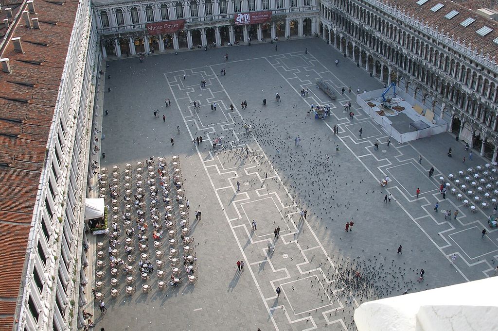
Daily life occupies edges. Vendors, crossings and local routes interrupt the ideal line. These are not necessarily failures; they show the city adapting.
Analysis should map several users. The ruler’s route, visitor’s route, service route and protest march can inhabit one axis differently.
Axis and power
The long controlled line is often associated with authority because it coordinates land and monuments. It can make the palace or state visible, stage military parade and organise surveillance.
That reading requires institution. A community procession, market street or memorial walk may use axial form for collective purposes. Symmetry is not intrinsically authoritarian.
Implementation can reveal power more clearly than shape. Were neighbourhoods cleared? Who financed the line? Which monuments were privileged? Who may cross the central ground?
The viewpoint also matters. An elevated ruler sees comprehensive order; a pedestrian encounters distance and control points. The axis can claim unity while lived access remains unequal.
Construction, clearance and incomplete lines
Axes are expensive because existing cities contain property and people. Opening a street requires acquisition and demolition. Levelling and drainage alter terrain. Monumental endpoints need coordinated funding.
Many projects remain partial. A line stops at an older block; one side develops; an intended monument is never built. Later planners may complete or redirect it under another ideology.
Plans often show clearance as blank space. Historical overlays recover removed buildings. Oral and community history recover lives lost from the diagram.
In landscapes, mature avenues take decades. Tree failure breaks the line. Replanting all at once restores uniform age but removes surviving veterans; phased replacement changes rhythm temporarily.
Multiple axes and productive contradiction
A dominant line can intersect secondary systems. Versailles’s groves make enclosed rooms beside the main axis. Washington’s cross routes support museums and city movement. Beijing’s east–west streets cross the imperial sequence. Brasília’s two main axes structure different programmes.
These intersections prevent the axis from explaining everything. Blocks, neighbourhoods and ecological systems have their own logic. A successful analysis shows where axial order is strong and where it yields.
Misalignment can be intentional. A mosque entrance may align with an urban square before turning towards qibla. A palace axis can bend around terrain. Geometry negotiates other obligations.
The most revealing urban moments often occur at crossings, where several authorities and movements meet.
How to read an axial plan
- Identify the abstract line and the elements that make it visible.
- Separate route, vista, avenue and grid.
- Locate nodes, crossings, endpoints and visual continuation.
- Draw longitudinal and transverse sections.
- Map ceremonial, everyday, service and restricted movement.
- Reconstruct property, clearance and incomplete implementation.
- Date later monuments, planting and traffic systems.
- Interpret political meaning from institutions, not symmetry alone.
Photograph from endpoints and from the side. The canonical centred view conceals lateral architecture and barriers.
Conservation and adaptation
An axis can survive conceptually while components change. Protecting it may require view-corridor planning, tree management and height controls. Too rigid a rule can freeze city development; too weak a rule can make the relationship unreadable.
Traffic often occupies ceremonial lines. Pedestrianisation can recover public use but changes access. Security zones interrupt routes. New memorials alter hierarchy.
Climate adaptation raises difficult choices. Shade trees improve long exposed malls while potentially narrowing vistas. Stormwater landscapes change flat lawns. Decisions should model both historical view and public comfort.
UNESCO’s comparative urban-development work reminds us that planning history and conservation operate at several scales.[6] The axis should be preserved as part of a living system, not as an empty arrow.
Axial planning is powerful because a line can coordinate enormous complexity. Its danger is the same: the line can make everything outside it appear secondary. Good history restores cross streets, workers, residents, water, terrain and change while still explaining why the axis remains visible.
Beijing: an axis accumulated across dynasties
Beijing's Central Axis connects gates, ceremonial spaces, imperial precincts and later civic monuments through a north–south order. Its current heritage meaning includes successive dynastic and modern transformations. The line is continuous as an organising idea even where buildings, access and political meanings change.
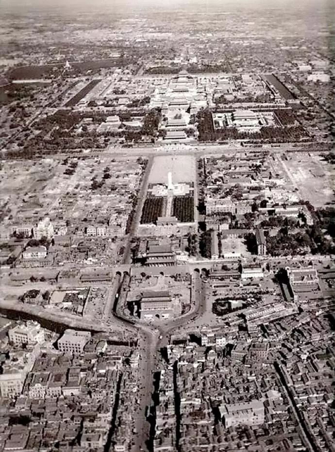
Beijing Central Axis aerial city. 北京市中心航拍图。注意图中的中华门仍在,人民英雄纪念碑已经建成,广场两侧人民大会堂和中国历史博物馆(今中国国家博物馆)尚未动工。人民英雄纪念碑于1958年年中揭幕;中华门拆除于1959年;人民大会堂和博物馆是1959年献礼建筑,当年兴工并竣工。证明此图拍摄时间约在1958年至1959年间。. In “Beijing: an axis accumulated across dynasties”, this view records the form, material and setting discussed in the passage. Source image dated 1958; that date records the image, not the original construction. Unknown photographer, Beijing Central Axis aerial city; Public domain. Resized proportionally; no crop, retouch or upscaling.
Approach historically depended on hierarchy. Not every person could pass through every gate or occupy the central path. The axis ordered privilege as well as orientation. Present public access and tourism create a different civic experience.
Courtyards and transverse spaces repeatedly thicken the line. The city is not a corridor: side districts, hutongs and markets make an urban fabric that the central diagram cannot represent. Protecting the axis should not entail erasing the life around it.
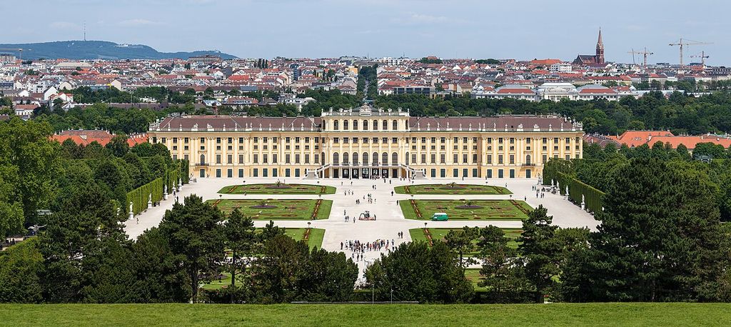
Schönbrunn Palace and central garden axis from the Gloriette. Schönbrunn Palace in Vienna , Austria. In “Beijing: an axis accumulated across dynasties”, this view records the form, material and setting discussed in the passage. Source image dated 2014; that date records the image, not the original construction. Thomas Wolf , www.foto-tw.de, Schönbrunn Palace and central garden axis from the Gloriette; CC BY-SA 3.0 de. Resized proportionally; no crop, retouch or upscaling.
Versailles: axis as hinge rather than arrow
At Versailles, palace sits between town approaches and garden prospect.[2] The main line changes meaning as it crosses forecourt, state rooms, terrace, water and distant landscape. It is not simply a road pointing outward.
Cross-axes, groves and service routes complicate the central view. Court ritual gave different users different degrees of access. The most commanding prospect belonged to a carefully controlled position.
Topography and optical adjustment help maintain apparent continuity across distance. A plan shows alignment; a section explains why features remain visible or disappear.
Washington: two historical plans on one civic line
L'Enfant's capital combined a grid with diagonal avenues and monumental reservations. The McMillan Commission later recovered, altered and extended that inheritance through a City Beautiful vision of the Mall.[3]
The resulting civic axis is a palimpsest. Museums, memorials, trees, roads and public events arrived at different dates. Treating the current aerial image as one founding act hides political choices and unrealised alternatives.
The Mall's openness enables national ceremony and protest. Its power derives partly from the fact that citizens can appropriate a monumental governmental space for claims the planners did not foresee.
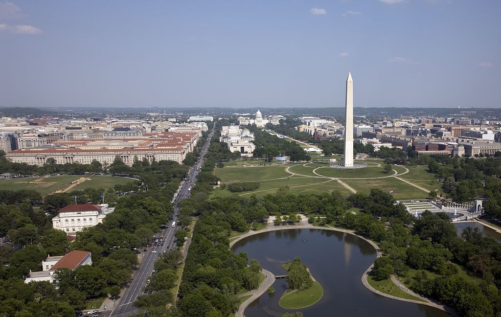
Aerial view of the National Mall, Washington, D.C. The Washington Monument is an obelisk near the west end of the National Mall in Washington, D.C., built to commemorate the first U.S. In “Washington: two historical plans on one civic line”, this view records the form, material and setting discussed in the passage. Source image dated 2008; that date records the image, not the original construction. Carol M. Highsmith, Aerial view of the National Mall, Washington, D.C; Public domain. Resized proportionally; no crop, retouch or upscaling.
Brasília: intersecting axes and unequal metropolitan growth
Brasília's Pilot Plan is organised through intersecting monumental and residential axes. The diagram efficiently distinguishes functions and produces a memorable national image. At ground level, grade separations, superblocks and large distances structure daily movement.
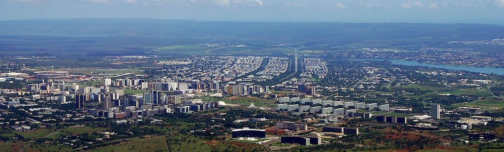
Brasilia Monumental Axis aerial. Aerial view of downtown Brasília (Plano Piloto) along the Monumental Axis from the new Mane Garrincha Arena/Estadio Nacional (left) to the Brazilian Federal Congress/Square of the Three Powers (right). In “Brasília: intersecting axes and unequal metropolitan growth”, this plan records the form, material and setting discussed in the passage. Source image dated 2013; that date records the image, not the original construction. Mariordo (Mario Roberto Duran Ortiz), Brasilia Monumental Axis aerial; CC BY-SA 3.0. Resized proportionally; no crop, retouch or upscaling.
The planned core cannot represent the whole metropolitan reality. Construction workers and later residents created satellite settlements beyond the celebrated form. Social geography exposes the limit of evaluating the capital only from the air.
Conservation faces a genuine dilemma: protect the spatial scale that defines the modernist project while enabling transit, accessibility, housing and active public life. Monumental emptiness is both heritage characteristic and lived challenge.
Axis as ritual and calendar
Some alignments relate architecture to sunrise, pilgrimage or procession. Such claims require measurement and historical evidence. A line that roughly faces an astronomical event may reflect terrain or convention rather than deliberate calculation.
Where documented, the axis can become temporal. Sunlight reaches a threshold on a particular date; a procession activates streets annually; a ruler's route gives gates their hierarchy. The plan is completed by event.
Modern roads can preserve the line while eliminating its former pace. A ceremonial walk and a traffic corridor are geometrically similar but experientially opposed.
Clearance and the cost of the uninterrupted view
Long urban axes often require demolition. Existing houses interrupt the line; property must be acquired; communities are displaced. The finished vista can make the intervention look inevitable because the removed fabric is no longer visible.
Historic maps should therefore show both before and after. Compensation records and resident accounts reveal distribution of cost. An “improvement” may create orientation and public space while producing private loss.
Incomplete axes are especially informative. A bend, narrowed segment or off-centre monument may record resistance, finance or terrain. Correcting it in a reconstruction could erase the history of negotiation.
Multiple lines and changing centres
Cities rarely have only one axis. Grids, river routes, pilgrimage streets and later boulevards intersect. Their centres may compete. A royal axis can be crossed by a commercial one; a modern transit line can shift daily movement away from ceremonial space.
This multiplicity prevents a deterministic reading in which all urban life obeys the ruler's gaze. Residents use short cuts, side streets and transverse markets. Power is made visible but never total.
Analysis should map degrees: geometric alignment, visual continuity, physical access, ceremonial use and institutional control. Two places can share a straight line while differing in every other respect.
Conservation of line, edge and lived route
An axis survives through the spaces that define it. Building height, tree canopy, paving, distant terminal and openings at the sides all matter. Protecting only the centre line is inadequate.
New development can preserve a view cone while making the pedestrian route inaccessible. Conversely, a transit intervention may alter the foreground but keep the line active for far more people. Heritage assessment should include movement and public benefit.
Climate adaptation may require shade on historically open ground. Carefully placed rows can reinforce direction; dense planting may close a prospect. The solution belongs to measured sections and lived tests, not an abstract ban on change.
Surveying the axis as a corridor of uncertainty
An axis should be drawn with width, not as an infinitely thin line. The corridor includes road, path, building edges, trees and the cone within which a terminal remains visible. Survey can establish where alignment is exact and where perception tolerates deviation.
Historic plans have their own accuracy. Overlaying them on satellite imagery may produce a false discrepancy caused by paper distortion. Control points and stated error are essential before declaring that a monument was “off axis.”
Three-dimensional sections add terrain and curvature. At territorial scale, an object aligned in plan may remain invisible because of a ridge. Designed sequence depends on both geometries.
Counter-axes and acts of appropriation
Ceremonial lines can be crossed by marches, markets and informal paths. These transverse occupations do not merely disrupt the plan; they show how citizens negotiate monumental order. A protest that fills the National Mall activates and contests federal symbolism simultaneously.
New memorials can create secondary centres. Their placement changes movement and sightlines without erasing the founding framework. Conservation should assess this evolving field rather than demand permanent compositional closure.
The axis remains politically powerful precisely because it is available for reinterpretation. Total control belongs to the planner's image, not to urban life.
Trees as walls, markers and obstructions
Rows of trees can reinforce an axis, create shade and supply intermediate scale. Their trunks mark rhythm while canopy forms a changing vault. Age gaps and disease can break direction as strongly as a missing building.
An open ceremonial axis may intentionally limit planting, but present heat can make that space unusable. Modelling views at mature canopy, not planting day, helps locate shade without losing terminals.
Tree renewal should record generation. A replanted avenue preserves design through biological replacement; pretending every tree is original misunderstands landscape authenticity.
The axis in cinema and national imagery
Film and broadcast use long perspectives to stage parades, power and collective identity. Camera position often becomes a canonical view that influences later maintenance. The media image can make a partial line stand for a whole capital.
That representation deserves analysis but not automatic authority. Everyday users cross and inhabit the space from lateral positions unseen on television.
Comparing ceremonial footage with pedestrian observation exposes the axis's double life: national emblem and ordinary urban route.
Emergency and closure
Security events can close an axis with checkpoints and barriers. The line remains visible while physical continuity disappears. Temporary measures sometimes become permanent without heritage review.
Risk planning should preserve alternative cross routes and accessible public space. Removable, integrated barriers can protect key sites while maintaining the legibility of approach.
An axis historically associated with state power carries particular responsibility: safety should not be allowed to erase the public whose movement gives the space civic meaning.
Underground systems across the ceremonial surface
Metro lines, utilities and service tunnels can cross or follow an axis without appearing in the view. Their stations and vents alter access and archaeology. Construction may reveal earlier roads or foundations beneath the monumental surface.
Infrastructure can democratise approach by bringing more people to a civic centre. It can also introduce security and crowd pressure. Heritage evaluation should weigh that lived access against local visual impact.
A section drawing that includes underground layers corrects the sovereign aerial diagram. The city continues above and below the line.
Ending the axis
Some axes terminate in a monument; others dissolve into landscape, water or ordinary streets. The character of the ending controls meaning. A gate concentrates passage, a horizon implies extension and a blocked line records incompletion.
Later buildings can replace or compete with a terminal. The decision may reflect political change rather than design error. Comparative photographs from several distances show when the new centre enters perception.
Conservation should protect the experience of ending, not simply a coordinate. Approach, scale and the space immediately around the terminal make the final point legible.
Watch: four different axial worlds
Choose Beijing’s Efforts to Protect Its Central Axis, Versailles, from Louis XIII to the French Revolution or Introduction to Theory of City Form. Together, the films connect architectural form with material, use and historical setting.
Beijing’s Efforts to Protect Its Central Axis
A current Chinese perspective on continuity, heritage and intervention
Watch on YouTubeDiscussion
Which building or designed landscape most clearly demonstrates Axial Planning, and what physical evidence supports that reading?
Reader Insights
Name the material, joint, opening, route or view you can observe.
Give the place, approximate date and a reliable source.
Separate documented history from your interpretation.
Join the Conversation
Share a concise observation or useful source below.
References
- UNESCO, Beijing Central Axis nomination dossier. View source
- UNESCO World Heritage Centre, “Palace and Park of Versailles.” View source
- US National Park Service, “The Mall,” National Mall plan and history. View source
- UNESCO World Heritage Centre, “Brasília.” View source
- US National Park Service, planning history of the Mall. View source
- UNESCO, urban development and axial-planning document. View source