by Tom Gurney
Tom Gurney BSc (Hons) is an art history expert with over 20 years experience
Email: tomgurney1@gmail.com / Phone: +44 7429 011000
Reading The English Landscape Garden
The English landscape garden is a highly constructed landscape designed to appear continuous, spacious and natural. It replaces or reworks tightly divided formal grounds with broad lawns, serpentine lakes, tree belts, clumps, circuits and carefully selected views. Boundaries and engineering are often hidden: the ha-ha controls livestock without interrupting the prospect; a dam appears as an easy slope; mass planting conceals roads and estate edges.
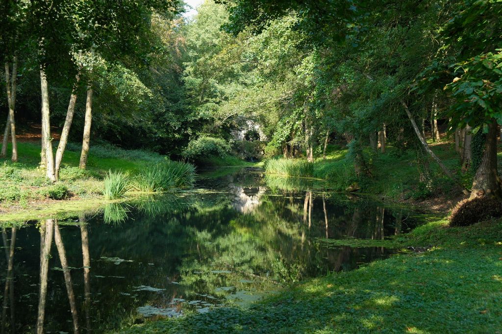
Stowe landscape Gardens National Trust 02. Stowe landscape Gardens National Trust. In “Reading The English Landscape Garden”, this view records the form, material and setting discussed in the passage. Source image dated 2024; that date records the image, not the original construction. Scott Wylie, Stowe landscape Gardens National Trust 02; CC BY 4.0. Resized proportionally; no crop, retouch or upscaling.
This was not nature released from design. It was another way of designing—and a way bound to concentrated landownership, agricultural “improvement,” labour and sometimes the removal of earlier gardens, roads or settlements. William Kent, Lancelot “Capability” Brown and later picturesque critics represent distinct moments rather than one uniform style.[1]
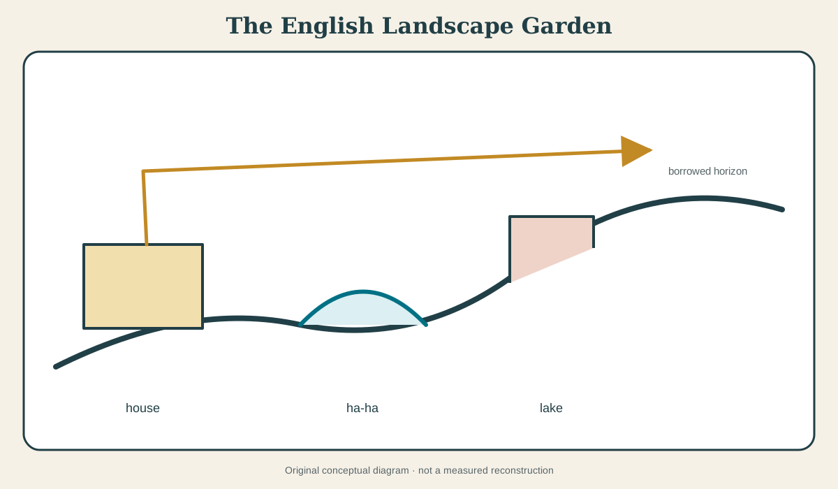
At a Glance
- Meaningan eighteenth-century British estate landscape composed to look broad, continuous and informally natural.
- Core devicessmooth lawn, serpentine water, clumps and belts, ha-ha, circuit, borrowed prospect and strategically placed garden buildings.
- How it was madeearth movement, damming, drainage, road diversion, planting, grazing and long maintenance.
- Key figuresWilliam Kent in earlier pictorial/architectural experiments; Capability Brown in large-scale integrated parks; Uvedale Price and Richard Payne Knight in later picturesque criticism.
- Essential cautionappearance cannot prove Brown’s authorship, and “natural” describes an effect rather than an absence of intervention.
Contents
- From compartment to prospect
- William Kent and Chiswick
- Capability Brown and composed naturalness
- Blenheim: engineering at territorial scale
- Studley Royal: water garden, ruin and sequence
- Ha-has, belts and hidden infrastructure
- Improvement, displacement and power
- Picturesque criticism
- Follies, bridges and distant incidents
- How to read an English landscape garden
From compartment to prospect
Many early eighteenth-century estates contained avenues, terraces, walled gardens and geometrical compartments. Landscape change did not occur overnight. Designers opened selected views, softened boundaries and introduced circuits while older features survived elsewhere.
The new broad prospect coordinated house, lawn, water and distant planting. Grass might appear to run directly to the façade. A lake widened at chosen viewpoints and narrowed around bends, concealing its dam and total extent. Clumps punctuated open ground; perimeter belts hid estate roads and less desirable views.
The composition was experienced from the house and in motion. A carriage or walking circuit changed the relation among water, trees, buildings and horizon. One view did not reveal the entire system. A plan that looks irregular can therefore be rigorously staged.
The word “landscape” matters because painting and theatre informed judgement. Designers and patrons spoke about scenes, foreground, middle distance and prospect. That does not mean a park was merely a picture. Bodies crossed slopes; livestock grazed; water drained; weather and season changed every scene.
William Kent and Chiswick
William Kent’s garden work is associated with an earlier, architecturally rich phase of English landscape design. At Chiswick, Lord Burlington’s villa, garden buildings, exedras, water and changing routes created a setting of antique reference and theatrical sequence. English Heritage’s history records the site’s evolving design rather than presenting it as a pure invention by one hand.[2]
Kent is often credited with “leaping the fence and seeing all nature was a garden,” a phrase that captures later reputation more than a technical method. At Chiswick, walls, hedges and compartments did not simply vanish. Architecture and planting created contrasts among formality, wooded shade and open view.
Temples, bridges, obelisks and classical fragments gave movement intellectual associations. A visitor recognised historical forms while encountering them through sequence. Garden building and landscape were mutually dependent.
Chiswick also demonstrates later change. Successive owners and restorers altered routes and planting. The current site allows a reading of Kent and Burlington only through surviving and reconstructed layers.
Capability Brown and composed naturalness
Brown’s practice transformed hundreds of estates through a recognisable but adaptable repertoire. He assessed the “capabilities” of a site, integrating house, water, ground and planting. His name became so synonymous with the style that many undocumented landscapes have been attributed to him from appearance alone.
Historic England’s research review makes attribution a central problem.[1] Estate accounts, plans, correspondence, contracts and chronology are required. A serpentine lake and clump do not sign themselves “Brown.” Assistants, surveyors, nurserymen and later imitators used related methods.
Brownian water often looks like a natural river or lake but depends on dam and engineered levels. Earth from excavation can shape banks. Bridges and culverts carry routes while keeping infrastructure visually quiet. Planting frames the house and controls revelation along a circuit.
The smooth effect demanded time. Newly planted belts were thin; future canopy was imagined. Grazing maintained lawn. Dredging preserved water. A design could take decades to mature, by which time ownership or fashion had changed.
Blenheim: engineering at territorial scale
Blenheim Palace brings monumental architecture and vast park into one political ensemble. UNESCO’s account recognises the palace and landscape, including Brown’s later transformation.[3] The park’s lake, bridge, lawns and planting appear inevitable now because engineering has been naturalised by age.
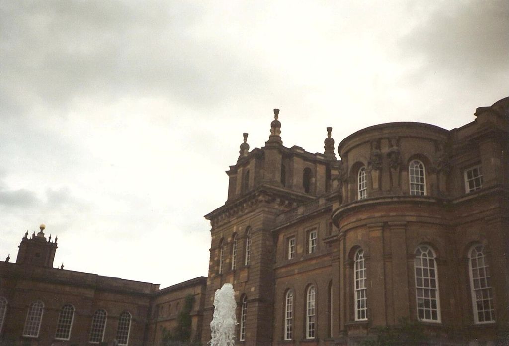
Blenheim Palace - Fountain - 1993 (4296305420). Scans of my really old photos of Blenheim Palace from the early 1990s. In “Blenheim: engineering at territorial scale”, this plan helps identify blenheim Palace landscape garden. Source image dated 1993; that date records the image, not the original construction. Elliott Brown from Birmingham, United Kingdom, Blenheim Palace - Fountain - 1993 (4296305420); CC BY 2.0. Resized proportionally; no crop, retouch or upscaling.
Damming the River Glyme created a broad body of water and altered the relation to Vanbrugh’s bridge. The operation was hydrological and visual. Levels concealed parts of the structure and produced a more expansive composition.
The palace’s military commemorative origin, aristocratic estate and landscape improvement belong together. Views make property and lineage visible. The park’s scale depends on land control far beyond the ornamental garden.
Later tree growth and loss continually alter Brown’s composition. Conservation must manage the watershed and veteran trees as well as palace vistas.
Studley Royal: water garden, ruin and sequence
Studley Royal differs from the mature Brownian park. Its designed water garden uses canals, ponds, cascades, statues and buildings in a controlled sequence, then brings the ruins of Fountains Abbey into the landscape experience. UNESCO identifies the combined ensemble as significant.[4]
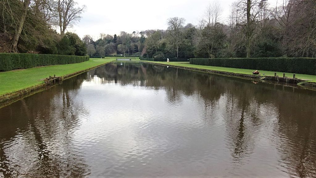
Lower Canal, Studley Royal Water Gardens, Yorkshire. Lower Canal, Studley Royal Water Gardens, Yorkshire. In “Studley Royal: water garden, ruin and sequence”, this view records the form, material and setting discussed in the passage. Source image dated 2019; that date records the image, not the original construction. Rosser1954, Lower Canal, Studley Royal Water Gardens, Yorkshire; CC BY-SA 4.0. Resized proportionally; no crop, retouch or upscaling.
The monastic ruin is not merely a picturesque ornament invented for the garden; it is a major medieval site with its own history. Later landscape design reframed it. This conjunction raises productive questions about antiquarian value, property and the aesthetic consumption of ruins.
Routes reveal water features in stages. Formal geometry and apparently natural wooded valley coexist. The site demonstrates why “English landscape” should not be equated only with Brown’s smooth lawn.
Conservation must respect both archaeological monument and designed views. Vegetation that gives romantic enclosure can damage masonry or block intended prospects. Water quality affects garden and abbey setting.
Ha-has, belts and hidden infrastructure
The ha-ha is a sunk boundary, commonly a ditch with a retaining wall on the garden side. From the house, the wall disappears and lawn seems to continue into grazing land. From close range, the drop controls animals and movement.
It is a device of selective vision. The privileged viewpoint receives continuity; the labourer, animal and person at the ditch encounter a hard division. That does not make the ha-ha fraudulent. It makes it architectural evidence of how view and land use are coordinated.
Tree belts perform related concealment. They screen roads, farms and boundaries while creating shelter and woodland routes. Their outer and inner faces may be managed differently. A gap caused by storm can suddenly expose the infrastructure the design hid.
Sunk roads, culverts and bridges maintain access without disrupting the prospect. Drains make smooth lawns possible. Estate maps and sections reveal these systems better than paintings.
Improvement, displacement and power
Landscape “improvement” often involved removing earlier formal gardens, felling avenues, rerouting roads, consolidating farms or moving settlements. The resulting openness expressed elite taste and control. Each site’s social history must be researched rather than assumed, but the possibility is structural to large estates.
The house looks across owned territory as if it were continuous private scenery. Working agriculture supplies the visual field while labour and tenancy remain distant. A temple or sham ruin can convert political history into aesthetic association.
Parliamentary enclosure, agricultural change and country-house wealth formed the wider context. The garden’s art cannot be separated from its economy. At the same time, patrons and designers did create subtle ecological, visual and spatial systems; acknowledging power does not make design analysis unnecessary.
Later public opening changes meaning. A private circuit becomes a visitor route; a controlled prospect becomes collective heritage. Admission, access and interpretation determine how far that transition goes.
Picturesque criticism
By the late eighteenth century, writers such as Uvedale Price and Richard Payne Knight criticised the smoothness and formula associated with Brown. They valued roughness, irregularity, aged trees and sudden contrast, drawing on categories of the picturesque in art and aesthetics.
The debate did not pit design against no design. Picturesque landscapes were also selected and composed, sometimes through deliberate neglect or constructed ruin. The controversy concerned what kinds of nature and visual experience should be cultivated.
Humphry Repton navigated between positions through Red Books that used before-and-after overlays to demonstrate proposed changes. These are powerful documents of persuasion, not neutral records. The improvement image shows the client what the designer wants accepted.
“Picturesque” later became a general adjective for scenic irregularity. Historically, however, it belongs to a specific critique and development within landscape thought.
Follies, bridges and distant incidents
Garden buildings give destinations and scale to the open park. A classical temple can command a ridge; a Gothic ruin introduces historical mood; a bridge carries the circuit while anchoring water. The building may be useful and imaginative at once.
An eyecatcher is positioned for distant view, sometimes outside the immediate garden. A belvedere reverses the relation by offering a prospect from within. A folly can do either, but “folly” describes its landscape and imaginative priority rather than a fixed form.
These structures help compose a circuit. A tower appears, disappears behind trees and returns across water. Conservation of the building without its view corridor preserves only part of the design.
How to read an English landscape garden
- Compare current contours with earlier maps and formal gardens.
- Find dams, ha-has, drains, sunk roads and other hidden work.
- Map views from house and circuit rather than relying on plan alone.
- Date belts, clumps and specimen trees by documentary and arboricultural evidence.
- Test designer attribution through accounts and chronology.
- Identify displaced routes, settlements and productive land where documented.
- Separate Brownian, picturesque, Victorian and modern layers.
Walk in more than one season. Leaf cover can create or close a prospect. Low winter light reveals earthwork. Water level changes the apparent shape of a lake.
Conservation over a tree’s lifetime
Historic England’s research and register work emphasises that designed landscapes need long-term management.[1][5] Veteran trees cannot be replaced instantly. A succession plan may plant the next generation before an old avenue fails, accepting a temporary double rhythm.
Lakes silt and dams require engineering inspection. Grazing regimes change. New diseases remove dominant species. Storms can open views not seen for centuries. Decisions should preserve spatial intention without pretending the biological material is fixed.
Public access brings paths, parking and events. These can support survival financially while compacting roots and eroding ground. Adaptation should use the landscape’s own hierarchy and concealment rather than scatter infrastructure across key prospects.
The English landscape garden’s achievement is not that it looks untouched. It is that large and often disruptive interventions were coordinated into an experience of continuity, movement and apparent ease. Reading the hidden work—technical, social and horticultural—makes that art more, not less, impressive.
The survey behind “natural” ground
An English landscape park may look as though house, lake and trees settled into an untouched valley. Its construction often required precise survey and major earth movement. Ridges were lowered, dams raised, streams widened, roads diverted and plantations positioned to manage views.
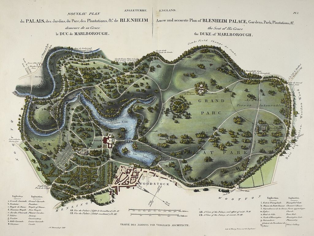
A new and accurate plan of Blenheim Palace , Gardens, Park, Plantations, &ª, the Seat of His Grace, the Duke of Marlborough. In “The survey behind “natural” ground”, this plan helps identify blenheim Palace landscape garden. Source image dated 1835; that date records the image, not the original construction. Nicolas Vergnaud, A new and accurate plan of Blenheim Palace , Gardens, Park, Plantations, &ª, the Seat of His Grace, the Duke of Marlborough; CC0. Resized proportionally; no crop, retouch or upscaling.
This work was partly concealed by design. Curving water hides its engineered limits; turf smooths cut and fill; perimeter belts screen boundaries. The apparent absence of effort is itself an aesthetic achievement and a social claim about control of land.
Archaeology can recover what the new surface buried: formal avenues, village remains, field boundaries and earlier water features. The later landscape did not replace a blank site. It edited inhabited and productive ground.
Chiswick and the experimental garden
Chiswick places garden buildings, classical reference and designed routes around a villa associated with Lord Burlington and William Kent.[2] Its scale allows the visitor to see how temple, exedra, lawn and planting construct successive scenes. It is not simply an early draft of Capability Brown.
Kent's work joined architecture to painterly composition and theatrical movement. A building may first appear obliquely, then become a destination; an opening frames another incident. Classical vocabulary gains meaning from sequence rather than from isolated correctness.
Later alteration and restoration complicate that experimental moment. Current planting and circulation mediate between historical evidence, public park use and the need to make several phases intelligible.
Brown at Blenheim: water and territorial scale
At Blenheim, Brown's intervention reshaped the relationship among palace, bridge, valley and water.[3] The enlarged lake altered topography and submerged parts of earlier design, making engineering central to the celebrated prospect.
The bridge appears to span a natural body of water, yet its meaning changed when the valley was flooded. Water level controls the visible proportions of architecture and banks. Dams, silt and catchment are therefore part of the designed composition.
Attribution also requires discrimination. Brown worked within an existing estate and his landscape continued to change. Later trees mature, fall and are replanted; views attributed to him may depend on subsequent management. Historic England's research review is valuable for bringing archival and field scholarship together rather than repeating a designer legend.[1]
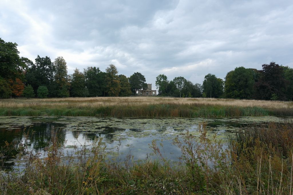
Stowe landscape Gardens National Trust 05. Stowe landscape Gardens National Trust. In “Brown at Blenheim: water and territorial scale”, this view records the form, material and setting discussed in the passage. Source image dated 2024; that date records the image, not the original construction. Scott Wylie, Stowe landscape Gardens National Trust 05; CC BY 4.0. Resized proportionally; no crop, retouch or upscaling.
Studley Royal: garden, ruin and monastic past
Studley Royal combines an eighteenth-century water garden with the ruins of Fountains Abbey and later parkland.[4] The monastic remains became a powerful incident in a designed sequence, but they retain an archaeological and religious history not created for picturesque effect.
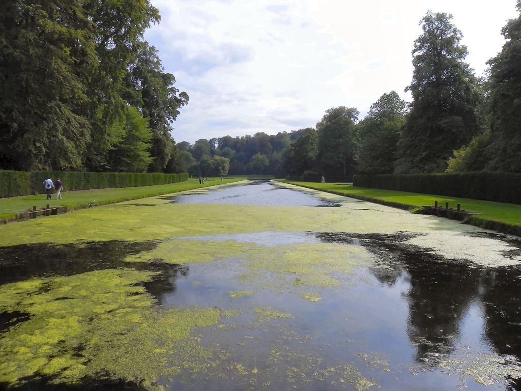
The Canal, Studley Royal Water Garden - geograph.org.uk - 2538047. The Canal, Studley Royal Water Garden. In “Studley Royal: garden, ruin and monastic past”, this view records the form, material and setting discussed in the passage. Source image dated 2011; that date records the image, not the original construction. David Dixon, The Canal, Studley Royal Water Garden - geograph.org.uk - 2538047; CC BY-SA 2.0. Resized proportionally; no crop, retouch or upscaling.
This double identity creates interpretive responsibility. The view from a designed route is historically important; so are the abbey's fabric, precinct and suppressed monastic landscape. Neither should be reduced to scenery for the other.
Water channels, canals and ponds establish pace and reflection. Their clarity depends on hydraulic maintenance. Algal growth, silt and flood management can change the formal image, while excessive cleaning can damage ecology and historic lining.
Estate improvement and the people moved from view
Park-making could close roads, reorganise farms, absorb commons and remove or relocate settlements. The smooth prospect may therefore encode displacement. Evidence comes from estate maps, enclosure records, archaeology and local history rather than from the finished view alone.
“Improvement” had economic meanings: more productive agriculture, higher rents, modernised estate management and elite prestige. Aesthetic naturalness existed within that programme. The term should be kept in its historical complexity rather than treated as an innocent synonym for beautification.
Labour remained essential after construction. Woodsmen, gardeners, gamekeepers, farm workers and domestic staff maintained distinctions between lawn, pasture, belt and pleasure ground. Their routes often ran outside the visitor's composed circuit.
Picturesque challenge and later public reception
Picturesque critics objected that Brownian smoothness and belts could become formulaic. They valued roughness, irregularity and visible incident, though their own landscapes were equally designed. Debate changed what owners planted, preserved and called natural.
In the nineteenth and twentieth centuries, some estates became institutions or public attractions; others were fragmented by development. Golf, car parking, forestry and wartime use added layers. A restoration that strips those away may clarify one design phase while erasing later social history.
Conservation works best when it identifies the indispensable spatial relationships—house to water, route to incident, open ground to belt—then manages trees and uses over long horizons. A landscape is not returned to a date by planting young copies of every tree on an old plan.
Animals, pasture and the ha-ha boundary
Grazing animals contributed movement, texture and land management to parkland. The ha-ha kept stock away from pleasure ground while preserving a continuous view. Its ditch and wall are simultaneously agricultural infrastructure and optical device.
Condition changes the illusion. Vegetation can fill the ditch; a collapsed wall becomes unsafe; a modern fence may restore stock control while drawing a new line across the prospect. Repair must address drainage and animal pressure as well as masonry.
Deer parks, dairying and estate farming complicate the idea of scenery. Productive and sporting uses were designed into the same land. The park's ecology today may depend on continued grazing under very different economic arrangements.
Maps before and after improvement
Estate maps can reveal avenues, villages, fields and roads removed by later design. Overlaying them with present terrain identifies surviving banks and hollow ways. Brown's apparently natural lake may cover earlier boundaries; a clump may mark or conceal archaeological fabric.[1]
Commission drawings show proposal, not automatic execution. Later maps test which paths and plantations were built. Accounts and correspondence can identify payments, labour and disputed decisions.
This sequence keeps attribution honest. A feature conventionally called “Capability Brown” may precede his commission, remain unrealised in his plan or have been reshaped after him. The mature landscape is collaborative across generations.
Climate, disease and the designed horizon
Ash dieback, drought and severe storms can remove a whole belt or clump within years. Exact replanting may recreate a vulnerable monoculture. Diversifying species protects resilience but changes colour, texture and historical botanical character.
View priorities should guide phasing. Some gaps can remain while young trees establish; temporary protection should avoid creating permanent visual clutter. Deadwood may retain habitat where it is safe and does not block the defining spatial relation.
The conservation objective is not the survival of each individual tree forever. It is continuity of park structure, ecological life and a documented process of renewal across tree generations.
The photograph from the ha-ha
Ground-level recording should include the positions the design normally hides. From inside a ha-ha or behind a tree belt, construction and labour become visible: retaining masonry, drainage, fencing, rides and coppice. These views correct the house-centred panorama without replacing it.
A paired photographic essay—principal prospect and service reverse—can show how naturalness was manufactured. The contrast also aids condition survey, since failure often begins on the unseen face.
This is not an attempt to expose the garden as fraudulent. It explains its accomplishment more fully: landscape art worked by coordinating engineering, agriculture and carefully controlled attention.
The reverse view also restores workers' movement to the map. Estate roads and gates that disappear from the principal prospect may be the routes that kept it functioning.
Literature, painting and the circular picturesque argument
Landscape designers drew on painting and poetry, while painters and writers responded to designed estates. Influence moved in both directions. A composition resembling a Claudean landscape does not prove that one canvas served as the plan.
Guidebooks taught visitors where to pause and which associations to feel. Their prescribed tours are evidence of reception, but actual movement could resist them. Diaries and sketches show alternative routes and weather.
The picturesque debate later turned the landscape itself into critical evidence. Roughness, variety and interruption were advocated against smooth formula. That criticism shaped new design, making theory another layer on the ground.
Public parks and borrowed estate scenery
Elements of the landscape-garden vocabulary entered public parks: curving drives, lakes, belts and strategically placed buildings. The social institution changed. Space intended for an owner and guests became a managed civic resource with by-laws and mass use.
This transfer should not be described as simple democratisation. Park authorities regulated classed activities, and neighbourhood access varied. Still, public occupation gave composed naturalness new everyday meanings.
Comparing estate and park clarifies which features are formal and which depend on land ownership. A lake can look Brownian in both settings while serving very different publics.
Watch: experiment, mature park and water garden
Choose England’s Greatest Garden Designer—Capability Brown, The Art of Capability Brown or The Secret History of the British Garden: The Eighteenth Century. Together, the films connect architectural form with material, use and historical setting.
England’s Greatest Garden Designer—Capability Brown
A university account of Brown, patronage and landscape change
Watch on YouTubeDiscussion
Which building or designed landscape most clearly demonstrates The English Landscape Garden, and what physical evidence supports that reading?
Reader Insights
Name the material, joint, opening, route or view you can observe.
Give the place, approximate date and a reliable source.
Separate documented history from your interpretation.
Join the Conversation
Share a concise observation or useful source below.
References
- Historic England, Capability Brown Research Impact Review. View source
- English Heritage, “Chiswick House: History.” View source
- UNESCO World Heritage Centre, “Blenheim Palace.” View source
- UNESCO World Heritage Centre, “Studley Royal Park including the Ruins of Fountains Abbey.” View source
- Historic England, “Capability Brown Landscapes Celebrated.” View source